It is my great pleasure, to introduce our colleagues at Faculty of Civil Engineering, Department of Geomatics, Czech Technical University (CTU) in Prague, Czech Republic as our “GeoForAll” lab of the month. CTU is one of the founding labs as part of the worldwide network of OSGeo laboratories following the motto Geo for All.
The GeoForAll Lab [1] (formerly OSGeo Research and Education Laboratory) is located at the Czech Technical University in Prague, Faculty of Civil Engineering, Department of Geomatics, Czech Republic. Their mission, as one of the laboratories in the OSGeo worldwide university network, is to develop collaboration opportunities for academic, industrial, and government organizations in open source GIS software and data . See the announcement and info at GIM) [2].
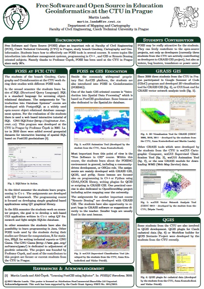
Figure 1 – Summary of CTU’s FOSS4G education activities [4]
The laboratory was established by Martin Landa and was the first lab to be established under the ICA-OSGeo MoU in Czech Republic. It has been expanding and providing support for the development and documentation of open-source geospatial software . The laboratory is devoted to education in geoinformatics using FOSS4G, and to research in open source software development for geospatial applications. CTU in Prague has a strong track record in Geoinformatics . Prof. Aleš Čepek has established a study program in geoinformatics since 2005 (originally with Prof Leoš Mervart), he is the author of project GNU Gama and of a minor project GNU Sqltutor (both hosted at GNU servers) and the editor in chief of Geoinformatics FCE CTU journal [2].
The major focus of CTU GeoForAll lab is software development. They are contributing to various international Open Source Geospatial Software projects, namely GRASS GIS, QGIS, and GDAL. Martin Landa is an OSGeo charter member since 2011 and a member of the GRASS Development Team since 2006. He is actively involved in the GRASS project as the lead architect of graphical user interface (GUI) development and PostGIS integration in GRASS vector architecture.
I am impressed to see the excellent student projects done at CTU. For example for the Google Summer of Code 2016 , Adam Laža’s project on “Complete basic cartography suite in GRASS GIS wxGUI Map Display” and Ondřej Pešek’s project on “PyQt GUI generated from XML” are great exampes of contributions from the CTU sutdent community to the wider OSGeo community.
There is also an impressive range of Masters student projects [3] of GeoForAll (OSGeoREL) Lab at CTU in Prague at https://github.com/ctu-geoforall-lab-projects/
I would like to thank Martin and all colleagues and students at CTU for their contributions to the GeoForAll initiative . We are looking forward to working and building more collaborations with all interested on this education mission.
Best wishes,
Suchith
[1] http://geomatics.fsv.cvut.cz/research/geoforall/
[2]https://www.gim-international.com/content/news/open-source-geospatial-and-education-laboratory
[3] https://www.youtube.com/channel/UCNy1pEGYxypkpQfx4m8qWGA
[4]http://geo.fsv.cvut.cz/~landa/publications/2012/ogrs2012/poster/landa-ogrs2012-poster.pdf