The Rise of OpenStreetMap as a World Mapping Agency

The Geospatial IG [1] of the Research Data Alliance will be meeting in Barcelona on 5th April 2017 to keep building ideas for the global research agenda for Geospatial Data Science.

https://www.rd-alliance.org/ig-geospatial-rda-9th-plenary-meeting

I would also like to make use of the Geospatial IG meeting opportunity at RDA9 in Barcelona to further discuss ideas on the rise of OpenStreetMap (OSM) as a World Mapping Agency (WMA) build by the efforts of thousands of volunteers.   It is also interesting to see the community links of the OpenStreetMap and  the Open Source Geospatial Foundation (OSGeo) expanding rapidly both locally and globally. OSM has now reaching the level of a Global Mapping Agency build by the efforts of thousands of volunteers and OSGeo is the world’s largest geospatial ecosystem.  What a great combination of synergies. Both initiatives are just over a decade  old and have fundamentally changed the whole geolandscape.

osm

Myself and colleagues are working on a paper on OSM and OSGeo and i want to use this meeting to discuss more ideas with the community. I look forward to welcome you all to RDA meeting in Barcelona.

Best wishes,

Suchith

Lab of the Month – GEOlab , Politecnico di Milano, Italy

It is my great pleasure, to introduce our colleagues at GEOlab (Geomatics and Earth Observation laboratory, http://geolab.como.polimi.it) at the Politecnico di Milano,   Italy as our “GeoForAll” lab of the month. GEOlab is a multi-disciplinary, multi-department research group established at Politecnico di Milano, Italy focused on collecting, modeling, analysing and representing Earth observations. Core research includes the following topics: GIS, cartography, global gravity models, GNSS (monitoring and navigation), remote sensing, photogrammetry, and signal processing.

PoliMappers

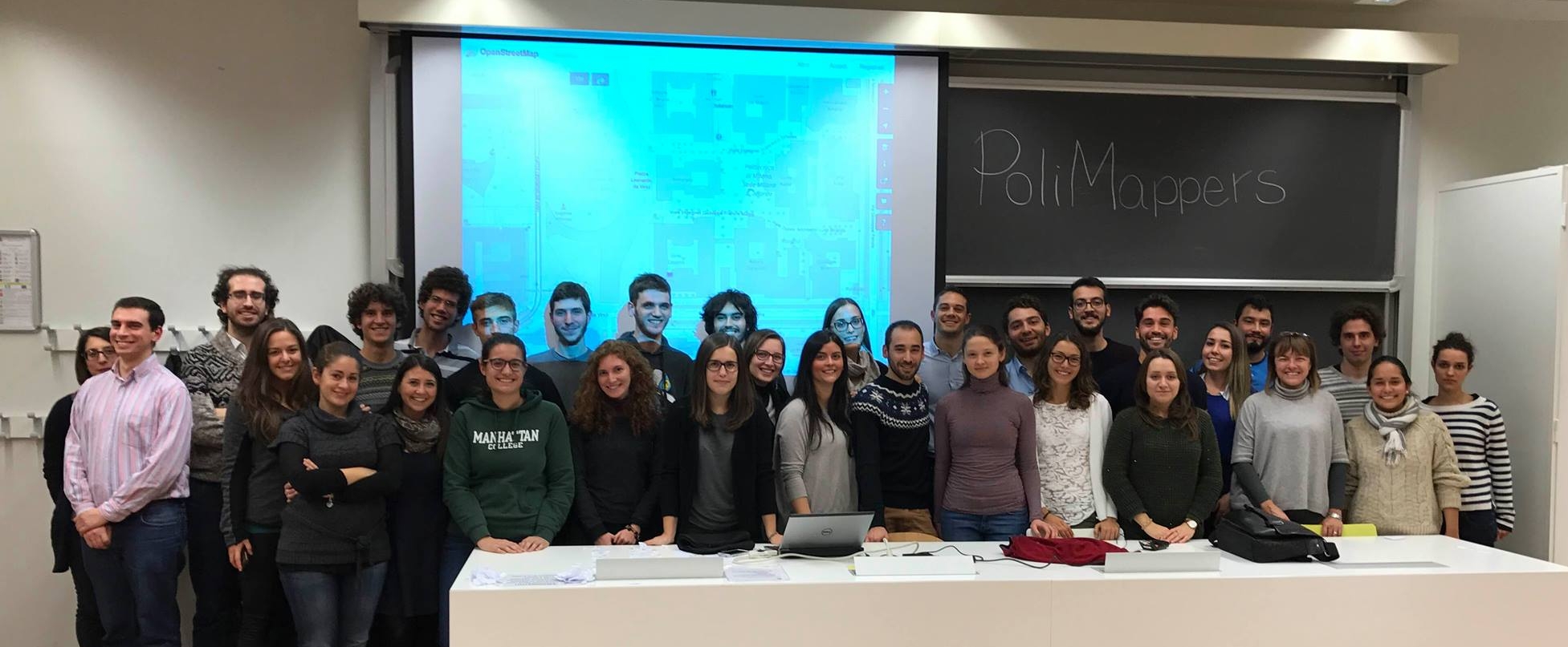
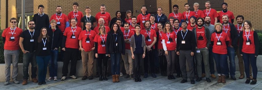
Fig 1 – Polimappers @ GEOlab

The GIS research group, lead by Prof. Maria Antonia Brovelli and Dr. Marco Minghini, is active in the research fields of Web Mapping, multi-dimensional visualization and virtual globes, spatial statistics, Volunteered Geographic Information (VGI), geo-crowdsourcing and Citizen Science. The team has a long and outstanding tradition in the use and development of open source geospatial solutions. The main software packages used include GRASS GIS, QGIS, PostGIS, GeoServer, MapServer, OpenLayers, Leaflet, PyWPS, istSOS, Rasdaman, and NASA World Wind.

group_photo_FOSS4G_Europe_2015


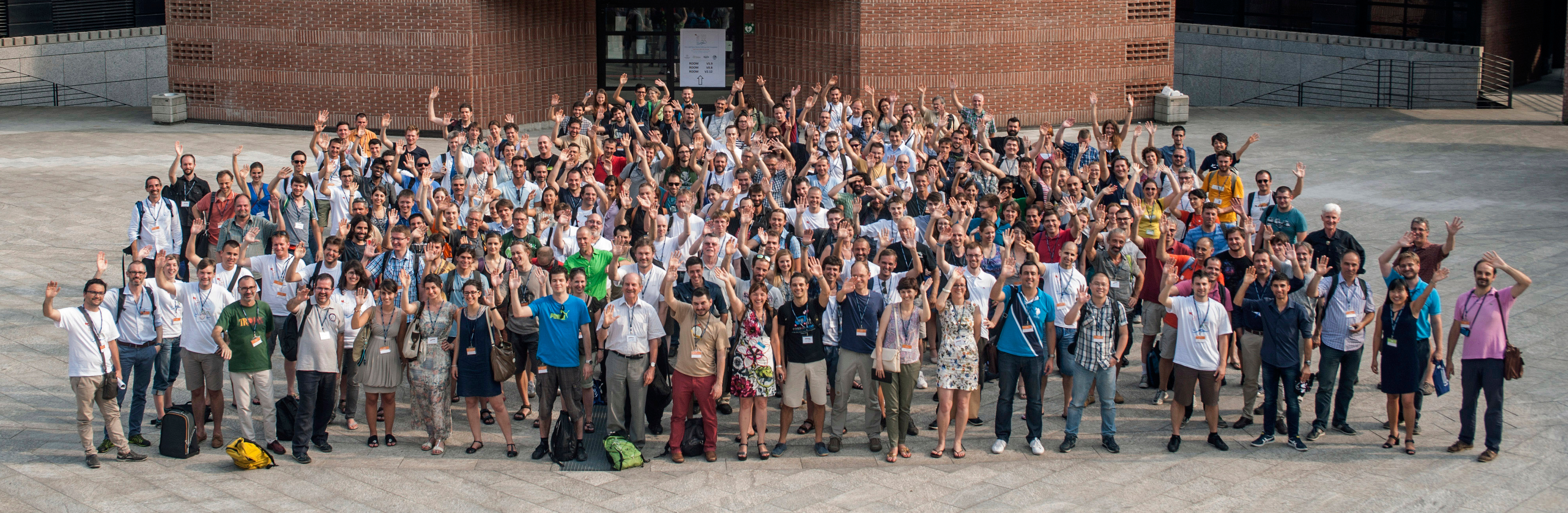
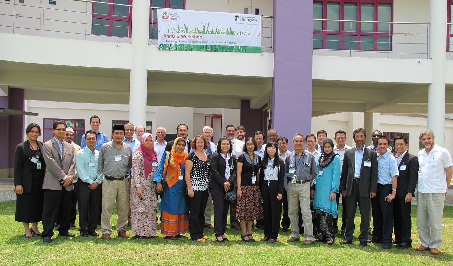
Fig 2 – FOSS4G-Europe participants

GEOlab is a great example of linking GeoForAll synergies with all key initiatives in Europe and globally. In addition to GeoForAll, GEOlab is officially affiliated to the AGILE network of laboratories. Members of the GIS GEOlab team are personally involved in a number of national and international associations, including SIFET (Italian Society for Photogrammetry and Topography), ASITA (Italian Federation of Scientific Associations for Environmental Information), GIT (Geosciences and Information Technologies), OSGeo (Open Source Geospatial Foundation), ISPRS (International Society of Photogrammetry and Remote Sensing), ICA (International Cartographic Association), HOT (Humanitarian OpenStreetMap Team), UN-GGIM (United Nations Global Geospatial Information Management) Academic Network, and UN Open GIS.

Some projects which are currently ongoing or just finished include giCASES – Creating a University-Enterprise Alliance for a Spatially Enabled Society, funded by Erasmus+ programme of the European Union; URBAN GEO BIG DATA (Urban Geomatics for Bulk Information Generation, Data Assessment and Technology Awareness), funded by the Italian Ministry of Education; MIGRATE (MIGRation pATterns in Europe) and City Focus, developed within the MYGEOSS project, which has received funding from the EU H2020 research and innovation programme; and The Paths of Regina – Crossborder paths linked to Via Regina, funded by the Interreg Italy-Switzerland Co-operation Programme 2007- 2013.

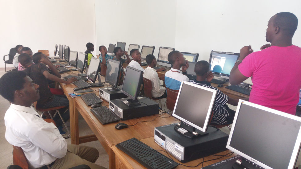
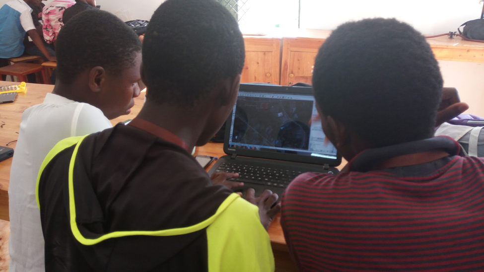
GEOlab is active in many other fields. Over the last couple of years a number of humanitarian mapathons were organized by the GEOlab staff thanks to the links with HOT, e.g. for the OSM GeoWeek 2015 and 2016 and after the earthquakes in Nepal and Ecuador. A very special and successful mapathon with more than 200 ,10-year old children was held in March 2016, see this post on HOT’s blog. (see Fig 3 and 4)

childrens_mapathon


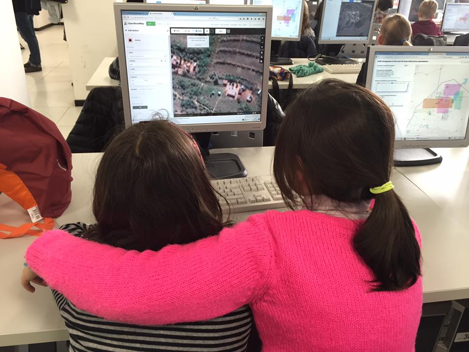
Fig 3 – Kids Map Swaziland for Malaria Elimination

Screen Shot 2017-03-05 at 09.52.21


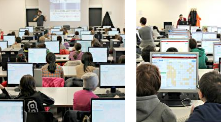
Fig 4 – Kids Map Swaziland for Malaria Elimination

Members of the GEOlab team have recently founded PoliMappers, the first European chapter of the YouthMappers students’ network having the purpose of building a young generation of mappers through open source and open data (OpenStreetMap). GEOlab organized a number of activities for the last MeetMeTonight, a national event where all Italian universities opened their activities to the public. Also, members of GEOlab have participated as speakers to local TED events, see e.g. this speech of Prof. Brovelli at TEDxLakeComo 2015 and this one of Dr. Minghini at TEDxYouth@LakeComo in 2012.

Since the first edition in 2013, GEOlab is among the organizers of the popular NASA World Wind Europa Challenge, which looks for urban management solutions developed using World Wind‘s open source technology and serving the EU INSPIRE Directive. GEOlab has also organized a number of conferences in the field of GIS and open source geospatial software: the First Meeting of the Italian GRASS users in 2000, the WebMGS 2010 – 1st International Workshop on Pervasive Web Mapping in 2010, Geoprocessing and Services, and the FOSS4G Europe 2015. Finally, since 2016 a new MSc Degree in Geoinformatics Engineering (fully taught in English and welcoming students from all over the world) has been established at Politecnico di Milano, where GEOlab staff is primarily involved in teaching.

On behalf of the GeoForAll community, we thank Maria, Marco and all colleagues from the GEOlab and for their contributions to the GeoForAll initiative and look forward to working and building more collaborations with all interested on this education mission.

Best wishes,

Suchith Anand

Happy OpenDataDay 2017

Dear colleagues,

Wishing you all Happy OpenDataDay 2017

Open Data Day [1] is an annual celebration of open data all over the world. For the seventh time in history, groups from around the world will create local events on the day where they will use open data in their communities. It is an opportunity to show the benefits of open data and encourage the adoption of open data policies in government, business and civil society. Details at http://opendataday.org/

opendataday

Weather data is critical for agriculture. I  thank  our GeoForAll colleagues in The European Centre for Medium-Range Weather Forecasts (ECMWF)[2] at Reading who are running the #OpenDataHack @ECMWF – Beyond weather: explore creative uses of open data ECMWF this weekend.

I have good memories of my visit last year for the first hackathon on a Global Flood Awareness System (GloFAS) [3] they organised .

glofas

Fig – participants at first hackathon on a Global Flood Awareness System (GloFAS) @ECMEF in 2016

Happy OpenDataDay 2017 to all…

Best wishes,

Suchith

[1] http://opendataday.org/
[2] http://www.ecmwf.int/
[3] https://opensourcegeospatial.icaci.org/2016/02/flood-awareness-education-platform/

GeoAmbassador– Dr Tuong-Thuy Vu

Dear colleagues,

It is my great pleasure to introduce our excellent colleague Dr Tuong-Thuy Vu as our GeoAmbassador. Dr Tuong-Thuy Vu is an Associate Professor of the School of Environmental and Geographical Sciences, University of Nottingham, Malaysia campus (UNMC). He is also the Asia chair of GeoForAll.

TTV


A geospatial scientist by training and research, Dr Vu has over 15-years research and teaching experiences across Eurasia. He obtained his Master and PhD from Asian Institute of Technology in 2000 and 2003,  respectively, and started exploring open-source tools at the early stage. After his PhD,  he worked as a research scientist at Earthquake Disaster Mitigation Research Center, Kobe, Japan (2003-2006) before joined Chiba University as a postdoctoral researcher in 2006-2007. In both places, he focused on the employment of geospatial technologies in disaster mitigation and management. He then joined GEO Grid team of National Institute of Advanced Industrial Science and Technology (AIST), Japan to further expand the research onto high-performance computing platform. In 2008, he went back to university to develop his academic career at Geoinformatics division, Royal Institute of Technology, Sweden. In early 2011, he took the position at University of Nottingham, Malaysia campus and assisted the establishment of the School of Geography and new MSc programmes at Malaysia campus.

Figure1

Late 2011, he established his OSGeo research lab (OSGeo.UNMC) [1], the first-of-its-kind in Southeast Asia and soon became among the first members of GeoForAll. OSGeo.UNMC aims at promoting open-source philosophy in education and research on geospatial science. The team developed the material to fully deploy OSGeo tools in teaching at postgraduate level, and introducing as an alternative tool for undergraduate students doing their final year project. In teaching and learning, OSGeo.UNMC team promote not only using open-source tools but also instructing a new way of open learning including open-mind, freedom, sharing and collaboration. There is a certain improvement of geospatial knowledge and skills for students when moving to open-source way, especially the confidence to try any available tools to address a specific issue.

Figure2


OSGeo.UNMC has been working very closely with Nottingham Geospatial Institute (NGI) team from the beginning. Together, we organised the AgriGIS 2012 (Figure 1), bringing together researchers and practitioners in agriculture and geospatial science. It was the very first public event to broadcast the name of OSGeo.UNMC to the region. In addition to presenting at many public events, convention and conferences to introduce OSGeo and open geospatial science, Dr Vu coordinated the establishment of OSGeo Malaysia chapter (Figure 2). Thuy also leads the team organising a series of training to the public (Figure 3) [2] [3]. In 2017, he is planning to assist the establishment of two new OSGeo labs in Vietnam universities.

figur3


OSGeo.UNMC is developing its strong research activities on geobig data analytics. The team was awarded good national and international funding to work on remote sensing data fusion, change detection, remote sensing image analysis services, crowd-sourced data quality.

In collaboration with its partners, OSGeo.UNMC promotes open geospatial science via collaborative research projects like urban construction management, urban green space, megafauna index mapping, and agricultural management.

Geo for All is a worldwide movement that provides immediate benefit to the world. We aim to create openness in Geo Education for developing creative and open minds in students which is critical for building open innovation and contributes to building up Open Knowledge for the benefit of the whole society and for our future generations. We are proud to honour Thuy as our GeoAmbassodor and we are extremely grateful for his contributions to Geo for All. Thuy is a great ambassador for Open Geospatial Science globally.

I am very grateful for getting this opportunity of introducing some of our amazing colleagues from different parts of our world each month as our GeoAmbassadors and get inspired by their amazing work and contributions for the wider community.

Best wishes,

Suchith Anand

[1] http://www.nottingham.edu.my/EGS/Research/GeospatialScience/OSGEO-lab.aspx

[2] https://blogs.nottingham.edu.my/geography/2016/03/01/gis-information-workshop/

[3] https://blogs.nottingham.edu.my/geography/2016/02/28/ensearch-gis-training-by-osgeo-lab/


SMARTIES Entrepreneurship competition – NASA Europa Challenge 2017

The RCUK funded SMARt ciTIES is led by Professor Michele Clarke (University of Nottingham) and Dr. Ajith Kaliyath (National Institute of Urban Affairs, India) brings together a consortium of multidisciplinary, international researchers to develop new collaborative solutions to the multi-layered challenges of rapid urbanisation. The expertise needed  involves education and social science, cultural heritage and urban planning, science and engineering, ecology and environmental sciences and information technology.

The network includes leading urban researchers from the UK and India, University of Nottingham, University of Birmingham, University of Southampton, Bishop Grosseteste University College, Loughborough University, Northumbria University, Nottingham Trent University and University of Surrey, Jawaharlal Nehru University, IIT Delhi, IIT Kharagpur, IIT Roorkee, Indian Institute of Population Studies Mumbai, Indira Gandhi Institute of Development Research Mumbai and Institute for Social and Economic Change, Bengaluru.

delhi1

The NASA Europa Challenge is there to inspire innovative ideas for building applications that serve the INSPIRE Directive and use the ESA-NASA open source virtual globe technology, Web World Wind. SMARt ciTIES is pleased to participate in this fifth year of the NASA Europa Challenge, specifically involving UK and India students. You are challenged to build a great application that serves some aspect of the OpenCitySmart design and uses NASA’s open source virtual globe technology, Web World Wind. SMARTIES has been promoting NASA Europa Challenge through our workshops in India [1],[2] .

We are pleased to announce the launch the SMARTIES Entrepreneurship competition through the NASA Europa Challenge 2017. SMARTIES will provide 5000 GBP for awards (£2500 for First Place, £1500 for the Second Place and £1000 for the Third Place). Due to the nature of the funding, the SMARTIES Entrepreneurship awards are specific to all UK and India students who participate in the NASA Europa Challenge 2017. This is a contest where everyone wins just by playing!  Help your city and thereby the cities of the world with capabilities all cities need. We are in this world together, let’s deliver results ‘for the benefit of all’, the NASA motto.

Details at http://eurochallenge.como.polimi.it/ and overview video at https://youtu.be/OQEzJrEDmEI

[1] https://opensourcegeospatial.icaci.org/2016/11/smarties-are-part-of-the-uk-prime-ministers-ministerial-delegation-to-india-for-the-tech-summit-2016/
[2] https://opensourcegeospatial.icaci.org/2016/11/reflections-from-uk-india-joint-network-on-sustainable-cities-and-urbanisation-in-india-city-level-workshop-on-chennai-urban-observatory-9th-10th-nov-2016-chennai-india/

EUROGEO 2017

The EUROGEO 2017 Conference is organised in Amsterdam, The Netherlands on 2-3 March 2017.

Geographical education is facing many challenges at schools and in higher education. The purpose of EUROGEO 2017 is to examine some of these issues and their possible responses.

Screen Shot 2017-02-22 at 14.02.00

EUROGEO 2017 will aim to address cross-cutting issues such as:

  • How does geographical education respond to needs of society and the world around us?
  • Does geographical education give young people the necessary tools they need to think spatially?
  • How do new technologies and open access to data help engage youngsters?
  • How should education respond to the ever-increasing importance of geographic information?


SDI-Open 2017

28th International Cartographic Conference pre-conference workshop on Spatial data infrastructures, standards, open source and open data for geospatial

SDI-Open 2017 

Jointly organized by the Commission on Open Source Geospatial Technologies and the Commission on SDI and Standards

1- 2 July 2017

 the George Washington University, Washington DC, United States

Details at http://sdistandards.icaci.org/sdi-open-2017-pre-conference-workshop/


SDI-Open 2015 was held at IBGE in Rio de Janeiro and was a great success thanks to everyone who contributed.

Proceedings at

http://sdistandards.icaci.org/sdi-open-2015-proceedings/

http://sdistandards.icaci.org/wp-content/uploads/2015/09/SDI-Open2015_Proceedings.pdf

Screen Shot 2017-02-22 at 13.07.16


We request you all to support SDI-Open 2017

STEM education using Open Principles

Happy to share this excellent updates from our GeoForAll colleagues in Tanzania. Over the first week of January 2017, a group of 60 secondary school students gathered at Marian University College, Bagamoyo for a ground-breaking training session – the Science Technology Engineering and Mathematics (STEM) Youth Boot Camp organised by Projekt Inspire in collaboration with the Ramani Huria team. These students, hailing from different regions of Tanzania (Dar es Salaam, Moshi, Arusha, Mbeya, to name a few), were there to be introduced to GIS and web mapping using open source technologies  and open data .

More details at https://hotosm.org/updates/2017-01-26_ramani_huria_trains_secondary_school_students_during_stem_boot_camp

QGIS

Picture 1 – Students learning map production using free and open technologies like QGIS (Photos thanks to  Projekt Inspire)

Some videos of this kindly send by Edward and team below

Summary of the bootcamp at https://youtu.be/yKIwgy656VA

Mapping Class at  https://youtu.be/v2iHAiYoxf0

Data-Entry-OSM

Figure 2- Students adding buildings  data into Open Street Map (Photo thanks to  Projekt Inspire)

More video about thier works can be found here at https://www.youtube.com/channel/UC3MK1kTDMAVuqsnFYIe-IIw

This as a great example of STEM education using Geo and Open Principles. This is really inspiring efforts for expanding STEM education for all by OSM and Ramani Huria team.  I really hope more students in developing countries will also get opportunity to get quality STEM education opportunities in the near future. GeoForAll will build upon this ideas and expand this globally. FOSS4G-Africa 2017.It is great opportunity to expand ideas. Details at https://foss4g-africa.org/en/home/

Best wishes,

Suchith

NASA-GODAN Local Farming challenge 2017

We are welcoming participation from all interested for the NASA-GODAN Local Farming challenge. Background of the challenge at http://aims.fao.org/es/activity/blog/godan-local-farming-challenge-2017

We want to bring together researchers and students to find solutions for local farming in growing cities, using open agriculture and nutrition data. Participants must use some aspect of the OpenCitySmart Design and use NASA’s open source virtual globe technology, WebWorldWind as a source of open data. Ideas may include ways for optimally linking local farming communities directly with potential customers, tools for visualising spatio-temporal aspects of local farming, tools for helping reducing wastage (for example linking with local food banks), and any number of solutions for helping our goal of Zero Hunger.

godan_nasa

More information at http://eurochallenge.como.polimi.it/

Challenge due date: August 8, 2017

Prize: 1000 Euros for the winning team and certificates from GODAN and NASA.

Contact: suchith.anand@godan.info

More details at http://www.godan.info/news/godan-nasa-europa-student-challenge-announcement

Invitation to Capacity Development WG

Currently, nearly 800 million people struggle with debilitating hunger and malnutrition and can be found in every corner of the globe. That’s one in every nine people, with the majority being women and children. The Global Open Data for Agriculture and Nutrition (GODAN) [1] supports the proactive sharing of open data to make information about agriculture and nutrition available, accessible and usable to deal with the urgent challenge of ensuring world food security. A core principle behind GODAN is that a solution to Zero Hunger lies within existing, but often unavailable, agriculture and nutrition data.

hague_logos

The Netherlands Ministry of Economic Affairs, CABI, GODAN, CTA and Wageningen UR  partnered to organise the 3rd Workshop on Creating Impacts with Open Data in Agriculture and Nutrition[1] . The workshop was hosted at the Ministry of Economic Affairs in the Hague earlier this week. I am happy to share the ideas that i  presented for the GODAN  Capacity Development WG [3] at the Hague meeting.

Details at https://www.slideshare.net/SuchithAnand/godan-working-group-on-capacity-development

I would like to welcome all interested to join the GODAN WG on Capacity Development and contribute to education and training on Open Data in food and agricultural sciences. This is open and free to all interested. Join at https://dgroups.org/fao/godan_cd

Best wishes,

Suchith

Dr. Suchith Anand
http://www.geoforall.org/
https://opensourcegeospatial.icaci.org

GeoForAll – Building and expanding Open Geospatial Science

[1] https://www.nottingham.ac.uk/genius/documents/godan-uon-intro.pdf

[2] http://g4aw.spaceoffice.nl/en/News/Agenda/68/3rd-International-Workshop-Creating-Impact-with-Open-Data-in-Agriculture-and-Nutrition.html

[3] http://www.godan.info/working-groups/capacity-development