GeoAmbassodor – Patrick Hogan

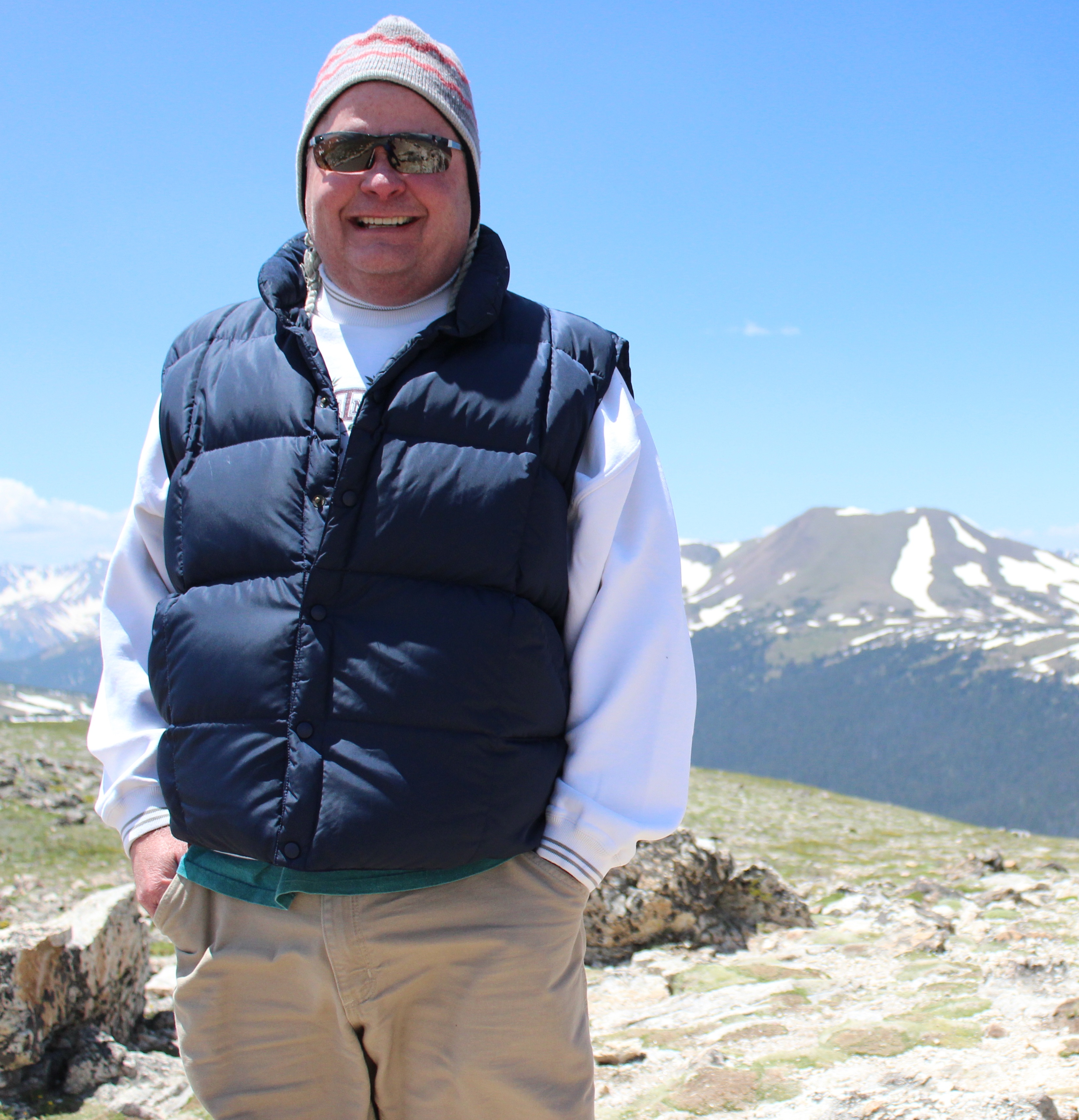
It is my great pleasure to introduce our colleague Patrick Hogan (NASA) as our GeoAmbassador.

patrickhogan


Patrick Hogan began his U.S. Government career with the Environmental Protection Agency in 1990, and then joined NASA a year later as their senior environmental geologist at Ames Research Center. In 2002 Patrick was asked to lead the NASA Learning Technologies program. This is where NASA World Wind was born, the world’s first open source virtual globe program. In 2009 World Wind received the prestigious NASA Software of the Year award. There are versions of World Wind in Java, Android and for the Web in JavaScript.

NASA has a motto, ‘for the benefit of all.’ In this spirit, NASA World Wind helps the world advance innovative solutions for spatial data in the realm of free and open source software, as well as proprietary. In recognition of this work, Patrick was awarded the NASA Exceptional Achievement Medal.

Patrick graduated in 1985 with a Masters in Earth Science and a teaching credential and was a High School science teacher for a couple years and then, as a licensed Professional Geologist and Registered Environmental Assessor, did geo-tech subsurface cleanup work for major refineries and the mining industry. Patrick is a former commercial deep sea diver and pilot, as well as a big fan of the Italian Renaissance.

We are especially grateful for Patrick’s efforts in creating the NASA Europa Challenge initiative which adds great momentum to our efforts to promote openness in education and research worldwide. Now in its fifth edition  the aim of this challenge is to inspire ideas for building great applications that serves the INSPIRE Directive and uses NASA’s open source virtual globe technology World Wind. This NASA challenge attracts the best minds to develop their ideas covering a broad range of domains from transportation to air quality to linked data. The previous competition winners work is available at

The Europa Challenge has always had Europe’s INSPIRE Directive to guide project development. This year we continue to have INSPIRE guide us and more specifically, we are looking for solutions specific to urban management. The CitySmart Europa Challenge is challenging the world’s *best and brightest* to deliver sustainable solutions serving city needs.

Almost every city needs the same data management tools as every other city. How can we help cities work together to be more sustainable, more livable and more resilient? If cities were able to share their solutions with each other, this would multiply their investment by the number of cities participating. Each city could develop different functionalities and then ‘share’ these with each other, massively increasing our planet’s collective productivity. This challenge is open to all on our home planet. Students and SMEs are welcome to join the competition this year.

This year’s Europa Challenge is an excellent opportunity for the global community to begin working in collaboration and prepare for the increasing climate change scenarios in cities context. Students are our future and looking at previous year’s contributions from Global Earthquake forecasts systems (developed by some high school students from Alaska who went on to win the first prize in 2015 and 2016!) to Urban Traffic Visual Analytics Simulator , it just shows the amazing contributions of these students and SMEs made for the global good and for the benefit of all.

Details at http://eurochallenge.como.polimi.it/ and overview video at https://youtu.be/OQEzJrEDmEI

Those interested in being part of this global enterprise, please subscribe here http://lists.osgeo.org/cgi-bin/mailman/listinfo/opencitysmart  . Your participation is very welcome.

We look forward to your strong participation for the NASA CitySmart Challenge 2017and joining our mission to make geospatial education and opportunities available for all.

Geo for All is a worldwide movement that provides immediate benefit to the world. We aim to create openness in Geo Education for developing creative and open minds in students which is critical for building open innovation and contributes to building up Open Knowledge for the benefit of the whole society and for our future generations. We are proud to honour Patrick as our GeoAmbassodor and we are extremely grateful for his contributions to Geo for All.

I am grateful for this opportunity of introducing some of our amazing colleagues from different parts of our world each month as our GeoAmbassadors and get inspired by their amazing work and contributions for the wider community.


Global Soil Week 2017

I want to thank the organisers and all participants for the very successful Global Soil Week 2017  in Berlin . The event brought together  representatives from governments, and scientific and civil society organizations to assess some the gaps and synergies in Sustainable Development Goals implementation.

Screen Shot 2017-05-26 at 11.25.14ISRIC, CIAT, GODAN and GIZ coorganised the Institutionalization of Open Data Workshop at the event . The aim of this workshop was to dentify gaps and challenges concerning the access to, the use of and the sharing of data; reflecting on strategies to make this data available and accessible to all: In order to improve the quality of agricultural extension services and to support decision-making concerning SLM implementation at the farm level, access to and availability of data (pedological, agro-ecological, socioeconomic) should be improved and ensured. In many cases, data are not available to agricultural service providers and/or are unavailable to the public. The underlying reasons for the unavailability of data can be manifold, ranging from unclear intellectual property rights to budgetary constraints which prevent making data usable and disseminating them. This working group will concentrate on the methods and mechanisms needed to render data available and accessible to all stakeholders, including local populations.

Screen Shot 2017-05-24 at 04.39.10


Screen Shot 2017-05-22 at 08.06.10


All images thanks to GSW 2017

Thanks to Christina Ketter (GIZ) who coordinated the workshop ,  Ben Schaap (GODAN) , Leroy Mwanzia (CGIAR/CIAT) who did lot of  background work for this successful workshop. Thanks to Andries Bosman (ISRIC),for presenting GODAN Soils Working Group and ISRIC , Daniel Jimenez (CGIAR/CIAT ) , country presentations from India, Ethiopia, Columbia and all participants for the productive workshop.

Screen Shot 2017-05-24 at 04.38.40


The links to presentations at:

Introduction to GODAN: Why we would need open data to achieve impacts with regards to SDG 2

https://www.slideshare.net/SuchithAnand/why-we-need-open-data-to-achieve-impacts-with-regards-to-sdg2

Institutional Change from a capacity development perspective: Open data developments for policy making on a global level

https://www.slideshare.net/SuchithAnand/institutional-change-from-a-capacity-development-perspective-open-data-developments-for-policy-making-on-a-global-level

It is good to see that the need for open data was acknowledged in the recommendations of GSW 2017 for the SDG HLPF.  We look forward toworking with you for expanding research ideas for contributing to the successful implementation of the Sustainable Development Goals .

The Open Source Geospatial Foundation (OSGeo) and the  Association of Geographic Information Laboratories in Europe (AGILE) signs MoU

On behalf of GeoForAll, i warmly welcome the MoU between The Open Source Geospatial Foundation (OSGeo) and the  Association of Geographic Information Laboratories in Europe (AGILE) to establish a collaborative relationship between the members of the AGILE and OSGeo communities.  The MoU was signed at the the 20th AGILE International Conference on Geographic Information Science at Wageningen, Netherlands on 10th May 2017 by Anita Graser (Board of Director, OSGeo) and Martin Raubal , Marinos Kavouras (co-chairs AGILE).

AGILE-OSGeo


Anita Graser (OSGeo) with Martin Raubal , Marinos Kavouras (AGILE) at the MoU signing ceremony during AGILE 2017


The MoU with AGILE will add to the excellent synergies building with our other MoUs with  like minded organisations such as University Consortium for Geographic Information Science (UCGIS), the International Cartographic Association (ICA), International Society for Photogrammetry and Remote Sensing (ISPRS) etc and will build a cooperative research agenda for open geospatial science.

OSGeo-AGILE MoU details at https://wiki.osgeo.org/wiki/MOU_AGILE

Best wishes,

Suchith

The Twentieth Session of the United Nations Commission on Science and Technology for Development

The Twentieth Session of the United Nations Commission on Science and Technology for Development was held from 08 – 12 May 2017 ,Palais des Nations, Geneva, Switzerland. The twentieth session will review the progress made in the implementation of the outcomes of the World Summit on the Information Society (WSIS).In addition, the Commission will hear presentations on national science, technology and innovation policy reviews.

Participants included Ministers and representatives of governments, civil society, the business community, academia and international and regional organizations. Most member States was represented by high-level delegations.

The first day consisted of an opening ceremony and two ministerial roundtables:

  • Contribution of the Commission to the 2017 theme of the Economic and Social Council, “Eradicating poverty in all its forms and dimensions through promoting sustainable development, expanding opportunities and addressing related challenges
  • Review of progress made in the implementation of World Summit on the Information Society outcomes,  held in the afternoon.

The Commission will address two priority themes, namely:

  • New innovation approaches to support the implementation of the Sustainable Development Goals
  • The role of science, technology and innovation in ensuring food security by 2030

I am thankful for the opportunity to present my inputs to the esteemed members at the 20th session of the UN Commission on Science and Technology for development

UNThe slides of my presentation at

https://www.slideshare.net/SuchithAnand/the-role-of-science-technology-and-innovation-in-ensuring-food-security-by-2030

My presentation recording at

https://conf.unog.ch/digitalrecordings/index.html?guid=public/31.0050/763B439D-5D07-4593-B280-C2BE3355C0C9_15h11&position=4524

Open data and open principles in science and education are key for ensuring food security by 2030. It is now for us to make use of it, for the benefit of all. Let us work together to eradicate extreme poverty and enable shared prosperity for all. Thank you.

Best wishes,

Suchith Anand

UN10


UN8

UN5


UN2

UN1

UN9


Recording of Webinar on “Publishing open data from an organisational point of view”

Currently, nearly 800 million people struggle with debilitating hunger and malnutrition and can be found in every corner of the globe. That’s one in every nine people, with the majority being women and children. The Global Open Data for Agriculture and Nutrition (GODAN) supports the proactive sharing of open data to make information about agriculture and nutrition available, accessible and usable to deal with the urgent challenge of ensuring world food security. A core principle behind GODAN is that a solution to Zero Hunger lies within existing, but often unavailable, agriculture and nutrition data.

At the GODAN Summit [1] in September 2016, GODAN launched a new Working Group on Capacity Development [2]. We have started a webinar series to reach out to the wider community on the importance of open data.  The first webinar took place on  March 2017 where we gave an overview of the activities of the WG and how you all can get involved. The webinar recording is available at http://aims.fao.org/activity/blog/recording-past-webinar-godan-wg-capacity-development

Screen Shot 2017-05-02 at 12.48.39


The second GODAN Capacity Building  webinar was on  “Publishing open data from an organisational point of view” and was lead by GODAN Action colleagues from the Open Data Institute [3] in London.

Webinar Speaker – Dr David Tarrant joined the Open Data Institute from the University of Southampton where he was a Lecturer in the Web and Internet Science Group. David has over 12 years of experience with the open agenda including a PhD on measuring the impact of open science. Before leaving the University, David created the first undergraduate course focussing on open data science.

The recording of the webinar is now available at https://youtu.be/WXUSBU6cRAo
This webinar focussed on  key aspects:

– Why publish open data
– What benefit can publishing open data bring
– Why licenses are the most important aspect of publishing open data
– How to start with publishing open data

This webinar will draw on content available in existing eLearning and in particular, will focus on the following eLearning modules available in the European Data Portal.

We shall also be drawing on the following module to outline the importance of staying focused in publication activities.

4) Measuring success for open data – https://www.europeandataportal.eu/elearning/en/module6


We welcome all interested in joining the GODAN WG on Capacity Development and contributing to education and training on Open Data in food and agricultural sciences. This is open and free to all interested. Join at https://dgroups.org/fao/godan_cd


GeoAmbassador– Dr. Peter Mooney

Dear colleagues,

It is my great pleasure to introduce Dr. Peter Mooney as our GeoAmbassador. Peter Mooney received his PhD in Computer Science in 2004 from Maynooth University. The topic of his PhD research was on shortest path optimisation. For the next number of years he worked with the Irish Environmental Protection Agency as a Research Fellow. During this time he began working in the areas of FOSS4G, Open Data and Volunteered Geographic Information (VGI). Indeed Peter has been actively working as a researcher in the area of VGI and Citizen since 2009. With the EPA he has worked as a web developer, database administrator and more recently as a software developer for the National Ambient Air Quality network.

peter

Dr Peter Mooney

In 2015, Peter took up a temporary position as lecturer in Computer Science at Maynooth University and in early 2017 he was appointed as a tenure track lecturer. In the summer of 2015 he became the European Co-Chair of GeoForAll with Prof. Maria Brovelli. Peter led a strong Irish proposal to host the global FOSS4G 2016 conference in Dublin but narrowly missed out to the fantastic Bonn FOSS4G 2016 bid. With colleagues in 2017 he is working to establish the first Irish OSGeo Local chapter. At the end of May this year there will be the first Irish OSGeo event with the 1st Irish OSGeo Symposium [1].

Peter is involved in many key activities. Summary of current activities below

– establishment of the first Irish OSGeo Local chapter
– co-editor on a number of special issue journals on Volunteered Geographic Information and Citizen Science namely [2]  [3]  [4]
– OSGeo Rebranding project  – Peter has volunteered to give input from  an academic perspective, making sure the website/rebranding supports the work we do with GeoForAll. He will also be providing a perspective from OSGeo local chapters.
– Data Quality Working Group Co-chair for the European COST Action “Citizen Science to promote creativity, scientific literacy, and innovation throughout Europe” [6]
– Recently co-chaired a very successful international workshop on Crowdsourcing in National Mapping [7]. Peter is passionate in his research and advocacy of VGI usage by government organisations and for use in policy making at a regional, national and international level
– Peter teaches on an MSc in Geocomputation in the university on topics such as web-based mapping (Leaflet and OpenLayers) and spatial databases (PostgreSQL PostGIS)
– In Peter’s other teaching activities to undergraduate and postgraduate courses he focuses on always using open source software and open data. For example in teaching Database Technologies to undergraduates he uses PostgreSQL and uses openly accessible data from sources such as OpenStreetMap for the purposes of examples.
– He encourages all of his research students to use the OSGeo Live Lubuntu O/S distribution for their work.
– His own research work focuses on developing methods to assess the quality of VGI and CS data, emphasis their usability and fitness for purposes, and the use of FOSS4G and OpenData as complimentary/ integrable components to official or authoritative processes.
We are proud to honour Peter Mooney as our GeoAmbassodor and we are extremely grateful for his contributions to Geo for All and this selfless contributions for expanding geoeducation opportunities for all.

Best wishes,

Suchith

[1] https://wiki.osgeo.org/wiki/Ireland/Symposium2017
[2] http://www.mdpi.com/journal/ijgi/special_issues/Geospatial_Big_Data_Urban_Studies
[3] http://explore.tandfonline.com/cfp/est/tgis-cfp-geospatial-data-2q2017
[4] http://explore.tandfonline.com/cfp/est/gsis/si3
[5] http://www.osgeo.org/marketing/rebranding.html
[6] http://www.cost.eu/COST_Actions/ca/CA15212
[7] http://www.cs.nuim.ie/~pmooney/eurosdr2017/


“GeoForAll” Lab of the Month – the Laboratory of socio-geographical research of the University of Siena, ITALY

Dear Colleagues,

It is my great pleasure, to introduce our colleagues at the Laboratory of socio-geographical research of the University of Siena, as our “GeoForAll” lab of the month. The University of Siena is one of the most ancient Italian Universities, founded in 1240. LADEST is the Laboratory of socio-geographical research of the University of Siena, based in the Department of Social, Political and Cognitive Sciences. The laboratory specialises in data collection and spatial analysis, Geographical Information Science, and territorial data mapping. Since the area of geography is a cornerstone of the activities, the expertise of LADEST – which includes volunteered geographic information (VGI), user-generated content (UGC), semantic analysis, photo-sharing, social networks dynamics, data mining and GIS based data visualization – will benefit the endeavour impacting on different projects.

IMG_20170428_150138

Prof. Cristina and colleagues at LADEST, University of Siena

LADEST employ mainstream GIS tools as well as applications developed in house to retrieve photo from Flickr or Tweets from Kowalski which has been one of the first experiment (in 2013) to retrieve georeferenced Tweets. They also developed TEA, TouristExperienceApplication at http://tea.ladestlab.it/

LADEST benefits from international exchanges and recently had two visiting professors namely Georg Gartner (TU Wien) and Claire Ellul (UCL) who have enriched the work done at LADEST with their lectures and citizen science experimentation.

In 2011 the University of Siena founded a sustainability network, Nesso (Network Siena Sostenibile) to foster fruitful exchanges with interested parties in order to define sustainable policies and operating solutions and then became a regional centre of the UNSDSN network. So Ladest is also engaged in sustainable development, sustainability indicators, smart cities.

LADEST has been the leader of a 4 year COST Action: IC1203 ENERGIC (2012-2016) on the harnessing crowdsourced geographic information from sources to software and methodologies (www.vgibo.eu) ENERGIC developed the “VGI Knowledge Portal”. This Portal provides information about the domain of Volunteered Geo-Information (VGI) by presenting its relevant concepts, products and their relationships. As the portal is a Wiki, it is used both to browse and to edit its page content.

LADEST current research focus is on the following:

The effect of airBnB in urban disneyfication process ( see http://ladestlab.it/maps/70/airbnbscapes , http://ladestlab.it/maps/68/the-airification-of-cities) citizen science and, territorial marketing and environmental monitoring.

A permanent Observatory on the use of Twitter platform by the Italian municipalities in collaboration with Twitter and ANCI (Associazione Nazionale Comuni Italiani).

(see https://ladestlab.it/maps/66/i-comuni-italiani-su-twitter-l-evoluzione-2013-2016)

Regional and urban analysis integrating crowdsourced geographic information with other authoritative data (e.g. Census data) to be employed for example in political geography. Their latest experiment on Brexit’s results (see http://ladestlab.it/maps/54/urban-britain-and-the-brexit-vote )

Landscape as a material and immaterial resource. Cristina Capineri founded the Museum of Landscape in Castelnuovo Berardenga (Siena) almost twety years ago (see http://www.comune.castelnuovo.si.it/?q=museo-paesaggio )

http://ladestlab.it/maps/60/mapping-flickr-number-of-flickr-photographs-per-country

The GeoForAll lab in University of Seina welcomes collaborations from all interested and work for making contributions to the wider society. More details at http://ladestlab.it

On behalf of the GeoForAll community, we thank Prof. Cristina Capineri and all colleagues from the University of Siena for their contributions to the GeoForAll initiative and look forward to working and building more collaborations with all interested on this education mission.

Best wishes,

Suchith

Open Source Scientific Software for Open Science

The annual European Geoscience Union (EGU) General Assembly was held from April 24 in Vienna. As in the previous years, there will be a dedicated Townhall event organised by the Open Source Geospatial Foundation (OSGeo) on Thursday, April 27, 2017

Screen Shot 2017-05-02 at 11.30.11

The paradigm of Open Science is based on the tiers Open Access, Open Data and Free Open Source Software (FOSS). However, the interconnections between the tiers remain to be improved. This is a critical factor to enable Open Science. This Townhall meeting reaches out all across EGU, especially welcoming Early Career Scientists, to network and discuss the current challenges and opportunities of the FOSS tier

Geospatial Data Science

Thanks to all who participated at the Research Data Alliance Geospatial IG meetings in Barcelona last week  to keep building ideas for the global research agenda for Geospatial Data Science [1],[2],3]. It was a pleasure meeting and discussing ideas with all.

Overview slides at https://www.rd-alliance.org/sites/default/files/attachment/GeospatialIG__P9.pdf

Science2030


geodatascWe had a very packed agenda ,so could not get time for detailed discussions, so i would like to get more ideas and discussions by email  on all topics esp. on “The Rise of OpenStreetMap as a World Mapping Agency” [4].

How will OSM look in 2030?

*   What are the opportunities?
*   What are the barriers?
*   How will it contribute to economic development in the poorest regions of our world?
*   What role will digital natives play in widening participation, diversity, inclusiveness especially for the poorest people (who have less access to costly technologies)?

The full list of slides of all presentations are at https://www.rd-alliance.org/ig-geospatial-rda-9th-plenary-meeting

Best wishes,

Suchith

[1] http://www.geoconnexion.com/uploads/publication_pdfs/uk_v15i18-058-059-Op951AF3.pdf

[2] http://www.mdpi.com/journal/ijgi/special_issues/science-applications

[3] https://www.devex.com/news/how-nasa-and-the-un-are-using-location-intelligence-to-build-smart-cities-in-developing-countries-89721

[4] https://opensourcegeospatial.icaci.org/2017/03/the-rise-of-openstreetmap-as-a-world-mapping-agency/

GeoAmbassador – Michael P. Finn ( U. S. Geological Survey)

It is my great pleasure to introduce Michael P. Finn as our GeoAmbassador. Michael P. Finn is a Research Cartographer in the U. S. Geological Survey’s Center of Excellence for Geospatial Information Science. He holds a BS in Geography with a Minor in Cartography and Map Technology from Southwest Missouri State University (now Missouri State University) and an MS in Civil Engineering from Virginia Polytechnic Institute & State University. Mike has worked as a Computer and IT Specialist, and a Research Cartographer with the US Geological Survey for the past 17 years. He also has 10 years of experience with the US Air Force and 7 years with the Defense Mapping Agency.

mikefinn

Mike Finn

Mike serves or has served on the Boards of Directors of the Cartography and Geographic Information Society (CaGIS), the American Society for Photogrammetry and Remote Sensing (ASPRS), and the Cyberinfrastructure Specialty Group of the Association of American Geographers (AAG). He has also served as the Director of the GIS Division for ASPRS. Mike is currently serving as President of CaGIS after serving as President-Elect in 2015 and Vice President in 2014. In addition, Mike is a member of the Editorial Board for the journal Cartography and Geographic Information Science.

For international scientific service, Mike is currently serving as Vice-Chair of the International Cartographic Association (ICA) Commission on Open Source Geospatial Technologies for the 2015 – 2019 term. In addition, he is and has been an active member of the ICA Commission on Map Projections. Previously, Mike served as a Co-Chair of the International Society for Photogrammetry & Remote Sensing’s (ISPRS) Technical Commission IV (TC – Geodatabases and Location Based Services), Working Group 4 (Geospatial Data Infrastructure) for the XXIIIrd ISPRS Congress (2012 – 2016) and Co-Chair of the TC IV (Geodatabases and Digital Mapping), WG 1 (Geospatial Data Infrastructure) for the XXIInd ISPRS Congress (2008 – 2012).

His research interests are in data-intensive and high-performance computing for scientific applications using digital geospatial data; in geodesy, spatial coordinate systems, and map projections; in quantitative approaches to imaging in environmental modeling and GIS. Mike is the Principal Investigator for CEGIS’ research project for Data-Intensive and High-Performance Computing. The principal objective is to explore data-intensive and high-performance computing, particularly within the CyberGIS domain, to support lidar and spatial data processing for te 3D Elevation Program (3DEP) of the US. A second objective is to investigate big data approaches and workflows with lidar and 3DEP as well as other big data integration with other USGS science data.

Mike’s recent research has been focused on on varied spectrum of activities from CyberGIS data services for enhancing the usability of high-resolution national topographic datasets to MPI and parallel file systems for processing large files in the LAS format. He has also worked on CUDA-based parallel map projection methods as well as problems with spatial binning relative to map projections. He has also contributed actively to the scientfic community from serving as member of the Editorial Board of the journal Cartography and Geographic Information Science to International Scientific Committee for the International Cartographic Conference, 2017

Mike and Silvana Comboim has been leading the ICA commission on Open Source Geospatial Technologies . They have successful organised the ICC workshop on Spatial data infrastructures, standards, open source and open data for geospatial (SDI-Open 2015)  jointly with the ICA Commission on Geoinformation Infrastructures and Standards, the Commission on Open Source Geospatial Technologies , Open Source Geospatal Foundation (OSGeo) and the Open Geospatial Consortium (OGC) on 20 and 21 August 2014 at Brazilian Institute of Geography and Statistics (IBGE) in Rio and the conference itself http://www.icc2015.org   was a great opportunity to strengthen the “Geo for All” initiative and to reinforce the key projects and research links for the future. Mike organised the workshop on “Advancing GIScience with Open Source Technologies,” on behalf of the ICA Commission on Open Source Geospatial Technologies, held in conjunction with AutoCarto 2016, in Albuquerque, New Mexico. A report with pictures on the workshop can be found at http://icaci.org/summary-of-the-workshop-on-advancing-giscience-with-open-source-technologies/ and https://github.com/mfinnCEGIS/workshopAdvancingGIScienceOST/

Mike is the co-organizer of the International Cartographic Conference 2017 Pre-Conference Workshop on Spatial data infrastructures, standards, open source and open data for geospatial (SDI-Open 2017), Washington, DC (http://icc2017.org/preconference-workshops/ ). I believe OpenSDI is a very important initiative

I want to thank Mike for all his contributions to GeoForAll community. I understand Mike will be retiring from government service later this year but i am sure he will be closely involved with GeoForAll activities as before. We are proud to honour Mike as our GeoAmbassodor and we are extremely grateful for his contributions to Geo for All.

Best wishes,

Suchith