GeoAmbassador of the month – Victoria Rautenbach

It is my great pleasure to introduce Victoria Rautenbach from the Centre of Geoinformation Science (CGIS) at the University of Pretoria (UP) in South Africa. as our GeoAmbassador. It is even more great pleasure to have another GeoAmbassodor Dr. Serena Coetzee (the GeoForAll chair of Africa and who all of our colleagues will already know) who nominated Victoria for us. I have been always amazed and inspired by the work that Serena and colleagues have been doing in South Africa. I first met Serena at ICC Dresden in 2013 where she also presented her ideas at the ICA Commission meeting of Open Source Geospatial Technologies meeting. I have not yet got the opportunity to meet Victoria but I am aware of her great work and contributions to Open Principles in Geo Education. I want to thank Serena for introducing to us a great colleague as our GeoAmbassodor of the month and sending us all the details.

 screen-shot-2016-11-03-at-11-42-03


Victoria Rautenbach, Centre of Geoinformation Science (CGIS), University of Pretoria, South Africa

Victoria is an enthusiastic contributor to open source / open data / open education work at University of Pretoria. She uses open source software, such as QGIS, GeoServer and PostGIS, in the modules that she teaches and is the first port of call for open source software support for students. She engages students in open data events and has arranged a number of events to introduce geoinformatics to school children. Below a few recent examples.

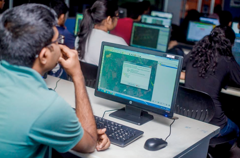
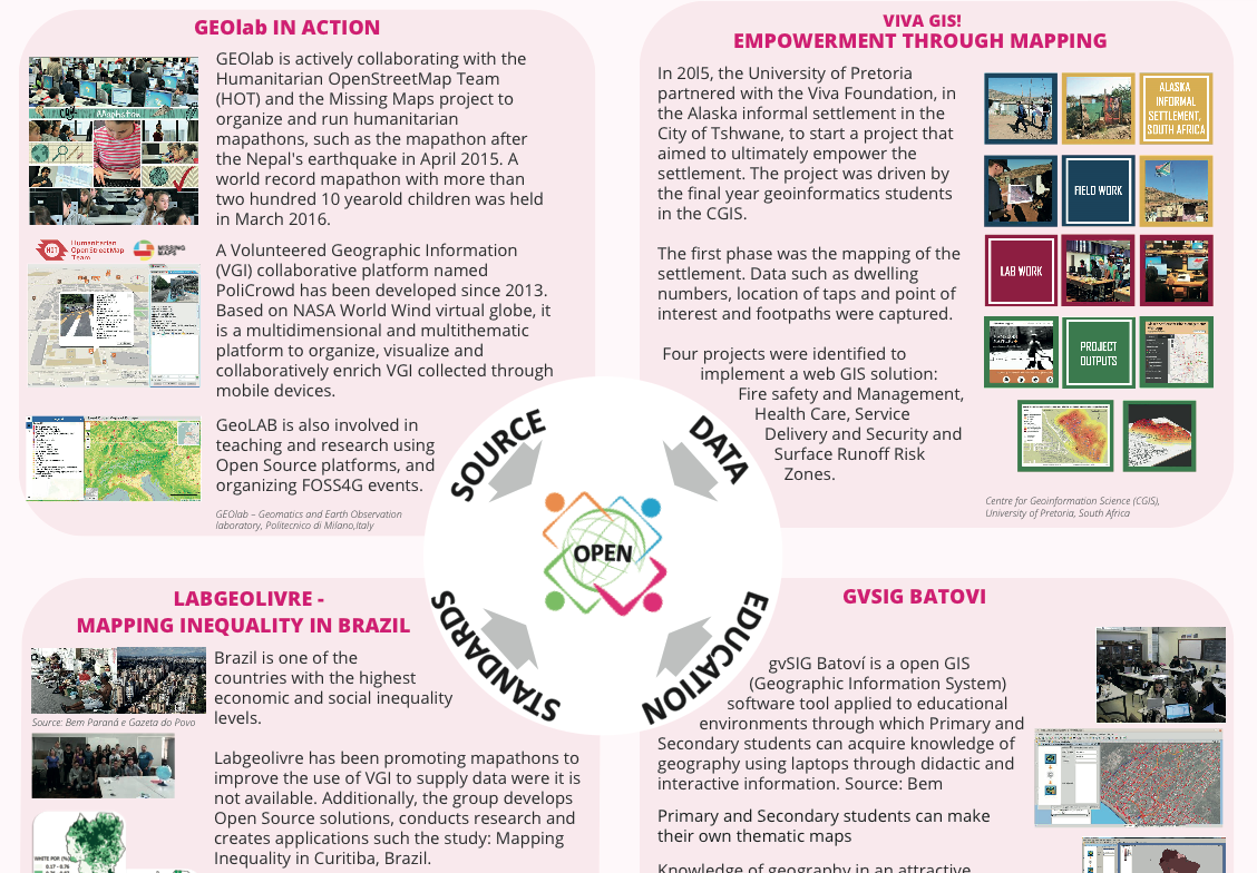
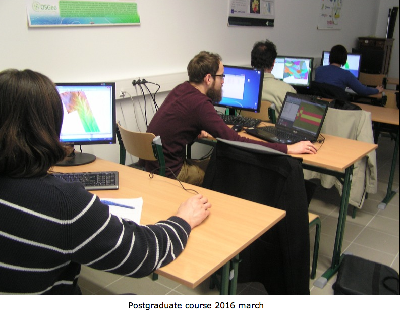
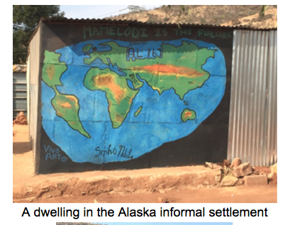
In 2014, Victoria helped to introduce the use of open source software in the final year project of geoinformatics students. Since 2015, the students have mapped the informal settlement called Alaska, in Mamelodi East, Pretoria (the name was given by locals because of its remoteness from the Pretoria city centre) for their project. After capturing data, such as dwelling numbers and tap distribution, various maps and 3D images were developed to show the current situation in the settlement. The data and maps assist local NGOs in the settlement with identifying and addressing symptoms of poverty, lack of security, and health concerns. This year, the students are improving the data and plan to add the footpaths to OpenStreetMap. A 2015 student blog describes their work and impressions https://mamelodimappers.wordpress.com/ .

screen-shot-2016-11-03-at-11-42-21


screen-shot-2016-11-03-at-11-42-30


screen-shot-2016-11-03-at-11-42-42


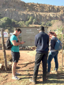
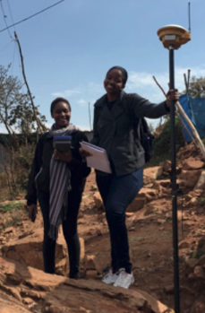
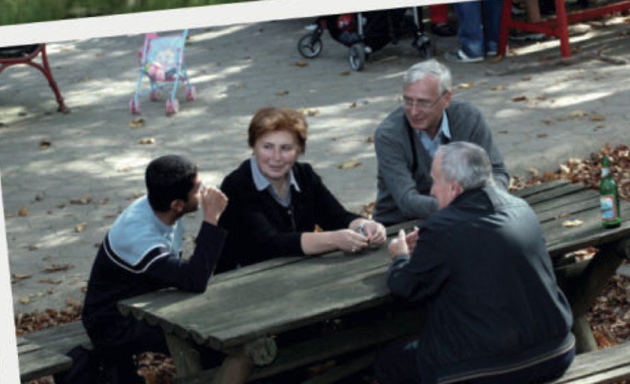
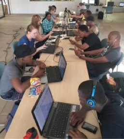
Third year students capturing data in the Alaska informal settlement

Victoria has also been involved in a number of student events to promote open data. The concept of an open data quest, started by SciBraai and Code4SA, is a South African initiative that encourages individuals from various backgrounds to discover and use South African data to find interesting stories and to create powerful visualizations.  In October 2015, the National Data Liberation was hosted at the Innovation Hub by Code4SA, geekulcha and Open Data Durban. Victoria Rautenbach competed at the event together with two UP students, Tshepo Mahudu and Sean Cullen, and another South African student, Nadia Oosthuizen (CSIR, Rhodes University), and Madi Hanekom (private consultant). They participated as Team DataDevils. The team used the 2013-2014 national protest data to create a visualization of the impact of protests on three economic hubs in South Africa. The DataDevils team was awarded first prize for their visualization at the Pretoria event. In April 2016, CGIS hosted a DataQuest on open data from the South African National Treasury. The aim of the event was to encourage participants to develop innovative data visualisations, stories and app ideas, using this local municipal budget information. For example, one participant designed a visualisation to show government spending per student at each South African university.

In 2016, Victoria hosted three groups of school children on three different Saturdays. The aim of the events was to inspire school children to be become passionate mappers through hands-on experience in a GIS lab. The first event was hosted for Grade 6 to 8 school children (12-14 years old) from the Leeuwenhof Academy. The event was part of the YouthMappers initiative and celebrated National Youth Day in South Africa. 55 children participated in two activities: 1) mapping a building on campus using ClassiCube (a free and easy-to-use substitute for Minecraft Classic, an early version of the popular game Minecraft); and 2) participating in a task of the Humanitarian OpenStreetMap Team (HOT) by mapping dwellings in Mozambique. This event ran concurrently with another YouthMappers event hosted by the Texas Tech University. During the two mapping events (i.e. at UP and Texas Tech), approximately 15,000 OpenStreetMap edits were made on this task (http://goo.gl/qst7Vu  )

screen-shot-2016-11-03-at-11-42-52).


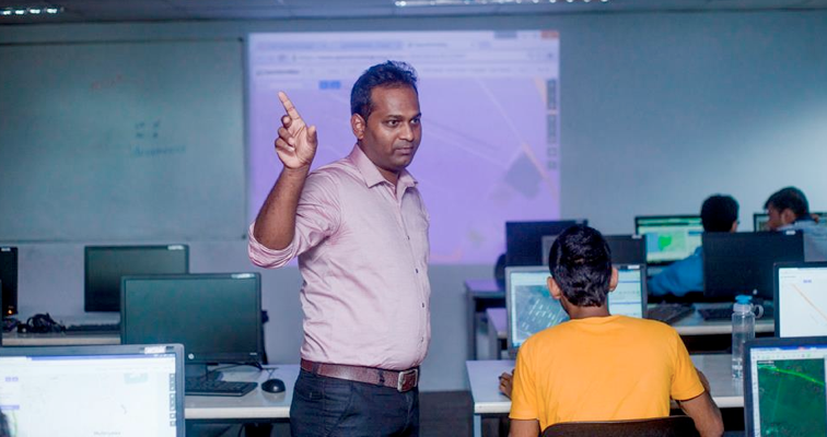
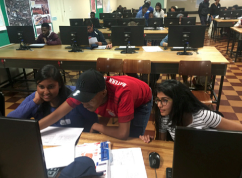
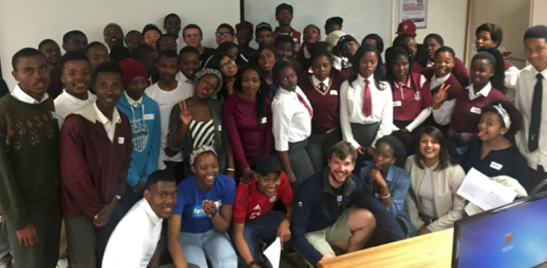
School learners experiencing geoinformatics at UP, August 2016

In August and September 2016, learners from a number of schools were invited to spend a Saturday at UP to learn about geoinformatics. Most learners were from Mamelodi (close to UP), but a few had travelled from as far as Limpopo (approx. 300km) and KwaZulu-Natal (approx. 600km) to attend the event. Each day started with short talks by UP staff members, UP students and professionals from industry. The talks provided insight into the work of a geoinformatics professional. Subsequently, the learners collected data on campus during a scavenger hunt and used this data to create a map of the campus.

screen-shot-2016-11-03-at-11-43-00


screen-shot-2016-11-03-at-11-43-17


YouthMappers map-a-thon, October 2016

A YouthMappers map-a-thon in October 2016 contributed to the Peace Corps efforts in Botswana. The aim of this Humanitarian OpenStreetMap Team (HOT) task was to contribute to a better base map for 45 sites in Botswana. The group of mappers mapped buildings and roads that would ultimately support long-term development and HIV projects in Botswana. The group used both OpenStreetMap and MapSwipe for the map-a-thon.

More information about CGIS activities can be found in the annual reports on the website at www.up.ac.za/cgis.

Geo for All is a worldwide movement that provides immediate benefit to the world. We aim to create openness in Geo Education for developing creative and open minds in students which is critical for building open innovation and contributes to building up Open Knowledge for the benefit of the whole society and for our future generations.

I am truly inspired to understand more about the amazing work done by Victoria and colleagues at the University of Pretoria. We are proud to honour Victoria as our GeoAmbassodor and we are extremely grateful for her contributions to Geo for All.

Best wishes,

Suchith Anand


Please share Open Principles in Education ideas and philosophy at all Geo events (Geography Awareness Week, OSM Geo week , GIS day etc )

Dear colleague,

May i request all who are taking part in various Geo events (Geography Awareness Week, OSM Geo Week, GIS day etc ) to also make use of the opportunity to promote Open Principles in GeoEducation by sharing information on GeoForAll and welcoming those interested to be part of this. Please give away OSGeo Live DVDs  and share GeoForAll ideas  at these events.

Screen Shot 2016-07-02 at 05.56.42

Open principles in geoeducation (open educational resources, free and open software, open data, open standards etc) are key for  true empowerment of staff and students globally and making geospatial education and opportunities accessible to all [1] . We look forward to working and building collaborations with all interested in this education mission. Access to quality education and opportunities is key for getting rid of extreme poverty and enabling broadly shared prosperity for all.

Our ideas are summarized at https://www.youtube.com/watch?v=SmGoC6iFds4

Millions of globally connected minds working together on the common mission of enabling Open Education opportunities for everyone will be key for making these developments possible. An idea whose time has come is the most powerful force in the universe, and the time for “Access to quality education opportunities for everyone” has arrived.

Education + Empowerment = GeoForAll

Happy GIS Day greetings in advance to all…

Best wishes,

Suchith

Dr. Suchith Anand
http://www.geoforall.org/

GeoForAll – Building and expanding Open Geospatial Science

Open Principles in Education

I would like to thank the Open Education SIG for the giving me opportunity to share our experiences on building Open Geospatial Science for the benefit of all to support Open Principles in Education.

Webinar recording available at

screen-shot-2016-10-14-at-11-35-18

Abstract at https://opensourcegeospatial.icaci.org/2016/09/open-principles-in-education-building-bridges-empowering-communities/

Slides at http://www.slideshare.net/SuchithAnand/


GeoAmbassador of the month – Nimalika Fernando

Dear colleagues,

It is my great pleasure to introduce Nimalika Fernando as our GeoAmbassador. I am grateful for this opportunity of introducing some of our amazing colleagues from different parts of our world each month as our GeoAmbassadors and this has also helped me also to learn and get inspired by their amazing work and contributions for the wider community. Nimalika established the OSGeo lab at Sri Lanka Institute of Information Technology(SLIIT), Sri Lanka in 2014. Though I have not yet got the opportunity to meet Nimalika , I am amazed by her teaching and contributions she made.

Nimalika_SLIITPhoto


Nimalika Fernando was an academic attached to Sri Lanka Institute of Information Technology(SLIIT), Sri Lanka from 2001 -2016 and now she is a research student at Curtin University, Perth Australia. Nimalika has moved to geospatial domain in 2005 with her MSc project, without having any formal education in GIS . GIS became practically important to the country at that time as Sri Lanka was facing large planning issues after 2004 Tsunami with no much technological knowledge at hand. Dr. Waidyasekara, a GIS enthusiastic who was a senior academic at SLIIT that time proposed a web GIS for post disaster recovery management but the concept and technologies were entirely new to the country. Nimalika happened to inquire about free and open source approaches and MapServer and PostGIS as tools were the starting point of her GIS journey to learn web GIS. Her link with FOSS GIS continued ever since and she had started teaching what she had learned by experience and advocating the value of open source GIS to Sri Lankan community.

She designed and delivered a module on web –GIS with Map Server in 2008 for postgraduate students at Postgraduate Institute of science , Peradeniya by invitation of the MSc course coordinator, Dr. Jagath Goonathilake , who had taken a very challenging decision that time to introduce open source GIS to his students , in a background where nobody have heard about such options available. This module has opened Sri Lankan GIS professionals to open source GIS, a very new domain in Sri Lanka then and now it has become an established module where she still continue to be a teaching panel member.

In 2009, she introduced a “Geographic Information Systems” module as an elective to undergraduate students of Faculty of IT, University of Moratuwa. The same module was introduced to Faculty of Computing, SLIIT in 2011 with more practical components. Both these modules provide a unique opportunity to Sri Lankan undergraduates having IT background to learn and experience geospatial domain.

In 2014, the first Sri Lankan free and open source community gathering, FOSS4G Sri Lanka 2014 was organized by Nimalika and her team (Dr. Yann, Aruna of UOM and FOSS community of SLIIT) which brings together GIS enthusiasts of Sri Lanka ,including some very new to FOSS GIS. (http://foss4gsrilanka.lk/ )

She has being mentoring and conducting guest lectures and seminars on open source GIS for Sri Lankan university students and public servants travelling around the country. She teaches tools such as MapServer, QGIS , PostGIS and OSM mapping to Sri Lankan community. She has being participating at GIS events worldwide and was presenting at FOSS4G 2009 Sydney, FOSS4G Asis 2014 Bangkok and FOSS4G 2015 Seoul. She assisted in organizing FOSS4G Asia 2014 Bangkok and Asia Special Track of FOSS4G 2015 Seoul.

At SLIIT she acted as the advisor of Rotaract Club of SLIIT, FOSS Community of SLIIT , leader of the Geoinformatics & LBS research group and acted as a student counsellor from 2012 onwards.

Her biography is at https://lk.linkedin.com/in/nimalika-fernando-53b82813

Nimalika also kindly send updates on OSGeo Lab of SLIIT which is summarized below

In February 2014, OSGeo lab of SLIIT was initiated as the second OSGeo lab of Sri Lanka with Nimalika as the contact point. (http://lists.osgeo.org/pipermail/announce/2014-February/000249.html)

It was Dr. Yann Chamin who motivated to initiate the lab, who was introduced to Nimalika by Vivien Deparday, a keen GIS developer who regularly visit Sri Lanka and always keen in linking Sri Lankan community with the world community. The lab marked a milestone for GIS teaching and learning of SLIIT students and the whole community.

Some remarks of the OSGeo lab of SLIIT and outcomes

  • An elective module , GIS is offered to SLIIT final year IT students via the lab , which became a very successful module where students are introduced to GIS concepts and tools. Many of them use the skills in their final year projects and professional life.
  • Lab act as a contact point for other Sri Lankan universities and community to get support and resources
  • OSGeo lab of SLIIT acted as the core organizer, providing venue and all logistics support for FOSS4G Sri Lanka 2014
  • A team of SLIIT students has won the best student presentation at the FOSS 4G 2016, Seoul for their presentation “Landmark Based Path Planning and Linear Path Generation for Mobile Map Applications.” ( News Article : http://www.directionsmag.com/entry/reflections-on-foss4g-seoul-2015/455554 )

They were trying to apply the local and personal context to land mark based path planning and developed a novel method for path planning using a weighted model. OSM data were used for the application.

Screen Shot 2016-09-05 at 14.58.54


SLIIT Students Pasundu Chandrasekara & Thejaka Mahaulpatha receiving the award at FOSS4G 2015 

  • OSGeo Lab of SLIIT links students to industry opportunities. Until now two students of SLIIT had obtained valuable internships for GIS Programming in World Bank projects in Sri Lanka. The experience they obtain via this would be remarkable as they work directly under the supervision of core developers from the team. They work related to GeoNode based application development.

 Some activities organized by the lab

  • We organized seminars to introduce new technologies and to link students ( Open data for resilience -2014, Geo-social Intelligence to aid Disaster Response -2015)
  • A workshop to celebrate the world geography awareness week is organized by the lab in 19th November 2016, linking with OSM Geography awareness week.

Poster  used for OSM workshop

Screen Shot 2016-09-05 at 14.59.07 

 Screen Shot 2016-09-05 at 14.59.17

Photos from the OSM Workshop

 Screen Shot 2016-09-05 at 14.59.28

Photos from the OSM workshop : Mr. Sudakarna fom GFDRR Project assisted as a resource person


  • As an immediate response to heavy floods occurred in Sri Lanka in May 2016, Humanitarian OpenStreetMap Team (HOT) organized global mapping events to map flood affected areas. SLIIT OSGeo lab also took part of this and organized a Mapathon to support flood on 21st of May 2016. This was a unique event, organized within a day while the university is blocked by floods.

 Screen Shot 2016-09-05 at 14.59.45

A photo from the Flood mapping event


( Link can be found here : https://www.mapbox.com/blog/relationships-tools-response/ )

Geo for All is a worldwide movement that provides immediate benefit to the world. We aim to create openness in Geo Education for developing creative and open minds in students which is critical for building open innovation and contributes to building up Open Knowledge for the benefit of the whole society and for our future generations. We are proud to honour Nimalika as our GeoAmbassador and we are extremely grateful for her contributions to Geo for All.

Best wishes,

Suchith Anand


“Geo4All” Lab of the Month –University of Zagreb, Croatia

It is my great pleasure to introduce our colleagues at OSGL of the Faculty of Geodesy, University of Zagreb, Croatia as our “Geo4All” lab of the month. I thank Dražen Tutić for providing all the background information and photos of the activities of the lab which is summarized in this article. I first met Dražen Tutić , Miljenko Lapaine and other colleagues when I visited Zagreb for the 10th Jubilee  Cartography and Geoinformation International conference for delivering a keynote presentation on “The Importance of Openness in Geospatial Education and Research”. That visit helped me to get a good understanding of the amazing work Dražen and colleagues were doing.

Screen Shot 2016-09-03 at 18.23.56Group photo with University of Zagreb colleagues

zagreb2


The University of Zagreb (http://www.unizg.hr/ ) (established in 1669) is the oldest and biggest university in South-Eastern Europe. It consists of 33 faculties, academies and the Centre for Croatian Studies. With its comprehensive programmes and over 72,000 students it is the strongest teaching institution in Croatia.

The Faculty of Geodesy, University of Zagreb (http://www.geof.unizg.hr ) is a public institution of higher education organizing and carrying out university studies, scientific and highly professional work in the scientific field of geodesy. The Faculty exists, as self-standing institution, since 1962. It is organized in three institutes (Geomatics, Cartography and Photogrammetry, Applied Geodesy), two laboratories (Laboratory for Measurements and Measuring Technology and Open Source Geospatial Laboratory) and the Observatory Hvar. The Faculty is the leading academic institution in geodesy and geoinformatics in Croatia and the region. It offers undergraduate, graduate, doctoral and specialist postgraduate study in geodesy and geoinformatics. Some 500 students are studying at the Faculty.

Dražen Tutić kindly send us the background information and activities of the lab which is summarized below .

Open Source Geospatial Lab (OSGL) was officially established in January 2014 with the goal to follow the mission and vision of the GeoForAll initiative, which we are trying to achieve by better structuring and fostering research, education and professional work in the development and application of open geospatial technologies and geoinformation. Details at http://www.geof.unizg.hr/mod/book/view.php?id=1165

 The Faculty of Geodesy introduced substantial number of geoinformatics courses and modules to the study of geodesy with the introduction of Bologna process in 2005. At first, students and teaching activities were supported by commercial software, but after more than 10 years, majority of teaching and student work is done using open source geospatial technologies such as QGIS, PostgreSQL+PostGIS, GRASS, PROJ4, Mapserver and OpenLayers. Students are also introduced to programming in several programming languages and are encouraged to solve problems by writing their own code.Nevertheless, we think that it is necessary to put more effort into bringing closer the open source technologies to students and teachers, as well as to our partners. So that was the primary activity of OSGL at the beginning.

Screen Shot 2016-09-03 at 18.08.43Screen Shot 2016-09-03 at 18.08.55


Agenda of the OSGL is as follows:

 * to support geospatial research and excellence in education through application of open source tools and data,

* to foster collaboration of Faculty professionals and scientists with national and international professionals and scientists,

* to educate on open source tools and data through study programmes, lifelong learning and other non-formal learning (including e-learning)

* to bring closer related professions and disciplines which can contribute to modern technologies in support spatial decision-making processes.

 Among the education materials we can highlight custom training materials for Linux and OSGeo programs published on the e-learning system, and expanded and localised training materials of QGIS GeoAcademy, module 104, Cartography using QGIS for Croatia and Montenegro. In collaboration with Students Council of Faculty of Geodesy and Croatian Cartographic Society we also organize or participate in educational events, e.g. OpenStreetMap Workshops for high school students or Humanitarian OpenStreetMap Team tasks. However, the special notion deserves students seminar Roles of Geodesy and Geoinformation in Sustainable Development where Suchith Anand participated as keynote speaker.

Screen Shot 2016-09-03 at 18.07.45


Screen Shot 2016-09-03 at 18.08.05


Screen Shot 2016-09-03 at 18.08.19

Our open source developing efforts are mainly in the field of our expertise, i.e. cartography and map projections. We are active in PROJ4 project and we published two QGIS plugins (for cartographic line generalisation and visualisation of map projection distortions). Latest project which we found challenging but also rewarding is automatic generation of custom small scale maps from OpenStreetMap data. With an example of automatic generation of wall world political map it has been shown that open data and open technologies can be used for the most challenging tasks in cartography, namely cartographic generalisation. More info on our projects can be found on Github (https://github.com/GEOF-OSGL ).

 Screen Shot 2016-09-03 at 18.09.12

 There is a lot work to be done in the future, especially in capacity building for open source tools and data in Croatia. Joining the GeoForAll initiative made our efforts easier and recognisable, with clear vision for our next steps.”

OSGL Croatia welcomes collaborations from all interested. Please email Dražen at dtutic@geof.hr

We thank Drazen and all colleagues and students at OSGL in Croatia for their contributions to the Geo4All initiative and look forward to working and building more collaborations with all interested on this education mission.

Best wishes,

Suchith Anand

http://www.geoforall.org

Inviting ideas to expand “GeoStudents for GeoFuture”.

Our colleagues at the Open Source Geospatial Lab [1] at the University of Zagreb, Croatia have  an excellent international seminar series  called “GeoStudents for GeoFuture”.

As part of this initiative, two year’s back, i was invited to deliver a  lecture series for students of the University of Zagreb  entitled “Roles of geodesy and geoinformatic in sustainable development”, along with  Prof. Dr. Yerach Doytsher (Faculty of Civil and Environmental Engineering Technion, Israel, the President of the FIG Comission 3) and Prof. Dr. Vladimir Tikunov ( Faculty of Geography, University of M.V. Lomonosov, Moscow, Russia, the President of the ICA Commission “GIS and Sustainable Development” .Details at http://www.geof.unizg.hr/mod/forum/discuss.php?d=335


zagrebFig 1 – Me with Prof. Dr. Yerach Doytsher (Faculty of Civil and Environmental Engineering Technion, Israel) and Prof. Dr. Vladimir Tikunov and his wife (  University of M.V. Lomonosov, Moscow, Russia ) .

zagreb4Fig 2 – Group photo with colleagues at University of Zagreb, Croatia

I really liked the focus of thier international seminar series on “GeoStudents for GeoFuture” and i am welcoming ideas from the wider geocommunity of how we can extend this “GeoStudents for GeoFuture” ideas to support  the International Map Year (IMY) by bringing together key scientists and students globally to work for contributing thier knowledge and skills for the UN sustainable development goals . Openness is key for true empowerment and sustainability [2].

One of the important things i learnt during  my lectures to students in universities worldwide (from USA to India), is that the digital natives are very smart. They have a very global outlook and are keen to contribute to building a better world for everyone . I remember talking to a student and asking her what GIS software she uses and her reply was “We use all different platforms to learn GIS but noone can trick us to  pay to buy GIS software when there is lot of free and open software now available” . I really liked this reply. This empowerment of students is exactly what we want. It is now not possible for any properitery GIS vendor to put “Iron Curtains” on freedom on  education tools.

“Geo for All” aims to create openness in Geo Education for developing creative and open minds in students which is critical for building open innovation and contributes to building up Open Knowledge for the benefit of the whole society and for our future generations.

Best wishes,

Suchith

Dr. Suchith Anand

http://www.geoforall.org/
Geo for All – Building and expanding Open Geospatial Science

GeoAmbassador of the month – Prof. Silvana Philippi Camboim

Dear colleagues,

It is my great pleasure to introduce Prof. Silvana Philippi Camboim as our GeoAmbassador.

Dr Silvana Comboim is Faculty at the Department of Geomatics at the Federal University of Paraná – UFPR, Brazil. She serves currently as the Chair of the Commission of Open Source Geospatial Technologies of the International Cartographic Association. She is the co-chair of “Geo for All” South America. She established the first Open Source Geospatial Lab in South America in the Federal University of Parana in 2012.

Silvana has strong research background in Geospatial Science, SDI and GI standards. Previously she was working at the Brazilian National Mapping Agency before moving to Federal University of Paraná as a professor at the Geomatics Department. She also coordinate the Standards Workgroup of the Brazilian NSDI (INDE). She also have a strong team and action plan in place for building this initiative for Brazil and South America.

Screen Shot 2016-08-05 at 08.22.58Dr. Silvana Philippi Camboim (Universidade Federal de Paraná ,Brazil)

Silvana is a true global citizen who has travelled around the world working for expanding opportunities for geospatial education for all. Silvana has been a great colleague for me at the International Cartographic Association (ICA) and the Open Source Geospatial Foundation (OSGeo). It is great pleasure that Silvana has succeeded me as the Chair of the ICA Commission on Geospatial Technologies. I had the pleasure to work closely with Silvana during my time as chair of the commission and I strongly believe that Silvana will build upon the work that we have done and take this to higher level.

Silvana is the leading force who took the initiative to establish the first OSGeo lab in South America at the Federal University of Parana, Brazil. The team of Open Geospatial Lab at UFPR comprise of Prof. Dr. Claudia Robbi Sluter ,Prof. Dr. Luciene S. Delazari ,Prof. Dr. Maria Cecilia B. Brandalize and Prof. Dr. Silvana Philippi Camboim . Details at http://www.labgeolivre.ufpr.br/?lang=en

I first met Silvana when she visited me at the University of Nottingham during her UK visit few years back. It was then we discussed initial ideas to establish the first OSGeo lab in South America and expand our collaborations. Her dedication and focus for expanding geoeducation opportunities in Brazil and globally has always inspired me.

As part of the International Map Year, Silvana and many colleagues in Brazil (Angelica Carvalho Di Maio, Luis Augusto Koenig Veiga, Juliana Magalhães Menezes, Marli Cigagna, Maria Cecília Bonato Bradalize, Raul Marques P. Friedman) have contributed to an Olympics of Cartography organised in Brazil, with almost 700 secondary schools distributed in the whole country. An Olympiad is a challenge, and challenges are incentives to improve the academic performance of students who can be awakened, in this case, to the study of spatial representation and the use of maps. The Ist Brazilian Cartographic Olympiad (OBRAC) has national coverage and was focused on high school students, aged between 14 and 18 years, from public and private schools. Among the objectives of the event stands out: stimulating school interest in science, especially in mapping science; provide teachers with the knowledge and tools for dynamic and participatory teaching areas covering the cartographic content; providing socialization of teachers and students through group activities and foster the training of human resources to work in the field of cartography and geotechnologies.

The project for the first Brazilian Cartographic Olympiad meets a worldwide celebration, the International Map year 2015/16, which aims to provide opportunities to engage people the in art, science and technology of maps’ construction and use. The map of participants can be accessed at http://www.olimpiadadecartografia.uff.br/index.php/mapa    and more information can be found in English at http://www.icc2015.org/brazilian-cartographic-olympiad.html

Silvana has already made a great start  for this new term of the commission with  the successful organization of ICC workshop on Spatial data infrastructures, standards, open source and open data for geospatial (SDI-Open 2015)  jointly organized by the ICA Commission on Geoinformation Infrastructures and Standards, the Commission on Open Source Geospatial Technologies , Open Source Geospatial Foundation (OSGeo) and the Open Geospatial Consortium (OGC) on 20 and 21 August 2014 at Brazilian Institute of Geography and Statistics (IBGE) in Rio de and the Conference itself http://www.icc2015.org  was a great opportunity to strengthen the “Geo for All” initiative and to reinforce the key projects and research links for the future.

I had the opportunity of participating in the NSDI conference and meetings in Brasília, Brazil in May 2014 . I would like to thank the Ministry of Planning, Government of Brazil for organising this excellent event and also for their kind invitation for keynote presentation where i shared the developments in Open Geospatial Science and Applications and its importance for widening education opportunities, new jobs creation and innovation ecosystems in Geoservices. It was also a good opportunity for me to see the amazing work Silvana and her colleagues are doing during that visit . I see the work that Silvana is doing in Brazil having a great momentum for our global activities of “Geo for All” mission.

I would like to share some of the things i learned from our colleagues in Brazil which i think is relevant to the wider community

  1. There are fast paced developments happening in Geospatial domain and it is important the countries should keep updating their Geoinformation policies to reflect this and take advantage of the new opportunities. I am pleased to see countries like Brazil are well tuned to global developments.
  2. It is important to have inputs from the academic community and i was pleased to see this bringing together of key people from government and academia to discuss ideas and good practices.
  3. Education and Capacity building is key for expanding opportunities.

Recently Silvana and our other colleagues at the International Cartographic Association (ICA) and its commissions have been contributing efforts as part of the International Map Year (IMY) by highlighting the value of cartography by “mapping” the UN sustainable development goals and providing map perspective on the sustainable development goals [1].

Screen Shot 2016-07-11 at 09.58.00


Special thanks to Silvana and cochair Michael P. Finn (United States Geological Survey) as well as all members of the commission for their contributions to the goal to reduce inequalities within and among countries. Inequalities can have a strong geographic component and maps are a powerful tool to understand factors and plan measures to address such issues. Details at http://icaci.org/files/developmentgoals/goal_10.pdf

Screen Shot 2016-07-11 at 13.18.25

 Geo for All is committed to work towards the vision of the United Nations 2030 Agenda for Sustainable Development for building a better world for everyone. Open Education is the simple and powerful idea that the world’s knowledge is a public good and that technology in general and the internet in particular provide an extraordinary opportunity for everyone to share, use, and reuse knowledge. Openness is key for true empowerment and sustainability. [2]

Geo for All is a worldwide movement that provides immediate benefit to the world.We will also link the ideas from Maps and Sustainable Development Goals to our Vision 2030 for Open Geospatial Science as there are also lot of synergies and will add momentum for our vision for Open Geospatial Science [3] . We aim to create openness in Geo Education for developing creative and open minds in students which is critical for building open innovation and contributes to building up Open Knowledge for the benefit of the whole society and for our future generations.

 I am sure Silvana will expand these ideas for the future. Silvana and Mike Finn are leading the  Advancing GIScience with Open Source Technologies [4] at AutoCarto 2016, USA . Silvana will be delivering keynote on “Experiences on How Openness Can Help to Reduce Inequality” and also chair the Open Discussion on “Future Directions: Thinking About the Road Ahead”.

We are looking forward to building  strong research and teaching collaborations  worldwide in Open Geospatial Science. We are proud to honour Silvana as our GeoAmbassodor and we are extremely grateful for her contributions to Geo for All.

Best wishes,

Suchith

[1] http://icaci.org/maps-and-sustainable-development-goals/

[2] https://opensourcegeospatial.icaci.org/2016/07/sharing-is-caring-why-openness-is-key-for-true-empowerment-and-sustainability/

[3] https://opensourcegeospatial.icaci.org/2016/06/open-consultation-on-the-vision-2030-for-open-geospatial-science/

[4] http://www.unm.edu/~sfreunds/autocarto2016/Open_Source_Geospatial.html

“Geo4All” Lab of the Month – Open Source Geospatial Lab, Department of Geodesy and Surveying at the Budapest University of Technology and Economics, Hungary

It is my great pleasure, to introduce our colleagues at the Open Source Geospatial Lab of Department of Geodesy and Surveying at the Budapest University of Technology and Economics , Hungary as our “Geo4All” lab of the month. The Budapest University of Technology and Economics (BME), is the most significant University of Technology in Hungary and is considered the world’s oldest Institute of Technology which has university rank and structure. It was the first institute in Europe to train engineers at university level [1]. It was founded in 1782. More than 110 departments and institutes operate within the structure of eight faculties. About 1100 lecturers, 400 researchers and other degree holders and numerous invited lecturers and expert specialists participate in education and research at the Budapest University of Technology and Economics. The Budapest University of Technology and Economics issues about 70% of Hungary’s engineering degrees. 34 professors/researchers of the university are members of the Hungarian Academy of Sciences.[2][3].

The OSGeo lab is run by the Department of Geodesy and Surveying and lead by Dr. Zoltán Siki. The members of the lab are Dr. Szabolcs Rózsa, Dr. ZitaUltmann, Ottó Deák, Dr. Csaba Égető, Dr. Bence Takács and Dr. Tamás Tuchband but draws heavily on interactions with other research groups and partners within the University, nationally and internationally.

They offer a range of bespoke courses for OSGEO education . Hungarian trainings are offered in QGIS ,GRASS GIS ,MapServer ,OpenLayers SpatialLite and PostGIS .Their degree programs make use of OSGEO software and tools for data collection, storage and analysis.  Their graduates receive a solid grounding in Open Source tools and their applications. Further details on their education programs can be found in their website at http://www.agt.bme.hu/osgeolab/index.php?page=training&lang=en

Screen Shot 2016-07-28 at 09.22.06


Screen Shot 2016-07-28 at 09.22.37


Screen Shot 2016-07-28 at 09.23.13

Screen Shot 2016-07-28 at 09.23.44

The Lab has also been active in presenting their research at other wider events. For example it was represented on the 13th Geospatial Information & Technology Association conference hosted by the Hungarian GITA organisation where visitors were able to receive additional information about our OSGeo Lab Budapest .

Screen Shot 2016-07-28 at 09.25.34


Screen Shot 2016-07-28 at 09.26.04

The OSGEO Lab at Budapest is involved in a number of major international and national research projects.  Their team works on further developments of open source software, search/fix bugs and maintain the Hungarian localizations (especially QGIS). They also provide software and spatial expertise to the solution of engineering problems using Open Source tools, software and standards.   The Geo for All lab in Budapest University of Technology and Economics welcomes collaborations from all interested and for making contributions to the wider society.

On behalf of the Geo4All community, we thank Zoltán Siki and all colleagues at the Budapest lab for their contributions to the Geo4All initiative and look forward to working and building more collaborations with all interested on this education mission.

Best wishes,

Suchith Anand

http://www.geoforall.org

[1] http://www.moveonnet.eu/directory/institution?id=HUBUDAPES02

[2] https://en.wikipedia.org/wiki/Budapest_University_of_Technology_and_Economics

[3] http://www.bme.hu/?language=en

First Anniversary edition of our Geo4All Newsletter and invitation to be our GeoAmbassadors

We are pleased to announce the first year anniversary of our GeoforAll Newsletter (this is our twelfth issue). On behalf of the GeoforAll community, I would like to thank  Nikos Lambrinos (Chief Editor) and our wonderful team of co-editors Rizwan Bulbul, Pavel Kikin, Alexey Kolesnikov, Rania Elsayed, Elżbieta Wołoszyńska-Wiśniewska, Antoni Perez Navaro, Emma Strong, Sergio Acosta Y Lara and  production designer Nikos Voudrislis  for their selfless dedication and volunteer efforts  which made this possible. This newsletter has been an amazing instrument to share information and ideas with the wider geocommunity and also highlight and honour the contributions of our excellent colleagues from across the world. Details at http://www.geoforall.org/newsletters/

This newsletter is a community initiative run by the community for the community. We welcome all community members to contribute and share their updates to the newsletter for the benefit of the wider geo community.

Screen Shot 2016-07-02 at 05.56.42


We have made ‘Open Principles’ as the key guideline for all articles. Relevant updates and information on free and open software, open data, open standards, open education resources are all welcome for future editions. It has been a learning curve for all of us, and we request you all to help us on this initiative.

We have great pleasure in introducing Professor Georg Gartner as our GeoAmbassador for this first Anniversary edition of our Geo4All Newsletter. More information at https://opensourcegeospatial.icaci.org/2016/07/geoambassodor-professor-georg-gartner/

So how can you contribute to enable geospatial education opportunities to all ? Everyone who is interested in enabling geospatial education opportunities to all are our GeoAmbassadors. It is not just the thousands of OSGeo members but also thousands of colleagues in ICA, ISPRS, UCGIS, AGILE, GSDI, AGS  who all work for Geoeducation opportunities for all who are our GeoAmbassadors. Geo for All is a world wide movement that provides immediate benefit to the world.

Share the free and open educational resources and software that are available from OSGeo Live to MapStory to Teacher Training resources   (developed thanks to the contributions to thousands of volunteers) all available free and open to all at http://www.geoforall.org/training/ to colleagues globally and be our GeoAmbassadors.

Also it is our great pleasure to introduce our colleagues at SIGTE, University of Girona [1] , Spain, as our “Geo4All” lab of the month. One of the founder labs of the Geo for All initiative, SIGTE has been contributing immensely to our teaching, research, and service activities. SIGTE colleagues have been the pioneers of a very successful summer school program dedicated to free and open geographic information software and aimed at promoting the use and development of free geospatial solutions and empowering students. Details are available at https://opensourcegeospatial.icaci.org/2016/07/geo4all-lab-of-the-month-sigte-university-of-girona-spain/

We thank Gemma Boix, Lluís Vicens, Gemma Pons, Rosa Olivella, Ferran Orduña,Toni Hernandez, Alexandre Busquets, Josep Sitjar, Laura Olivas and all colleagues and students at SIGTE lab for their contributions to the Geo4All initiative and look forward to working and building more collaborations with all interested on this education mission.

Share the power of Geographic Information video that SIGTE developed  https://vimeo.com/22069904  This is a wonderful introductory video that can be used by all colleagues globally to promote GIS at all levels  .  “In the not so distant future, it is hoped that GIS will help us build a better and more efficient society for all” – This is exactly why we are all working on Geo4All…

The contributions of SIGTE colleagues is a good example of our philosophy and why we are working on Geo4All at https://opensourcegeospatial.icaci.org/2016/07/sharing-is-caring-why-openness-is-key-for-true-empowerment-and-sustainability/

Let us work together  to support open principles in education and enable Geo technologies in empowering communities and helping improving the Quality of Life and standards of living for everyone. Let us all work together to help create a world that is more accessible, equitable and full of innovation and opportunities for everyone.

Happy Anniversary to all.

Best wishes,

Suchith Anand
http://www.geoforall.org/

Future of GIS should be empowerment NOT enslavement – Examples needed for Geo4All newsletter

Around six months ago , i send an open letter to AAG humbly requesting to include Open Education principles  firmly in the new Advanced Placement course in Geographic Information Science and Technology (GIS&T) [1].  I was concerned by the enslavement strategy in geoeducation . I haven’t heard any updates but i really hope AAG will consider my humble request.We have moral responsibility to be the voice for open principles in geoeducation and protect open principles for our future generations.

Inspite of all the technological advancements, it is a sad fact that majority of the world’s poorest living in urban areas do not still have access to basic facilities (clean water, proper sanitation and hygiene facilities , good quality education opportunities etc).
GIS is fundamental technology in infrastructure development and high cost proprietary GIS is unaffordable to governments, town planners and local authorities in developing and economically poor countries. In order to achieve UN Millennium Development Goals it is essential to provide free and open source geospatial tools to universities, government organisations etc in developing countries for helping them achieve these targets .But with the availability of Open Source GIS technologies now it offers a great opportunity for governments and municipal authorities in developing countries also to implement GIS tools for their decision making and implementation needs (without having to pay huge annual licencing costs to proprietary GIS vendors) and help improving the lives of some of the most poorest people and by giving the geospatial tools to the municipal authorities for their decision making and implementation needs will help in improving the living standards of the people. We need to empower people and communities (NOT enslaving them by forcing them to pay high licencing costs ) to make sure future generations are fully empowered.

Thanks to our Geo4All colleagues, we have already seen lot of examples from our amazing colleagues globally of the potential of Geo technologies in empowering communities and helping improving the lives of some of the most poorest people and by capacity building staff and students and giving the geospatial tools to the municipal authorities for their infrastructure upgradation programs ( which in the long term will result in providing clean water, proper sanitation and hygiene facilities etc) and will help in improving the living standards of the people. It is with these aims that the Geo4All community decided to work on
OpenCitySmart – The Open platform for Smart Cities [2]. We will have an article on OpenCitySmart for our March 2015 newsletter.

So i request you all to
please send us examples of GIS empowering people, companies, startups and governments worldwide for our Geo4All monthly newsletter http://www.geoforall.org/newsletters 

Geo for All is the Open Source Geospatial Foundation’s Educational outreach and our mission for making geospatial education and opportunities accessible to all. Our monthly newsletters are key to reach out our ideas to thousands of readers and build new collaborations.We request wider geocommunity to share any updates/developments as short reports for next issue of Geo4All newsletter.

Also we want to hightlight the geospatial industry, SMEs and service providers building on OSGeo ecosystem [3]  in our future editions of our newsletter. The aim is to get the wider community know about the excellent companies and startups (generating hundreds of highly skilled jobs) that make the OSGeo ecosystem and encourage more collaborations and startups which will help accelerate digital economy for the future . This will create innovation opportunities globally and locally. For example, the startup community is especially open to the use of open software and data avoiding huge licensing costs and restrictions which may impact on their business plans, raise early start-up costs and restrict their ability to innovate and it frees them of the need to use proprietary software and data allowing them greater branding freedom and product flexibility.


So please email our chief editor [email-  labrinos@eled.auth.gr  ] a short article about your company and how OSGeo software has been empowering you and enabling your growth . We also welcome
usecases and implementation examples of how OSGeo software and open principles in education are empowering universities, government organisations, NGOs etc. We will get your articles published in our newsletter in forthcoming issues. Please make sure you send your articles before 24th of every month to get it published in the next month’s edition.

We are looking forward to your contributions on examples of GIS truly empowering people, communities and organisations.We welcome everyone interested to join synergies and work together to support open principles in geoeducation and enable Geo technologies in empowering communities and helping improving the Quality of Life and standards of living for everyone. Let us all work together to help create a world that is more accessible, equitable and full of innovation and opportunities for everyone.


Best wishes,


Suchith Anand

http://www.geoforall.org/

[1] http://lists.osgeo.org/pipermail/ica-osgeo-labs/2015-June/001742.html
[2] https://www.youtube.com/watch?v=aWuMfMMPfPw
[3] http://www.osgeo.org/search_profile?SET=1