Help Humanitarian OpenStreetMap Team map against malaria!

Humanitarian OpenStreetMap Team (HOT) is calling all mappers to help us and our partners eliminate malaria with our biggest project to date! Nearly half of the world’s population is at risk of malaria. In 2015, there were roughly 212 million malaria cases and an estimated 429 000 malaria deaths.*

Screen Shot 2017-03-05 at 09.52.21

 
Fig 1 – A very special and successful mapathon with more than 200 ,10-year old children was held in March 2016 at GEOlab , Italy, see this post on HOT’s blog.
HOT is working on two projects, mapping over 500,000 square kilometers in 7 countries. This project collective is part of the Missing Maps initiative in conjunction with DigitalGlobe, the Clinton Health Access Initiative, the Gates Foundation, PATH and MapBox.  We’re dedicating this whole week to support this crisis mapping project, including a competition for our Youth Mappers chapters.

“GeoForAll” Lab of the Month – Open Source Geospatial Lab, Belgrade, Serbia

Today, The Open Source Geospatial Foundation celebrates our 11th Anniversary. On behalf  of the Open Source Geospatial Foundation i would like to  send our greetings to everyone on the happy occassion of 11th Anniversary of when our  Foundation was founded (4th Feb 2006) at http://www.osgeo.org/node/1672

It is my great pleasure, to introduce our colleagues at the Open Source Geospatial Lab of The Department of Geodesy and Geoinformatics of the Faculty of Civil Engineering, University of Belgrade as our “GeoForAll” lab of the month. The Department of Geodesy and Geoinformatics of the Faculty of Civil Engineering, University of Belgrade has been actively using open source software in education of geodetic engineers at the undergraduate, graduate and PhD studies. A large number of bachelor’s, master’s and doctoral thesis has been created using open source software. Additionally, a significant number of scientific papers written by members of the department has also been published using open source software. The development of Laboratory for development of open source geospatial technologies – OSGL Belgrade at the Department of Geodesy and Geoinformatics seemed like the logical next step in the process of promotion and cultivation of a open source approach to the improvement of teaching and research at the University of Belgrade. In addition to intensive use of open source in BSc and MSc courses, there is an example of contribution to open source community from Luka Glušica, an OSGL Belgrade member and master student of the Geoinformatics module at the Department of Geodesy and Geoinformatics who has got Google Summer of Code scholarship. Luka is currently working on his master thesis in the field of Information Technologies in Cartography at OSGL Belgrade, under the mentorship of Dr. Milan Kilibarda. Luka works on development of JavaScript framework that will allow developers to easily implement istSOS functionality in existing or new web application. (details: https://webpractice-lukag.github.io/istSOS-Web-API/)

Screen Shot 2017-02-04 at 17.45.36

In addition to their teaching obligations, members of OSGL lab are also involved in international and national scientific and innovation projects. One of the ongoing projects is APOLLO, the EU-funded HORIZON 2020 project aiming to develop a market-ready platform of agricultural advisory services for primarily, but not exclusively, at smallholder farmers in Europe. The APOLLO project aims to bring benefits of precision agriculture to farmers through affordable information services, making extensive use of free and open Earth Observation data, such as those provided by the European Union’s Copernicus programme. These services will help farmers to make better decisions by monitoring growth and health of crops, providing advice on when to irrigate and till their fields, and estimating the yields. Ultimately, these interventions should lead to decreased costs and higher yields – and therefore increased profitability and competitiveness. (http://apollo-h2020.eu/)

Recently completed Serbian research data portal which was developed under Danube Data and Services Infrastructure (DRDSI) project was also made at OSGL Belgrade using open source Geonetwork (http://osgl.grf.bg.ac.rs/en/services/geonetwork/). “The purpose of the work within the Serbian research data portal is to establish a ‘local node’ for the DRDSI in Serbia and to explore how this approach could be adopted by key actors in the country. This work created a ready and sustained means to harvest metadata using an Open Data approach, based on the technologies used by the DRDSI platform. In addition, it acts as a demonstrator for other organisations to share data by documenting the approach and experience gained, creating further content for the DRDSI Platform.” (from: Data Infrastructures in Support of Macro-Regional Development. Experiences and Lessons Learned from the Danube Region; EUR 28297 EN; doi:10.2791/42047 )

Many workshops and conferences were organised by OSGL Belgrade. Some examples below

GeoMLA: Geostatistics and Machine Learning Applications in Climate and Environmental Sciences; (http://geomla.grf.bg.ac.rs/)

WorldDailyMeteo: space-time interpolation of daily meteorological variables at 1 km resolution;(http://dailymeteo.org/2014), folowed by Special issue in Spatial Statistics

Spatial and spatio-temporal modeling of meteorological and climatic variables using Open Source software (http://www.sciencedirect.com/science/article/pii/S2211675315000536)

R+OSGeo in higher education (http://geostat-course.org/R_OSGeo_in_Education_Belgrade)

Screen Shot 2017-02-04 at 17.41.51


OSGL Belgrade core team from left: Nemanja Branisavljevic, Dragutin Protic, Branislav Bajat, Milan KIlibarda, Ognjen Antonijevic, Luka Glusica, Aleksandar Sekulic

The GeoForAll lab in University of Belgrade welcomes collaborations from all interested and for making contributions to the wider society. More details at http://osgl.grf.bg.ac.rs/en/

On behalf of the GeoForAll community, we thank Dr. Milan KIlibarda and all colleagues from the University of Belgrade and for their contributions to the GeoForAll initiative and look forward to working and building more collaborations with all interested on this education mission.

Happy birthday to OSGeo Foundation and may God’s grace and blessings be with all of us and OSGeo for our efforts to empower everyone with open geo principles  to help create a world that is more accessible, equitable and full of innovation and opportunities for everyone.

Best wishes,

Suchith Anand
http://www.geoforall.org/

“GeoForAll” Lab of the Month – Texas A&M University – Corpus Christi , USA

Dear Colleagues,

On behalf of GeoForAll and the Open Source Geospatial Foundation let me take this opportunity to wish you and your families a very Happy New Year 2017 [1] and a successful year ahead. It is also my great pleasure, to introduce our colleagues at Texas A&M University – Corpus Christi , USA as our “GeoForAll” lab of this month in the New Year.

The Spatial {Query} Lab [2] at Texas A&M University – Corpus Christi [3] has a mission of making spatial technology, education, and information accessible to everyone. A large part of meeting this mission is the continued development and maintenance of the GeoAcademy curriculum (http://spatialquerylab.com/foss4g-academy-curriculum/).

texas1


Richard Smith (Assistant Professor and Program Coordinator of GISc/GSEN) said “Over the past several months, we have been working to update the labs to match the latest versions of QGIS, GRASS, and Inkscape, as well as releasing related lecture materials. Combined, the GeoAcademy curriculum offers five college-level courses of content, all Creative Commons licensed and freely available to all who wish to use it. As an example of recent use, the GeoAcademy curriculum is being used as the inaugural curriculum for the UN Open GIS Initiative where we are currently teaching our third cohort of students and will be teaching the fourth and final cohort starting in December. Students at the Spatial {Query} Lab worked hard to get the curriculum updated to QGIS 2.14 for the course and are thrilled that their work is having an immediate benefit and being used by the UN Open GIS Initiative. The beauty of maintaining this type of open curriculum is seeing its adoption, use, and collaborations that are taking place. Another project we are working on at the Spatial {Query} Lab is our map scanning project (http://spatialquerylab.com/projects/map-scanning/) where we are scanning, cataloging, transcribing, and rectifying tens of thousands of historic maps from South Texas (we occasionally blog about interesting things we find as we scan them at: http://spatialquerylab.com/tag/find-of-the-week/).

texas


We will begin publishing this collection online to the public, for free, starting in Spring 2017. Something we are particularly proud of is the software we wrote to operationalize our scanning project, BandoCat, has been so useful to us, and, as we have demonstrated it to others, looks to be potentially useful for them, we are going to be open sourcing the BandoCat software beginning in Spring 2017 in the hopes that it can be useful to others who are looking at digitizing hard copy maps and documents.” Thank you Richard for these excellent updates from your lab. This is truly amazing work you and colleagues are doing…

texas2


On behalf of the GeoForAll community, we thank Richard Smith and all colleagues the Texas A&M University – Corpus Christi , USA for their help and for their contributions to the GeoForAll initiative and look forward to working and building more collaborations with all interested on this education mission. We believe in empowering people with spatial decision making tools to help build a better society for all of humanity. Open principles in geoeducation (open educational resources, free and open software, open data, open standards etc) are key for  true empowerment of staff and students globally and making geospatial education and opportunities accessible to all . Access to quality education and opportunities is key for getting rid of extreme poverty and enabling broadly shared prosperity for all.

Millions of globally connected minds working together on the common mission of enabling Open Education opportunities for everyone will be key for making these developments possible. An idea whose time has come is the most powerful force in the universe, and the time for “Access to quality education opportunities for everyone” has arrived. We look forward to working and building collaborations with all interested in this education mission.

Happy Year of Open 2017 …

open2017


Best wishes,

Suchith Anand

[1] https://opensourcegeospatial.icaci.org/2017/01/happy-year-of-open-2017/

[2] http://www.spatialquerylab.com

[3] http://gisc.tamucc.edu

Summary of the workshop on Advancing GIScience with Open Source Technologies

The ICA Commission on Open Source Geospatial Technologies held a very well-attended, successful one-day workshop on Advancing GIScience with Open Source Technologies the day before the start of Auto Carto. The agenda consisted of seven invited speakers and an open discussion session. The Chair of the commission, Silvana Camboim, opened the presentations and led the discussion. The Vice-Chair, Michael P. Finn, organized the workshop and served as the moderator. Summary of the workshop on Advancing GIScience with Open Source Technologies are at http://icaci.org/summary-of-the-workshop-on-advancing-giscience-with-open-source-technologies/

“GeoForAll” Lab of the Month – Asian Institute of Technology, Thailand

It is my great pleasure, to introduce our colleagues at Asian Institute of Technology, Thailand as our “GeoForAll” lab of the month. The Asian Institute of Technology promotes technological change and sustainable development in the Asian-Pacific region through higher education, research and outreach. Established in Bangkok in 1959, AIT has become a leading regional postgraduate institution and is actively working with public and private sector partners throughout the region and with some of the top universities in the world. Recognized for its multinational, multicultural ethos, the Institute operates as a self-contained international community at its campus located 40km (25 miles) north of downtown Bangkok, Thailand. More details at http://www.ait.ac.th

Thailand has a very vibrant OSGeo community. Thailand hosted the Free & Open Solutions for Geoinformatics-Asia conference in Bangkok( 2-5 December 2014)

Bringing together FOSS4G users and developers worldwide and foster closer interactions with and amongst Asian communities in order to share ideas for improving software and applications. The Bangkok conference covered all aspects of FOSS4G, Open Data and Open Standards, with a particular focus on exchanging experiences between FOSS4G users and developers and providing first-hand information on FOSS4G for developing national/local spatial data infrastructures in Asian countries. FOSS4G-Asia 2014 also commemorated ten years since the FOSS-GRASS User Conference was held at Faculty of Engineering, Chulalongkorn University, Thailand between 12-14 September 2004.

screen-shot-2016-12-09-at-15-06-47


The OSGeoLab@AIT was established for promote and enhance education, research and service activities in the area of Open Geospatial Science & Applications. The OSGeo software were taught in various classes including Geographic Information Systems, Web GIS Technology,  Spatial Analysis Methods in GIS, Geospatial Data Processing etc. Recently the class of Free and Open Source Software for Geospatial Analysis was initialized. This course aims at providing students with practical utilization of Free and Open Source Software (FOSS) for data manipulation, management and analysis of remote sensing images and GIS data. 50 computers in the laboratory was installed the OSGeo VM suite. More details are at http://rsgis.ait.ac.th/osgeoait/category/education/

screen-shot-2016-12-09-at-15-07-11

The lab is lead by Dr.Sarawut Ninsawat (Team Leader) with Prof. Nitin K. Tripathi Dr. Marc Souris, Mr. Sanit Arunpold , Dr. Rajesh V Chowdhary , Mr. Dalower Hossain . GeoForAll lab at AIT also provide training activities such as Geospatial Analysis using Free Open Sources Software (FOSS) and PyQGIS for QGIS plugins development.

screen-shot-2016-12-09-at-15-07-26


During August 2016, the workshop of GNSS & Crowdsourcing for Geospatial Data using OSM was organized for undergraduate students from 16 countries who have few background on geoinformatics. The participants learned the principle of GNSS and understand how it works. Also, they have opportunity to use GNSS receiver in AIT and analyzed the result. Furthermore, afternoon session, they will be assigned task to map the certain things in AIT and then locate and input the information via Open Street Map platform. More details of the lab are at http://rsgis.ait.ac.th/osgeoait/

screen-shot-2016-12-09-at-15-07-35


The group at AIT also submitted a proposal for hosting the FOSS4G2018 conference and was passed to second stage of selection. However due to the great sadness situation of the passing away of H.M. King Bhumibol Adulyadej of Thailand, they decided to withdrawn from the selection process since it is unlikely as they cannot approach any organisation in the current situation.

GeoForAll’s mission is to make geospatial education opportunities open to all and to make sure we all work together to create global citizens contributing to the betterment of humanity. Please be our GeoAmbassadors and share these ideas with all. Open principles in education (open educational resources, free and open software, open data, open standards etc) are key for true empowerment of staff and students globally and making education and opportunities accessible to all . We look forward to working and building collaborations with all interested in this education mission. Access to quality education and opportunities is key for getting rid of extreme poverty and enabling broadly shared prosperity for all.


The Open Source Geospatial Foundation is the world’s largest Geospatial ecosystem , so we welcome you to the huge network of our partners and collaborators globally from governments, industry , universities, NGOs worldwide that you can connect to expand your ideas rapidly. Open innovation is key in driving Digital Economy opportunities and we are determined to make sure that everyone benefits.

We thank Sarawut Ninsawat , Nitin Tripathi ,Marc Souris, , Sanit Arunpold , Rajesh Chowdhary , Dalower Hossain and all colleagues and students at GeoForAll lab at the AIT for their contributions to the GeoForAll initiative and look forward to working and building more collaborations with all interested on this education mission.

Best wishes,

Suchith Anand


Reflections from UK-India Joint Network on Sustainable Cities and Urbanisation in India “City level workshop on Chennai Urban Observatory” 9th -10th Nov 2016, Chennai, India


The City level workshop on Chennai Urban Observatory was organised as part of the UK-India Joint Network on Sustainable Cities and Urbanisation in India and held on 9-10 November 2016 at Taj Club House in Chennai., India The main objective of this workshop was to bring together academia, government organisations, NGOs, industry representatives to discuss ideas and to develop a framework for Urban Observatories relevant to Chennai and was held as part of the 5th Anniversary for Sustainable Chennai Forum . The theme of the event was Chennai as a Global City.

The RCUK funded SMARt ciTIES  is lead by Professor Michele Clarke (University of Nottingham) and Dr. Ajith Kaliyath (National Institute of Urban Affairs, India) brings together a consortium of multidisciplinary, international researchers with expertise spanning education and social science, cultural heritage and urban planning, science and engineering, ecology and environmental sciences and information technology to develop new collaborative solutions to the multi-layered challenges of rapid urbanisation. The Network includes leading urban researchers from University of Nottingham, University of Birmingham, University of Southampton, Bishop Grosseteste University College, Loughborough University, Northumbria University, Nottingham Trent University  and University of Surrey from the UK. From India there are urban researchers from Jawaharlal Nehru University, IIT Delhi, IIT Kharagpur, IIT Roorkee, Indian Institute of Population Studies Mumbai, Indira Gandhi Institute of Development Research Mumbai, Institute for Social and Economic Change, Bengaluru and Tata Institute of Social Sciences, Mumbai from India.

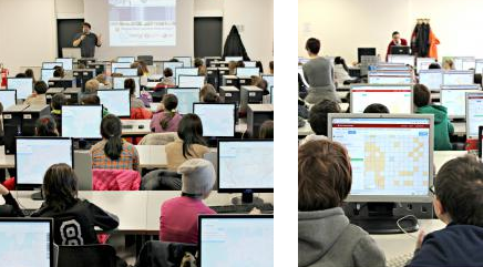
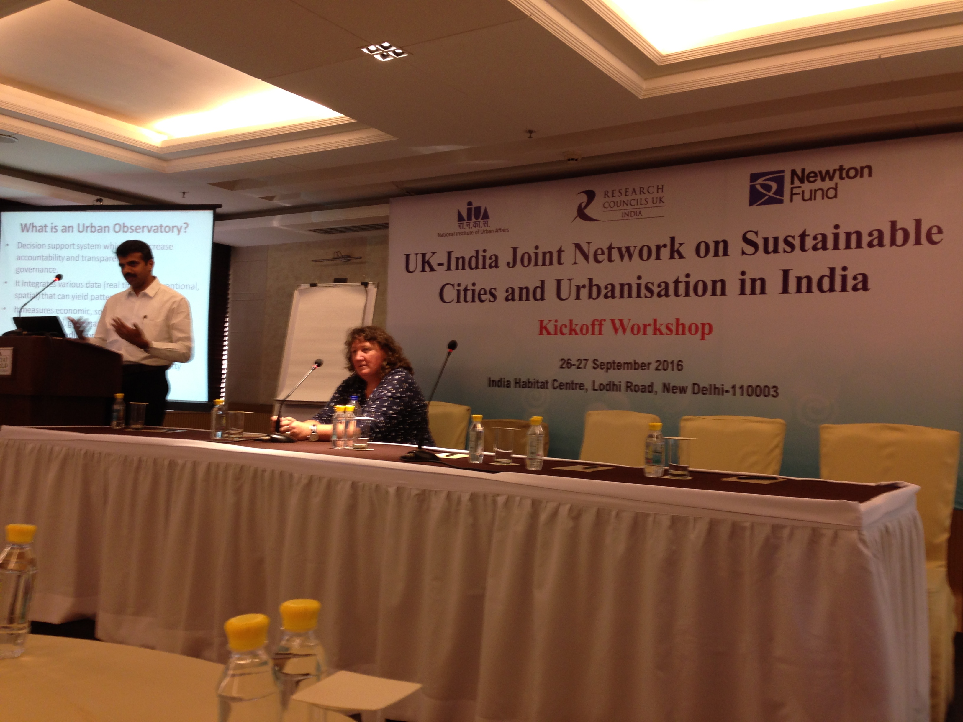
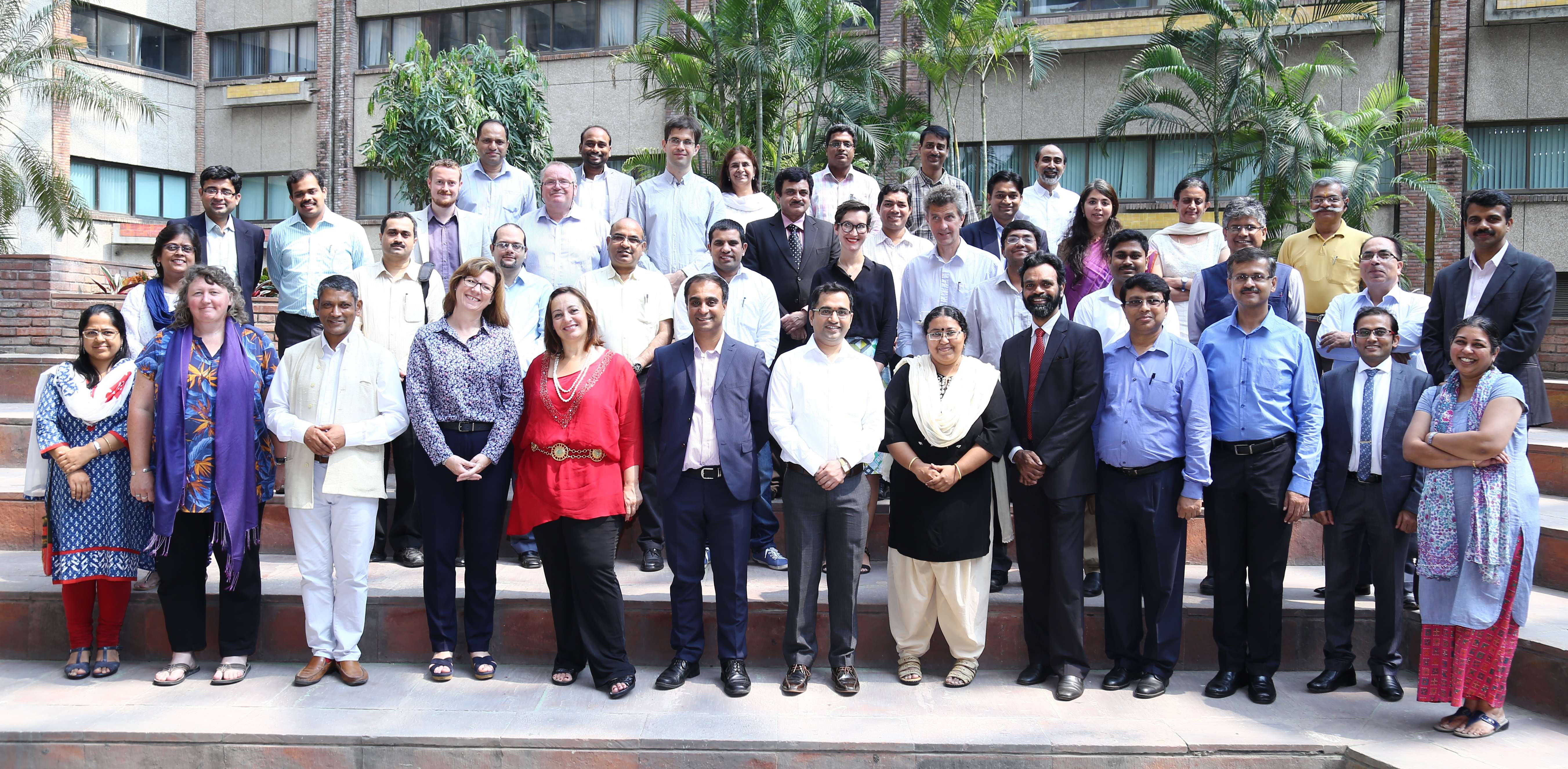
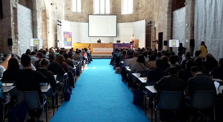
The workshop started with welcome address given by Mr Ram Venkataramani, President Madras Chamber of Commerce (MCCI). In the Inaugural session , Dr Ajith Kaliyath (Indian Principal Investigator, NIUA) highlighted the fact that Chennai is one of India’s smart cities and Chennai is now linked with other local, regional, national and international city sites. Prof. Michele Clarke (UK Principal Investigator, University of Nottingham) gave the context of the joint network model . She also highlighted the need for multidisciplinary approach for sustainable development (Fig 1).

chennai1


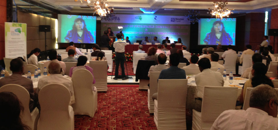
Fig 1 – Inaugural session of workshop on Chennai Urban Observatory

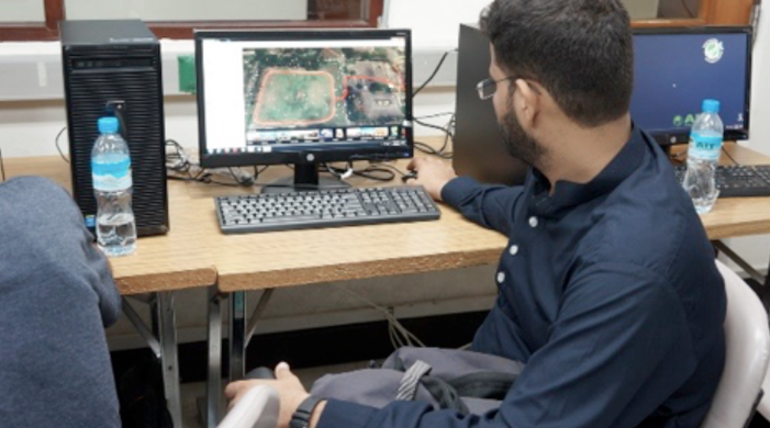
The Inaugural session had keynote address on “Visioning Chennai as a Global city” by Dharmendra Yadav (Secretary to Government, Housing and Urban Development Department and Vice Chair CMDA Chennai) . Mr Yadav highlighted that Urban growth in India is enormous and so are the challenges. This was followed by thematic session on Chennai as a global city with presentations on “the Role of Trade, Industry and Government” by Dr. Vijay Pingale (Joint Secretary, Industries Department, Government of Tamil Nadu) . In his presentation on  “Socio-economics dynamics in the city” Raghuttama Rao, (Managing Director IMACS) highlighted that Tamil Naidu economy is the second biggest in India by GDP with Chennai representing only 20% of the total. Chennai is the fourth largest metropolitan area in India. This was followed by presentations on “Making cities efficient and liveable” by K. Venugopal (Director, Kasturi and Sons) ,  “Data to intelligence” with examples from UK and India from Suchith Anand ( University of Nottingham) and presentation on “Human and material mobility” by Gitakrishnan Ramadurai (Department of civil engineering, IITM).

In the afternoon session on 9th November focused on “building a roadmap to how we can achieve a road map to a sustainable, affordable urban observatory that provide data you need.” Professor Michèle Clarke (University of Nottingham) set the scene by her short presentation on “Smart Cities: two contrasting examples from Britain” . The examples shown were Bristol and Newcastle both of which are port cities and share some characteristics with Chennai. Both have set out to create data to better understand their city. The Newcastle smart city web site is hosted by the University of Newcastle in collaboration with the city council and other city stakeholders – ‘ScienceCentral’. The Newcastle system is pragmatic in its use of existing data (including citizen science e.g. weather observers). The system makes little use of social data – although it has the potential to include in the future. There is a need to have a discussion about the use of data type and how these might best help citizens manage their business and social lives. The Newcastle web site is developing all the time as extra data is being added to the site. The Newcastle example provide a good way to start any smart city project but its long term future is unclear i.e. its funding basis is not clear. It’s important to have contractual agreement with all those providing data. The system also offers scenario modelling possibilities for traffic, energy, flooding and other critical pathways. The Bristol model is different in that the City Council is hosting the data/web server and is the main driver. The city centre has a square mile of 5 MG Wi-Fi which is hoped will allow people and infrastructure to exchange data in real time anywhere within the city centre. The system has clear privacy protocols. Both are two different systems but are science driven; Council and Universities working in collaboration with involvement of wider stakeholders.

This was followed by presentation from A. Shankar (National Direct Head – Strategic Consulting, Urban Solutions, JLL) who gave an overview of Chennai Smart City proposal followed by Chennai master plan by Mr Shivshanmugam (Member and Chief Planner, CMDA Chennai). These presentations brought together sharing of research and ideas to set the scene for specific discussion on topics on Challenges of global cities, Role of technology in governance, Institutional ecosystem and need for capacity building.

chennai2


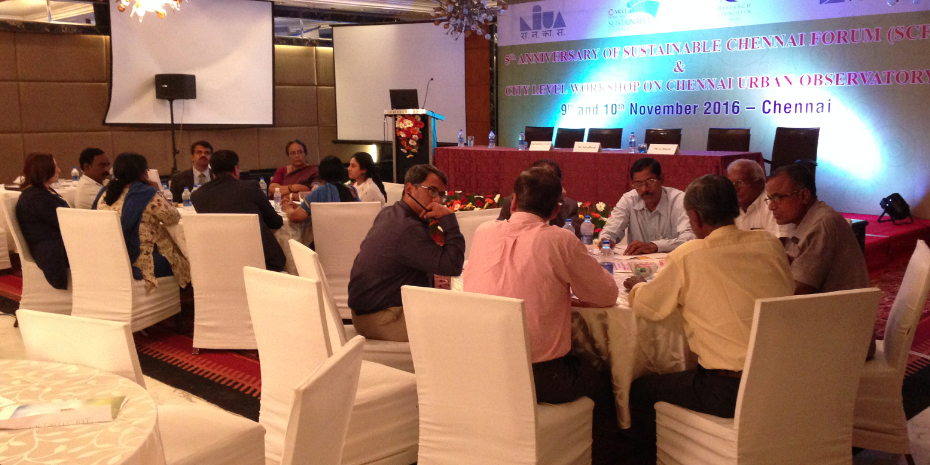
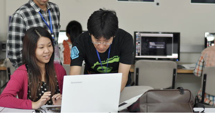
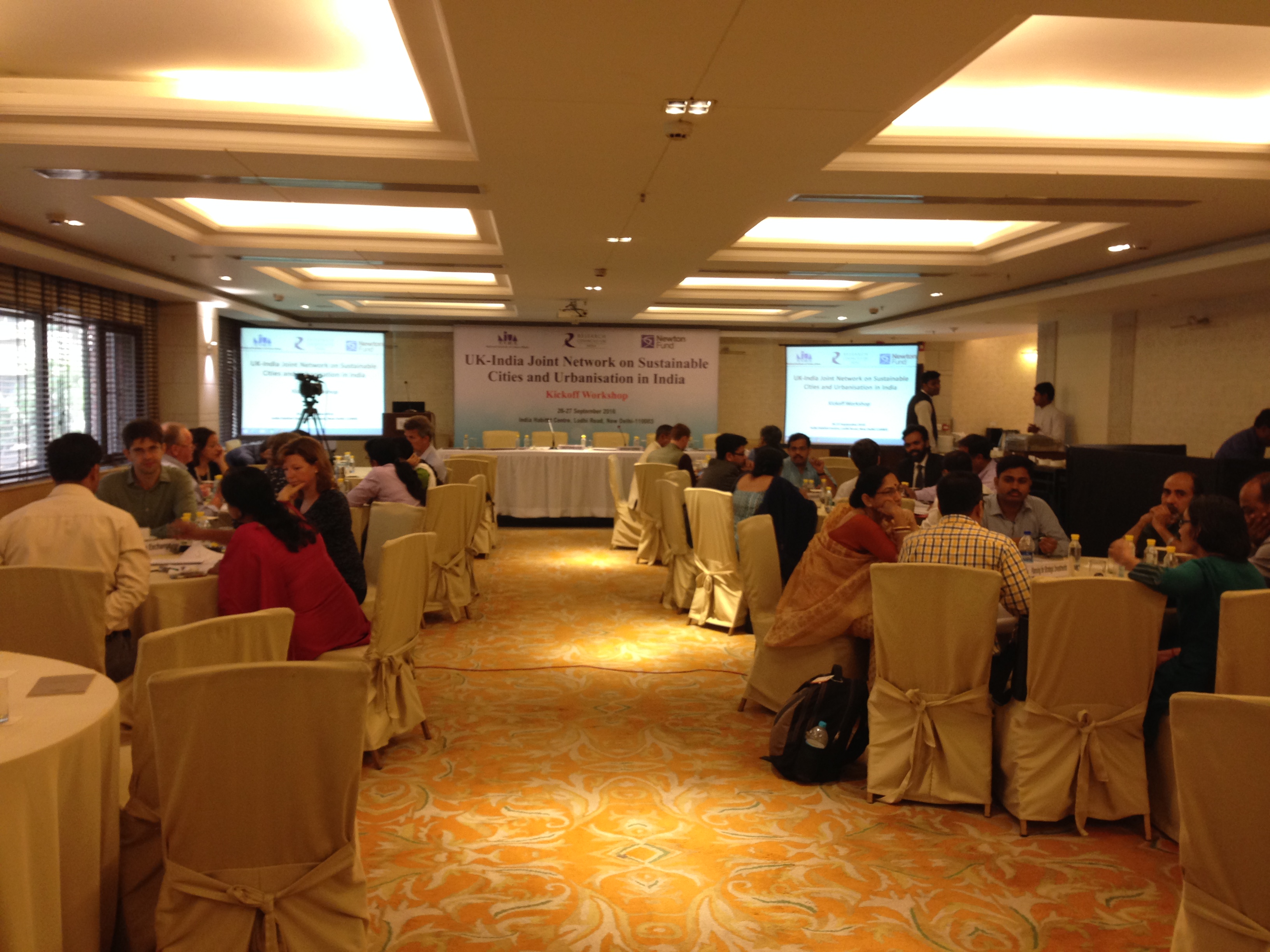
Fig 2 – Group discussions at workshop on Chennai Urban Observatory

On 10th November (day two) there was presentations on Knowing matters; doing delivers (RV) , Data to actionable intelligence ( Professor Michèle Clarke, Associate Pro Vice-Chancellor, University of Nottingham). Michele highlighted the importance of open source data and the need for multi-disciplinary approaches to smart city data generation. Open data can be generated and shared freely to enhance confidence in the policy making process. This was followed by presentation from Professor Sudhir Chella Rajan ( Department of Humanities and Social Science, IITM, Chennai) on Conceptual Foundations of the Urban Observatory in which he highlighted that periurbanisation of Indian cites has seen a massive increase in recent years – New Bombay, New Calcutta. He highlighted the need for establishing ‘urban labs’ to better understand the middle space between ‘rural’ and ‘urban’.

This was followed by group discussions key topics on Opportunities under Smart City, Chennai, Data needs for Chennai Observatory, Enabling citizen engagement and Establishing global network.

chennai3


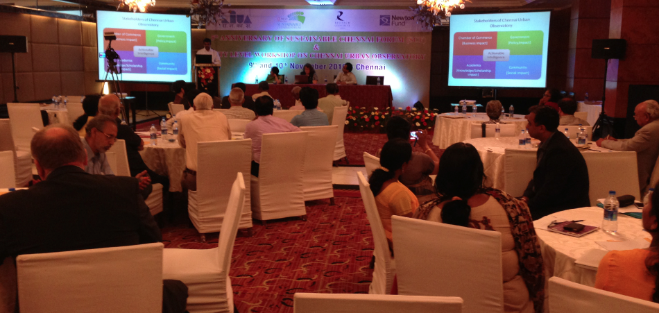
Fig 3 : Presentation to High level panel at workshop on Chennai Urban Observatory

All groups presented their summary to the whole team and their inputs were included in the High level panel presentation done by Dr Ajith Kaliyath, (Indian Principal Investigator, UK India Joint Network on Sustainable Cities.)

The outcomes of the discussions from the two days was presented by Ajith Kaliyath . Ajith highlighted the wider context; local context ( the sustainable Chennai forum) and the need for Chennai Urban Observatory and its objectives. The key stakeholders were identified i.e the chamber of commerce, academia, community and government (Fig 4) and also the key data needs for the observatory (Fig 5);

screen-shot-2016-11-28-at-14-11-22


Fig 4 – Stakeholder groups of CUO

screen-shot-2016-11-28-at-14-11-34


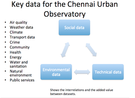
Fig 5 – Key data for CUA

The presentation to the High level panel also outlined the expected outputs/impacts; critical pathways; work packages (WP1 – WP8); sustainability and long term aspects for example, Key platform based on Web based free and open source Geospatial mapping to ensure low investment and operation costs, options for customisation and long term scalability; legal and institutionalisation; the way forward and future funding ideas.

High level panel provided feedback that this project is very important and highlighted that if the project is to succeed it needs a technical secretariat to make things happen. The secretariat mush be full time and use government, universities and university students (through projects) to collect and organise the data. The workshop concluded with Vote of thanks from Gayathri Sriram ( Vice President Madras Chamber of Commerce (MCCI).

We thank all participants for their active contributions for the success of this workshop. Special thanks to Ajith and Michele for their efforts and leadership in this. We look forward to building up more ideas and collaborations for our future workshops later this year in India to further expand ideas on Urban Observatories relevant to the needs of Indian cities.


Happy GIS Day 2016

Dear colleague,

Happy GIS Day 2016 to all. May i request all who are taking part in various Geo events (Geography Awareness Week, OSM Geo Week, GIS day etc ) to  make use of the opportunity to promote Open Principles in Education by sharing information on GeoForAll and welcoming those interested to be part of Open Principles in Education [1].

Screen Shot 2016-07-02 at 05.56.42

Everyday is a GeoForAll Day . So please share GeoForAll ideas [2] everyday from now to your colleagues, students and be our GeoAmbassadors.

May the FOSS be with everyone…

Best wishes,

Suchith

Dr. Suchith Anand
http://www.geoforall.org
https://opensourcegeospatial.icaci.org

GeoForAll – Building and expanding Open Geospatial Science

[1] https://opensourcegeospatial.icaci.org/2016/10/open-principles-in-education/
[2] https://opensourcegeospatial.icaci.org/2016/11/pass-it-on-joy-of-selfless-sharing-on-gis-day-and-other-geo-events/

Pass it on – Joy of selfless sharing on GIS Day and other Geo events

Dear colleagues,

May i request all who are taking part in various Geo events (Geography Awareness Week, OSM Geo Week, GIS day etc ) to  make use of the opportunity to promote Open Principles in GeoEducation by sharing information on GeoForAll and welcoming those interested to be part of Open Principles in Education. Please give away OSGeo Live DVDs, USBs [1] and share GeoForAll ideas [2]  at these events.

Our students worldwide are now our GeoAmbassodors and already doing a great contribution by excellent work that they are doing now  as the biggest donors of GIS software[3].   I am also very happy that free and open source software like QGIS have now fully  empowered  all and students and by sharing the software ,  students are now the biggest donors of GIS software. They are breaking down the artificial barriers created by proprietary GIS vendors and rapidly bringing down the walls of digital divide.  The values of sharing and caring that  our current students globally have are more important than thier technical skills or knowledge and they inspire me every second. They are all true global citizens. Knowledge without compassion is useless. Caring and sharing are important values in education  . Details of why this is important at https://opensourcegeospatial.icaci.org/2016/07/sharing-is-caring-why-openness-is-key-for-true-empowerment-and-sustainability/

The ideas are summarized at https://www.youtube.com/watch?v=SmGoC6iFds4

Screen Shot 2016-07-02 at 05.56.42

I am warmly welcoming all GeoMentors to be TrueMentors and start supporting Open Principles in Education. Just share GeoForAll ideas and urls of of free and open source software like  QGIS download from http://qgis.org/en/site/     (there is also lot of documentation for learning at http://www.qgis.org/en/docs/index.html      and  free online materails produced by GeoForAll colleagues at GeoAcademy with comprehensive QGIS tutorials  at http://spatialquerylab.com/foss4g-academy-curriculum/      and  the freely available training materials at http://www.geoforall.org/training with everyone and you are a True GeoMentor!   So please pass on the GeoForAll ideas to everyone. Everyone is welcome to join the fun and festivities of Geo days to accelerate sharing and donation of free and open source GIS! So easy 🙂

Screen Shot 2016-09-07 at 13.02.19
Open principles in geoeducation (open educational resources, free and open software, open data, open standards etc) are key for  true empowerment of staff and students globally and making geospatial education and opportunities accessible to all [2] . We look forward to working and building collaborations with all interested in this education mission. Access to quality education and opportunities is key for getting rid of extreme poverty and enabling broadly shared prosperity for all. Millions of globally connected minds working together on the common mission of enabling Open Education opportunities for everyone will be key for making these developments possible. An idea whose time has come is the most powerful force in the universe, and the time for “Access to quality education opportunities for everyone” has arrived.

Education + Empowerment = GeoForAll

Happy GIS Day greetings in advance to all…

May the FOSS be with everyone…

Best wishes,

Suchith

Dr. Suchith Anand
http://www.geoforall.org/
https://opensourcegeospatial.icaci.org/

GeoForAll – Building and expanding Open Geospatial Science

[1] https://live.osgeo.org/en/index.html
[2] https://opensourcegeospatial.icaci.org/2016/09/geo4all-empowering-academics-and-educators-globally-requesting-colleagues-to-share-geo4all-ideas-at-all-geography-events/
[3] https://opensourcegeospatial.icaci.org/2016/11/award-for-the-biggest-donors-of-gis-software-goes-to-all-our-students-worldwide/

Reflections from the Kickoff workshop of the UK-India Joint Network on Sustainable Cities and Urbanisation in India

The Kickoff workshop of the UK-India Joint Network on Sustainable Cities and Urbanisation in India was held on 26-27 September 2016 at India Habitat Centre in New Delhi. The main objective of this kickoff meeting was to bring together academia, government organisations, NGOs, industry representatives to discuss ideas and to develop a framework for Urban Observatories relevant to the needs of Indian cities.


delhi1

The RCUK funded SMARt ciTIES  is lead by Professor Michele Clarke (University of Nottingham) and Dr. Ajith Kaliyath (National Institute of Urban Affairs, India) brings together a consortium of multidisciplinary, international researchers with expertise spanning education and social science, cultural heritage and urban planning, science and engineering, ecology and environmental sciences and information technology to develop new collaborative solutions to the multi-layered challenges of rapid urbanisation.

The Network includes leading urban researchers from University of Nottingham, University of Birmingham, University of Southampton, Bishop Grosseteste University College, Loughborough University, Northumbria University, Nottingham Trent University  and University of Surrey from the UK.

From India there are urban researchers from Jawaharlal Nehru University, IIT Delhi, IIT Kharagpur, IIT Roorkee, Indian Institute of Population Studies Mumbai, Indira Gandhi Institute of Development Research Mumbai, Institute for Social and Economic Change, Bengaluru and Tata Institute of Social Sciences, Mumbai from India.

As well as establishing a multi-institutional and interdisciplinary network bringing together Centres of Excellence in the UK and India, the Network will reach beyond academia and engage with innovators, policy makers, industry and civil society.

To help achieve these aims Network will develop the Urban Observatory model in India and catalyzing its adoption in a number of Indian cities. These Observatories will provide relevant, indigenous new knowledge and insights to help implement the Government of India’s Smart Cities Mission, Atal Mission for Rejuvenation and Urban Transformation (AMRUT) and the Housing for All by 2022 Mission [1].

delhi3

The project kickoff meeting on Sep 26th-27th was attended by representatives from all members of the consortium. The meeting started with introduction from Mr. Jagan Shah (Director, NIUA) and Mr. Jeetendra Singh, (Director, NITI Aayog) discussing on Urban Sector-Priorities of Government of India. Nafees Meah, (Director, RCUK India) gave the context of the joint network model following setting the scene by Dr Ajith Kaliyath (Indian Principal Investigator, NIUA) and Prof. Michele Clarke (UK Principal Investigator, University of Nottingham).

delhi2


There were presentations from Dr. Arindam Biswas, IIT Rourkee on Sustainable Habitat under IMPRINT and Possibilities of data driven governance by Poornima Dore (Tata Trusts) in the opening session. This was followed by three main sessions which spanned the two days . Urban Observatories , Use of Big Data in Urban Observatories and Community Engagement with Urban Observatories. Each session had two keynotes to set the scene and the discussions on specific topics . The keynotes byKsenia Chmutina (Loughborough University), Kala Sridhar (ISEC, Bengaluru), Suchith Anand (University of Nottingham), Arkopal Goswami & Bhargab Maitra ( IIT Kharagpur), Christopher Atkin (Bishop Grosseteste University and Arindam Biswas (IIT Roorkee) which brough together sharing of research and ideas .

For the session on Urban Observatories the participants were divided into four groups each looking at a particular challenge i.e Monitoring Urban Dynamics: MDGs to SDGs; Evidence Based Planning/Policies, Data and Indian Cities, Opportunities under National Urban Missions. The teams then presented the summary of the discussions to the whole group .On the final day of the workshop there was consolidation of all the discussions from all the sessions and groups . The summary was presented to the High Level Panel.

Governments and city planners are increasingly developing city visions which identify long-term goals for IT (connectivity/’smart’ systems/digital services,GNSS), infrastructure (housing /transport /water/waste/energy/goods/food) and development (green growth/livelihood improvements) but urban sustainability is challenged by social (poverty/cohesion/inclusion/diversity), environmental (extreme weather/tectonics/disease outbreaks) and economic (recession/declining labour market/oil price fluctuations) factors which frequently operate on shorter timescales and which can impact severely on cities, urban ecosystems and people. Understanding these challenges at individual city level requires data and information to enable monitoring of cities at multiple scales to improve our understanding of how cities work and to develop an evidence-based approach to identifying novel solutions. The Urban Observatory approach offers a platform to enable data-led regional planning at different temporal and spatial scales. We will work with local government and city administrators, Chambers of Commerce and Metropolitan Development Authorities to collaborate on the creation of new Urban Observatories in these cities, with the aim of harnessing the power of Big Data and geographical information systems. Leveraging the multidisciplinary expertise and experience in the UK-India Network on Sustainable Cities and Urbanisation we will hold planning workshops in each city, which will include members of local society, administration, higher education and the Regional Studies Association India Network. Network members will contribute data, expertise and information to the Urban Observatories and work with the local communities to tailor the information to meet the needs of different stakeholders. This will also aim to link and build synergies with the United Nations Sustainable Development Goal 11 (Sustainable Cities and Communities).

Screen Shot 2016-07-11 at 09.58.00
We thank all participants for their active contributions for the success of this workshop. Special thanks to Ajith and Michele for their efforts and leadership in this. We look forward to building up more ideas and collaborations for our future workshops later this year in India to further expand ideas on Urban Observatories relevant to the needs of Indian cities.


[1]  http://www.rcuk.ac.uk/international/offices/india/indianews/jointnetworksustainablecities/


“Geo4All” Lab of the Month – SIGTE, University of Girona, Spain


It is my great pleasure, to introduce our colleagues at SIGTE University of Girona [1], Spain as our “Geo4All” lab of the month. One of the founder labs of the Geo for All initiative, SIGTE has been contributing immensely to our teaching, research and service activities.

University of Girona is a public institution devoted to excellence in teaching and research and to participating in the progress and development of society through the creation, transmission, diffusion and criticism of knowledge related to the sciences, technology, the humanities, the social sciences and the arts. It is deeply rooted in Catalonia and Catalan culture and is one of the primary economic and cultural motors of the region. At the same time, it pursues a vocation of universality and openness to all traditions, and cultures. The University, located in the city of Girona, is a part of the Catalan public university system. Historically, the Universitat de Girona is heir to the so-called Estudi General which was created in 1446 by Alphonse the Magnanimous, who granted Girona the privilege of awarding degrees in grammar, rhetoric, philosophy and theology, law and medicine. Recently, in 1991, a decree of the Catalan Government created the new Universitat de Girona, a multidisciplinary reference point thanks to contributions from a rich variety of university cultures.

The Geographical Information Systems and Remote Sensing Service (SIGTE) of the University of Girona is a research support service specialized in geospatial data treatment and the use and application of geographic information technologies. They offer technical support, advice, training and technological solutions in the field of geographic information. SIGTE colleagues have been the pioneers of a very successful summer school program dedicated to free and open geographic information software and aimed at promoting the use and development of free geospatial solutions and empowering students.

The Summer School, that was traditionally been held in Girona during one week in July (and it has been running for 5 editions -2010 to 2014-), have brought together 30 persons from around the world (see figures 1,2). The programme was focused on open web services and web map applications, especially in regard to publishing data on the web. It dealt with issues such as spatial data base management and consultation, the creation of web-based geospatial services and the development of web viewers for data publication. The Summer School offered participants practical experience in the use of free geospatial software to create and implement open web services and web map applications.

Screen Shot 2016-07-09 at 18.30.09


Fig 1 – Girona GIS Open Source Summer School in progress

Screen Shot 2016-07-09 at 18.30.28

Fig 2 –Group Photo of Summer School Participants

I still remember the email discussions that I had with Lluis, Gemma and other colleagues (sometime in early 2009!) when we put together a joint ERASMUS bid for helping us start upon this Summer School initiative and I am very grateful I had the opportunity to collaborate with amazing colleagues at SIGTE to lay the seeds of this pioneering Summer School initiative. This summer school initiative has been an inspiration for lot of similar Open Source GIS summer schools around the world from China to India. GIS Open Source Summer School initiative aims to ensure the highest quality of results and internationalize the curricula, in order to prepare students in an international working environment and competitive skills with emphasis on collaboration during the course. All course materials from the summer school are available online [2].

In 2016, SIGTE is still working and applying free and open source technologies in the geospatial domain, in a wide variety of technical projects such as a Participatory GIS, the Mosquito Alert! project (a citizen platform for studying and control mosquitoes which transmit global diseases) or SIG Dunes (a web mapping application for the inventory and monitoring the dunes located on the shore front of the Catalan coast), among others.

On the training side, SIGTE is providing basic and specialized training courses (on site and on line courses) based on the use of Open Source Technologies in Geospatial applied to different scopes (regional and local planning managers, public administration in general, researchers in primathology, oceanography, …) and UNIGIS Girona [3], has become a Msc in GIS where FOSS has a noticeable adoption and presence, and it is a sign of identity.

Moreover, SIGTE that is the organizer of the Spanish FOSS4G (Jornadas de SIG Libre) [4], ten editions to now, in 2016 has also organized the 2nd International QGIS User and Developer Conference as well as a QGIS Hackfest [5] with the kind support of the OSGeo Foundation.

Screen Shot 2016-07-09 at 18.30.40Fig 3 – Plenaries at 10th Jornadas de SIG Libre

I would like to thank our SIGTE colleagues for their pioneering introductory video on Power of Geography at https://vimeo.com/22069904
I really liked the final sentence in the video “In the not so distant future, it is hoped that GIS will help us build a better and more efficient society for all” – This is exactly why we are all working on Geo4All… 

The contributions of SIGTE colleagues are good example of our philosophy and why we are working on Geo4All at https://opensourcegeospatial.icaci.org/2016/07/sharing-is-caring-why-openness-is-key-for-true-empowerment-and-sustainability/

We thank Gemma Boix, Lluís Vicens, Gemma Pons, Rosa Olivella, Ferran Orduña,Toni Hernandez, Alexandre Busquets, Josep Sitjar, Laura Olivas and all colleagues and students at SIGTE lab for their contributions to the Geo4All initiative and look forward to working and building more collaborations with all interested on this education mission.

Best wishes,

Suchith Anand

[1] http://www.sigte.udg.edu/en/

[2] http://www.sigte.udg.edu/en/gis-summer-school/

[3] http://www.unigis.es

[4] http://www.sigte.udg.edu/jornadassiglibre/en/

[5] http://blog.qgis.org/2016/06/30/report-back-15th-qgis-hackfest-in-girona-spain/