GeoAmbassador – Michael P. Finn ( U. S. Geological Survey)

It is my great pleasure to introduce Michael P. Finn as our GeoAmbassador. Michael P. Finn is a Research Cartographer in the U. S. Geological Survey’s Center of Excellence for Geospatial Information Science. He holds a BS in Geography with a Minor in Cartography and Map Technology from Southwest Missouri State University (now Missouri State University) and an MS in Civil Engineering from Virginia Polytechnic Institute & State University. Mike has worked as a Computer and IT Specialist, and a Research Cartographer with the US Geological Survey for the past 17 years. He also has 10 years of experience with the US Air Force and 7 years with the Defense Mapping Agency.
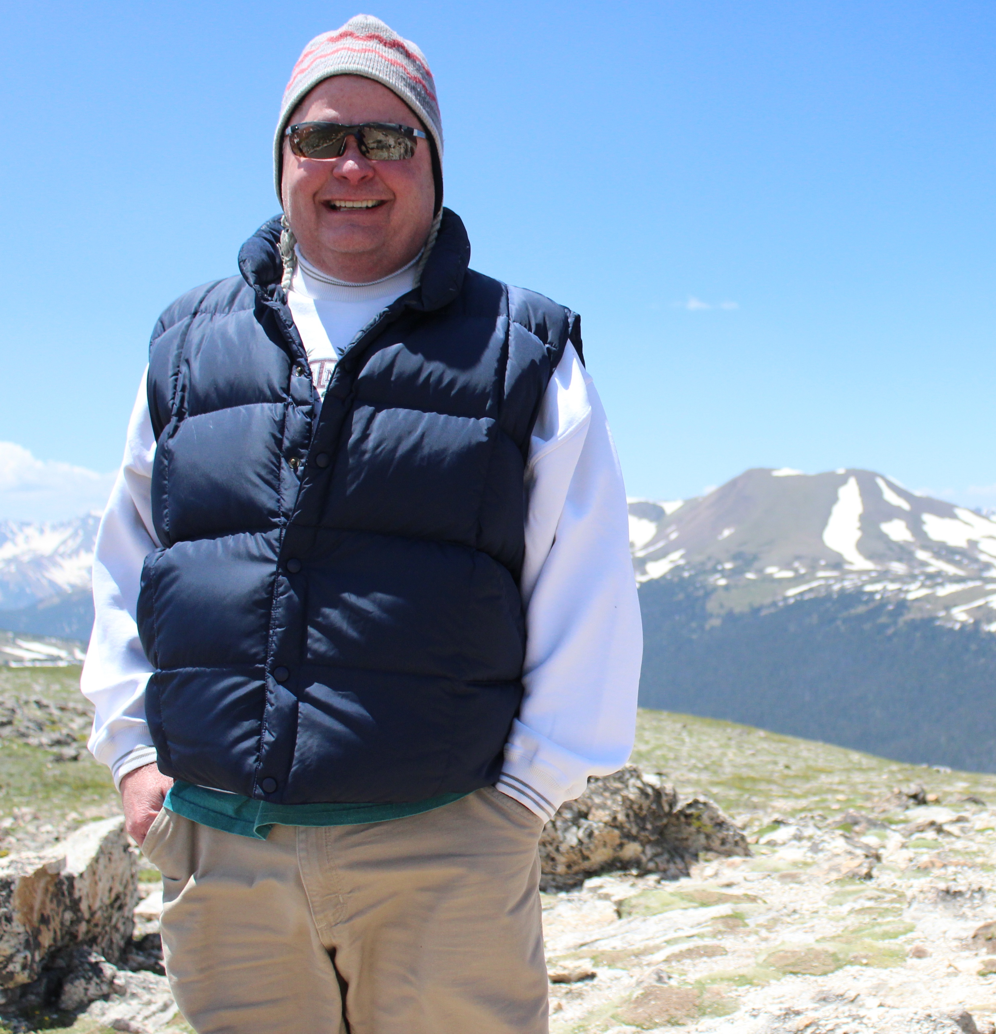
mikefinn

Mike Finn

Mike serves or has served on the Boards of Directors of the Cartography and Geographic Information Society (CaGIS), the American Society for Photogrammetry and Remote Sensing (ASPRS), and the Cyberinfrastructure Specialty Group of the Association of American Geographers (AAG). He has also served as the Director of the GIS Division for ASPRS. Mike is currently serving as President of CaGIS after serving as President-Elect in 2015 and Vice President in 2014. In addition, Mike is a member of the Editorial Board for the journal Cartography and Geographic Information Science.

For international scientific service, Mike is currently serving as Vice-Chair of the International Cartographic Association (ICA) Commission on Open Source Geospatial Technologies for the 2015 – 2019 term. In addition, he is and has been an active member of the ICA Commission on Map Projections. Previously, Mike served as a Co-Chair of the International Society for Photogrammetry & Remote Sensing’s (ISPRS) Technical Commission IV (TC – Geodatabases and Location Based Services), Working Group 4 (Geospatial Data Infrastructure) for the XXIIIrd ISPRS Congress (2012 – 2016) and Co-Chair of the TC IV (Geodatabases and Digital Mapping), WG 1 (Geospatial Data Infrastructure) for the XXIInd ISPRS Congress (2008 – 2012).

His research interests are in data-intensive and high-performance computing for scientific applications using digital geospatial data; in geodesy, spatial coordinate systems, and map projections; in quantitative approaches to imaging in environmental modeling and GIS. Mike is the Principal Investigator for CEGIS’ research project for Data-Intensive and High-Performance Computing. The principal objective is to explore data-intensive and high-performance computing, particularly within the CyberGIS domain, to support lidar and spatial data processing for te 3D Elevation Program (3DEP) of the US. A second objective is to investigate big data approaches and workflows with lidar and 3DEP as well as other big data integration with other USGS science data.

Mike’s recent research has been focused on on varied spectrum of activities from CyberGIS data services for enhancing the usability of high-resolution national topographic datasets to MPI and parallel file systems for processing large files in the LAS format. He has also worked on CUDA-based parallel map projection methods as well as problems with spatial binning relative to map projections. He has also contributed actively to the scientfic community from serving as member of the Editorial Board of the journal Cartography and Geographic Information Science to International Scientific Committee for the International Cartographic Conference, 2017

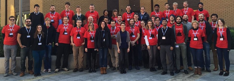
Mike and Silvana Comboim has been leading the ICA commission on Open Source Geospatial Technologies . They have successful organised the ICC workshop on Spatial data infrastructures, standards, open source and open data for geospatial (SDI-Open 2015)  jointly with the ICA Commission on Geoinformation Infrastructures and Standards, the Commission on Open Source Geospatial Technologies , Open Source Geospatal Foundation (OSGeo) and the Open Geospatial Consortium (OGC) on 20 and 21 August 2014 at Brazilian Institute of Geography and Statistics (IBGE) in Rio and the conference itself http://www.icc2015.org   was a great opportunity to strengthen the “Geo for All” initiative and to reinforce the key projects and research links for the future. Mike organised the workshop on “Advancing GIScience with Open Source Technologies,” on behalf of the ICA Commission on Open Source Geospatial Technologies, held in conjunction with AutoCarto 2016, in Albuquerque, New Mexico. A report with pictures on the workshop can be found at http://icaci.org/summary-of-the-workshop-on-advancing-giscience-with-open-source-technologies/ and https://github.com/mfinnCEGIS/workshopAdvancingGIScienceOST/

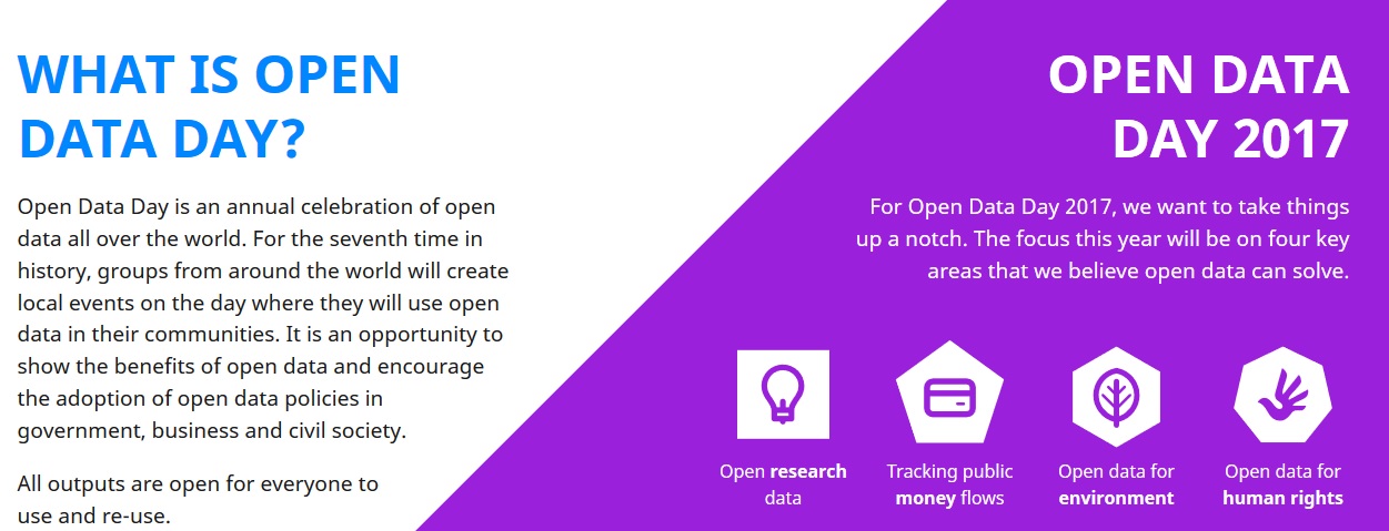
Mike is the co-organizer of the International Cartographic Conference 2017 Pre-Conference Workshop on Spatial data infrastructures, standards, open source and open data for geospatial (SDI-Open 2017), Washington, DC (http://icc2017.org/preconference-workshops/ ). I believe OpenSDI is a very important initiative

I want to thank Mike for all his contributions to GeoForAll community. I understand Mike will be retiring from government service later this year but i am sure he will be closely involved with GeoForAll activities as before. We are proud to honour Mike as our GeoAmbassodor and we are extremely grateful for his contributions to Geo for All.

Best wishes,

Suchith

“GeoForAll” Lab of the Month – Czech Technical University in Prague, Czech Republic

It is my great pleasure, to introduce our colleagues at Faculty of Civil Engineering, Department of Geomatics, Czech Technical University (CTU) in Prague, Czech Republic as our “GeoForAll” lab of the month. CTU is one of the founding labs as part of the worldwide network of OSGeo laboratories following the motto Geo for All.

The GeoForAll Lab [1] (formerly OSGeo Research and Education Laboratory) is located at the Czech Technical University in Prague, Faculty of Civil Engineering, Department of Geomatics, Czech Republic. Their mission, as one of the laboratories in the OSGeo worldwide university network, is to develop collaboration opportunities for academic, industrial, and government organizations in open source GIS software and data . See the announcement and info at GIM) [2].

ctu

Figure 1 – Summary of CTU’s FOSS4G education activities [4]

The laboratory was established by Martin Landa and was the first lab to be established under the ICA-OSGeo MoU in Czech Republic. It has been expanding and providing support for the development and documentation of open-source geospatial software . The laboratory is devoted to education in geoinformatics using FOSS4G, and to research in open source software development for geospatial applications. CTU in Prague has a strong track record in Geoinformatics . Prof. Aleš Čepek has established a study program in geoinformatics since 2005 (originally with Prof Leoš Mervart), he is the author of project GNU Gama and of a minor project GNU Sqltutor (both hosted at GNU servers) and the editor in chief of Geoinformatics FCE CTU journal [2].

The major focus of CTU GeoForAll lab is software development. They are contributing to various international Open Source Geospatial Software projects, namely GRASS GIS, QGIS, and GDAL. Martin Landa is an OSGeo charter member since 2011 and a member of the GRASS Development Team since 2006. He is actively involved in the GRASS project as the lead architect of graphical user interface (GUI) development and PostGIS integration in GRASS vector architecture.

I am impressed to see the excellent student projects done at CTU. For example for the Google Summer of Code 2016 , Adam Laža’s project on “Complete basic cartography suite in GRASS GIS wxGUI Map Display” and Ondřej Pešek’s project on “PyQt GUI generated from XML” are great exampes of contributions from the CTU sutdent community to the wider OSGeo community.

There is also an impressive range of Masters student projects [3] of GeoForAll (OSGeoREL) Lab at CTU in Prague at https://github.com/ctu-geoforall-lab-projects/

I would like to thank Martin and all colleagues and students at CTU for their contributions to the GeoForAll initiative . We are looking forward to working and building more collaborations with all interested on this education mission.

Best wishes,

Suchith

[1] http://geomatics.fsv.cvut.cz/research/geoforall/

[2]https://www.gim-international.com/content/news/open-source-geospatial-and-education-laboratory

[3] https://www.youtube.com/channel/UCNy1pEGYxypkpQfx4m8qWGA

[4]http://geo.fsv.cvut.cz/~landa/publications/2012/ogrs2012/poster/landa-ogrs2012-poster.pdf

Open innovation for Europe – FOSS4G-Europe 2017 – Call for academic GeoForAll track papers (coorganised by ICA, OSGeo and ISPRS)

FOSS4G-Europe 2017 will be held  at the National School of Geographic Sciences (ENSG) in Marne La Vallé, France, from July 18th to 22nd, 2017 . The third edition of the conference is organized at École Nationale des Sciences Géographiques (ENSG).  Following an established tradition, FOSS4G-Europe organizes an academic track  which will run as a single-track over one day. FOSS4G-Europe invites original research contributions scientific papers dealing with Open Data, Open Software, Open Hardware and Open Science in general are highly welcome. Submissions focusing on INSPIRE, Big Data and Societal Challenges are particularly encouraged. All types of papers are welcome, such as on results achieved, case studies, work in progress, and demos. We discourage, however, mere presentations of technology or use cases without properly justifying originality against the scientific state of the art and without particular novelty.

foss4g-europe
Submission deadline: March 31, 2017
Acceptance notice: April 14, 2017
Camera ready version: May 15, 2017
Conference: July 19, 2017

Details at http://europe.foss4g.org/2017/Academic_Track

We look forward to your submissions and strong participation for Open innovation for Europe – FOSS4G-Europe 2017

Is Geographic Information Science Proprietary?

Dear colleagues,

It has come to my attention that some proprietary GIS vendors are doing big marketing of thier proprietary products as the Science!  Science is not any specific GIS proprietary tools!

Science2030

GeoForAll is a global community of scientists, academics and teachers  who are all working for  expanding Open Principles in Science and Education.  Our aim is to empower all academics and students worldwide. Openness is fundamental in harnessing the true potential of Geospatial Science and expanding digital economy opportunities for all . Open innovation is key in driving Digital Economy opportunities and we are determined to make sure that everyone benefits.

Why are Open Principles important in science and education ? Please see the links below

http://www.geoconnexion.com/uploads/publication_pdfs/uk_v15i18-058-059-Op951AF3.pdf

https://opensourcegeospatial.icaci.org/2016/07/sharing-is-caring-why-openness-is-key-for-true-empowerment-and-sustainability/
https://opensourcegeospatial.icaci.org/2016/06/open-consultation-on-the-vision-2030-for-open-geospatial-science/
https://opensourcegeospatial.icaci.org/2016/02/future-of-gis-should-be-empowerment-not-enslavement-examples-needed-for-geo4all-newsletter/

My presentation slides on this is at

https://www.slideshare.net/SuchithAnand/open-principles-in-geoeducation

For anyone opposing Open Principles in Education , i humbly request them to please consider supporting Open Principles in Education  as education and empowerment are key for getting rid of extreme poverty and help create digital economy opportunities also for billions of our economically poor brothers and sisters across our planet . Access to quality education opportunities is everyone’s birthright. So do join us and let us all work together to enable open principles in education to help create a world that is more accessible, equitable and full of innovation and opportunities for everyone.

Best wishes,

Suchith

Dr. Suchith Anand
http://www.geoforall.org/
https://opensourcegeospatial.icaci.org

GeoForAll – Building and expanding Open Geospatial Science

Open Principles in Education & Science for bridging the digital divide

Recording of the Global Open Data for Agriculture and Nutrition (GODAN) webinar on capacity development

The Global Open Data for Agriculture and Nutrition (GODAN) supports the proactive sharing of open data to make information about agriculture and nutrition available, accessible and usable to deal with the urgent challenge of ensuring world food security. At the GODAN Summit in September 2016, GODAN launched a new Working Group on Capacity Development. Background information at http://aims.fao.org/activity/blog/recording-past-webinar-godan-wg-capacity-development

The recording link of the first Global Open Data for Agriculture and Nutrition (GODAN) webinar on capacity development is at https://youtu.be/ezOEhsm7hGI

screen-shot-2016-11-28-at-11-44-48
The webinar will help understand the current developments including overview on the GODAN Action project [1]  and how to be part of the capacity development activities.  Join the Capacity Development WG at https://dgroups.org/fao/godan_cd/join

[1] http://www.cta.int/en/article/2016-08-03/the-godan-action-project-an-innovative-approach.htm

How NASA and the United Nations are using location intelligence to build smart cities in developing countries

Very interesting article on How NASA and the United Nations are using location intelligence to build smart cities in developing countries is at

https://www.devex.com/news/how-nasa-and-the-un-are-using-location-intelligence-to-build-smart-cities-in-developing-countries-89721

GeoForAll is very happy to be part of these excellent global developments happening at all levels and dimensions.There is also strong synergies with UN OpenGIS Initiative. We encourage all to be part of the various calls from Global Food Security to SMARTIES Entrepreneurship competitions [1],[2][3] to expand ideas.

Screen Shot 2016-07-11 at 13.18.25

We welcome everyone interested to join synergies and work together to expand OpenCitySmart opportunities[4][5] and enable Geo technologies in empowering communities and helping improving the Quality of Life and standards of living for everyone. Let us all work together to help create a world that is more accessible, equitable and full of innovation and opportunities for everyone.

[1] http://aims.fao.org/es/activity/blog/godan-local-farming-challenge-2017

[2] https://opensourcegeospatial.icaci.org/2017/03/smarties-entrepreneurship-competition-nasa-europa-challenge-2017/

[3] https://opensourcegeospatial.icaci.org/2017/01/invitation-to-nasa-citysmart-challenge-solutions-for-sustainable-cities-2/

[4] https://opensourcegeospatial.icaci.org/2016/02/opencitysmart-the-open-platform-for-smart-cities/

[5] https://www.youtube.com/watch?v=aWuMfMMPfPw

The Rise of OpenStreetMap as a World Mapping Agency

The Geospatial IG [1] of the Research Data Alliance will be meeting in Barcelona on 5th April 2017 to keep building ideas for the global research agenda for Geospatial Data Science.

https://www.rd-alliance.org/ig-geospatial-rda-9th-plenary-meeting

I would also like to make use of the Geospatial IG meeting opportunity at RDA9 in Barcelona to further discuss ideas on the rise of OpenStreetMap (OSM) as a World Mapping Agency (WMA) build by the efforts of thousands of volunteers.   It is also interesting to see the community links of the OpenStreetMap and  the Open Source Geospatial Foundation (OSGeo) expanding rapidly both locally and globally. OSM has now reaching the level of a Global Mapping Agency build by the efforts of thousands of volunteers and OSGeo is the world’s largest geospatial ecosystem.  What a great combination of synergies. Both initiatives are just over a decade  old and have fundamentally changed the whole geolandscape.

osm

Myself and colleagues are working on a paper on OSM and OSGeo and i want to use this meeting to discuss more ideas with the community. I look forward to welcome you all to RDA meeting in Barcelona.

Best wishes,

Suchith

Help Humanitarian OpenStreetMap Team map against malaria!

Humanitarian OpenStreetMap Team (HOT) is calling all mappers to help us and our partners eliminate malaria with our biggest project to date! Nearly half of the world’s population is at risk of malaria. In 2015, there were roughly 212 million malaria cases and an estimated 429 000 malaria deaths.*

Screen Shot 2017-03-05 at 09.52.21

 
Fig 1 – A very special and successful mapathon with more than 200 ,10-year old children was held in March 2016 at GEOlab , Italy, see this post on HOT’s blog.
HOT is working on two projects, mapping over 500,000 square kilometers in 7 countries. This project collective is part of the Missing Maps initiative in conjunction with DigitalGlobe, the Clinton Health Access Initiative, the Gates Foundation, PATH and MapBox.  We’re dedicating this whole week to support this crisis mapping project, including a competition for our Youth Mappers chapters.

Lab of the Month – GEOlab , Politecnico di Milano, Italy

It is my great pleasure, to introduce our colleagues at GEOlab (Geomatics and Earth Observation laboratory, http://geolab.como.polimi.it) at the Politecnico di Milano,   Italy as our “GeoForAll” lab of the month. GEOlab is a multi-disciplinary, multi-department research group established at Politecnico di Milano, Italy focused on collecting, modeling, analysing and representing Earth observations. Core research includes the following topics: GIS, cartography, global gravity models, GNSS (monitoring and navigation), remote sensing, photogrammetry, and signal processing.

PoliMappers

Fig 1 – Polimappers @ GEOlab

The GIS research group, lead by Prof. Maria Antonia Brovelli and Dr. Marco Minghini, is active in the research fields of Web Mapping, multi-dimensional visualization and virtual globes, spatial statistics, Volunteered Geographic Information (VGI), geo-crowdsourcing and Citizen Science. The team has a long and outstanding tradition in the use and development of open source geospatial solutions. The main software packages used include GRASS GIS, QGIS, PostGIS, GeoServer, MapServer, OpenLayers, Leaflet, PyWPS, istSOS, Rasdaman, and NASA World Wind.

group_photo_FOSS4G_Europe_2015


Fig 2 – FOSS4G-Europe participants

GEOlab is a great example of linking GeoForAll synergies with all key initiatives in Europe and globally. In addition to GeoForAll, GEOlab is officially affiliated to the AGILE network of laboratories. Members of the GIS GEOlab team are personally involved in a number of national and international associations, including SIFET (Italian Society for Photogrammetry and Topography), ASITA (Italian Federation of Scientific Associations for Environmental Information), GIT (Geosciences and Information Technologies), OSGeo (Open Source Geospatial Foundation), ISPRS (International Society of Photogrammetry and Remote Sensing), ICA (International Cartographic Association), HOT (Humanitarian OpenStreetMap Team), UN-GGIM (United Nations Global Geospatial Information Management) Academic Network, and UN Open GIS.

Some projects which are currently ongoing or just finished include giCASES – Creating a University-Enterprise Alliance for a Spatially Enabled Society, funded by Erasmus+ programme of the European Union; URBAN GEO BIG DATA (Urban Geomatics for Bulk Information Generation, Data Assessment and Technology Awareness), funded by the Italian Ministry of Education; MIGRATE (MIGRation pATterns in Europe) and City Focus, developed within the MYGEOSS project, which has received funding from the EU H2020 research and innovation programme; and The Paths of Regina – Crossborder paths linked to Via Regina, funded by the Interreg Italy-Switzerland Co-operation Programme 2007- 2013.

GEOlab is active in many other fields. Over the last couple of years a number of humanitarian mapathons were organized by the GEOlab staff thanks to the links with HOT, e.g. for the OSM GeoWeek 2015 and 2016 and after the earthquakes in Nepal and Ecuador. A very special and successful mapathon with more than 200 ,10-year old children was held in March 2016, see this post on HOT’s blog. (see Fig 3 and 4)

childrens_mapathon


Fig 3 – Kids Map Swaziland for Malaria Elimination

Screen Shot 2017-03-05 at 09.52.21


Fig 4 – Kids Map Swaziland for Malaria Elimination

Members of the GEOlab team have recently founded PoliMappers, the first European chapter of the YouthMappers students’ network having the purpose of building a young generation of mappers through open source and open data (OpenStreetMap). GEOlab organized a number of activities for the last MeetMeTonight, a national event where all Italian universities opened their activities to the public. Also, members of GEOlab have participated as speakers to local TED events, see e.g. this speech of Prof. Brovelli at TEDxLakeComo 2015 and this one of Dr. Minghini at TEDxYouth@LakeComo in 2012.

Since the first edition in 2013, GEOlab is among the organizers of the popular NASA World Wind Europa Challenge, which looks for urban management solutions developed using World Wind‘s open source technology and serving the EU INSPIRE Directive. GEOlab has also organized a number of conferences in the field of GIS and open source geospatial software: the First Meeting of the Italian GRASS users in 2000, the WebMGS 2010 – 1st International Workshop on Pervasive Web Mapping in 2010, Geoprocessing and Services, and the FOSS4G Europe 2015. Finally, since 2016 a new MSc Degree in Geoinformatics Engineering (fully taught in English and welcoming students from all over the world) has been established at Politecnico di Milano, where GEOlab staff is primarily involved in teaching.

On behalf of the GeoForAll community, we thank Maria, Marco and all colleagues from the GEOlab and for their contributions to the GeoForAll initiative and look forward to working and building more collaborations with all interested on this education mission.

Best wishes,

Suchith Anand

Happy OpenDataDay 2017

Dear colleagues,

Wishing you all Happy OpenDataDay 2017

Open Data Day [1] is an annual celebration of open data all over the world. For the seventh time in history, groups from around the world will create local events on the day where they will use open data in their communities. It is an opportunity to show the benefits of open data and encourage the adoption of open data policies in government, business and civil society. Details at http://opendataday.org/

opendataday

Weather data is critical for agriculture. I  thank  our GeoForAll colleagues in The European Centre for Medium-Range Weather Forecasts (ECMWF)[2] at Reading who are running the #OpenDataHack @ECMWF – Beyond weather: explore creative uses of open data ECMWF this weekend.

I have good memories of my visit last year for the first hackathon on a Global Flood Awareness System (GloFAS) [3] they organised .

glofas

Fig – participants at first hackathon on a Global Flood Awareness System (GloFAS) @ECMEF in 2016

Happy OpenDataDay 2017 to all…

Best wishes,

Suchith

[1] http://opendataday.org/
[2] http://www.ecmwf.int/
[3] https://opensourcegeospatial.icaci.org/2016/02/flood-awareness-education-platform/