The State of GeoForAll

The Slides from The State of GeoForAll presented by Helena Mitasova, Vaclav Petras, Anna Petrasova from North Carolina State University (NCSU) GeoForAll Lab  at FOSS4G 2017 Boston is at https://ncsu-geoforall-lab.github.io/geoforall/#/

State of GeoForAll

I also want to congratulate GeoForAll colleagues at the North Carolina State University, USA  for their excellent course “Tools for open geospatial science”.  Details at https://ncsu-geoforall-lab.github.io/open-science-course/

This is excellent course covering all key foundation topics of open geospatial science. This will be a really good structure for other universities to replicate ideas in their GIS courses.

ESA’s Earth Observation Open Science 2017

The European Space Agency (ESA) is organizing the 3rd consultation meeting of EO Open Science in ESRIN (Frascati, Italy) on  25–28 September 2017 to explore new challenges and opportunities for EO research created by the rapid advances in Information and Communications Technologies (ICT).

EOOpenScience

This includes open tools and software, data-intensive science, virtual research environment, citizen science and crowdsourcing, advanced visualization, e-learning and education of the new generation of EO and Data scientists. The conference will present activities in EO Open Science and Innovation and develop a Roadmap for future ESA  exploitation activities under the EO Science for society programme.

The schedule is at http://eoopenscience.esa.int

There is live streaming at https://livestream.com/ESA/OpenScience2017


btw we launched the OpenCitySmart ideas at EO Open Science in 2015 https://opensourcegeospatial.icaci.org/2015/07/launch-of-opencitysmart-the-open-platform-for-smart-cities/

Nunaliit

Members of the ICA Commission on Open Source Geospatial Technologies,

As some of us learned at the International Cartographic Conference 2017, there is an interesting open source application that could be more widely known to those of us in our domain. That application is Nunaliit. Please check it out at http://nunaliit.org. The developers at Carleton University, Canada, welcome your feedback. Please take a little bit of time to learn about it, use it, and, possibly, join their community. In addition, they always welcome pull requests to fix bugs or add features.

Again, information about Nunaliit can be found at http://nunaliit.org and the source is currently hosted at https://github.com/GCRC/nunaliit.

The primary point of contact for Nunaliit is Amos Hays, as follows:

Amos Hayes
Geomatics and Cartographic Research Centre
Carleton University, Canada
http://gcrc.carleton.ca
ahayes@gcrc.carleton.ca
+1.613.520.2600×8179

If you would like more information, please contact him.
Thank you.

Michael P. Finn
Commission Co-Chair

Inviting everyone to contribute for keep building the global research agenda for Geospatial Data Science

Research Data Alliance (RDA) https://www.rd-alliance.org      is  a global community-driven organisation launched and supported by the European Commission together with partners from other regions of the world. RDA has the goal of building the social and technical infrastructure to enable open sharing of research data across geographical boundaries and disciplines. The RDA Plenaries are working meetings held every six months in different places around the world focused on helping move the community forward in creating tangible deliverables that improve data sharing across disciplines, technologies, and countries.

RDA10

The 10th RDA Plenary meeting will be held in Montrèal, Canada, 19-21 September 2017 . The Geospatial IG will be  meeting  at Montreal to keep building ideas for the global research agenda for Geospatial Data Science .  Details at https://www.rd-alliance.org/groups/geospatial-ig.html

The agenda and online connecting details at
https://www.rd-alliance.org/ig-geospatial-rda-10th-plenary-meeting

Please note one more important presentation  is now added to the agenda

The EarthServer Initiative [1]: Towards a Standards-Based Datacube Federation – Peter Baumann

I look forward to welcome you all for productive discussions and actions for keep us building  the global research agenda for Geospatial Data Science.

Best wishes,

Suchith Anand
[1]  http://www.earthserver.eu

Team of high school and undergraduate NASA interns win the GODAN Local Farming challenge Award 2017

On behalf of the G7’s Global Open Data for Agriculture and Nutrition (GODAN), I want to thank all students and mentors who contributed for the NASA Worldwind Europa Challenge 2017.

fig1

In January 2017, GODAN released a call for participants to take part in a Local Farming Challenge, with support from the NASA Europa Challenge. The call aimed to bring together researchers and students to find solutions for local farming in growing cities, using open agriculture and nutrition data. Agriculture must respond to an increasing urban population and changing climate conditions. Optimising local food production to wisely support our nutrition needs is an area where creative solutions are essential to our future.

fig2


We had a range of amazing projects submitted for this challenge . In August 2017, at the final awards ceremony event held in Nokia headquarters in Finland  we announced the winner of the GODAN challengeAgroSphere which was developed by a team of high school and undergraduate NASA interns

fig3


AgroSphere is an educational web application that visualizes the effects of climate change on agriculture using a large collection of global agriculture and climate data.

fig4


You can see all the amazing projects at http://eurochallenge.como.polimi.it/projects2017

fig5


GODAN Award details at http://www.godan.info/news/agrosphere-wins-2017-godan-nasa-local-farming-challenge

Video recording of the event at https://livestream.com/Coup4/nasa-europa-challenge-2017/videos/162117612

Well done everyone and thank you for sharing your expertise for the benefit of all.

GeoAmbassador – Bridget Fleming

It is my great pleasure to introduce Bridget Fleming from South Africa as our GeoAmbassador. Bridget Fleming is the regional chair of GeoForAll Africa (along with Serena Coetzee and Rania Elsayed ) and has been actively expanding geoeducation opportunities for all. Bridget is a passionate advocate for using Geotechnologies in the classroom. She is the IEB (Independent Examination Board) geography national moderator and has authored a number of textbooks and digital classroom resources. She has recently returned to the classroom after a few years of running a start-up GIS company where she was involved in Geospatial education and training. She is on the National GISSA council (Education portfolio) and is the Chair of the Southern African Geography Teachers’ Association (SAGTA). She is presently HOD Geography at St John’s College  in South Africa.

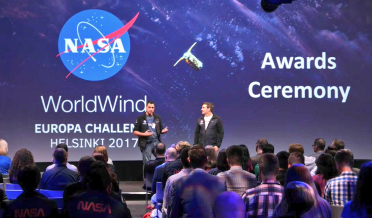
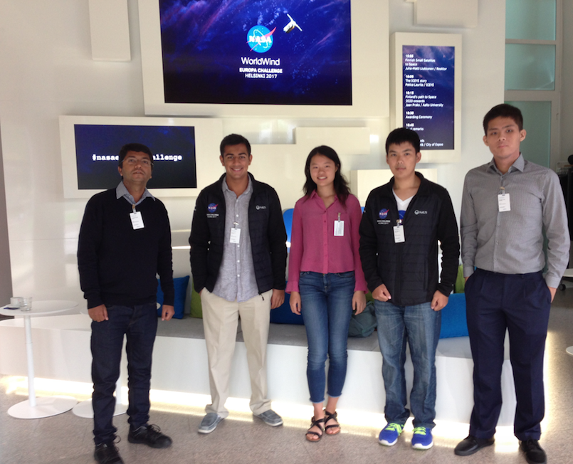
Bridget is also one of the key organisors behind the success of the recent SAGTA+FOSS4G Africa conference hosted by St John’s College in Houghton, Johannesburg.. Bridget kindly send me the summary and photos which I have included below to give the bigger idea of the amazing work that she and colleagues are doing.

fig3

fig1


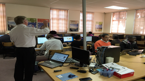
From 26-30 June 2017 for the SAGTA, OSGeo Africa and the QGIS South Africa User Group held the FOSS4G Africa 2017 conference at the school, hosted by the geography department.  GIS is a burgeoning industry and is part of the school curriculum in South Africa. However, many schools do not have the facilities to teach it and most teachers don’t have the training. The first two days of the conference saw forty plus geography teachers and academics gather to address these issues, share their insights and get some hands-on training. GIS is a small component of the curriculum yet its greatest impact is through using it to teach geography and other subjects. It can play a major role in improving spatial literacy in learners.

fig2


fig4


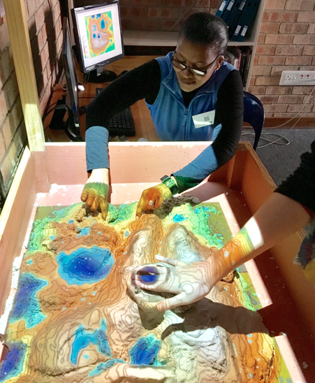
Highlights included talks and a workshop by Malcolm McInerney, the Australian keynote speaker, demonstrations of the tangible landscape in Mrs Jones’ geography classroom and hands-on QGIS workshops.

fig5


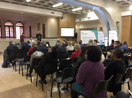
On the Tuesday, SASDI (South African Spatial Data Infrastructure) held a successful workshop for fifty GIS professionals, academics and government officials in the Jeffrey auditorium.

fig6


On the Wednesday, another thirty members of the GIS industry arrived for their three day technical conference, along with seventy members of GIS Society of South Africa (GISSA) for their quarterly general meeting. This was the big day of the conference, intended as an overlap between education and industry. Amongst several excellent education-related and technical GIS presentations, were two panel discussions. In one, educators discussed their requirements and how industry could help. In the other, industry discussed career paths and the skills required from the education system.

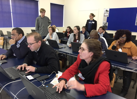
The Thursday and Friday saw some technical presentations and six four-hour hands-on workshops. Some adventurous teachers from Mthatha stayed on for this part of the conference! The guest speaker was Stephen Mather from Cleveland, Ohio, who started the OpenDroneMap (ODM) project. Besides the keynote, he presented a workshop on ODM where the class learnt how to process images from drones.

Some of the geekier delegates moved off campus on the Saturday for a GIS software code-sprint at the Johannesburg Centre for Software Engineering in Braamfontein, a great new IT innovation hub opened recently by Wits.  More details at https://foss4g-africa.org/en/home/

I am sure Bridget and colleagues will expand these ideas for the future. We are looking forward to building  strong research and teaching collaborations  worldwide in Open Geospatial Science. We are proud to honour Bridget as our GeoAmbassador and we are extremely grateful for her contributions to GeoForAll.

Best wishes,

Suchith Anand