Call for tutors for the UN Open GIS Initiative

If you have expertise in QGIS and would like to volunteer your expertise for UN Open GIS Initiative online self paced  courses [1] please email  directly Prof. Maria Antonia Brovelli ( email – maria.brovelli@polimi.it )

The UN Open GIS Initiative aims at identifying and developing open source geospatial solutions that meets the requirements of UN operations, taking full advantage of the expertise of mission partners. The scope of the UN Open GIS initiative covers not only the development of geospatial software for the entire lifecycle of geospatial information at enterprise level from data collections, management, and sharing of geospatial data to geospatial analysis and web and mobile geospatial applications for UN operations, but also the capacity building of the UN for the sustainability and eventual technology transfer to other potential user groups.

UNOpenGIS

More details are at http://unopengis.org/about.html

Your help and support for the UN OpenGIS Initiative will be greatly appreciated.

[1] https://lists.osgeo.org/pipermail/geoforall/2017-September/004118.html

The Open Source Geospatial Foundation and the International Geographical Union sign MoU

Tsu, Japan, 30 September, 2017

The Open Source Geospatial Foundation (OSGeo) and the International Geographical Union (IGU) signed a Memorandum of Understanding (MoU) to establish a collaborative relationship between the global community of Geography professionals and the Open Source Geospatial community. The goal of this agreement is to promote the distribution and use of open geo-data in research, teaching and applications, promote the development of related GIS and Remote Sensing Open Source software, to work closely with the GeoForAll initiative in promoting open principles in education and science, and to organize joint international workshops on global geo-information sharing through the use of open geo-data and Open Source Geospatial software

IGU1Fig: Professor Venkatesh Raghavan (President of OSGeo) and Professor Yukio Himiyama, (President of the IGU) at the MoU Signing at Tsu, Japan on 30th Sep 2017

Professor Yukio Himiyama, President of the IGU, said “The IGU Executive Committee believes that this MoU offers potential of to IGU and OSGeo to make great contribution to society, and is excited to assist bridging the world geographic community with the Open Source geospatial community, and to support this bottom-up initiative.Some IGU Commissions may plan to organize joint international meetings on global geo-information sharing, while still others may wish to promote the distribution and use of open geo-data sets, So, let’s work together!”

IGU2

Professor Venkatesh Raghavan, President of OSGeo, said “Partnership with IGU will help further the goals and objectives of the OSGeo Foundation and foster R&D of high societal value. This MoU will bring OSGeo and IGU communities closer and complement each others strengths and extend their global reach. This is exciting news for the OSGeo community and its GeoForAll educational outreach. Look forward for fruitful collaborations between IGU and OSGeo

*About IGU*

The International Geographical Union (IGU) is an international,non-governmental, professional organization devoted to the development of the discipline of Geography.The purposes of the IGU are primarily to promote Geography through initiating and coordinating geographical research and teaching in all countries of the world.

*About OSGeo*

The Open Source Geospatial Foundation (OSGeo) is a not-for-profit organization whose mission is to support and promote the collaborative development of open source geospatial technologies and data. GeoForAll [1] is a collaborative education and research outreach initiative of OSGeo for making geospatial education and opportunities accessible to all.

[1] http://www.geoforall.org/

GeoAmbassador – Sven Schade

On behalf of the GeoForAll community, it is my great pleasure to honour Sven Schade as our GeoAmbassador. Sven Schade is a Scientific Project Officer at the European Commission’s science and knowledge service, the Joint Research Centre (JRC). He is based at the Ispra site in Northern Italy. Being a Geospatial Information Scientist by education (among the first to study Geoinformatics in Europe), Sven became a strong promoter of open principles and public participation in scientific research. Building on a wide range of experiences reaching from Spatial Data Infrastructures (SDIs), data interoperability and Semantic Web technology, via environmental research and Citizen Science, all the way to decision support systems and scientific support to policy making, he got into the rare position of being able to interconnect highly diverse communities and to foster multi-disciplinary collaborations.
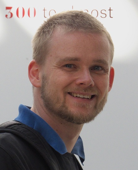
sven_2015

Sven Schade

Examples of his service include his contributions as a member of the Advisory Board of the GeoForAll initiative (http://www.geoforall.org/), the Advisory Board of the European Citizen Science Association (ECSA, https://ecsa.citizen-science.net/) – as co-chair, and the council of the International Society for Digital Earth (ISDE, http://www.digitalearth-isde.org/). As an editor-in-chief of the International Journal of Spatial Data Infrastructure Research (IJSDIR, http://ijsdir.jrc.ec.europa.eu/) he also supports open and free publication practices. Recently the portfolio of research papers and critical notes from the field has been extended to geospatial data set descriptions, so that also research on gathering and processing data can be better rewarded.

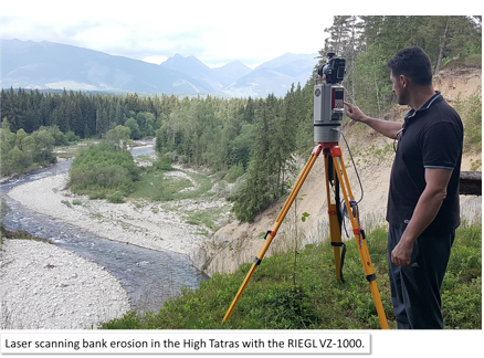
One of his main activities at present concentrate on the relationship between Citizen Science (i.e. research conducted – at least partially – by laypersons) and environment-related policy making. As part of the so called Environmental Knowledge Community (EKC), Sven leads the related collaborative work with colleagues from the European Commission (DG Environment, DG Joint Research Centre, DG Research and Innovation, DG Clima, SDG Eurostat and the European Environment Agency), and external partners with a view to develop a shred understanding of environmental issues, improve decision making and strengthen trustful relationships. Apart from openness and transparency, the potentials in using geospatially-aware methods and tools are immense, and a highly important – but not the only – part of new and innovative solutions. Current investigations include, for example, the use of mobile application to monitor invasive alien species – plant and animals that spear outside their usual territory and cause harm to e.g. human health or agricultural production – (see http://digitalearthlab.jrc.ec.europa.eu/app/invasive-alien-species-europe); a mobile phone app and its use for raising awareness and collect data about natural protected areas, Natura 2000 (see http://digitalearthlab.jrc.ec.europa.eu/app/mynatura2000); and work on an open source (hardware and software) solution to accurately measure air quality (see http://www.mdpi.com/1424-8220/16/3/403).

sven1

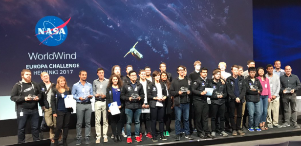
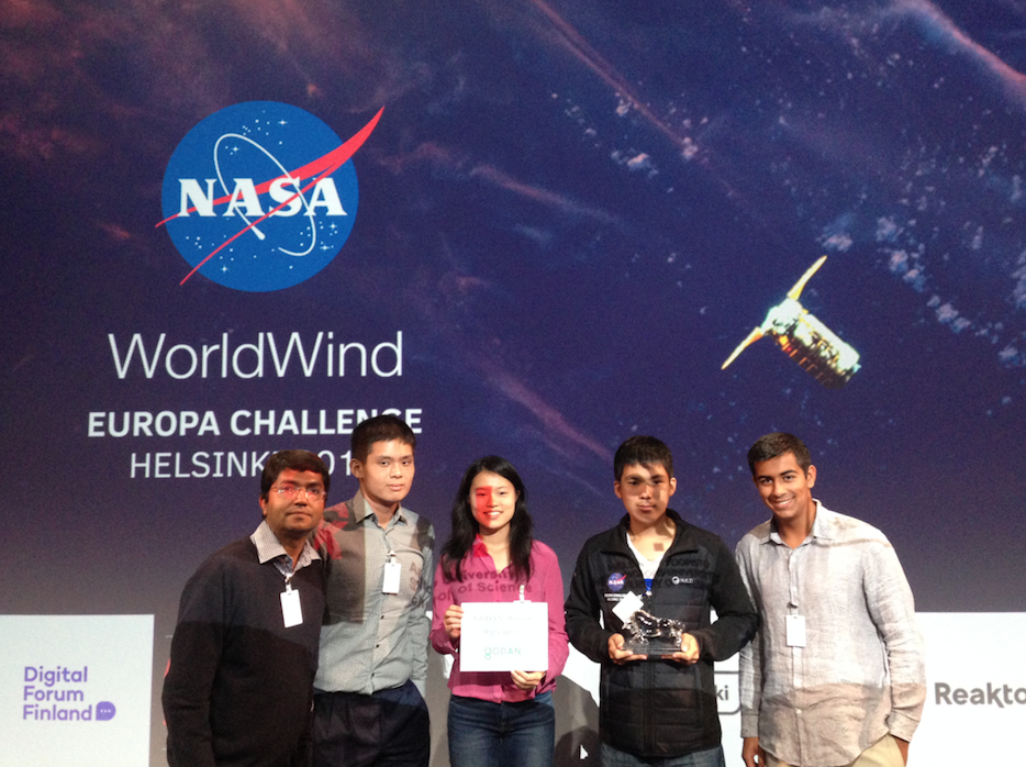
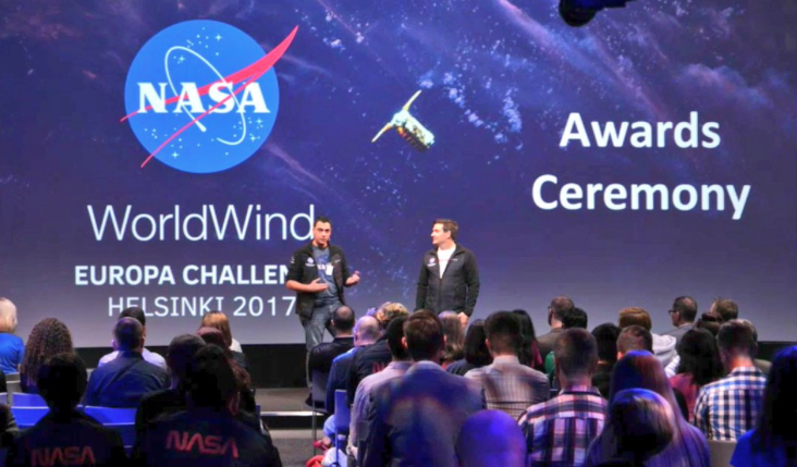
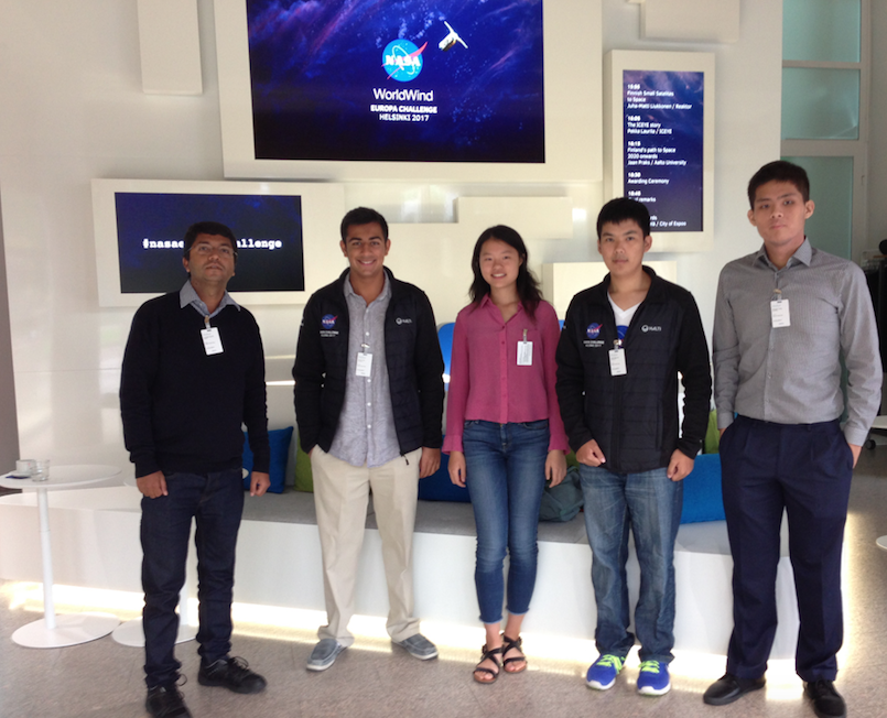
Parts of the above mentioned work is routed in the MYGEOSS project (http://digitalearthlab.jrc.ec.europa.eu/mygeoss/), to which Sven also contributed as part of the project team. It was an initiative to develop GEOSS-based (Global Earth Observation System of Systems) smart Internet applications informing European citizens on the changes affecting their local environment. Apart from few applications that were developed in-house by the JRC, the majority of applications was developed through three open calls for innovative ideas (with the condition to use and produce open source software and data). All source code has been made available openly. Behind the scenes, the experiences gained from this work, also helped to evaluate submissions to the University Challenge of the Copernicus Masters program (see, for example, http://www.copernicus-masters.com/prize/university-challenge/), NASA World Wind Europa Challenges (see, for example, http://www.nasaeuropachallenge.com/).

Alongside his services as program committee member to conferences such as AGILE, Big Data from Space, INSPIRE, and Earth Observation Science 2.0, Sven provides continuous support to the scientific tracks of the European and the International FOSS4G conferences. His ambitions to push for open science is also continued when reviewing scientific articles for journals such as PlosONE, First Monday, Transactions in GIS, International Journal of Geographic Information Science, Computers & Geosciences, and Semantic Web – Interoperability, Usability, Applicability Journal.

Sven is working for the JRC since 2013, where he was already employed for three years as a post-doc (2009-2012). Before re-joining the JRC, he worked at the European Environment Agency (EEA) as project manager for the Shared Environmental Information System (SEIS). In his early career, Sven spent ten years with the Institute for Geoinformatics (IfGI) of the University of Muenster – where he completed his diploma and PhD studies (in 2004 and 2009, respectively) and contributed to numerous national and European-level research projects in the area of geospatial information science. At IfGI, Sven was employed as a member of the Münster Semantic Interoperability Lab (MUSIL) and between 2006 and 2009 he also worked as technical consultant for Geospatial Partners s.r.l.

Everybody reading this and identifying items of interest I kindly invited to contact Sven directly. You are also kindly invited to submit an article contribution to IJSDIR, here: http://ijsdir.jrc.ec.europa.eu/index.php/ijsdir/pages/view/authors

We are proud to honour Sven Shade as our GeoAmbassodor and we are extremely grateful for his contributions to GeoForAll and for his selfless contributions for expanding geoeducation opportunities for all.

Best wishes,

Suchith Anand


Team of high school and undergraduate NASA interns win the GODAN Local Farming challenge Award 2017

On behalf of the G7’s Global Open Data for Agriculture and Nutrition (GODAN), I want to thank all students and mentors who contributed for the NASA Worldwind Europa Challenge 2017.

fig1

In January 2017, GODAN released a call for participants to take part in a Local Farming Challenge, with support from the NASA Europa Challenge. The call aimed to bring together researchers and students to find solutions for local farming in growing cities, using open agriculture and nutrition data. Agriculture must respond to an increasing urban population and changing climate conditions. Optimising local food production to wisely support our nutrition needs is an area where creative solutions are essential to our future.

fig2


We had a range of amazing projects submitted for this challenge . In August 2017, at the final awards ceremony event held in Nokia headquarters in Finland  we announced the winner of the GODAN challengeAgroSphere which was developed by a team of high school and undergraduate NASA interns

fig3


AgroSphere is an educational web application that visualizes the effects of climate change on agriculture using a large collection of global agriculture and climate data.

fig4


You can see all the amazing projects at http://eurochallenge.como.polimi.it/projects2017

fig5


GODAN Award details at http://www.godan.info/news/agrosphere-wins-2017-godan-nasa-local-farming-challenge

Video recording of the event at https://livestream.com/Coup4/nasa-europa-challenge-2017/videos/162117612

Well done everyone and thank you for sharing your expertise for the benefit of all.

GeoAmbassador – Bridget Fleming

It is my great pleasure to introduce Bridget Fleming from South Africa as our GeoAmbassador. Bridget Fleming is the regional chair of GeoForAll Africa (along with Serena Coetzee and Rania Elsayed ) and has been actively expanding geoeducation opportunities for all. Bridget is a passionate advocate for using Geotechnologies in the classroom. She is the IEB (Independent Examination Board) geography national moderator and has authored a number of textbooks and digital classroom resources. She has recently returned to the classroom after a few years of running a start-up GIS company where she was involved in Geospatial education and training. She is on the National GISSA council (Education portfolio) and is the Chair of the Southern African Geography Teachers’ Association (SAGTA). She is presently HOD Geography at St John’s College  in South Africa.

Bridget is also one of the key organisors behind the success of the recent SAGTA+FOSS4G Africa conference hosted by St John’s College in Houghton, Johannesburg.. Bridget kindly send me the summary and photos which I have included below to give the bigger idea of the amazing work that she and colleagues are doing.

fig3

fig1


From 26-30 June 2017 for the SAGTA, OSGeo Africa and the QGIS South Africa User Group held the FOSS4G Africa 2017 conference at the school, hosted by the geography department.  GIS is a burgeoning industry and is part of the school curriculum in South Africa. However, many schools do not have the facilities to teach it and most teachers don’t have the training. The first two days of the conference saw forty plus geography teachers and academics gather to address these issues, share their insights and get some hands-on training. GIS is a small component of the curriculum yet its greatest impact is through using it to teach geography and other subjects. It can play a major role in improving spatial literacy in learners.

fig2


fig4


Highlights included talks and a workshop by Malcolm McInerney, the Australian keynote speaker, demonstrations of the tangible landscape in Mrs Jones’ geography classroom and hands-on QGIS workshops.

fig5


On the Tuesday, SASDI (South African Spatial Data Infrastructure) held a successful workshop for fifty GIS professionals, academics and government officials in the Jeffrey auditorium.

fig6


On the Wednesday, another thirty members of the GIS industry arrived for their three day technical conference, along with seventy members of GIS Society of South Africa (GISSA) for their quarterly general meeting. This was the big day of the conference, intended as an overlap between education and industry. Amongst several excellent education-related and technical GIS presentations, were two panel discussions. In one, educators discussed their requirements and how industry could help. In the other, industry discussed career paths and the skills required from the education system.

The Thursday and Friday saw some technical presentations and six four-hour hands-on workshops. Some adventurous teachers from Mthatha stayed on for this part of the conference! The guest speaker was Stephen Mather from Cleveland, Ohio, who started the OpenDroneMap (ODM) project. Besides the keynote, he presented a workshop on ODM where the class learnt how to process images from drones.

Some of the geekier delegates moved off campus on the Saturday for a GIS software code-sprint at the Johannesburg Centre for Software Engineering in Braamfontein, a great new IT innovation hub opened recently by Wits.  More details at https://foss4g-africa.org/en/home/

I am sure Bridget and colleagues will expand these ideas for the future. We are looking forward to building  strong research and teaching collaborations  worldwide in Open Geospatial Science. We are proud to honour Bridget as our GeoAmbassador and we are extremely grateful for her contributions to GeoForAll.

Best wishes,

Suchith Anand

GeoForAll Lab of the month – Institute of Geography, Faculty of Science, Pavol Jozef Šafárik University in Košice, Slovakia

It is my great pleasure to introduce our colleagues at the Institute of Geography, Faculty of Science, Pavol Jozef Šafárik University in Košice, Slovakia as the GeoForAll lab of the month. I would like to thank Dr.Michal Gallay for providing me all background information on the lab activities.

The Institute was established in 1998 and it is located in Košice – the second biggest city in Slovakia. Their research and education is organized by three research groups: Physical Geography, Human Geography and Regional Geography, and Geographic Information Science. The list of projects and publications provides an overview of their research is at http://geografia.science.upjs.sk/index.php/en/research .

Currently, the Institute is led by Prof. Jaroslav Hofierka, who is the director and a professor in Geoinformatics. He specialises on developing methods for multivariate environmental modelling and spatial analysis of environmental phenomena in the open-source GRASS GIS.

Recently, their GIS group (http://geo.ics.upjs.sk/index.php/en/institute/structure-of-institute/oddelenie-geoinformatiky) has focused on 3D applications of combined use of terrestrial and airborne laser scanning in speleology and karst geomorphology (http://spatial3d.science.upjs.sk/), which relates to optimization of processing and analysing big spatial data by the means of distributed computing. The findings improved the understanding of morphogenesis of the Domica cave by the means of 3D geomorphometry, assessing the photovoltaic potential in urban landscape also on buildings facades as 3D vector data. Some new methods of modelling the DEM surface, water flow and solar irradiation by parallelized modules in the GRASS GIS and the OpenMP library are currently under review. The most recent research initiatives specialise on spaceborne and UAV-based remote sensing. The feasibility study for the European Space Agency looks at the suitability of the Sentinel 2 multispectral imagery for ascertaining solar transmittance of urban greenery (http://esa-surge.science.upjs.sk/). The project SEGMENT, with the partners from Comenius University in Bratislava, searches for new methods for land surface segmentation from microscale level to coarser level. High-resolution mapping with UAV and terrestrial lidar is the core method of data collection in this project.

Their research is closely integrated with teaching. Currently, they are running single Geography programme and Geography combined with another discipline in Bachelor level. The Master level offers two single degrees: (i) Geography and Geoinformatics and (ii) Geography with another discipline for teaching at primary and secondary schools. Since September 2017, they started the first year of a doctoral programme in Geoinformatics and Remote Sensing as the only institution in Slovakia. The PhD. programme is also open for anyone interested from abroad speaking good English (http://geo.ics.upjs.sk/index.php/en/study/doktorandske-studium-phd ).

The students gradually develop the GIS skills from the first year as undergraduates. The compulsory courses of Cartography and GIS involve necessary theoretical knowledge needed in the practical classes. The practical develop standard skills of geospatial data handling and analysis in the two alternatives, the proprietary and open source GIS. Later in the following two years, the students can opt for Open-source GIS or Graphics in Geography. The Master programmes strengthens and expands the skills in the classes such as Geospatial analysis and modelling which elucidates procedures of solar irradiation modelling, soil erosion modelling, geographically weighted regression, water flow analysis, etc. The Unmanned Aerial Systems teach practical aspects of mapping with UAVs, related aspects of the national legislation, processing of aerial imagery by image-matching techniques. In a similar sense, the classes of Terrestrial Laser Scanning and Global Navigation Satellite Systems provide practical experience and data processing skills with the technologies. The Remote Sensing class focuses on theory and practise of processing the satellite and airborne imagery, lidar or radar data and interpretation techniques. Land Information Systems develop skills in web-based presentation of geographic data for management land management. Details of their study programs at http://geo.ics.upjs.sk/index.php/en/study-en

serbia2


The students employ their geospatial competences in other classes of partial disciplines in Physical Geography and Human Geography. All GIS courses are provided in English for incoming ERASMUS+ students, the list can be found at http://geografia.science.upjs.sk/index.php/en/study/erasmus .

The stated software, but also the hardware and geodata infrastructure are concentrated in two laboratories: the Laboratory of GIS and the Laboratory of Remote Sensing (http://geo.ics.upjs.sk/index.php/en/institute/laboratory).

From the international point of view, two items have recently expanded the standard geospatial infrastructure that makes the labs unique. It is the Riegl VZ-1000 terrestrial laser scanner capable of online full-waveform processing up to 1400 meters and 550 kHz measurement rate. They are using it now for acquiring time-series of 3-D vegetation for ground truthing the solar transmittance derived from Sentinel 2 imagery in the project for ESA. The second item is a custom integration of the state-of-the-art technologies within an UAV platform capable of high-resolution and high-accuracy laser scanning, hyperspectral imaging, and photographic imaging. The technological solution comprises the latest development of a completely autonomous, unmanned helicopter by Aeroscout, the Scout B1-100 UAV helicopter that provides a payload capacity of up to 30 kg. Production of the UAV system and payload integration was financed within the project of University Science Park TECHNICOM co-funded by the European Union Structural Funds and the Ministry of Education, Science, Research and Sport of the Slovak Republic. More details are summarized in this ISPRS Archives paper (https://www.int-arch-photogramm-remote-sens-spatial-inf-sci.net/XLI-B1/823/2016/ ). They invite all interested researchers to contact them and in order to collaborate and use this specific equipment.

I want to thank Jaro Hofierka  and all colleagues and students at Pavol Jozef Šafárik University for their contributions to the GeoForAll initiative . We are looking forward to working and building more collaborations with all interested on this education mission.

Best wishes,

Suchith

A Small Circle in Asia Contains More Than Half the World’s Population – But How many GI Scientists are from here?

For decades high cost proprietary GIS reduced the education and entrepreneurship  opportunities in GIS for the economically poor.

asia


But now Thanks to the Open Source Geospatial Foundation and all OSGeo and open education volunteers , these inequalities for access to geospatial software and learning opportunities  is changing fast.It is the efforts of OSGeo volunteers that helped make tools like QGIS  available free to all schools worldwide forever.
futuregeo

Future is shaped by the decisions made by  everyone everyday. Thank you to all OSGeo volunteers for your work that has made possible  Geo education opportunities  accessible  for all . Be our GeoAmbassadors and let  us pledge and work  for open principles in science and education  to eradicate extreme poverty and enable shared prosperity for all.

More details at https://www.slideshare.net/SuchithAnand/the-future-of-geo-is-open 

https://opensourcegeospatial.icaci.org/2017/07/the-future-of-geo-is-open/ 

http://www.ee.co.za/article/open-source-conference-promotes-spatial-literacy.html

Lab of the Month – the Department of Civil, Environmental and Mechanical Engineering of the University of Trento, Italy

It is my great pleasure, to introduce our colleagues at the Department of Civil, Environmental and Mechanical Engineering of the University of Trento, Italy as the GeoForAll Lab of the month .The laboratory http://www.ing.unitn.it/~grass/ aims to support the research in the spatial information field, the development of FOSS4G systems and the education using FOSS. Research has lead to the development of new data processing techniques which have been implemented as FOSS4G, see e.g. the signal and image segmentation software by Alfonso Vitti [0] or GRASS’ modules for GNSS planning [1].geo1The PyGRASS library [2], which allows the access to low-level GRASS APIs using the python language, has been developed by Pietro Zambelli while he was PhD student at the laboratory for the Google Summer of Code 2012. Clara Tattoni and Marco Ciolli research is focussed on the use of FOSS4G in ecology: conservation of endangered species, invasion of pests and historical spatio temporal variation of alpine forest coverage and developement of future scenarios.     They have been organising a Summer school for Tanzanian Ecologists and International students for several years (see newsletter V2 n3). They recently digitized and distributed the historical map of the Italian Kingdom of 1936[6].

geo2


geo3


The laboratory has published a lot of educational material on its main web site [3]: GRASS and QGIS tutorials, lectures slides, live DVDs and Virtual Machines. It has organized many one-day workshops about FOSS4G during national and international conferences, including international FOSS4G meetings and for professionals [5]. The laboratory is involved in the Italian GRASS users and has hosted its 2001 and 2011 meetings. In 2002 the laboratory organized the “Open Source Free Software GIS – GRASS users conference 2002”, the first GRASS meeting in 8 years, starting a series of conferences which converged in the FOSS4G meetings in 2006.

geo4On behalf of the GeoForAll community, we thank Clara Tattoni, Paolo Zatelli and all colleagues from the the University of Trento’ lab for their contributions to the GeoForAll initiative and look forward to working and building more collaborations with all interested on this education mission.

Best wishes,

Suchith

[0] http://www.ing.unitn.it/~vittia/sw/index.html

[1] http://www.ing.unitn.it/~grass/software.html

[2] https://grasswiki.osgeo.org/wiki/Python/pygrass

[3] http://www.ing.unitn.it/~grass/

[4] http://www.ing.unitn.it/~grass/conferences/GRASS2002/home.html

[5] http://events.unitn.it/grass2017

[6] http://193.205.194.133/


GeoAmbassador– Prof. Dr. Josef Strobl

It is my great pleasure to introduce our excellent colleague Prof. Dr. Josef Strobl as our GeoAmbassador. Josef Strobl is Professor at the Department of Geoinformatics at the University of Salzburg, Austria. He is one of the pioneers involved in expanding geoeducation esp. online GIS education through the UNIGIS International Association . He is not only the chair of UNIGIS but also the brains behind the success of UNIGIS . Josef  is the force behind GI_Forum GeoInformatics Forum Salzburg which helped establish University of Salzburg at the centre of key developments by bringing together the GI-Forum community to discuss new ideas and developments for the future.

I greatly admire his leadership abilities and vision. When we established GeoForAll, he was one of the first visionaries that we approached to serve on our Advisory Board . We thank Josef and colleagues for establishing the 75th OSGeo lab at the University of Salzburg.

Josef


A geographer by training and research, Dr Strobl has over 30-years research and teaching experiences. He obtained his Master and PhD from the University of Vienna in 1982 and 1984, respectively. His research interests are in Geographical Information Science and Systems, Remote Sensing and Image Processing., Spatial Analysis, Digital Terrain Models, Spatial modelling of renewable energy potentials, Spatial Statistics and Geostatistics. Modelling and Simulation of dynamic processes. Open Systems architectures, interfaces, metadata and catalogues – SDI, Location based services. Internet-based distance education. Active learning in online environments and design of interactive learning materials, Learning with Geoinformation – from spatial awareness to thinking to citizenship.

His services to the geo community are immense. He serves as the Full Member, of Austrian Academy of Sciences (ÖAW) and Chair ÖAW Commission for GIScience. He is the Co-Founder and President (2007-2011) Austrian Umbrella Org. for Geographical Information (AGEO).. Board. He is the Founder and President since 1999 International Institute for Geographic Information (IIG).

Josef is member of GISIG Executive Committee , Member of Eurogi Executive Committee , Council Member of the International Society of Digital Earth (ISDE ). Josef serves in the Editorial board memberships of GIScience , International Journal of Geoinformatics , ISPRS International Journal of Geo-Information ,Journal of Geomatics .He has (Visiting) faculty positions at many universities worldwide.
I am grateful for this opportunity of introducing some of our amazing colleagues from different parts of our world each month as our GeoAmbassadors and get inspired by their amazing work and contributions for the wider community. We are proud to honour Josef as our GeoAmbassodor and we are extremely grateful for his contributions to Geo for All. Josef is a great ambassador for Geospatial Science globally. May I also use this opportunity to send greetings on behalf of GeoForAll to all colleagues now  at GI_Forum 2017 this week (July 4-7 , 2017) and wishing them productive meetings and discussions.

Best wishes,
Suchith Anand

http://jstrobl.zgis.net/
https://www.oeaw.ac.at/en/m/strobl-josef/
http://www.unigis.net
http://www.gi-forum.org

FOSS4G Africa 2017 spreads ideas to expand GeoEducation and empowerment across Africa

Greetings to all our colleagues who worked for the success of FOSS4G Africa 2017 in Johannesburg this week. It is also a great lead-up to FOSS4G 2018 in Dar es Salaam and to expand the wave of ‘Openness’  that is  sweeping across the world and gains traction and momentum in every facet of society.

Screen Shot 2017-06-30 at 19.48.41


Screen Shot 2017-06-30 at 20.02.33

Thanks to  SAGTA (Southern African Geography Teachers’ Association) and  it is great to see that they have teamed up with the world of secondary and tertiary education .  Our thanks to every member of the GeoForAll Team who made this happen and the impacts that you all are now starting will be felt everywhere in the future.

The full conference program, keynotes at https://foss4g-africa.org/en/home/