Open Source Geospatial Research and Education Lab established at the Czech Technical University in Prague

We are pleased to announce the establishment of Open Source Geospatial Research and Education (OSGeoREL) Laboratory in the Czech Republic at the Faculty of Civil Engineering, Czech Technical University in Prague. The laboratory is one of the members of a worldwide network developed under the auspices of the ICA-OSGeo Memorandum of Understanding (MoU).

In 2011, the International Cartographic Association (ICA) signed a Memorandum of Understanding (MoU) with the Open Source Geospatial Foundation (OSGeo) with a view to develop global collaboration opportunities for academia, industry and government organisations in the field of open source GIS software and data. The MoU aims to provide expertise and support for the establishment of Open Source Geospatial Laboratories and Research Centres across the world to support the development of open source geospatial software technologies, training and expertise.

OSGeoREL at the CTU in Prague is led by Martin Landa, Department of Mapping and Cartography. The laboratory is devoted to education in geoinformatics using FOSS4G, and to research in open source software development for geospatial applications. Martin Landa is an OSGeo charter member since 2011 and a member of the GRASS Development Team since 2006. He is actively involved in the GRASS project  http://grass.osgeo.org/  as the lead architect of graphical user interface (GUI) development and PostGIS integration in GRASS vector architecture.

Geoinformatics at the CTU in Prague: Prof. Aleš Čepek has established a study program in geoinformatics since 2005 (originally with Prof. Leoš Mervart), he is the author of project GNU Gama and of a minor project GNU Sqltutor (both hosted at GNU servers) and the editor in chief of Geoinformatics FCE CTU journal.

More details of the lab at http://geo.fsv.cvut.cz/gwiki/osgeorel

UK Government implements “Open Standards Principles”

The UK Government has implemented “Open Standards Principles” policy from 1 November 2012 and all government bodies will have to comply by them. This will provide the foundation on which to select and implement open standards to support open data, the IT and digital strategies.

Details at http://www.cabinetoffice.gov.uk/sites/default/files/resources/Open-Standards-Principles-FINAL.pdf

http://www.cabinetoffice.gov.uk/news/government-bodies-must-comply-open-standards-principles

This will open huge opportunities for education and training in open source, open standards, open data and we welcome this development.

gvSIG Batoví initiative in Uruguay

This is a request for Spanish speaking volunteers to help us with some educational content translation and structuring for gvSIG Batoví initiative in Uruguay, so that it benefits wider community worldwide. The aim of gvSIG Batoví is to develop a powerful educational tool that enables primary and secondary education students to understand space, to easily interpret maps and to learn free technologies as part of the wider CEIBAL Initiative  http://www.ceibal.org.uy/

We are the first Honorary Member of the gvSIG Association from the UK  http://www.gvsig.org/web/organization/news-office/news/centre-for-geospatial-science-university-of-nottingham-first-honorary-member-of-the-gvsig-association-from-the-uk/?searchterm=cgs      and have strong collaborations with the gvSIG community and would like to support the excellent education initiative in whatway possible, so if any of you with Spanish-English translation skills can volunteer some time, please let me know and i would greatly appreciate your help.

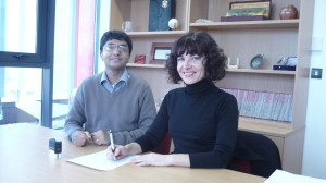
Collaboration agreement by Amelia del Ray (on behalf of gvSIG Association) and Suchith Anand (University of Nottingham) in 2010

More details are at

http://www.gvsig.org/web/home/projects/gvsig-educa

http://www.ceibal.org.uy/

http://www.sensysmag.com/resources/toolbox/28182-gvsig-educa-offers-desktop-open-source-gis-for-education.html

The video link (with English translation) http://www.youtube.com/watch?v=orwN9K07XPo  is useful to get basic information on the wider CEIBAL initiative.

Many thanks in advance.

FOSS4G 2012- India

Thanks to efforts of Dr K.S . Rajan (IIIT Hyderabad) and many colleagues in OSGeo India, the first FOSS4G 2012 India conference was successfully organised in Hyderabad India in Oct 2012.

Prof. Venkatesh Raghavan was also honored with the 2012 Sol Katz Award for Geospatial Free and Open Source Software during the inaugural session of the FOSS4G-India 2012 conference in Hyderabad, India. Venka’s dedication to FOSS4G and his community work around the world, promoting open source geospatial, is second to none. He has been involved in OSGeo since the foundation was formed in 2006, and we are lucky to have such a strong global voice in him.

On behalf of ICA Commission on Open Source Geospatial Technologies a presentation on the importance of Open Source Geospatial Labs in Developing countries was presented. Slides at

http://elogeo.nottingham.ac.uk/xmlui/handle/url/139

Official Launch of ICA-OSGeo Lab

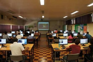
Congratulations to Dr Serena Coetzee and her team for the successful official launch of ICA-OSGeo Lab in South Africa (5th Oct, 2012)

Details at http://eepublishers.co.za/article/university-of-pretoria-436.html

http://web.up.ac.za/default.asp?ipkCategoryID=20212

This will rapidly grow and provide opportunities for many students across Africa to learn geospatial science in the future.

Open Source GIS and WebMapping for UN staff, Vienna

On behalf of the ICA Commission on Open Source Geospatial Technologies, i am pleased to announce Open Source GIS and WebMapping for UN staff workshop on 20 and 21 November 2012 in Vienna.

http://www.un-spider.org/event/5764/2012-11-20/hands-workshop-open-source-gis-and-webmapping-un-staff-20-and-21-november-2012

I would like to thank Barend Köbben (ITC, Netherlands) who is the course organiser, Prof Georg Gartner (ICA President) for his strong support and leadership, and SOMAP 2012 Organisers for their help in hosting the workshop.

All workshop materials will be made available at the workshop website after the event. This workshop is organized as part of our vision for spreading the benefits of geospatial technologies to all.


Summary of “The Internet and Geospatial Technologies” workshop at Autocarto 2012, Ohio, USA

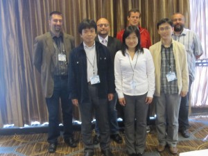
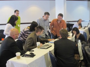
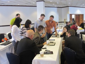
Thanks to Michael P. Finn (U. S. Geological Survey) leadership and efforts , we ran a successful pre-conference workshop on “The Internet and Geospatial Technologies” together with colleagues from the ICA Commission  on Maps and the Internet at AutoCarto 2012 in Columbus, Ohio on 16th Sep 2012.

Workshop summary report  and some photos  that Mike has kindly send is available at  autoCarto_ICA_workshop