“Open Geospatial Science & Applications” webinar series

The ICA-OSGeo Lab Network and MundoGeo are now pleased to inform the schedule of  “Open Geospatial Science & Applications” webinar series. We are expecting around 500-1000 participants for our webinars . This estimate is based on the stats provided by MundoGeo on previous webinar attendance . The webinars will be open and free to all on first come register basis.

The webinars will also be recorded for the benefit of the wider community and made available at MundoGeo website and our new “Geo for All” website that the University of Southampton are now building.

The tentative schedule of first 6 webinars at

  • Oct 18th, 2013 @14:00 UTC – OSGeo Live for Education (Jeremy Morley, University of Nottingham)
  • Nov 7th, 2013 @14:00 UTC – Open Geo Science (Patrick Bell et al, British Geological Survey)
  • Dec 10th, 2013 @14:00 UTC – Free and Open Source Software for Geospatial Applications (FOSS4G): A mature alternative in the geospatial technologies arena ( Maria Brovelli and Rafael Moreno)
  • Jan 2014 -Introduction to GRASS GIS 7 (Lluís Vicens, SIGTE)
  • Feb 2014 – gvSIG Batoví (Sergio Acosta y Lara, MTOP, Uruguay)
  • March 2014 – AURIN (Chris Pettit, Uni. of Melbourne)

All are welcome.


“Geo for All” education mission is launched

FOSS4G 2013 has been a great success (28 Workshops, 180 Presentations., 833 delegates  ) thanks to the countless hours of efforts put in by our dedicated volunteers. Special thanks to our team members Abi, Addy, Antony, Barend, Barry, Claire, Franz-Josef, Jeremy, Jo, IanH, IanE, Mark, Matt, Rollo and Steven who not only made FOSS4G 2013 http://2013.foss4g.org/about-foss4g/committee/   a great success  but also has given firm foundation for the “Geo for All” Education initiative .

We also launched OSGeo Live 7.0 at FOSS4G 2013 in  Nottingham. Thanks to the selfless efforts and dedication of hundreds of volunteers worldwide that help make this excellent resource possible for the benefit of the wider community . Details at http://live.osgeo.org/en/index.html   Having free and open GI software is key for making possible for students in developing and poor countries  to be also able to get geospatial education (without the need for high cost  proprietary GI software ) and OSGeo Live is central to our education efforts. Our Education Team will now with full dedication and focus will carry on the “Geo for All” initiative to all across the world. Our key aim is to make it possible for students in developing and poor countries  to be also able to get geospatial education. By 2015, we will  have 50 Open Source Geospatial Labs established in universities in Africa alone and they will all be  teaching GIS courses to hundreds of students. We also will be starting work on “Train the Trainer” GIS program for school teachers all over the world.

We also launched our latest ICA-OSGeo research lab in Switzerland at  ETH Zurich at FOSS4G 2013 . The Open Source Geospatial Laboratory at ETH Zurich is part is part of the Institute of Cartography and Geoinformation, chair of Cartography . Details at http://www.ikg.ethz.ch/karto/index_EN
The preceding Institute of Cartography was founded in 1925 by Professor Eduard Imhof, one of the main founders of modern academic cartography. It is therefore the oldest university institute in cartography world-wide. In 2011, with the establishment of the new chair of Geoinformation Engineering, the scope of activities of the institute was expanded and its name was adapted. In cartography, the institute strives to maintain its leading position in topographic cartography (relief representation), thematic cartography, and atlas cartography (school atlases, national atlases) by exploiting and further developing cartographic knowledge and adapting it to new interactive technologies and application domains. Geoinformation Engineering aims at analyzing, representing, modelling, and visualizing spatio-temporal decision processes and integrates such models in mobile geoinformation services and spatial information technologies.It also aims to provide support for increasing the number and quality of open source teaching and training materials for Cartography and GIS. As a proud member of the ICA-OSGeo Network , the ETH Zurich OSGL is focusing on Education, Open Geodata and on Cartographic and Geospatial Research. The lab website at http://karlinapp.ethz.ch/osgl/index.html

Thanks to the momentum build by FOSS4G 2013, we have got many new applications from  universities in this week alone for establishing research labs, so we are well in track to keep bringing investment for staff and infrastructure to  establish over 100 research labs in universities world wide by Sep 2014 (the time of the next  FOSS4G conference which will be in USA).  We  will be  now working to setup a brand new website for our rapidly  expanding education initiative and take this to the next level.

Once again many thanks to all of you who helped for making FOSS4G 2013 a great success. Without all of your help, we would not have been able to make this possible. Also thanks to all volunteers who made and kept their pledges at FOSS4G 2013  http://2013.foss4g.org/conf/pledge/

Best wishes,

Suchith (on behalf of “Geo for All” Team of FOSS4G 2013)

Contribution of open source to Europe’s economy

Interesting article on the Contribution of open source to Europe’s economy https://joinup.ec.europa.eu/news/contribution-open-source-europes-economy-450-billion-year

OpenForum Academy is a think tank with a broad aim to examine the paradigm shift towards openness in computing that is currently underway, and to explore how this trend is changing the role of computing in society.

Full article at
http://www.openforumacademy.org/library/ofa-research/first-conference-proceedingsA4.pdf

Open Source Geospatial Lab established at CAGIS, University of North Carolina at Charlotte, USA

We are pleased to announce the establishment of  ICA-OSGeo Lab at the Center for Applied GIScience (CAGIS), University of North Carolina at Charlotte (UNCC), USA. CAGIS is an interdisciplinary research center that focuses on using advanced space-time theories, methods, and technologies in cutting-edge Geographic Information Science for complex geographical problem-solving. Based on the synergistic coupling of spatiotemporal and computational thinking, major research themes of CAGIS consist of 1) CyberGIS for large-scale geographical problem-solving, 2) Land use/cover change and sustainability, 3) Complexity theory and geospatial modeling, 4) Big data and space-time analytics, 5) Remote sensing, sensor networks and volunteered geographic information, 6) Computational intelligence for geocomputational modeling, 7) Cartography and geovisualization, and 8) Open source GIS. CAGIS has unique strength in these cutting-edge research themes and has intensive interest in their applications in alternative spatially integrated domains, including environmental studies, ecology, earth science, hydrology, spatial epidemiology, social science, transportation, urban regional analysis and policies. More details at http://gis.uncc.edu

This open source geospatial laboratory (https://gis.uncc.edu/osgl) is a joint initiative of the International Cartographic Association (ICA) and the Open Source Geospatial Foundation (OSGeo). The lab will be led by Dr. Wenwu Tang (Executive director of CAGIS) and Dr. Xingjian Liu with support from two full-time permanent positions: Director of Research & Outreach (John B. Vogler) and Resident Systems Administrator (Jason Watson). The facility has a well-equipped computational laboratory specializing in technologies for spatial analysis and geocomputation, spatial cyberinfrastructure, and big spatial data. It has also has access to advanced supercomputing computing resources held by US NSF XSEDE (https://www.xsede.org/), Open Science Grid (http://www.opensciencegrid.org/), RENCI (Renaissance Computing Institute; http://www.renci.org/), and URC (University Research Computing; http://www.urc.uncc.edu/) at UNC Charlotte.

OSGeo is a not-for-profit organisation founded in 2006 whose mission is to support and promote the collaborative development of open source geospatial technologies and data.

ICA is the world authoritative body for cartography, the discipline dealing with the conception, production, dissemination and study of maps.

#############################################################

This is our second lab in North Carolina. The first one was established  by Dr.Helena Mitasova at the Center for Earth Observation, North Carolina State University in Oct 2012.

We now have 40 labs established across the planet and will have over 100 labs established by this time next year. Our biggest growth countrywise is  USA (7 labs established already and plans in place for establishing over 20 research labs in the biggest universities in US by 2015). Region wise the biggest growth is in Europe  with 14 labs established (4 in the UK alone at Universities of Southampton, Newcastle, Warwick and Nottingham). We will have over 50 labs established in European universities by 2015.

We are very happy this education initiative is transforming geospatial education in both developed and developing countries in such a short time since its launch. In addition to providing high impact research in geospatial science , we are also working on developing open learning platforms and open educational resources (For example, ELOGeo –  http://elogeo.nottingham.ac.uk/xmlui ) to help open doors for GIS education opportunities for students from economically poor background worldwide to study GIS.

This rapid  growth and interest has been beyond our  expectation. When we started on this initative our aim was to establish 5 labs in 5 years ! Thanks to all of you for your strong support for making this initiative a great success. The key principle of all of our labs is developing high impact geospatial research and providing GIS education opportunities for all. We are looking forward to your university joining us soon.

Happy Maptember

Three of the greatest geographic and mapping meetings are taking place in the UK this month and it is excellent that that two of them will be at Nottingham. For the first time ever the global Free and Open Source Geospatial conference http://2013.foss4g.org will take place in the UK. Co-located with the huge annual UK GI gathering, the AGI GeoCommunity, these two events will turn Nottingham University campus into the focus of the geospatial world. Details at http://www.maptember.org

It is very appropriate that Nottingham  is the venue for FOSS4G 2013  as it was here according to legend that many centuries ago, Professor R Hood and colleagues established a research centre to pioneer innovative research methodologies for developing positive income redistribution models to help the poor. He would have been surprised to see the ridiculously high annual licensing fees that some of the proprietary software companies and vendors charge!  This is limiting education opportunities in GIS for poor students worldwide.

But there is good news for everyone who wish to learn  GIS  as the latest version of OSGeo Live will be officially launched at FOSS4G 2013 in  Nottingham. Thanks to the selfless efforts and dedication of hundreds of volunteers worldwide that help make this possible. OSGeo Live 7.0 features more than fifty open source, standards compliant geospatial desktop applications, web applications and frameworks. A complete installation kit and high-quality sample data in multiple industry standard formats are included. It is composed entirely of free software, allowing it to be freely distributed, duplicated and passed around. You are very  welcome to visit http://live.osgeo.org/en/index.html

Happy Maptember to all and looking forward to seeing you in Nottingham.

Updates from ICC 2013 Dresden meeting

The ICC 2013 conference was a great success thanks to the hard work and efforts of the ICA Executive and Local Organisers. With over 1400 delegates from all over the world, it was an excellent event. This year there was also three minute slot for commissions at the main plenary session , which was an excellent platform to reach out to academics worldwide and  I got so many new expressions of interest for joining our education initiative from delegates  just because of this short plenary presentation opportunity.

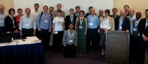
We also had an excellent meeting of the ICA-OSGeo Labs Network at ICC 2013 last week (thanks to Arlete for the photo) and thanks to all of you who attended and contributed for this. Silvania, Chris and Serena did excellent short presentations of their labs at our meeting and it helped give the bigger picture. We will also be working closely with the ICA Commission on Education as there are lot of synergies that we can jointly build upon for the future.

dresden
Reminder of our next monthly telemeeting tomorrow (5th Sep, 2013)  at 18:00 UTC. Agenda at  http://wiki.osgeo.org/wiki/ICA_OSGeo_Lab_Network_2013-09-05

As we have only one hour, the two key priorities and discussions will be OGC Schools at GitHub initiative that Luis Bermudez (OGC)  will present and OpenGIS Webinar series (MundoGeo). Thanks again to Phil and GeoTech Centre for hosting us.

I am looking forward to see many of you at FOSS4G Nottingham in 2 weeks’ time (actually in 12 days! – it really hectic and exciting time for us here). We are really hoping that FOSS4G 2013 will be excellent.

First ICA-OSGeo Lab in Switzerland established at SUPSI

We are pleased to announce that the first Open Source Geospatial Lab in Switzerland is established at the University of Applied Sciences and Arts of Southern Switzerland (SUPSI)  http://www.supsi.ch/home_en.html

In a society marked by profound changes, the University of Applied Sciences and Arts of Southern Switzerland (SUPSI)  produces, develops and disseminates knowledge and expertise as propellant forces fundamental to support the economic, social, technological and artistic progress, and to contribute to the cultural and ethical growth of both society as a whole and its individual members. In this context, the Institute of Earth Sciences (IST) is a historical research and education institution, integrated in SUPSI and mainly involved in activities strictly related to the environment and its characteristics. It is composed of specialists in management of surface water and groundwater, natural hazards assessment, geological analyses, environmental databases, natural resource monitoring and geographic information systems (GIS). The geomatics division at the IST is particularly active in the field of the open source software, open standard and management of real time data collected from automatic monitoring network.

This open source geospatial laboratory is a joint initiative of the International Cartographic Association (ICA) and the Open Source Geospatial Foundation (OSGeo). The lab will be led by Professor Massimiliano Cannata. He also leads the Division of Geomatics http://www.supsi.ch/ist_en/settori-attivita/geomatica.html

Massimiliano is also an OSGeo Charter member and an active member of the open source geospatial community. His laboratory is also the developer of the Free and Open Source Sensor Observation Service Data Management System( istSOS ) which implements the SOS standard. Details at http://istgeo.ist.supsi.ch/software/istsos/

OSGeo is a not-for-profit organisation founded in 2006 whose mission is to support and promote the collaborative development of open source geospatial technologies and data.

ICA is the world authoritative body for cartography, the discipline dealing with the conception, production, dissemination and study of maps.

Ohio’s First Open Source Geospatial lab will be established at Kent State University

We are pleased to announce that Kent State University will be home to Ohio’s first Open Source Geospatial Laboratory. The laboratory will support computational social science research and educational excellence through the development, implementation, and application of open source geo-computation and geo-visualization.

The laboratory is expected to attract considerable interest from spatial scientists, economic/urban geographers, regional scientists, and policy-makers who are keen to contribute to and learn about the evaluation, extension, and implementation of multi-scale and multi-mechanism framework for comparative space-time analysis of regional and urban dynamics. The laboratory will be active in dissemination of new comparative metrics for the broader research community. The software used to support most activities of the laboratory is open source, meaning the source code can be modified and re-distributed royalty and fee free. This open source geospatial laboratory is a joint initiative of the International Cartographic Association (ICA) and the Open Source Geospatial Foundation (OSGeo).

Professor Xinyue Ye, GIS Faculty at Kent State University and founding director of computational social science research lab will lead the initiative.

The facility will open in September 2013.

OSGeo is a not-for-profit organisation founded in 2006 whose mission is to support and promote the collaborative development of open source geospatial technologies and data.

ICA is the world authoritative body for cartography, the discipline dealing with the conception, production, dissemination and study of maps.

Details at http://www.osgeo.org/node/1376