“Geo4All” Lab of the Month – Open Source Geospatial Lab, Department of Geodesy and Surveying at the Budapest University of Technology and Economics, Hungary

It is my great pleasure, to introduce our colleagues at the Open Source Geospatial Lab of Department of Geodesy and Surveying at the Budapest University of Technology and Economics , Hungary as our “Geo4All” lab of the month. The Budapest University of Technology and Economics (BME), is the most significant University of Technology in Hungary and is considered the world’s oldest Institute of Technology which has university rank and structure. It was the first institute in Europe to train engineers at university level [1]. It was founded in 1782. More than 110 departments and institutes operate within the structure of eight faculties. About 1100 lecturers, 400 researchers and other degree holders and numerous invited lecturers and expert specialists participate in education and research at the Budapest University of Technology and Economics. The Budapest University of Technology and Economics issues about 70% of Hungary’s engineering degrees. 34 professors/researchers of the university are members of the Hungarian Academy of Sciences.[2][3].

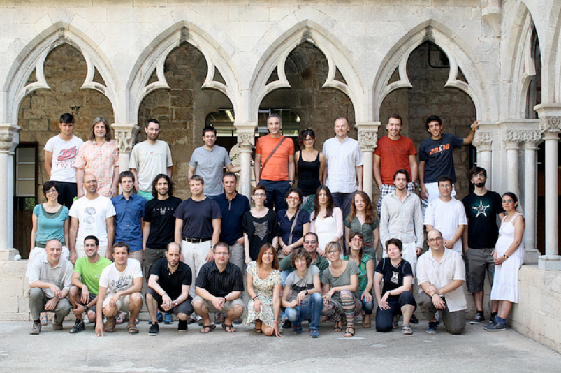
The OSGeo lab is run by the Department of Geodesy and Surveying and lead by Dr. Zoltán Siki. The members of the lab are Dr. Szabolcs Rózsa, Dr. ZitaUltmann, Ottó Deák, Dr. Csaba Égető, Dr. Bence Takács and Dr. Tamás Tuchband but draws heavily on interactions with other research groups and partners within the University, nationally and internationally.

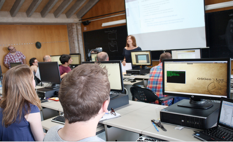
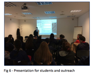
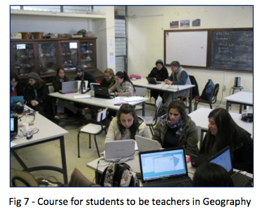
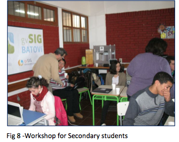
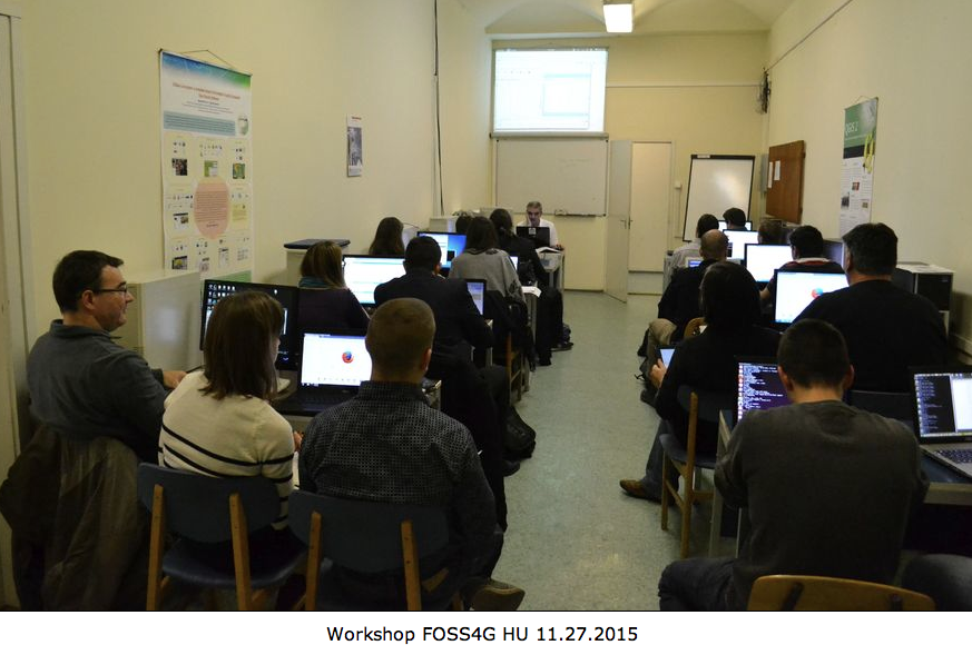
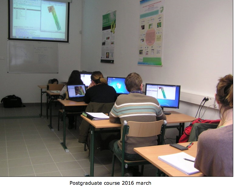
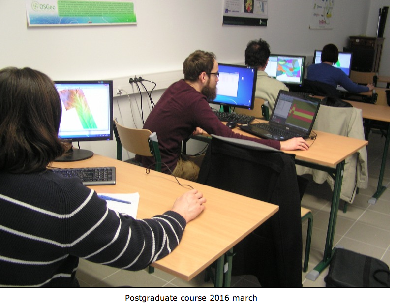
They offer a range of bespoke courses for OSGEO education . Hungarian trainings are offered in QGIS ,GRASS GIS ,MapServer ,OpenLayers SpatialLite and PostGIS .Their degree programs make use of OSGEO software and tools for data collection, storage and analysis.  Their graduates receive a solid grounding in Open Source tools and their applications. Further details on their education programs can be found in their website at http://www.agt.bme.hu/osgeolab/index.php?page=training&lang=en

Screen Shot 2016-07-28 at 09.22.06


Screen Shot 2016-07-28 at 09.22.37


Screen Shot 2016-07-28 at 09.23.13

Screen Shot 2016-07-28 at 09.23.44

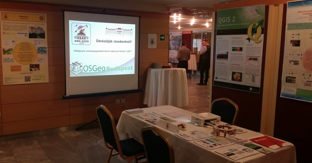
The Lab has also been active in presenting their research at other wider events. For example it was represented on the 13th Geospatial Information & Technology Association conference hosted by the Hungarian GITA organisation where visitors were able to receive additional information about our OSGeo Lab Budapest .

Screen Shot 2016-07-28 at 09.25.34


Screen Shot 2016-07-28 at 09.26.04

The OSGEO Lab at Budapest is involved in a number of major international and national research projects.  Their team works on further developments of open source software, search/fix bugs and maintain the Hungarian localizations (especially QGIS). They also provide software and spatial expertise to the solution of engineering problems using Open Source tools, software and standards.   The Geo for All lab in Budapest University of Technology and Economics welcomes collaborations from all interested and for making contributions to the wider society.

On behalf of the Geo4All community, we thank Zoltán Siki and all colleagues at the Budapest lab for their contributions to the Geo4All initiative and look forward to working and building more collaborations with all interested on this education mission.

Best wishes,

Suchith Anand

http://www.geoforall.org

[1] http://www.moveonnet.eu/directory/institution?id=HUBUDAPES02

[2] https://en.wikipedia.org/wiki/Budapest_University_of_Technology_and_Economics

[3] http://www.bme.hu/?language=en

Next steps for the Open Consultation on Open Geospatial Science – Vision 2030

From September 11-17, 2016, data professionals and researchers from all disciplines and from across the globe will convene in Denver, Colorado, USA for International Data Week (IDW). The theme of this landmark event is ‘From Big Data to Open Data: Mobilizing the Data Revolution’. As such, the International Data Week will bring together data scientists, researchers, industry leaders, entrepreneurs, policy makers  to explore how best to exploit the data revolution to improve our knowledge and benefit society through data-driven research and innovation. Details at http://www.internationaldataweek.org

Screen Shot 2016-07-19 at 12.32.57

I am pleased to inform that the next meeting of Geospatial IG of the Research Data Alliance will be held during RDA 8th Plenary in Denver 15th to 17th September 2016

Our meeting will be held on Friday, 16 Sept, 13:30 – 15:00.

The meeting objectives are to :

* Update on the Open Consultation on Open Geospatial Science – Vision 2030 [1]
* Ideas for educational programs for Geospatial Data Science (for example building synergies with CODATA-RDA School of Research Data Science [2])
* Discuss Ideas for starting new WGs (eg in Transport Data)

Draft meeting agenda at https://rd-alliance.org/ig-geospatial-rda-8th-plenary-meeting

Specifically to expand the discussions and ideas on Open Geospatial Science – Vision 2030 [1] and how we can build synergies towards the vision of the UN 2030 Agenda for Sustainable Development for building a better world for all. 

Details at https://opensourcegeospatial.icaci.org/2016/07/how-can-we-contribute-our-efforts-for-united-nations-2030-agenda-for-sustainable-development-for-building-a-better-world-for-everyone-3/ 

We are also inviting ideas from the wider community for short presentation (max 5 min) from various research groups working in Geospatial Data Science for the Denver meeting to share your ideas and explore ideas for future research collaborations. There will be opportunity to join remotely for this session and present for interested participants . If you wish to contribute to this session or those interested to initiate new Working Groups for the Geospatial IG please email me or any of the cochairs by 20th Aug 2016.

Details at https://rd-alliance.org/groups/geospatial-ig.html

We welcome ideas and participation from those interested for contributing to this.

Best wishes,

Suchith

Dr. Suchith Anand
http://www.geoforall.org/

Geo for All – Building and expanding Open Geospatial Science

Building Bridges, Empowering communities

Just one month after the successful FOSS4G UK  conference, our colleagues in Austria have run an excellent  FOSSGIS Conference (4th to 6th July 2016) at the University of Salzburg.

http://www.fossgis-konferenz.de/2016/

The FOSSGIS Conference 2016 is organized by FOSSGIS e.V (german language local chapter of the OSGeo), the OpenStreetMap Community and the Open Source Geospatial Foundation (OSGeo) in cooperation with the University of Salzburg. I want to thank our colleagues at the GeoforAll lab at Salzburg for their support and contributions.

The FOSSGIS-conference is the largest german-language conference for Free and Open Source Software for GIS and Free Geodata hosting about 400 participants. FOSSGIS offers lots of presentations and workshops concerning FOSSGIS, Open Data, OpenStreetMap and more.

Photos from the event at https://www.flickr.com/photos/uni-salzburg/albums/72157667838354303

It is just amazing to see the growth  and impact of our global community from Argentina http://www.foss4g-ar.org   to Japan https://sites.google.com/site/foss4ghokkaido/

Thank you to all the kind volunteers  in all  countries and regions for their selfless efforts that help make this possible .All these events are organised for the community, but also by the community. It is this global outlook that is key to our success. On behalf of Geo4All, i invite strong participation from everyone for our Global FOSS4G conference this year at Bonn [1]

Screen Shot 2016-07-19 at 12.35.09

We want to invite all of you to be our GeoAmbassodors [2] and contribute to Education, Research and Service for the betterment of humanity as the key guiding principle and work towards the vision of the UN 2030 Agenda for Sustainable Development for building a better world for all. 

Details at  https://opensourcegeospatial.icaci.org/2016/07/how-can-we-contribute-our-efforts-for-united-nations-2030-agenda-for-sustainable-development-for-building-a-better-world-for-everyone-3/

Best wishes,

Suchith

Dr. Suchith Anand
http://www.geoforall.org/

Geo for All – Building and expanding Open Geospatial Science

[1] http://2016.foss4g.org/home.html

[2] http://www.osgeo.org/node/1714

How can we contribute our efforts for United Nations 2030 Agenda for Sustainable Development for building a better world for everyone?

Dear colleagues,

I would like to thank all our colleagues at the International Cartographic Association (ICA) and its commissions for their efforts as part of the International Map Year (IMY) by highlighting the value of cartography by “mapping” the UN sustainable development goals and providing map perspective on the sustainable development goals [1].

Special thanks esp. to chair and cochair of the Commission on Open Source Geospatial Technologies, Prof. Silvana Philippi Camboim (Federal University of Paraná, Brazil) and Michael P. Finn (United States Geological Survey) as well as all members of the commission for their contributions to the goal to reduce inequalities within and among countries. Inequalities can have a strong geographic component and maps are a powerful tool to understand factors and plan measures to address such issues. Details at http://icaci.org/files/developmentgoals/goal_10.pdf

Screen Shot 2016-07-11 at 09.58.00

Geo for All is committed to work towards the vision of the United Nations 2030 Agenda for Sustainable Development for building a better world for everyone. Open Education is the simple and powerful idea that the world’s knowledge is a public good and that technology in general and the internet in particular provide an extraordinary opportunity for everyone to share, use, and reuse knowledge. Openness is key for true empowerment and sustainability. [2]

Screen Shot 2016-07-11 at 13.18.25

So how can you contribute to enable geospatial education opportunities to all ? Please be our GeoAmbassadors and share your expertise. Everyone who is interested in enabling geospatial education opportunities to all are our GeoAmbassadors. It is not just the thousands of Open Source Geospatial Foundation (OSGeo) members but also thousands of colleagues in ICA, ISPRS, UCGIS, AGILE, GSDI, AGS who all work for Geoeducation opportunities for all who are our GeoAmbassadors. Geo for All is a world wide movement that provides immediate benefit to the world.

Share the free and open educational resources and software that are available from OSGeo Live to MapStory to Teacher Training resources (developed thanks to the contributions to thousands of volunteers) all available free and open to all at http://www.geoforall.org/training/ to colleagues globally and be our GeoAmbassadors.

All our GeoAmbassodors should contribute to Education, Research and Service for the betterment of humanity as the key guiding principle and work towards the vision of the UN 2030 Agenda for Sustainable Development for building a better world for all. Details at https://opensourcegeospatial.icaci.org/2016/07/first-anniversary-edition-of-our-geo4all-newsletter-and-invitation-to-be-our-geoambassadors/

We will also link the ideas from Maps and Sustainable Development Goals to our Vision 2030 for Open Geospatial Science as there are also lot of synergies and will add momentum for our vision for Open Geospatial Science [3] . We aim to create openness in Geo Education for developing creative and open minds in students which is critical for building open innovation and contributes to building up Open Knowledge for the benefit of the whole society and for our future generations.

Best wishes,

Suchith

Dr. Suchith Anand

http://www.geoforall.org/

Geo for All – Building and expanding Open Geospatial Science

[1] http://icaci.org/maps-and-sustainable-development-goals/

[2] https://opensourcegeospatial.icaci.org/2016/07/sharing-is-caring-why-openness-is-key-for-true-empowerment-and-sustainability/

[3] https://opensourcegeospatial.icaci.org/2016/06/open-consultation-on-the-vision-2030-for-open-geospatial-science/

First Anniversary edition of our Geo4All Newsletter and invitation to be our GeoAmbassadors

We are pleased to announce the first year anniversary of our GeoforAll Newsletter (this is our twelfth issue). On behalf of the GeoforAll community, I would like to thank  Nikos Lambrinos (Chief Editor) and our wonderful team of co-editors Rizwan Bulbul, Pavel Kikin, Alexey Kolesnikov, Rania Elsayed, Elżbieta Wołoszyńska-Wiśniewska, Antoni Perez Navaro, Emma Strong, Sergio Acosta Y Lara and  production designer Nikos Voudrislis  for their selfless dedication and volunteer efforts  which made this possible. This newsletter has been an amazing instrument to share information and ideas with the wider geocommunity and also highlight and honour the contributions of our excellent colleagues from across the world. Details at http://www.geoforall.org/newsletters/

This newsletter is a community initiative run by the community for the community. We welcome all community members to contribute and share their updates to the newsletter for the benefit of the wider geo community.

Screen Shot 2016-07-02 at 05.56.42


We have made ‘Open Principles’ as the key guideline for all articles. Relevant updates and information on free and open software, open data, open standards, open education resources are all welcome for future editions. It has been a learning curve for all of us, and we request you all to help us on this initiative.

We have great pleasure in introducing Professor Georg Gartner as our GeoAmbassador for this first Anniversary edition of our Geo4All Newsletter. More information at https://opensourcegeospatial.icaci.org/2016/07/geoambassodor-professor-georg-gartner/

So how can you contribute to enable geospatial education opportunities to all ? Everyone who is interested in enabling geospatial education opportunities to all are our GeoAmbassadors. It is not just the thousands of OSGeo members but also thousands of colleagues in ICA, ISPRS, UCGIS, AGILE, GSDI, AGS  who all work for Geoeducation opportunities for all who are our GeoAmbassadors. Geo for All is a world wide movement that provides immediate benefit to the world.

Share the free and open educational resources and software that are available from OSGeo Live to MapStory to Teacher Training resources   (developed thanks to the contributions to thousands of volunteers) all available free and open to all at http://www.geoforall.org/training/ to colleagues globally and be our GeoAmbassadors.

Also it is our great pleasure to introduce our colleagues at SIGTE, University of Girona [1] , Spain, as our “Geo4All” lab of the month. One of the founder labs of the Geo for All initiative, SIGTE has been contributing immensely to our teaching, research, and service activities. SIGTE colleagues have been the pioneers of a very successful summer school program dedicated to free and open geographic information software and aimed at promoting the use and development of free geospatial solutions and empowering students. Details are available at https://opensourcegeospatial.icaci.org/2016/07/geo4all-lab-of-the-month-sigte-university-of-girona-spain/

We thank Gemma Boix, Lluís Vicens, Gemma Pons, Rosa Olivella, Ferran Orduña,Toni Hernandez, Alexandre Busquets, Josep Sitjar, Laura Olivas and all colleagues and students at SIGTE lab for their contributions to the Geo4All initiative and look forward to working and building more collaborations with all interested on this education mission.

Share the power of Geographic Information video that SIGTE developed  https://vimeo.com/22069904  This is a wonderful introductory video that can be used by all colleagues globally to promote GIS at all levels  .  “In the not so distant future, it is hoped that GIS will help us build a better and more efficient society for all” – This is exactly why we are all working on Geo4All…

The contributions of SIGTE colleagues is a good example of our philosophy and why we are working on Geo4All at https://opensourcegeospatial.icaci.org/2016/07/sharing-is-caring-why-openness-is-key-for-true-empowerment-and-sustainability/

Let us work together  to support open principles in education and enable Geo technologies in empowering communities and helping improving the Quality of Life and standards of living for everyone. Let us all work together to help create a world that is more accessible, equitable and full of innovation and opportunities for everyone.

Happy Anniversary to all.

Best wishes,

Suchith Anand
http://www.geoforall.org/

“Geo4All” Lab of the Month – SIGTE, University of Girona, Spain


It is my great pleasure, to introduce our colleagues at SIGTE University of Girona [1], Spain as our “Geo4All” lab of the month. One of the founder labs of the Geo for All initiative, SIGTE has been contributing immensely to our teaching, research and service activities.

University of Girona is a public institution devoted to excellence in teaching and research and to participating in the progress and development of society through the creation, transmission, diffusion and criticism of knowledge related to the sciences, technology, the humanities, the social sciences and the arts. It is deeply rooted in Catalonia and Catalan culture and is one of the primary economic and cultural motors of the region. At the same time, it pursues a vocation of universality and openness to all traditions, and cultures. The University, located in the city of Girona, is a part of the Catalan public university system. Historically, the Universitat de Girona is heir to the so-called Estudi General which was created in 1446 by Alphonse the Magnanimous, who granted Girona the privilege of awarding degrees in grammar, rhetoric, philosophy and theology, law and medicine. Recently, in 1991, a decree of the Catalan Government created the new Universitat de Girona, a multidisciplinary reference point thanks to contributions from a rich variety of university cultures.

The Geographical Information Systems and Remote Sensing Service (SIGTE) of the University of Girona is a research support service specialized in geospatial data treatment and the use and application of geographic information technologies. They offer technical support, advice, training and technological solutions in the field of geographic information. SIGTE colleagues have been the pioneers of a very successful summer school program dedicated to free and open geographic information software and aimed at promoting the use and development of free geospatial solutions and empowering students.

The Summer School, that was traditionally been held in Girona during one week in July (and it has been running for 5 editions -2010 to 2014-), have brought together 30 persons from around the world (see figures 1,2). The programme was focused on open web services and web map applications, especially in regard to publishing data on the web. It dealt with issues such as spatial data base management and consultation, the creation of web-based geospatial services and the development of web viewers for data publication. The Summer School offered participants practical experience in the use of free geospatial software to create and implement open web services and web map applications.

Screen Shot 2016-07-09 at 18.30.09


Fig 1 – Girona GIS Open Source Summer School in progress

Screen Shot 2016-07-09 at 18.30.28

Fig 2 –Group Photo of Summer School Participants

I still remember the email discussions that I had with Lluis, Gemma and other colleagues (sometime in early 2009!) when we put together a joint ERASMUS bid for helping us start upon this Summer School initiative and I am very grateful I had the opportunity to collaborate with amazing colleagues at SIGTE to lay the seeds of this pioneering Summer School initiative. This summer school initiative has been an inspiration for lot of similar Open Source GIS summer schools around the world from China to India. GIS Open Source Summer School initiative aims to ensure the highest quality of results and internationalize the curricula, in order to prepare students in an international working environment and competitive skills with emphasis on collaboration during the course. All course materials from the summer school are available online [2].

In 2016, SIGTE is still working and applying free and open source technologies in the geospatial domain, in a wide variety of technical projects such as a Participatory GIS, the Mosquito Alert! project (a citizen platform for studying and control mosquitoes which transmit global diseases) or SIG Dunes (a web mapping application for the inventory and monitoring the dunes located on the shore front of the Catalan coast), among others.

On the training side, SIGTE is providing basic and specialized training courses (on site and on line courses) based on the use of Open Source Technologies in Geospatial applied to different scopes (regional and local planning managers, public administration in general, researchers in primathology, oceanography, …) and UNIGIS Girona [3], has become a Msc in GIS where FOSS has a noticeable adoption and presence, and it is a sign of identity.

Moreover, SIGTE that is the organizer of the Spanish FOSS4G (Jornadas de SIG Libre) [4], ten editions to now, in 2016 has also organized the 2nd International QGIS User and Developer Conference as well as a QGIS Hackfest [5] with the kind support of the OSGeo Foundation.

Screen Shot 2016-07-09 at 18.30.40Fig 3 – Plenaries at 10th Jornadas de SIG Libre

I would like to thank our SIGTE colleagues for their pioneering introductory video on Power of Geography at https://vimeo.com/22069904
I really liked the final sentence in the video “In the not so distant future, it is hoped that GIS will help us build a better and more efficient society for all” – This is exactly why we are all working on Geo4All… 

The contributions of SIGTE colleagues are good example of our philosophy and why we are working on Geo4All at https://opensourcegeospatial.icaci.org/2016/07/sharing-is-caring-why-openness-is-key-for-true-empowerment-and-sustainability/

We thank Gemma Boix, Lluís Vicens, Gemma Pons, Rosa Olivella, Ferran Orduña,Toni Hernandez, Alexandre Busquets, Josep Sitjar, Laura Olivas and all colleagues and students at SIGTE lab for their contributions to the Geo4All initiative and look forward to working and building more collaborations with all interested on this education mission.

Best wishes,

Suchith Anand

[1] http://www.sigte.udg.edu/en/

[2] http://www.sigte.udg.edu/en/gis-summer-school/

[3] http://www.unigis.es

[4] http://www.sigte.udg.edu/jornadassiglibre/en/

[5] http://blog.qgis.org/2016/06/30/report-back-15th-qgis-hackfest-in-girona-spain/

GeoAmbassodor – Professor Georg Gartner

Dear colleagues,

It is my great pleasure to introduce Professor Georg Gartner as our GeoAmbassador. It is indeed a honour for us to have an eminent colleague and a visionary who helped us to create “Geo for All” as our first  GeoAmbassodor.

Georg Gartner is a Full Professor for Cartography at the Vienna University of Technology. He holds graduate qualifications in Geography and Cartography from the University of Vienna and received his Ph.D. and his Habilitation from the Vienna University of Technology. He was awarded a Fulbright grant to the USA and several research visiting fellowships. He was Dean for Academic Affairs for Geodesy and Geoinformation at Vienna University of Technology. He is Editor of the Book Series “Lecture Notes on Geoinformation and Cartography” by Springer and Editor of the “Journal on LBS” by Taylor & Francis. He serves currently as Past President of the International Cartographic Association.

Screen Shot 2016-07-02 at 07.32.30


Fig 1 – Prof. Georg Gartner (Georg is a true cartographer in every sense. He even has map background in his profile photo!)

Georg is a true global citizen who has travelled around the world working for expanding opportunities for geospatial education for all. Georg has been a mentor and great colleague for me at the International Cartographic Association (ICA). Sometimes random meetings help shape future events and my first meeting with Georg was by sheer coincidence as I sat next to him for lunch during AutoCarto conference around 8 years back in Shepherdstown, West Virginia, USA. At that time Georg was the Chair of the ICA Commission on Maps and the Internet and I introduced myself and within few minutes we were discussing ideas for expanding research collaborations and organise Location Based Services conference in Nottingham! Georg is the founder of LBS conference series which was key to help establish LBS research and journals. His vision for establishing LBS research has always inspired me. His humility and helpfulness are great qualities that I greatly admire.

It was thanks to the support and vision of Georg Gartner and Arnulf Christl (OSGeo President at that time) which was key in helping bringing together like minded communities on the bigger vision of joining efforts for enabling geospatial education and opportunities for all for helping create a better world. The International Cartographic Association and the Open Source Geospatial Foundation signed an MoU in 2011 (Fig 2) on the goal of developing global collaboration opportunities for academia, industry and government organizations in open source geospatial software and data . This MoU was updated and renewed in July 2015 . In 2015, International Society for Photogrammetry and Remote Sensing (ISPRS) joined GeoforAll (Fig 3).

Screen Shot 2016-07-02 at 07.32.39

Fig 2- Prof. Georg Gartner and Arnulf Christl shake hands after signing the MoU at Intergeo 2011 in Germany


Screen Shot 2016-07-02 at 07.33.24


Fig 3 – Three presidents at AfricaGEO 2015 in Cape Town .Prof. Georg Gartner (International Cartographic Association), Jeff McKenna (Open Source Geospatial Foundation) and Prof. Chen Jun (International Society for Photogrammetry and Remote Sensing )

We are proud to honour Georg as our inaugural GeoAmbassodor and we are extremely grateful for his contributions to Geo for All. We wish Georg and his wonderful family all the very best for the future. We are truly grateful for Georg for his strong support and guidance over the years . Georg also serves on the advisory board of Geo for All and we look forward to his guidance for the future.

Best wishes,

Suchith

Sharing is Caring – Why Openness is key for true empowerment and sustainability?

Dear colleagues,

“Geo for All” was started from nothing but the synergies of  joining brilliant minds and communities worldwide on a common mission makes the seemingly “impossible” possible. As we did not have any initial funding  , we had gone through lot of difficulties in our initial stages but it is thanks to the support of our amazing colleagues globally who are all our GeoAmbassadors that we were able to achieve our amazing growth.

Screen Shot 2016-07-02 at 05.56.42

Scalability is key for cost/sustainability issues esp. if we are thinking of national and global scale of expansion for providing high quality education opportunities for all . The cost of hardware is getting lower (and will keep decreasing), internet access is increasing (even in developing countries, it will keep increasing) , so if we can also provide free and open technologies , open data, open educational resources etc it will be a big enabler for bridging the digital divide. We  have amazing academic colleagues in Geo4All globally who are contributing their knowledge for Open Education efforts. We can get a flavor from last year’s GeoForAll – Global Educator of the Year Award 2015. Details are at http://www.geoforall.org/news/?action=story&id=20

It is my great pleasure to introduce our Geo4All colleagues at the National Bureau of Surveying (Dirección Nacional de Topografía – MTOP), Montevideo ,Uruguay. The amazing work that Sergio Acosta Y Lara and colleagues in Uruguay have done through gvSIG Batovi initiative has been an inspiration for all of us.

gvSIG Batovi is an excellent example of a successful initiative in Open Principles in Education and helps us to understand why scalability and costs for scaling is fundamental . This is a good example of scalability of education opportunities with very little resources using Open Principles. Imagine if all these hundreds of schools and thousands of students had to depend on buying software and data for their teaching and learning. This simple idea can be scaled to millions of schools globally .This empowerment of educators and students is the true essence and gift of Open Principles.

Through their focus on Open Principles in Education they have now provided high quality spatial technologies education to students in all schools across Uruguay . Thanks to the Plan Ceibal they also have free laptops for all Primary and Secondary students in the country so they truly have the opportunity to reach every student no matter they are rich or poor with high quality teaching and learning tools.

https://www.youtube.com/watch?v=orwN9K07XPo   (Video with English translation)

gvSIG Batoví is a GIS (Geographic Information System) software tool applied to educational environments driven by the National Bureau of Surveying (Dirección Nacional de Topografía – MTOP) for the Plan Ceibal (OLPC initiative for Uruguay), through which Primary and Secondary students can acquire knowledge of geography using laptops through informative and interactive information.

Screen Shot 2016-07-01 at 15.28.41

Figure 1 – Shows examples of gvSIG Batoví in action
The tool, after its launch, became the first Uruguayan distribution that gives rise to gvSIG Educa (Fig 2), which aims to be a tool for educators to provide students a better analysis and understanding of the region, as well as collaborate with the assimilation of spatial concepts using visual tools.

Screen Shot 2016-07-01 at 15.28.59


It also provides the possibility to both teachers and students to develop their own thematic maps from different layers of spatial information available turning the learning process in a much more attractive, motivating and interactive one (Fig 3).


Screen Shot 2016-07-01 at 15.29.06


Based on Free/Libre Open Source GIS software, the initiative was the result of collective work that included the coordinated participation of four institutions: the National Bureau of Surveying, the gvSIG Association (Spain), the Geospatial Information Technologies Working Group (GTIG) of the College of Engineering (UDELAR ) and the Ceibal Center (Centgro Ceibal)

Screen Shot 2016-07-01 at 15.29.15


After it’s launch it has been spread intensly through various presentations in congresses, workshops, courses and webinars. Workshops and Train the trainer programs for teachers in Geography and students are organised to build the future leaders in geography education (see Fig 5, 6, 7 , 8)

Screen Shot 2016-07-01 at 15.29.22


Screen Shot 2016-07-01 at 15.29.31


Screen Shot 2016-07-01 at 15.29.37


Screen Shot 2016-07-01 at 15.29.44


We are now working with MapStory Foundation http://mapstory.org/     to expand our spatial literacy in school level program globally. For example, “mapping the neighbourhood” exercises to help teach spatial literacy in schools globally. I think having MapStory examples of deforestation in different places might also be a good example to help teach students on effects of climate change as well as need for protecting the environment. Teaching Spatial literacy in schools is key for also helping build good global citizens.

Through our new initiative of Geo4All Schools we aim to use geotechnologies as a usecase to advance STEM interest in Schools through Open Principles so that students develop creative minds and develop to be future thought leaders and creative thinkers to help solve global challenges (not just to be just users).

We are already making huge impact from thousands of schools in countries like Uruguay to Spain and thousands of universities worldwide  are now benefiting from Open Principles in GeoEducation . Ideas that  starts from nothing are very powerful and keeps expanding exponentially . The bigger aim is to also to advance STEM education across the world and bring together schools, teachers and students across the world in joint projects and help building international understanding and global peace.

Best wishes,

Dr. Suchith Anand

http://www.geoforall.org/