GeoForAll Webinar Series – FOSS4G at The National Renewable Energy Laboratory

On behalf of GeoForAll, we would like to welcome you to our next webinar which might be  of interest to wider community.Details on the webinar on Friday December 2, 2016 at 7:00 PM GMT and how to connect remotely below. 
 
 
The National Renewable Energy Laboratory (NREL) is the United States’ primary laboratory for renewable energy and energy efficiency research and development. Details at http://www.nrel.gov
Talk details and how to connect are at http://www.geoforall.org/webinars/
 
Please join at https://ucdenver.zoom.us/j/173408130If you can’t attend, presentation recording will be posted in the Geo4All YouTube Channel https://www.youtube.com/channel/UCL1E2akvCNWP_nC0p5CpB8g
FOSS4G Tools for Geospatial Analysis at the National Renewable Energy Lab: A Pragmatic Approach
Presented by Nick Grue
The proliferation of geospatial analysis tools and methods means that no matter what your analysis goals, there are likely several options for running analysis, generating data, and visualizing your results. With a wide selection of tools to choose from, you are also presented with the question of which tool is most useful, has highest performance and efficiency, and easiest to use for your case.Here at the National Renewable Energy Lab (NREL), we had the unique opportunity to start fresh with building a new analysis model, and had to decide which technologies would be most useful. We eventually ended up primarily using Python for analysis, and PostGIS and Geoserver for visualization. Deciding on those tools took a fair amount of testing and comparison. This webinar will discuss the different tests we ran, our findings, and why some tools appeared to be better suited for our case than others.Analysis tools discussed in this webinar will include PostGIS vector analysis, PostGIS raster analysis, Python analysis of vector datasets, Python vectorized analysis of raster datasets, Python multiprocessing, and Geoserver visualization.

=====================================
Dan Getman of the NREL did an excellent presentation last year on “Creation, Analysis, Sharing, and Visualization of Complex Spatiotemporal Data Using Free and Open Source Software at the National Renewable Energy Laboratory”.The recording is at https://www.youtube.com/watch?v=Z0NTPFzGXn8&feature=youtu.be
We thank Rafael Moreno  and colleagues  at the University of Colarado Denver, USA for their help  in organising the GeoForAll free webinars for the benefit of the wider community.

OPEN FIELDS

Today, nearly 800 million people suffer from hunger and malnutrition around the world. For the first time in human history, we have the knowledge and the tools to put an end to it. Open data makes that knowledge available to everyone [1].

At the 2012 G-8 Summit, G-8 leaders committed to the New Alliance for Food Security and Nutrition, the next phase of a shared commitment to achieving global food security. As part of this commitment, they agreed to “share relevant agricultural data available from G-8 countries with African partners and convene an international conference on Open Data for Agriculture, to develop options for the establishment of a global platform to make reliable agricultural and related information available to African farmers, researchers and policymakers, taking into account existing agricultural data systems.”

screen-shot-2016-11-28-at-11-44-48

The GODAN initiative was announced at the Open Government Partnership Conference in October 2013 following 2012 G8 discussions.  Participants made commitments to Open Data for Agriculture at the International Conference on Open Data for Agriculture in Washington D.C. Subsequently the Governments of the United States and United Kingdom partnered to form this global initiative.


I am really happy to get the opportunity to work for the  Global Open Data for Agriculture and Nutrition (GODAN) . I am seconded from the University of Nottingham to GODAN now.  I would like to invite you all to know more about the amazing work that GODAN  is doing  and join us. Some introduction slides that i presented on GODAN  at AgriGIS ThinkTank at Kenya last month are at  https://www.nottingham.ac.uk/genius/documents/godan-uon-intro.pdf


OPEN FIELDS is the second episode of GODAN’s new documentary web series that meets individuals around the world who are on the frontline of how technology and data are reshaping agriculture to combat food insecurity and improve global nutrition. In this episode, viewers meet Eunice, a successful smallholder farmer who lives outside of Mombasa, Kenya. In Kenya, around 80 per cent of people have access to some form of farmable land. Although the soil is rich and fertile for farming, many plots of land stand empty or with failed crops.In the Mombasa region, Haller Foundation (a GODAN partner) have been working with local farmers for 50 years to design organic methods to improve crop production and also provide a solid economic stream for rural families.

Eunice has found success in maximizing her crop yield by using the open-source mobile phone app from the Haller Foundation. With an estimated 83% of Kenya now online, largely through mobile phones, Haller Farmers App has been developed to digitise and release local knowledge on a global scale, to anyone, anywhere. The application is free to use for anyone with a smartphone and internet access. They have also worked with Free Basics and Airtel Kenya to improve rural access for low income families, providing free data to download and use the app.


Let us now all work together on our joint mission  to get every government, non­-governmental, international and private sector organization to make agriculture and nutrition data available, accessible and usable so that we acheive the United Nations Sustainable Development Goal on End hunger, achieve food security and improved nutrition, and promote sustainable agriculture. So please join the Open Data Revolution to end global hunger and together we can make this possible.

Best wishes,

Suchith

Dr. Suchith Anand

http://www.geoforall.org/

GeoForAll – Building and expanding Open Geospatial Science


[1] https://opensourcegeospatial.icaci.org/2016/10/reflections-from-godan-summit-2016-join-the-open-data-revolution-to-end-global-hunger/

Summary of AgriGIS ThinkTank and Workshop 2016, Nairobi, Kenya

We are pleased to report on the success of AgriGIS Workshop & Think Tank meetings in Nairobi organised jointly by the The University of Nottingham, the Regional Centre for Mapping of Resources for Development (RCMRD), the Global Open Data for Agriculture and Nutrition (GODAN) and Crops for the Future (CFF) on October 27-28, 2016.

The objective of the event was to provide a forum for stakeholders in agricultural research organizations in Africa to share knowledge and propose strategies on improving the use of  open data, open educational resources , free and open geospatial software with the aim to expand Capacity Building and Training in AgriGIS to support Global Food Security.

The slides of the event  are at  http://www.nottingham.ac.uk/grace/events/agrigis-kenya-slides.aspx

screen-shot-2016-11-28-at-14-23-47


screen-shot-2016-11-28-at-14-23-10


We thank all the participants for their inputs and contributions for the Think-Tank discussions which covered the following themes (details to the summary of each theme are available at the event website)

*   Big challenges for Agriculture in the African context
*   Tools (known & wish list) used for agri using satellite/remote data collection
*   Existing or potential data sets we would like to use
*   Practical, technical, policy, impementation obstacles to Location aspects/geotechnologies for agri
*   Data and Modelling

There was interest and support from  participants for the need for Open Data in Agriculture and  initiatives like GODAN [1].

screen-shot-2016-11-28-at-14-22-40

Some of the key themes that emerged  from the Think Tank discussions were  the following

*   Importance of the need of an organisation locally to facilitate and ensure sustainability of AgriGIS
*   Spearheading open data and free and open software use for cost savings, expanding innovation and sustainability
*   Need for Capacity building among stakeholders

We are getting lot of emails of interest lot of colleagues in Africa expressing interest in follow up activities. We are pleased to inform that Center for Agricultural Networking and Information Sharing (CANIS) , Kenya has volunteered to  host the secretariat for the Think Tank  for developing as a focal point for interaction with other stakeholders on Open GIS and open data and keep building the ideas from the ThinkTank. We thank Kiringai Kamau and colleagues at CANIS for their support.  Please contact Kiringai (email  – kiringai@gmail.com  ) for expanding AgriGIS momentum in Kenya. We are also pleased to welcome CANIS as our new GeoforAll lab in Kenya.

It is good to see many blogposts from participants of the workshop such as the one at GEOSYMP  http://geosymp.com/2016/10/what-happened-at-the-agrigis-workshop-and-think-tank/

screen-shot-2016-11-28-at-14-24-39 screen-shot-2016-11-28-at-14-24-24

screen-shot-2016-11-28-at-14-22-59


We would like to specifically thank our hosts RCMRD ( Dr Hussein Farah and all colleagues) for their excellent organisation and arrangements including the hands on workshop .  We need to also make use of the community and momentum build by the ThinkTank for expanding future collaborations and make sure the community is kept  updated. Please make use of the  Twitter  created  to share your ideas https://twitter.com/hashtag/agrigisnr2016?f=tweets&vertical=default&src=hash

We  shared some examples of research at Nottingham at http://www.nottingham.ac.uk/genius/documents/egrasp-nairobi.pdf

More photos of the event at https://www.flickr.com/photos/148880137@N06/

We are hoping to keep building the collaborations in AgriGIS to  support Global Food Security.

Best wishes,

Suchith Anand

[1] http://www.nottingham.ac.uk/genius/documents/godan-uon-intro.pdf

Reflections from UK-India Joint Network on Sustainable Cities and Urbanisation in India “City level workshop on Chennai Urban Observatory” 9th -10th Nov 2016, Chennai, India


The City level workshop on Chennai Urban Observatory was organised as part of the UK-India Joint Network on Sustainable Cities and Urbanisation in India and held on 9-10 November 2016 at Taj Club House in Chennai., India The main objective of this workshop was to bring together academia, government organisations, NGOs, industry representatives to discuss ideas and to develop a framework for Urban Observatories relevant to Chennai and was held as part of the 5th Anniversary for Sustainable Chennai Forum . The theme of the event was Chennai as a Global City.

The RCUK funded SMARt ciTIES  is lead by Professor Michele Clarke (University of Nottingham) and Dr. Ajith Kaliyath (National Institute of Urban Affairs, India) brings together a consortium of multidisciplinary, international researchers with expertise spanning education and social science, cultural heritage and urban planning, science and engineering, ecology and environmental sciences and information technology to develop new collaborative solutions to the multi-layered challenges of rapid urbanisation. The Network includes leading urban researchers from University of Nottingham, University of Birmingham, University of Southampton, Bishop Grosseteste University College, Loughborough University, Northumbria University, Nottingham Trent University  and University of Surrey from the UK. From India there are urban researchers from Jawaharlal Nehru University, IIT Delhi, IIT Kharagpur, IIT Roorkee, Indian Institute of Population Studies Mumbai, Indira Gandhi Institute of Development Research Mumbai, Institute for Social and Economic Change, Bengaluru and Tata Institute of Social Sciences, Mumbai from India.

The workshop started with welcome address given by Mr Ram Venkataramani, President Madras Chamber of Commerce (MCCI). In the Inaugural session , Dr Ajith Kaliyath (Indian Principal Investigator, NIUA) highlighted the fact that Chennai is one of India’s smart cities and Chennai is now linked with other local, regional, national and international city sites. Prof. Michele Clarke (UK Principal Investigator, University of Nottingham) gave the context of the joint network model . She also highlighted the need for multidisciplinary approach for sustainable development (Fig 1).

chennai1


Fig 1 – Inaugural session of workshop on Chennai Urban Observatory

The Inaugural session had keynote address on “Visioning Chennai as a Global city” by Dharmendra Yadav (Secretary to Government, Housing and Urban Development Department and Vice Chair CMDA Chennai) . Mr Yadav highlighted that Urban growth in India is enormous and so are the challenges. This was followed by thematic session on Chennai as a global city with presentations on “the Role of Trade, Industry and Government” by Dr. Vijay Pingale (Joint Secretary, Industries Department, Government of Tamil Nadu) . In his presentation on  “Socio-economics dynamics in the city” Raghuttama Rao, (Managing Director IMACS) highlighted that Tamil Naidu economy is the second biggest in India by GDP with Chennai representing only 20% of the total. Chennai is the fourth largest metropolitan area in India. This was followed by presentations on “Making cities efficient and liveable” by K. Venugopal (Director, Kasturi and Sons) ,  “Data to intelligence” with examples from UK and India from Suchith Anand ( University of Nottingham) and presentation on “Human and material mobility” by Gitakrishnan Ramadurai (Department of civil engineering, IITM).

In the afternoon session on 9th November focused on “building a roadmap to how we can achieve a road map to a sustainable, affordable urban observatory that provide data you need.” Professor Michèle Clarke (University of Nottingham) set the scene by her short presentation on “Smart Cities: two contrasting examples from Britain” . The examples shown were Bristol and Newcastle both of which are port cities and share some characteristics with Chennai. Both have set out to create data to better understand their city. The Newcastle smart city web site is hosted by the University of Newcastle in collaboration with the city council and other city stakeholders – ‘ScienceCentral’. The Newcastle system is pragmatic in its use of existing data (including citizen science e.g. weather observers). The system makes little use of social data – although it has the potential to include in the future. There is a need to have a discussion about the use of data type and how these might best help citizens manage their business and social lives. The Newcastle web site is developing all the time as extra data is being added to the site. The Newcastle example provide a good way to start any smart city project but its long term future is unclear i.e. its funding basis is not clear. It’s important to have contractual agreement with all those providing data. The system also offers scenario modelling possibilities for traffic, energy, flooding and other critical pathways. The Bristol model is different in that the City Council is hosting the data/web server and is the main driver. The city centre has a square mile of 5 MG Wi-Fi which is hoped will allow people and infrastructure to exchange data in real time anywhere within the city centre. The system has clear privacy protocols. Both are two different systems but are science driven; Council and Universities working in collaboration with involvement of wider stakeholders.

This was followed by presentation from A. Shankar (National Direct Head – Strategic Consulting, Urban Solutions, JLL) who gave an overview of Chennai Smart City proposal followed by Chennai master plan by Mr Shivshanmugam (Member and Chief Planner, CMDA Chennai). These presentations brought together sharing of research and ideas to set the scene for specific discussion on topics on Challenges of global cities, Role of technology in governance, Institutional ecosystem and need for capacity building.

chennai2


Fig 2 – Group discussions at workshop on Chennai Urban Observatory

On 10th November (day two) there was presentations on Knowing matters; doing delivers (RV) , Data to actionable intelligence ( Professor Michèle Clarke, Associate Pro Vice-Chancellor, University of Nottingham). Michele highlighted the importance of open source data and the need for multi-disciplinary approaches to smart city data generation. Open data can be generated and shared freely to enhance confidence in the policy making process. This was followed by presentation from Professor Sudhir Chella Rajan ( Department of Humanities and Social Science, IITM, Chennai) on Conceptual Foundations of the Urban Observatory in which he highlighted that periurbanisation of Indian cites has seen a massive increase in recent years – New Bombay, New Calcutta. He highlighted the need for establishing ‘urban labs’ to better understand the middle space between ‘rural’ and ‘urban’.

This was followed by group discussions key topics on Opportunities under Smart City, Chennai, Data needs for Chennai Observatory, Enabling citizen engagement and Establishing global network.

chennai3


Fig 3 : Presentation to High level panel at workshop on Chennai Urban Observatory

All groups presented their summary to the whole team and their inputs were included in the High level panel presentation done by Dr Ajith Kaliyath, (Indian Principal Investigator, UK India Joint Network on Sustainable Cities.)

The outcomes of the discussions from the two days was presented by Ajith Kaliyath . Ajith highlighted the wider context; local context ( the sustainable Chennai forum) and the need for Chennai Urban Observatory and its objectives. The key stakeholders were identified i.e the chamber of commerce, academia, community and government (Fig 4) and also the key data needs for the observatory (Fig 5);

screen-shot-2016-11-28-at-14-11-22


Fig 4 – Stakeholder groups of CUO

screen-shot-2016-11-28-at-14-11-34


Fig 5 – Key data for CUA

The presentation to the High level panel also outlined the expected outputs/impacts; critical pathways; work packages (WP1 – WP8); sustainability and long term aspects for example, Key platform based on Web based free and open source Geospatial mapping to ensure low investment and operation costs, options for customisation and long term scalability; legal and institutionalisation; the way forward and future funding ideas.

High level panel provided feedback that this project is very important and highlighted that if the project is to succeed it needs a technical secretariat to make things happen. The secretariat mush be full time and use government, universities and university students (through projects) to collect and organise the data. The workshop concluded with Vote of thanks from Gayathri Sriram ( Vice President Madras Chamber of Commerce (MCCI).

We thank all participants for their active contributions for the success of this workshop. Special thanks to Ajith and Michele for their efforts and leadership in this. We look forward to building up more ideas and collaborations for our future workshops later this year in India to further expand ideas on Urban Observatories relevant to the needs of Indian cities.


Happy PostGIS Day

Happy PostGIS Day 🙂

On behalf of GeoForAll community, I am pleased to share the latest edition of our newsletter. Thanks to Dr Nikos Lambrinos (Chief Editor) and our amazing team of editors for making this possible.

Download the latest newsletter at http://www.geoforall.org/newsletters/

We would like to introduce our colleagues at Department of Geoinformatics, Palacký University in Olomouc, Czech Republic as our “GeoForAll” lab of the month. Details at https://opensourcegeospatial.icaci.org/2016/11/geoforall-lab-of-the-month-department-of-geoinformatics-palacky-university-in-olomouc-czech-republic/

We are also happy to present Victoria Rautenbach from the Centre of Geoinformation Science (CGIS) at the University of Pretoria (UP) in South Africa. as our GeoAmbassador. It is even more great pleasure to have another GeoAmbassodor Dr. Serena Coetzee (the GeoForAll chair of Africa ) who nominated Victoria for us. I want to thank Serena for introducing to us a great colleague as our GeoAmbassodor of the month and sending us all the details at https://opensourcegeospatial.icaci.org/2016/11/geoambassador-of-the-month-victoria-rautenbach/

GeoForAll’s mission is make geospatial education opportunities open to all and to make sure we all work together to create global citizens contributing to the betterment of humanity. Please be our GeoAmbassadors and share these ideas with all. Open principles in education (open educational resources, free and open software, open data, open standards etc) are key for true empowerment of staff and students globally and making education and opportunities accessible to all . We look forward to working and building collaborations with all interested in this education mission. Access to quality education and opportunities is key for getting rid of extreme poverty and enabling broadly shared prosperity for all.

Screen Shot 2016-07-02 at 05.56.42


The Open Source Geospatial Foundation  is the world’s largest Geospatial ecosystem , so we welcome you to the huge network of our partners and collaborators globally from governments, industry , universities, NGOs worldwide that you can connect to  expand your ideas rapidly. Open innovation is key in driving Digital Economy opportunities and we are determined to make sure that everyone benefits.

May the FOSS be with everyone…

Best wishes,

Suchith

Dr. Suchith Anand
http://www.geoforall.org/
https://opensourcegeospatial.icaci.org

GeoForAll – Building and expanding Open Geospatial Science

Happy GIS Day 2016

Dear colleague,

Happy GIS Day 2016 to all. May i request all who are taking part in various Geo events (Geography Awareness Week, OSM Geo Week, GIS day etc ) to  make use of the opportunity to promote Open Principles in Education by sharing information on GeoForAll and welcoming those interested to be part of Open Principles in Education [1].

Screen Shot 2016-07-02 at 05.56.42

Everyday is a GeoForAll Day . So please share GeoForAll ideas [2] everyday from now to your colleagues, students and be our GeoAmbassadors.

May the FOSS be with everyone…

Best wishes,

Suchith

Dr. Suchith Anand
http://www.geoforall.org
https://opensourcegeospatial.icaci.org

GeoForAll – Building and expanding Open Geospatial Science

[1] https://opensourcegeospatial.icaci.org/2016/10/open-principles-in-education/
[2] https://opensourcegeospatial.icaci.org/2016/11/pass-it-on-joy-of-selfless-sharing-on-gis-day-and-other-geo-events/

Volunteers needed for producing a simple webform and website for publishing data on annual Open Source Report Card for organisations

Dear colleagues,

The Open Source Geospatial Foundation is the world’s largest geospatial ecosystem benefiting not just millions of users globally but also hundreds of thousands of  organisations globally from big organisations like Google to smaller companies like esri, Envitia etc are all benefiting from this rapidly expanding ecosystem.

Screen Shot 2016-07-11 at 13.18.25

Open source software and open data are the backbone  that underpins much of the service delivery across the public, private and consumer sectors of the world economy. Governments, industry ,start-ups are leveraging open source software and open data to accelerate innovation in Geospatial. Economic impact of open source software on innovation and the competitiveness of the ICT sector is huge as many studies have shown. Open source is not only a catalyst for business  growth, but also a key driver and enabler of future success for many startups today.

Google has shared thier annual Open Source Report Card, highlighting thier most popular projects,  statistics and detailing some of the projects they have released in 2016.

https://opensource.googleblog.com/2016/10/google-open-source-report-card.html

I thought it is really good idea and it will be good if more organisations start producing their annual Open Source report cards. So I request volunteers to help us produce a simple webform which can be outputted to  a website with search facilities etc for collating information that will help all business and government organisations to produce thier annual open source report card . We will also link this website with GeoForAll website and archive it etc.

The main information we need are

*   Name of Organisation
*   Name of Contact person
*   Email of contact person
*   Website
*   Country
*   Year
*   Which open source projects have your organisation contributed with details/links etc
*   Which open source codesprints, conferences, events have you supported this year
*   Plans for next year

We will be pleased to collate and publish this as an annual special edition for Geo4All newsletter.

Could anyone help us with this. Please let Nikos or myself know if you are interested . Thanks in advance.

Best wishes,

Suchith

Dr. Suchith Anand
http://www.geoforall.org/

Geo for All – Building and expanding Open Geospatial Science

Pass it on – Joy of selfless sharing on GIS Day and other Geo events

Dear colleagues,

May i request all who are taking part in various Geo events (Geography Awareness Week, OSM Geo Week, GIS day etc ) to  make use of the opportunity to promote Open Principles in GeoEducation by sharing information on GeoForAll and welcoming those interested to be part of Open Principles in Education. Please give away OSGeo Live DVDs, USBs [1] and share GeoForAll ideas [2]  at these events.

Our students worldwide are now our GeoAmbassodors and already doing a great contribution by excellent work that they are doing now  as the biggest donors of GIS software[3].   I am also very happy that free and open source software like QGIS have now fully  empowered  all and students and by sharing the software ,  students are now the biggest donors of GIS software. They are breaking down the artificial barriers created by proprietary GIS vendors and rapidly bringing down the walls of digital divide.  The values of sharing and caring that  our current students globally have are more important than thier technical skills or knowledge and they inspire me every second. They are all true global citizens. Knowledge without compassion is useless. Caring and sharing are important values in education  . Details of why this is important at https://opensourcegeospatial.icaci.org/2016/07/sharing-is-caring-why-openness-is-key-for-true-empowerment-and-sustainability/

The ideas are summarized at https://www.youtube.com/watch?v=SmGoC6iFds4

Screen Shot 2016-07-02 at 05.56.42

I am warmly welcoming all GeoMentors to be TrueMentors and start supporting Open Principles in Education. Just share GeoForAll ideas and urls of of free and open source software like  QGIS download from http://qgis.org/en/site/     (there is also lot of documentation for learning at http://www.qgis.org/en/docs/index.html      and  free online materails produced by GeoForAll colleagues at GeoAcademy with comprehensive QGIS tutorials  at http://spatialquerylab.com/foss4g-academy-curriculum/      and  the freely available training materials at http://www.geoforall.org/training with everyone and you are a True GeoMentor!   So please pass on the GeoForAll ideas to everyone. Everyone is welcome to join the fun and festivities of Geo days to accelerate sharing and donation of free and open source GIS! So easy 🙂

Screen Shot 2016-09-07 at 13.02.19
Open principles in geoeducation (open educational resources, free and open software, open data, open standards etc) are key for  true empowerment of staff and students globally and making geospatial education and opportunities accessible to all [2] . We look forward to working and building collaborations with all interested in this education mission. Access to quality education and opportunities is key for getting rid of extreme poverty and enabling broadly shared prosperity for all. Millions of globally connected minds working together on the common mission of enabling Open Education opportunities for everyone will be key for making these developments possible. An idea whose time has come is the most powerful force in the universe, and the time for “Access to quality education opportunities for everyone” has arrived.

Education + Empowerment = GeoForAll

Happy GIS Day greetings in advance to all…

May the FOSS be with everyone…

Best wishes,

Suchith

Dr. Suchith Anand
http://www.geoforall.org/
https://opensourcegeospatial.icaci.org/

GeoForAll – Building and expanding Open Geospatial Science

[1] https://live.osgeo.org/en/index.html
[2] https://opensourcegeospatial.icaci.org/2016/09/geo4all-empowering-academics-and-educators-globally-requesting-colleagues-to-share-geo4all-ideas-at-all-geography-events/
[3] https://opensourcegeospatial.icaci.org/2016/11/award-for-the-biggest-donors-of-gis-software-goes-to-all-our-students-worldwide/

“GeoForAll” Lab of the Month – Department of Geoinformatics, Palacký University in Olomouc, Czech Republic

Dear GeoForAll Colleagues,

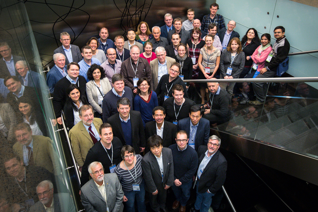
It is my great pleasure to introduce our colleagues at Department of Geoinformatics, Palacký University in Olomouc, Czech Republic as our “GeoForAll” lab of the month. I thank Dr Rostislav Netek for providing all the background information and photos of the activities of the lab which is summarized in this article.

“The Department of Geoinformatics, Palacký University in Olomouc, Czech Republic is a leading department in Czech Republic in fields of Cartography nad Geoinformatics. It guarantees the bachelor study, the master study and PhD study. They are the 100th member of GeoForAll. In research, their staff focus their activity on geoinformatics topics, development and application of GIS as well as free and open source solutions.

fig1

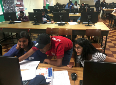
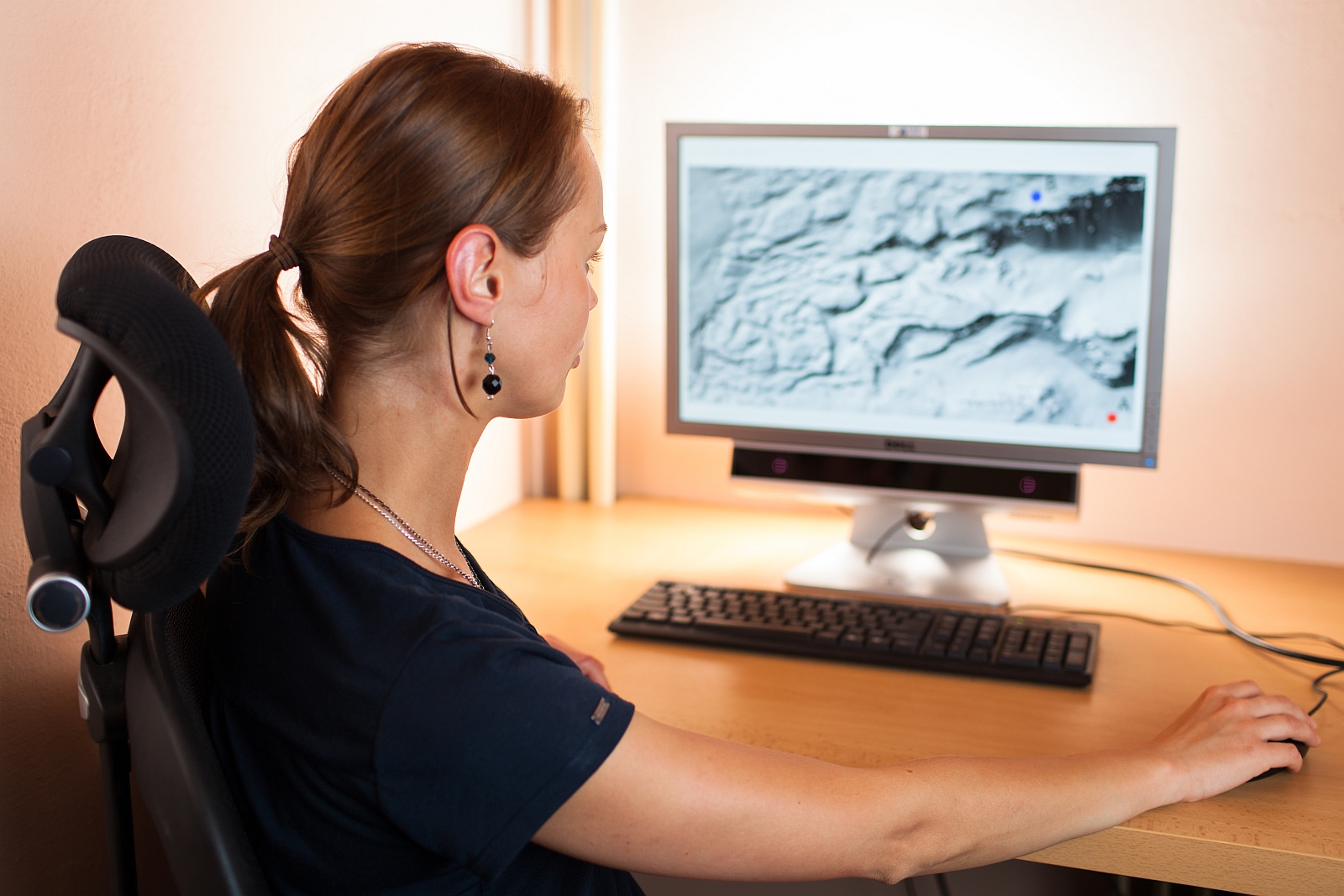
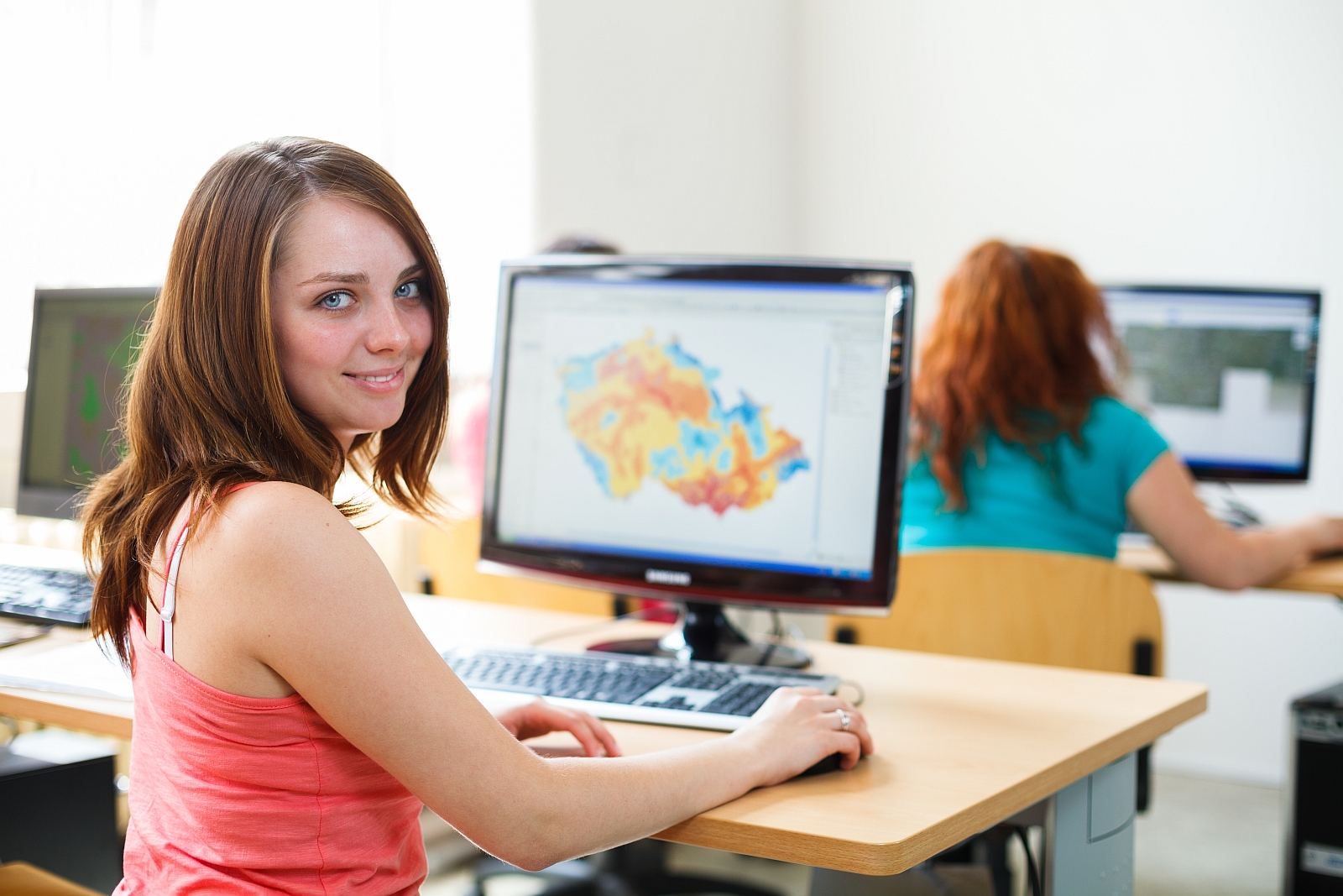
The Department of Geoinformatics was founded in 2001. Nowadays, the Department of Geoinformatics is a separate academic department that offers high quality education and research. It is renowned both nationally and internationally.  The main fields are geoinformatics and geoinformation technologies in education and research, and their promotion, both in the Czech Republic and abroad. Its activities encompass teaching in the field of geoinformatics with special emphasis on geographical aspects, research projects that follow international trends and promotion of modern geoinformation technologies in all spheres of the Czech society. The Department owns two specialised laboratories for geoinformation systems and remote sensing and one research laboratory for the eye-tracking technique in cartography. It uses state-of-the-art equipment and software. Its teaching activities are accompanied by cooperation with prominent national commercial companies in the field as well as renowned foreign universities. The teachers do their best to react to the individual needs of students of bachelor, master and doctoral programmes enabling them to take part in research projects, work and gain experience in commercial companies and excel in national specialised student contests.

fig2

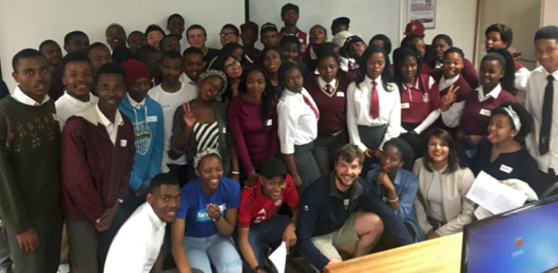
The Department of Geoinformatics is a  centre of education and research as well as popular activities in the field of geoinformatics and cartography on national and international scale.

fig3


  • Cartographical Days in Olomouc – A  yearly event consisting of lectures by top experts in thematic cartography and selected fields of application organised by the Dept. of Geoinformatics in cooperation with cartographic, geographic, GIS&T and other associations
  • Olomouc Geoinformatics Colloquiums (OGiC) – Invited lectures by prominent foreign experts aimed at academics and the professional public that take part in the activities of the Department of Geoinformatics.
  • Cartographical conferences by the Cartographic Societies of the Czech and Slovak Republic
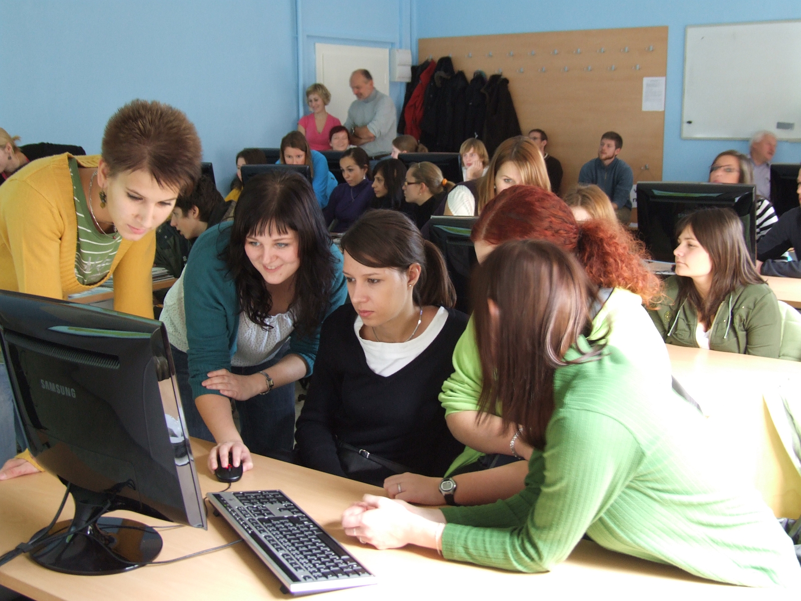
  • GISday – A global educational event held on the third Wednesday of November each year that enables geographic information systems users and vendors to open doors of the Department to schools, businesses and the general public to showcase real-world applications of GIS
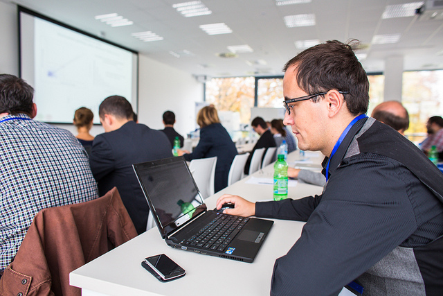
  • An autumn Olomouc (Podzimni Olomouc) – week of lectures and workshops made by external experts from both academic and commercial community, especially focused on technologies, new solutions, etc.
  • In February 2014 The CARTOCON Conference took place at thier Department – the biggest carto conference in middle Europe ever, many prominent visitors from all over the world, four ICA commissions meetings, etc.
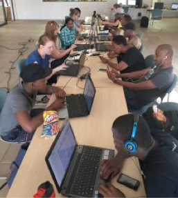
  • cz –  Czech local (mini)conference for Free and Open source Software for Geoinformatics (foss4g) took place at their Department last week!


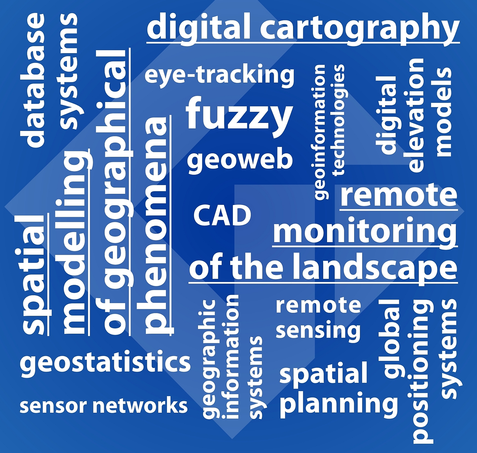
In research, the staff focus their activity on general geoinformatics topics, development and application of  geographical information systems, remote sensing, data processing, thematic and digital cartography, landscape spatial modelling, spatial planning in GIS, etc. Currently, the Department‘s  activities concentrate on research fields:  Spatial modelling of geographical phenomena in GIS, Digital cartography, Remote monitoring of landscape, (Open source) GI technologies.

The Department of Geoinformatics cooperates with a number of public institutions and private companies. The cooperation can have the form of a  project, commissioned job or student work.  The longterm partners are primarily the Czech Hydrometeorological Institute, the Czech Statistical Office, the Regional Authority of the Olomouc Region, the Olomouc Municipal Authority,the  SmartGIS company, the Forest Management Institute and the Transport Research Centre, local representation of OSGeo Foundation, etc.

fig5


fig8


fig7

Every year, many of their students study abroad at universities all across Europe. There are many contractual partner universities as part of the ERASMUS and CEEPUS programme, e.g. the universities of Bochum, Vienna, Valencia, Salzburg, Belgrade, Krakow, Lublin, Trondheim, Sofia, Budapest and other European cities. Similarly, thier Department receives students and teachers from Poland, Hungary, Spain and Serbia. Recently, they have been able to host among others Richard LeGates, Carsten Jürgens, Lászlo Zentai, Tamas Janczo, Maik Netzband, Ranka Stanković, Dagmara Kociuba, Branislav Bajat, Krzystov Kalamucki, Monika Michálková or Bela Markus, who give lectures as part of the Olomouc Geoinformatics Colloquium (OGiC).

fig6

Especially Assoc. Prof. Vilem Pechanec and Dr. Rostislav Netek are deeply focused in their research into FOSS solutions and technologies. Both of thier lectures and research take benefit from many open source solutions – thier server runs on Apache, webpages are powered by WordPress, for GIT/GIS on server-side they use UMN Mapserver, Geoserver, PostgreSQL, PostGIS, SpatiaLite. They also offer every academic year specialized courses such as Scripting in GIS (Python) , GIS online and Web Cartography (Leaflet, OpenLayers, Geoserver), Statistices (R-project), Dynamic web (HTTP Apache, PHP), Freeware a Open Source (GDAL/OGR, FWTools, …), most courses are supported by QGIS software and OSM datasources. Thier staff are involved in membership or open source groups (OSGEO at international level, GeoForAll, OSGEO/FOSS4G at local level ,FOSS expert group within Czech Association for Geoinformation, Open data activities).

Department of Geoinformatics is a  collective member of the Czech Association for Geoinformation (http://www.cagi.cz), co-organises its events and participates in its development. The Department of Geoinformatics is one of the most important bodies in the Czech Republic. Major cartographic activities in the Czech Republic (http://www.czechmaps.cz), the competition provides an organizational map of Children‘s Drawing Contest and Barbara Petchenik. It holds its annual Day of Cartography and in 2009 hosted the 18th cartographic conference.  The Department of Geoinformatics works closely with the Czech Geographic Society (http://www.geography.cz) and is the seat of the Section of Cartography and GIS.  The Department of Geoinformatics works closely with the Society for Photogrammetry and Remote Sensing (http://www.sfdp.upol.cz). The Department of Geoinformatics is actively involved in a number of international cartographic associations (http://cartography.tuwien.ac.at/ica/) and is represented in the Commission for National and Regional Atlases. The Department of Geoinformatics supports activities of the  International Geographical Union (http://www.igu-net.org) and is represented in the Commission for Geographical Information Systems. The Department of Geoinformatics is in close contact with the Slovak Association for Geoinformatics (http://www.sagi.sk).”


More details are at their web page at http://www.geoinformatics.upol.cz (English version currently under construction :-);

Brochure in English at http://www.geoinformatics.upol.cz/wp-content/uploads/Geoinformatika_brozura_eng.pdf

http://www.geoinformatics.upol.cz/katedra/clenstvi-a-partnerstvi/osgeo

University in Olomouc welcomes collaborations from all interested. Please email Rostislav at rostislav.netek@upol.cz

We thank Rostislav and all colleagues and students at the Department of Geoinformatics, Palacký University in Olomouc, Czech Republic for their contributions to the GeoForAll initiative and look forward to working and building more collaborations with all interested on this education mission.

Happy GIS Day greetings to all.

Best wishes,

Suchith Anand

GeoAmbassador of the month – Victoria Rautenbach

It is my great pleasure to introduce Victoria Rautenbach from the Centre of Geoinformation Science (CGIS) at the University of Pretoria (UP) in South Africa. as our GeoAmbassador. It is even more great pleasure to have another GeoAmbassodor Dr. Serena Coetzee (the GeoForAll chair of Africa and who all of our colleagues will already know) who nominated Victoria for us. I have been always amazed and inspired by the work that Serena and colleagues have been doing in South Africa. I first met Serena at ICC Dresden in 2013 where she also presented her ideas at the ICA Commission meeting of Open Source Geospatial Technologies meeting. I have not yet got the opportunity to meet Victoria but I am aware of her great work and contributions to Open Principles in Geo Education. I want to thank Serena for introducing to us a great colleague as our GeoAmbassodor of the month and sending us all the details.

 screen-shot-2016-11-03-at-11-42-03


Victoria Rautenbach, Centre of Geoinformation Science (CGIS), University of Pretoria, South Africa

Victoria is an enthusiastic contributor to open source / open data / open education work at University of Pretoria. She uses open source software, such as QGIS, GeoServer and PostGIS, in the modules that she teaches and is the first port of call for open source software support for students. She engages students in open data events and has arranged a number of events to introduce geoinformatics to school children. Below a few recent examples.

In 2014, Victoria helped to introduce the use of open source software in the final year project of geoinformatics students. Since 2015, the students have mapped the informal settlement called Alaska, in Mamelodi East, Pretoria (the name was given by locals because of its remoteness from the Pretoria city centre) for their project. After capturing data, such as dwelling numbers and tap distribution, various maps and 3D images were developed to show the current situation in the settlement. The data and maps assist local NGOs in the settlement with identifying and addressing symptoms of poverty, lack of security, and health concerns. This year, the students are improving the data and plan to add the footpaths to OpenStreetMap. A 2015 student blog describes their work and impressions https://mamelodimappers.wordpress.com/ .

screen-shot-2016-11-03-at-11-42-21


screen-shot-2016-11-03-at-11-42-30


screen-shot-2016-11-03-at-11-42-42


Third year students capturing data in the Alaska informal settlement

Victoria has also been involved in a number of student events to promote open data. The concept of an open data quest, started by SciBraai and Code4SA, is a South African initiative that encourages individuals from various backgrounds to discover and use South African data to find interesting stories and to create powerful visualizations.  In October 2015, the National Data Liberation was hosted at the Innovation Hub by Code4SA, geekulcha and Open Data Durban. Victoria Rautenbach competed at the event together with two UP students, Tshepo Mahudu and Sean Cullen, and another South African student, Nadia Oosthuizen (CSIR, Rhodes University), and Madi Hanekom (private consultant). They participated as Team DataDevils. The team used the 2013-2014 national protest data to create a visualization of the impact of protests on three economic hubs in South Africa. The DataDevils team was awarded first prize for their visualization at the Pretoria event. In April 2016, CGIS hosted a DataQuest on open data from the South African National Treasury. The aim of the event was to encourage participants to develop innovative data visualisations, stories and app ideas, using this local municipal budget information. For example, one participant designed a visualisation to show government spending per student at each South African university.

In 2016, Victoria hosted three groups of school children on three different Saturdays. The aim of the events was to inspire school children to be become passionate mappers through hands-on experience in a GIS lab. The first event was hosted for Grade 6 to 8 school children (12-14 years old) from the Leeuwenhof Academy. The event was part of the YouthMappers initiative and celebrated National Youth Day in South Africa. 55 children participated in two activities: 1) mapping a building on campus using ClassiCube (a free and easy-to-use substitute for Minecraft Classic, an early version of the popular game Minecraft); and 2) participating in a task of the Humanitarian OpenStreetMap Team (HOT) by mapping dwellings in Mozambique. This event ran concurrently with another YouthMappers event hosted by the Texas Tech University. During the two mapping events (i.e. at UP and Texas Tech), approximately 15,000 OpenStreetMap edits were made on this task (http://goo.gl/qst7Vu  )

screen-shot-2016-11-03-at-11-42-52).


School learners experiencing geoinformatics at UP, August 2016

In August and September 2016, learners from a number of schools were invited to spend a Saturday at UP to learn about geoinformatics. Most learners were from Mamelodi (close to UP), but a few had travelled from as far as Limpopo (approx. 300km) and KwaZulu-Natal (approx. 600km) to attend the event. Each day started with short talks by UP staff members, UP students and professionals from industry. The talks provided insight into the work of a geoinformatics professional. Subsequently, the learners collected data on campus during a scavenger hunt and used this data to create a map of the campus.

screen-shot-2016-11-03-at-11-43-00


screen-shot-2016-11-03-at-11-43-17


YouthMappers map-a-thon, October 2016

A YouthMappers map-a-thon in October 2016 contributed to the Peace Corps efforts in Botswana. The aim of this Humanitarian OpenStreetMap Team (HOT) task was to contribute to a better base map for 45 sites in Botswana. The group of mappers mapped buildings and roads that would ultimately support long-term development and HIV projects in Botswana. The group used both OpenStreetMap and MapSwipe for the map-a-thon.

More information about CGIS activities can be found in the annual reports on the website at www.up.ac.za/cgis.

Geo for All is a worldwide movement that provides immediate benefit to the world. We aim to create openness in Geo Education for developing creative and open minds in students which is critical for building open innovation and contributes to building up Open Knowledge for the benefit of the whole society and for our future generations.

I am truly inspired to understand more about the amazing work done by Victoria and colleagues at the University of Pretoria. We are proud to honour Victoria as our GeoAmbassodor and we are extremely grateful for her contributions to Geo for All.

Best wishes,

Suchith Anand