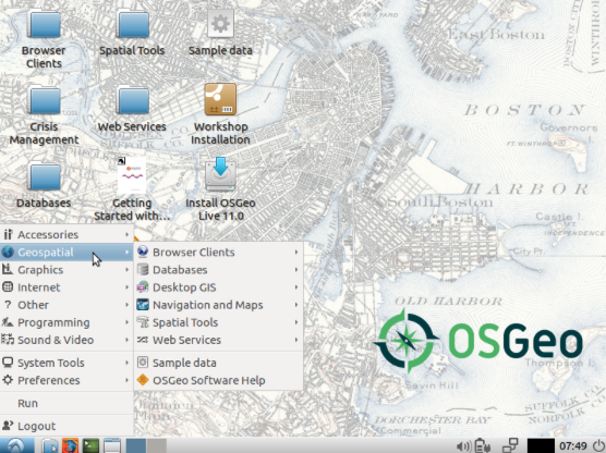
OSGeo-Live 11.0 Released and available free for the benefit of everyone

Version 11.0 of the OSGeo-Live GIS software collection ( http://live.osgeo.org ) has been released, ready for FOSS4G 2017  http://2017.foss4g.org/ in Boston, USA.

We are very thankful for the  efforts of all  who have directly helped with OSGeo-Live packaging, documenting and translating, and thousands who have been involved in building the packaged software.   There is whole range of excellent software (DesktopGIS,  Databases, Webservices etc) available free for the benefit of everyone.

OSGeoLive

Full list of software available at http://live.osgeo.org/en/overview/overview.html

Download the OSGeo-Live 11.0 image at http://live.osgeo.org/en/download.html

This excellent resource is made  available to the global community thanks to the hardwork and selfless dedication of thousands of amazing volunteers. Thank you all for making this possible. Full details at http://www.osgeo.org/node/1809

Thank you to all OSGeo volunteers for your work that has made possible  Geo education opportunities  accessible  for all . Be our GeoAmbassadors and let  us pledge and work  for open principles in science and education  to eradicate extreme poverty and enable shared prosperity for all. Please support and share the philosophy of Openness in Geospatial Science  and Education

https://opensourcegeospatial.icaci.org/2017/07/the-pledge-i-support-open-principles-for-science-and-education-for-building-a-better-world-for-everyone/

GeoForAll Lab of the month – Institute of Geography, Faculty of Science, Pavol Jozef Šafárik University in Košice, Slovakia

It is my great pleasure to introduce our colleagues at the Institute of Geography, Faculty of Science, Pavol Jozef Šafárik University in Košice, Slovakia as the GeoForAll lab of the month. I would like to thank Dr.Michal Gallay for providing me all background information on the lab activities.

The Institute was established in 1998 and it is located in Košice – the second biggest city in Slovakia. Their research and education is organized by three research groups: Physical Geography, Human Geography and Regional Geography, and Geographic Information Science. The list of projects and publications provides an overview of their research is at http://geografia.science.upjs.sk/index.php/en/research .

Currently, the Institute is led by Prof. Jaroslav Hofierka, who is the director and a professor in Geoinformatics. He specialises on developing methods for multivariate environmental modelling and spatial analysis of environmental phenomena in the open-source GRASS GIS.

Recently, their GIS group (http://geo.ics.upjs.sk/index.php/en/institute/structure-of-institute/oddelenie-geoinformatiky) has focused on 3D applications of combined use of terrestrial and airborne laser scanning in speleology and karst geomorphology (http://spatial3d.science.upjs.sk/), which relates to optimization of processing and analysing big spatial data by the means of distributed computing. The findings improved the understanding of morphogenesis of the Domica cave by the means of 3D geomorphometry, assessing the photovoltaic potential in urban landscape also on buildings facades as 3D vector data. Some new methods of modelling the DEM surface, water flow and solar irradiation by parallelized modules in the GRASS GIS and the OpenMP library are currently under review. The most recent research initiatives specialise on spaceborne and UAV-based remote sensing. The feasibility study for the European Space Agency looks at the suitability of the Sentinel 2 multispectral imagery for ascertaining solar transmittance of urban greenery (http://esa-surge.science.upjs.sk/). The project SEGMENT, with the partners from Comenius University in Bratislava, searches for new methods for land surface segmentation from microscale level to coarser level. High-resolution mapping with UAV and terrestrial lidar is the core method of data collection in this project.

Their research is closely integrated with teaching. Currently, they are running single Geography programme and Geography combined with another discipline in Bachelor level. The Master level offers two single degrees: (i) Geography and Geoinformatics and (ii) Geography with another discipline for teaching at primary and secondary schools. Since September 2017, they started the first year of a doctoral programme in Geoinformatics and Remote Sensing as the only institution in Slovakia. The PhD. programme is also open for anyone interested from abroad speaking good English (http://geo.ics.upjs.sk/index.php/en/study/doktorandske-studium-phd ).

The students gradually develop the GIS skills from the first year as undergraduates. The compulsory courses of Cartography and GIS involve necessary theoretical knowledge needed in the practical classes. The practical develop standard skills of geospatial data handling and analysis in the two alternatives, the proprietary and open source GIS. Later in the following two years, the students can opt for Open-source GIS or Graphics in Geography. The Master programmes strengthens and expands the skills in the classes such as Geospatial analysis and modelling which elucidates procedures of solar irradiation modelling, soil erosion modelling, geographically weighted regression, water flow analysis, etc. The Unmanned Aerial Systems teach practical aspects of mapping with UAVs, related aspects of the national legislation, processing of aerial imagery by image-matching techniques. In a similar sense, the classes of Terrestrial Laser Scanning and Global Navigation Satellite Systems provide practical experience and data processing skills with the technologies. The Remote Sensing class focuses on theory and practise of processing the satellite and airborne imagery, lidar or radar data and interpretation techniques. Land Information Systems develop skills in web-based presentation of geographic data for management land management. Details of their study programs at http://geo.ics.upjs.sk/index.php/en/study-en
serbia2


The students employ their geospatial competences in other classes of partial disciplines in Physical Geography and Human Geography. All GIS courses are provided in English for incoming ERASMUS+ students, the list can be found at http://geografia.science.upjs.sk/index.php/en/study/erasmus .

The stated software, but also the hardware and geodata infrastructure are concentrated in two laboratories: the Laboratory of GIS and the Laboratory of Remote Sensing (http://geo.ics.upjs.sk/index.php/en/institute/laboratory).

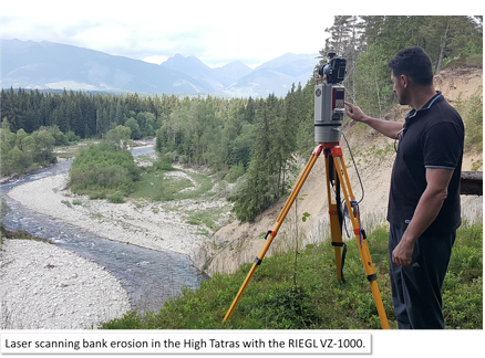
From the international point of view, two items have recently expanded the standard geospatial infrastructure that makes the labs unique. It is the Riegl VZ-1000 terrestrial laser scanner capable of online full-waveform processing up to 1400 meters and 550 kHz measurement rate. They are using it now for acquiring time-series of 3-D vegetation for ground truthing the solar transmittance derived from Sentinel 2 imagery in the project for ESA. The second item is a custom integration of the state-of-the-art technologies within an UAV platform capable of high-resolution and high-accuracy laser scanning, hyperspectral imaging, and photographic imaging. The technological solution comprises the latest development of a completely autonomous, unmanned helicopter by Aeroscout, the Scout B1-100 UAV helicopter that provides a payload capacity of up to 30 kg. Production of the UAV system and payload integration was financed within the project of University Science Park TECHNICOM co-funded by the European Union Structural Funds and the Ministry of Education, Science, Research and Sport of the Slovak Republic. More details are summarized in this ISPRS Archives paper (https://www.int-arch-photogramm-remote-sens-spatial-inf-sci.net/XLI-B1/823/2016/ ). They invite all interested researchers to contact them and in order to collaborate and use this specific equipment.

I want to thank Jaro Hofierka  and all colleagues and students at Pavol Jozef Šafárik University for their contributions to the GeoForAll initiative . We are looking forward to working and building more collaborations with all interested on this education mission.

Best wishes,

Suchith

The Pledge – I support Open Principles for Science and Education for building a better world for everyone

It is over a decade now since we started working on the philosophy of Openness in Geospatial Science  and Education [1],[2],[3].

fig1
Please find below the  pledge for  supporting Open Principles for Science and Education for building a better world for everyone .

“I believe Science is a public good and quality education opportunities should be open and accessible for everyone.

I will work to eliminate the digital divide and contribute to building up Open Knowledge for the benefit of all humanity, with special effort to enlighten future generations.

I contribute my service for the betterment of all humanity using the guiding principles of the United Nations 2030 Agenda for Sustainable Development in building a better world for everyone.

I will work to advance and increase Open Knowledge for the benefit of all humanity with special consideration of those less fortunate.

I will be a voice for Open Principles in Science and Education and promote this pledge through my networks.”

Thank you for your support.


[1] http://www.mdpi.com/journal/ijgi/special_issues/science-applications

[2] http://www.springer.com/earth+sciences+and+geography/geography/journal/40965

[3] http://www.geoconnexion.com/uploads/publication_pdfs/uk_v15i18-058-059-Op951AF3.pdf


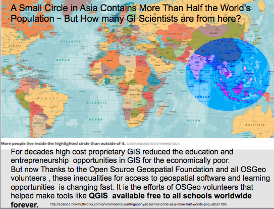
A Small Circle in Asia Contains More Than Half the World’s Population – But How many GI Scientists are from here?

For decades high cost proprietary GIS reduced the education and entrepreneurship  opportunities in GIS for the economically poor.

asia


But now Thanks to the Open Source Geospatial Foundation and all OSGeo and open education volunteers , these inequalities for access to geospatial software and learning opportunities  is changing fast.It is the efforts of OSGeo volunteers that helped make tools like QGIS  available free to all schools worldwide forever.
futuregeo

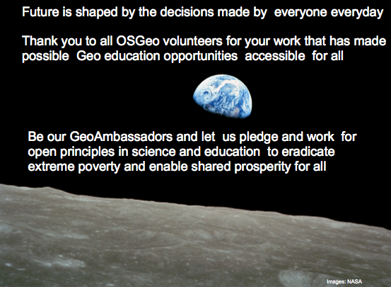
Future is shaped by the decisions made by  everyone everyday. Thank you to all OSGeo volunteers for your work that has made possible  Geo education opportunities  accessible  for all . Be our GeoAmbassadors and let  us pledge and work  for open principles in science and education  to eradicate extreme poverty and enable shared prosperity for all.

More details at https://www.slideshare.net/SuchithAnand/the-future-of-geo-is-open 

https://opensourcegeospatial.icaci.org/2017/07/the-future-of-geo-is-open/ 

http://www.ee.co.za/article/open-source-conference-promotes-spatial-literacy.html

The Future of Geo is Open

This is a request for help as I need inputs from the wider community to get more ideas for my presentation at FOSS4G-Europe 2017 later this month. FOSS4G-Europe 2017 will be held at the École Nationale des Sciences Géographiques (ENSG) in Paris, France, from July 18th to 22nd, 2017 . Details at http://europe.foss4g.org/2017/

geoforall

My keynote presentation will be on “The Future of Geo is Open” and I would like to invite ideas/inputs for this. It is also an good time to reflect on the developments in Open Geospatial Science [1],[2],[3] as it is over a decade now since we started working on the philosophy of Openness in Geospatial Science  and Education.

I am looking forward to discussing new ideas with you all at FOSS4G-Europe 2017.

Best wishes,

Suchith


[1] http://www.mdpi.com/journal/ijgi/special_issues/science-applications

[2] http://www.springer.com/earth+sciences+and+geography/geography/journal/40965

[3] http://www.geoconnexion.com/uploads/publication_pdfs/uk_v15i18-058-059-Op951AF3.pdf

Lab of the Month – the Department of Civil, Environmental and Mechanical Engineering of the University of Trento, Italy

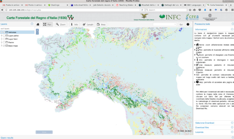
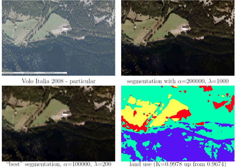
It is my great pleasure, to introduce our colleagues at the Department of Civil, Environmental and Mechanical Engineering of the University of Trento, Italy as the GeoForAll Lab of the month .The laboratory http://www.ing.unitn.it/~grass/ aims to support the research in the spatial information field, the development of FOSS4G systems and the education using FOSS. Research has lead to the development of new data processing techniques which have been implemented as FOSS4G, see e.g. the signal and image segmentation software by Alfonso Vitti [0] or GRASS’ modules for GNSS planning [1].geo1The PyGRASS library [2], which allows the access to low-level GRASS APIs using the python language, has been developed by Pietro Zambelli while he was PhD student at the laboratory for the Google Summer of Code 2012. Clara Tattoni and Marco Ciolli research is focussed on the use of FOSS4G in ecology: conservation of endangered species, invasion of pests and historical spatio temporal variation of alpine forest coverage and developement of future scenarios.     They have been organising a Summer school for Tanzanian Ecologists and International students for several years (see newsletter V2 n3). They recently digitized and distributed the historical map of the Italian Kingdom of 1936[6].

geo2


geo3


The laboratory has published a lot of educational material on its main web site [3]: GRASS and QGIS tutorials, lectures slides, live DVDs and Virtual Machines. It has organized many one-day workshops about FOSS4G during national and international conferences, including international FOSS4G meetings and for professionals [5]. The laboratory is involved in the Italian GRASS users and has hosted its 2001 and 2011 meetings. In 2002 the laboratory organized the “Open Source Free Software GIS – GRASS users conference 2002”, the first GRASS meeting in 8 years, starting a series of conferences which converged in the FOSS4G meetings in 2006.

geo4On behalf of the GeoForAll community, we thank Clara Tattoni, Paolo Zatelli and all colleagues from the the University of Trento’ lab for their contributions to the GeoForAll initiative and look forward to working and building more collaborations with all interested on this education mission.

Best wishes,

Suchith
[0] http://www.ing.unitn.it/~vittia/sw/index.html

[1] http://www.ing.unitn.it/~grass/software.html

[2] https://grasswiki.osgeo.org/wiki/Python/pygrass

[3] http://www.ing.unitn.it/~grass/

[4] http://www.ing.unitn.it/~grass/conferences/GRASS2002/home.html

[5] http://events.unitn.it/grass2017

[6] http://193.205.194.133/


GeoAmbassador– Prof. Dr. Josef Strobl

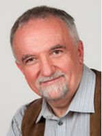
It is my great pleasure to introduce our excellent colleague Prof. Dr. Josef Strobl as our GeoAmbassador. Josef Strobl is Professor at the Department of Geoinformatics at the University of Salzburg, Austria. He is one of the pioneers involved in expanding geoeducation esp. online GIS education through the UNIGIS International Association . He is not only the chair of UNIGIS but also the brains behind the success of UNIGIS . Josef  is the force behind GI_Forum GeoInformatics Forum Salzburg which helped establish University of Salzburg at the centre of key developments by bringing together the GI-Forum community to discuss new ideas and developments for the future.

I greatly admire his leadership abilities and vision. When we established GeoForAll, he was one of the first visionaries that we approached to serve on our Advisory Board . We thank Josef and colleagues for establishing the 75th OSGeo lab at the University of Salzburg.

Josef


A geographer by training and research, Dr Strobl has over 30-years research and teaching experiences. He obtained his Master and PhD from the University of Vienna in 1982 and 1984, respectively. His research interests are in Geographical Information Science and Systems, Remote Sensing and Image Processing., Spatial Analysis, Digital Terrain Models, Spatial modelling of renewable energy potentials, Spatial Statistics and Geostatistics. Modelling and Simulation of dynamic processes. Open Systems architectures, interfaces, metadata and catalogues – SDI, Location based services. Internet-based distance education. Active learning in online environments and design of interactive learning materials, Learning with Geoinformation – from spatial awareness to thinking to citizenship.

His services to the geo community are immense. He serves as the Full Member, of Austrian Academy of Sciences (ÖAW) and Chair ÖAW Commission for GIScience. He is the Co-Founder and President (2007-2011) Austrian Umbrella Org. for Geographical Information (AGEO).. Board. He is the Founder and President since 1999 International Institute for Geographic Information (IIG).

Josef is member of GISIG Executive Committee , Member of Eurogi Executive Committee , Council Member of the International Society of Digital Earth (ISDE ). Josef serves in the Editorial board memberships of GIScience , International Journal of Geoinformatics , ISPRS International Journal of Geo-Information ,Journal of Geomatics .He has (Visiting) faculty positions at many universities worldwide.
I am grateful for this opportunity of introducing some of our amazing colleagues from different parts of our world each month as our GeoAmbassadors and get inspired by their amazing work and contributions for the wider community. We are proud to honour Josef as our GeoAmbassodor and we are extremely grateful for his contributions to Geo for All. Josef is a great ambassador for Geospatial Science globally. May I also use this opportunity to send greetings on behalf of GeoForAll to all colleagues now  at GI_Forum 2017 this week (July 4-7 , 2017) and wishing them productive meetings and discussions.

Best wishes,
Suchith Anand
http://jstrobl.zgis.net/
https://www.oeaw.ac.at/en/m/strobl-josef/
http://www.unigis.net
http://www.gi-forum.org

FOSS4G Africa 2017 spreads ideas to expand GeoEducation and empowerment across Africa

Greetings to all our colleagues who worked for the success of FOSS4G Africa 2017 in Johannesburg this week. It is also a great lead-up to FOSS4G 2018 in Dar es Salaam and to expand the wave of ‘Openness’  that is  sweeping across the world and gains traction and momentum in every facet of society.

Screen Shot 2017-06-30 at 19.48.41


Screen Shot 2017-06-30 at 20.02.33

Thanks to  SAGTA (Southern African Geography Teachers’ Association) and  it is great to see that they have teamed up with the world of secondary and tertiary education .  Our thanks to every member of the GeoForAll Team who made this happen and the impacts that you all are now starting will be felt everywhere in the future.

The full conference program, keynotes at https://foss4g-africa.org/en/home/


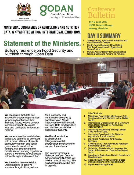
Statement of the Ministers for Agriculture at the Global Open Data for Agriculture and Nutrition Data (GODAN) Conference and the 4th Agritec Africa Exhibition

We recognize that data and innovation creates opportunities for people to influence their lives and future, reduce poverty, increase productivity, create jobs and participate in decision-making.

We underscore that sustainable agriculture can only be achieved with a broad alliance of people, particularly women and youth, governments, small holder farmers, civil society and the private sector, working together to secure a world that is food secure, without hunger and malnutrition.

We therefore resolve to take urgent actions to achieve sustainable agriculture, reduce food insecurity and nutritional challenges by constituting an African Intergovernmental Network on Open Data for Agriculture and Nutrition, under the auspices of GODAN.

We therefore decide to establish an Intergovernmental Coordination mechanism to support the network. The Intergovernmental Network on Open Data for Agriculture and Nutrition will hold an annual meeting. The next conference will be held in Uganda.

Screen Shot 2017-06-30 at 08.50.55


The GODAN conference held in Nairobi  (14-16th June 2017) http://godanagritec.com is a result of a commitment made by Kenya’s Cabinet Secretary for Agriculture, Livestock and Fisheries, Mr. Willy Bett at the September 2016 Global Open Data on Agriculture and Nutrition (GODAN) Summit held at the margins of the UN General Assembly, in New York.

Thanks to the government of Kenya and Africa for their leadership for Open Data in Agriculture and Nutrition


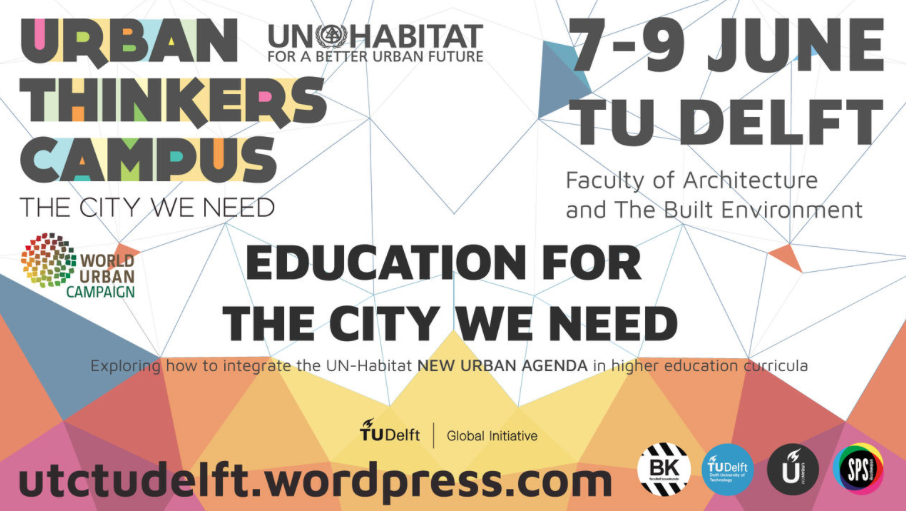
Education for the City we need – how to integrate the UN-Habitat NEW URBAN AGENDA in higher education curricula?

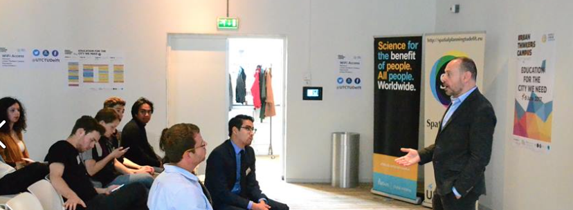
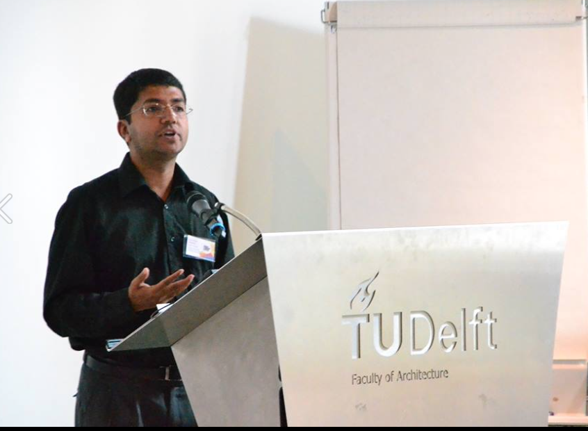
Last week (7 – 9 June 2017) TU Delft organised  an Urban Thinkers’ Campus (UTC ) on Higher Education for the New Urban Agenda. The title of the UTC was “EDUCATION FOR THE CITY WE NEED”.  A concept sponsored by UN HABITAT in partnership with the World Urban Campaign.delft

The aim of the meetings was to explore how to integrate the UN-Habitat NEW URBAN AGENDA in higher education curricula. How do we prepare young professionals to understand and implement challenges related to the New Urban Agenda in diverse national and local developing environments? That’s the question the Urban Thinkers’ Campus aimed to answer.

Screen Shot 2017-06-11 at 10.52.14

The New Urban Agenda is the outcome document agreed upon at the Habitat III cities conference in Quito, Ecuador, in October 2016 and signed by all the UN member states.This event brought together speakers and participants  to discuss strategies, methodologies, literature and practical exercises that can be implemented in higher education courses in Europe and elsewhere. Our attention is on social, economic and environmentally sustainable urban development everywhere, but the challenges of urbanisation in the Global South are truly urgent.

delft1

I would like to thank the organisors for the excellent initiative and for inviting me to share our ideas and the need for Open Principles in Education for  “EDUCATION FOR THE CITY WE NEED”. I hope Open Principles in Education is firmly included in the education ideas for the future.

I fully support TUDelft Global mission statement “Science for the benefit of people. All people. Worldwide.”