GeoAmbassador – Dr. Mark Ware (University of South Wales, UK )

On behalf of GeoForAll and the Open Source Geospatial Foundation, it is my great pleasure to introduce Dr. Mark Ware of the University of South Wales, UK as our GeoAmbassador. Mark is a Reader in GIS at the University of South Wales, United Kingdom. His research interests include automated map generalization, GIS-based optimization algorithms, GIS for disaster management, spatial data structures and Open Source GIS. He has studied, researched and worked in GIS since 1989. During that time, he has been involved in many GIS teaching, research and consultancy projects with partners that include BECTA, Ordnance Survey, BGS, MULRI, Environment Agency, West Coast Energy and Admiral. Mark regularly present research results in the academic literature and enjoy attending and presenting at conferences.

mark


University of South Wales (previously the University of Glamorgan) has been active in the fields of GIS education and research for over 30 years. Most of this activity is carried out by the university’s GIS Research Unit (http://gis.research.southwales.ac.uk/), which is currently led by Prof Gary Higgs. The unit has always been based in a computing department – currently it is part of the School of Computing and Mathematics. This has meant that much of its teaching and research has looked at GIS from a computing perspective. Mark was key lead in helping establish the first Open Source Geospatial lab in Wales as in November 2013 the unit joined GeoForAll and it became the first Open Source Geospatial lab in Wales.

Mark Ware provided the following updates on FOSS GIS and Teaching at USW

“GIS is taught at both undergraduate and post-graduate level; USW is proud to have delivered one of the UK’s first Masters programme dedicated fully to GIS. Traditionally, our teaching has made extensive use of proprietary software. While still using this software on some of our modules, in recent years FOSS has played a significant role in our delivery. At undergraduate level, QGIS is used extensively as a means of introducing first-year mainstream computing students to the world of GIS. The fact that the software is readily and freely available for download and installation make it an attractive option. Students almost always like the subject – we try our best to make their studies as interesting and relevant as possible. This is achieved by emphasising the computing aspects (such as discussing underlying algorithms, talking about and demonstrating the ability to create plugins, and emphasising good data modelling and design) and by the use of data sets and example applications that are local (this is facilitated to a large extent by access to open data products such as OSM and https://data.police.uk/) Second and third year students have dedicated modules in which they can learn about spatial databases (PostgresSQL/PostGIS) and web mapping (GeoServer, OpenLayers and Leaflet); the emphasis here is on the design, implementation, deployment and administration of systems, rather than simply their use and application. Our post-graduate teaching places more importance on the applications of GIS, with modules often being taken by students from courses in other academic subject areas (including geography, environmental studies and BIM); QGIS is again the primary software used. The group also has experience of delivering short courses in GIS to local businesses and organisations. The most recent of these, which took place at USW in June 2016, was a free Introduction to GIS course. This was organised and sponsored by WISERD (http://www.wiserd.ac.uk/) and focused on the use of QGIS and freely available socio-economic data sets.

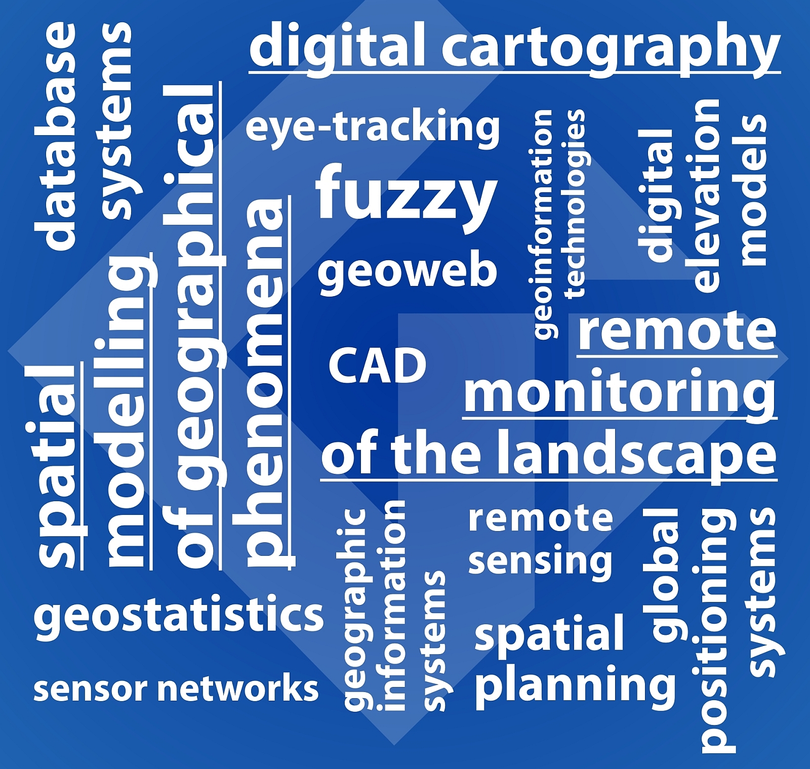
USW has a strong-track record in GIS research, with notable success in various areas, including: automated cartographic design (map generalization and label placement), terrain modelling, data compression, accessibility modelling and population estimation modelling. Here are some examples of some of our more recent projects, each of which involves the development or application of open-source solutions:

One of the first FOSS projects undertaken at USW involved the design and implementation an online geoportal, the main function of which is to enhance the ability of researchers to search for and find socio-economic research data relating to Wales. The aim is to encourage collaborative research and re-use of data. This work was carried out as part of our involvement with The Wales Institute of Socio-Economic Research, Data and Methods (http://www.wiserd.ac.uk/). The portal was built using various open-source technologies, including PostgresSQL, PostGIS, GeoServer, Apache, OpenLayers and GeoExt. It was developed by Dr Richard Fry (now at Swansea University, UK) and Dr Rob Berry (now at the Countryside and Community Research Institute, UK).

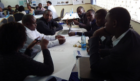
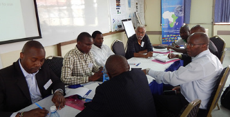
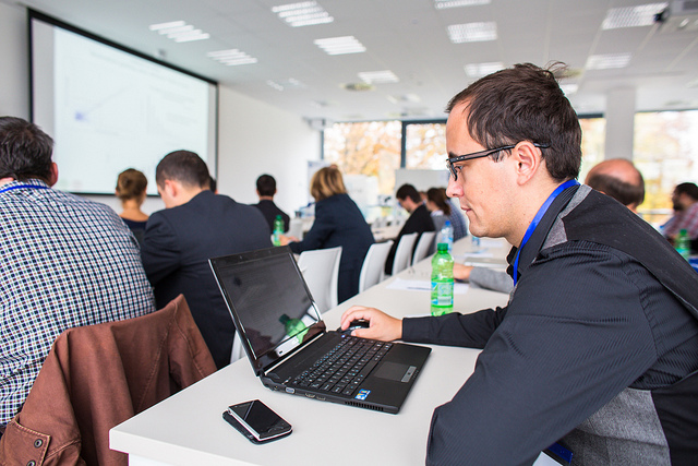
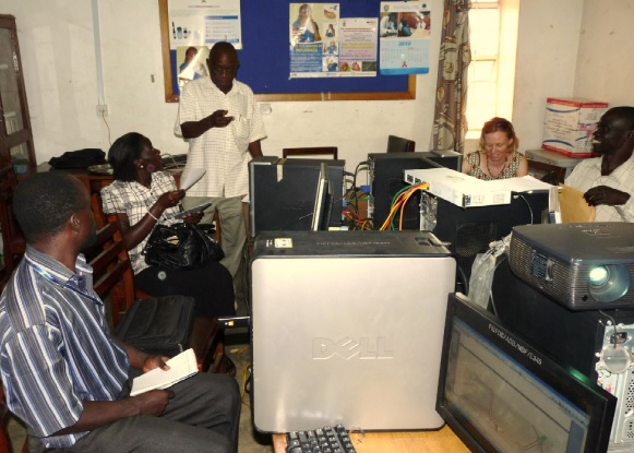
A recently completed project1 has considered ways of improving crowdsourced mapping in developing countries (particularly in East Africa) for the purposes of disaster preparedness. In many developing countries, maps of vulnerable region tend to be low resolution and/or not up to date. There are many examples of crowdsourced mapping initiatives that have taken place after a disaster has occured, but the geographic information becomes available perhaps days or weeks later. By populating digitals map before a potential disaster, various advantages may be gained, including the information being available at the outset of disaster response. The project focused specifically on the Mbale region of Uganda, with which USW has close links. At the beginning of the study, the region was poorly mapped. Early in the project, its main investigator, Dr Dave Farthing, ran several courses in Mbale to train locals in the use of GIS and GPS for data gathering and data analysis (see image below). The project identified competing factors that either inspire/discourage communities to/from adopting and using mapping technologies. The main output from the project is a new model (called the TASUT model) for encouraging technology acceptance and sustained use in the context of digital mapping in developing countries, together with an accompanying set of detailed guidelines for its application. These guidelines suggest (along with many other things) that appropriate training, the use of free open-source GIS, the adoption of standard data formats and making GI available under an open or Creative Commons license are all key to promoting the initial acceptance and then sustained use of mapping technologies. The hope is that we can make apply, and further develop, the TASUT model and its guidelines in future mapping/GIS projects – please get in touch if you are interested in collaborating!

mark1

A soon to be completed PhD project (being undertaken by Jon Britton and supervised by Dave Kidner) has considered the problem of spatial data processing on the web using open standards and open source software. To date the work has produced a detailed specification for a generic web-based GIS client application able to access data and processes provided by standard geospatial services. This specification has been used to develop a prototype browser-based GIS application based on existing open-source software. The prototype, named SmartWPS, can integrate data from standard sources, such as WFS, WCS and WMS, and process this data using remote WPS. ”

Geo for All is committed to work towards the vision of the United Nations 2030 Agenda for Sustainable Development for building a better world for everyone [1]. Open Education is the simple and powerful idea that the world’s knowledge is a public good and that technology in general and the internet in particular provide an extraordinary opportunity for everyone to share, use, and reuse knowledge. Openness is key for true empowerment and sustainability [2].

We are proud to honour Mark as our GeoAmbassador and we are extremely grateful for his contributions to Geo For All.

Best wishes,

Suchith

Dr. Suchith Anand
http://www.geoforall.org/
https://opensourcegeospatial.icaci.org/

GeoForAll – Building and expanding Open Geospatial Science

[1] http://icaci.org/maps-and-sustainable-development-goals/

[2] https://opensourcegeospatial.icaci.org/2016/07/sharing-is-caring-why-openness-is-key-for-true-empowerment-and-sustainability/

1 David W. Farthing, 2015, “Theory of Acceptance and Sustained Use of Technology: A technology acceptance model adapted in the context of digital mapping for disaster preparedness in East Africa”, PhD Thesis, available from the University of South Wales (soon to be available from the British Library)

Happy Year of Open 2017

Happy New Year 2017.  On behalf of GeoForAll community , we are very excited to support the Year of Open  2017 and looking forward to work with you all on expanding Open Education worldwide.

open2017


15 years ago the term “Open Educational Resources” was created, the Budapest Open Access Initiative was launched, and the first Creative Commons licenses were released;

10 years ago the Cape Town Open Education Declaration was written;

5 years ago the first Open Education Week took place and the first OER World Congress was held, resulting in the Paris OER Declaration.

2017 is a great year to celebrate our achievements while making even more people aware of the benefits of openness. That’s why we’re calling 2017 the Year of Open, and we want the global open community to lead the way. Here’s how:

*   Use promotional materials https://drive.google.com/drive/u/1/folders/0B-2iwGe3GdicVWZpVG9jOExoVDQ . The more people see the Year of Open logo, the more they will want to find out what it’s about.

*   Get the word out about open. Write blog posts, op-eds, articles; make videos; hold discussions with new audiences. Let everyone know you support open by using the #yearofopen hashtag.

*   Participate in Open Education Week https://www.openeducationweek.org – let’s make this the biggest and best one yet. Open Education Week is one of the key activities for open education globally, with online and locally hosted events around the world.  Get ideas on the website, and let us know what you’re doing so it will appear on the Open Education Week events calendar.

The Year of Open is not just for open education; we encourage our colleagues working in other areas of open to join with us. Look for more information in the coming few weeks, and the official launch on 1.17.17.

Access to quality education opportunities is everyone’s birthright. Open principles  in education (open educational resources , open standards, free and open software, open access to research publications) are key to lower entry barriers and make sure there is no digital divide etc. Open principles  in education are key for breaking down the artificial barriers and rapidly bringing down the walls of digital divide.  Caring and sharing are important values in education  .

Education and empowerment are key for getting rid of extreme poverty and help create digital economy opportunities also for billions of our economically poor brothers and sisters across our planet .  Education and empowerment of students are also key for developing creative and open minds in students which is critical for building open innovation and contributes to building up Open Knowledge for the benefit of the whole society and for our future generations.So let us all  join efforts and  work together to enable open principles in education to help create a world that is more accessible, equitable and full of innovation and opportunities for everyone.

Details of why this is important at

https://opensourcegeospatial.icaci.org/2016/07/sharing-is-caring-why-openness-is-key-for-true-empowerment-and-sustainability/

Wishing everyone  Happy New Year 2017…

Best wishes,

Suchith

Dr. Suchith Anand
http://www.geoforall.org/
https://opensourcegeospatial.icaci.org/

GeoForAll – Building and expanding Open Geospatial Science

Seasons Greetings from GeoForAll

As 2016 is nearly over, i wish to take this opportunity to thank each and every one of you for your support and contributions which helped to build up the “GeoFor All”    initiative. Our thanks to an incredible 2016.  2016 has been an important year for us as it exactly 10 years ago we started putting initial ideas for Open Geospatial Science [1]. We went through lot of hardships and struggles (some laughed at us initially!) but it has been an incredibly amazing journey over the last decade.

We had to take this one step at a time to make this possible . We started by building the community (started workshops, conferences), then we started establishing dedicated open source research labs in universities so we have universities globally invested to the idea, then we started dedicated journals etc for expanding the discipline and now we are working on implementing our vision 2030 [2].

Geospatial Science = Open Geospatial Science

We were very clear from the start that we will be supporting Open Principles (open standards, open data, open educational resources, open software, open access to scientific publications) for our mission to ensure sustainability and bring together academics, universities, industry, SMEs, NGOs together on this shared vision.

Geo for All is a shared idea whose time has come.  An idea whose time has come is the most powerful force in the universe, and the time for “Access to quality education opportunities for everyone” has arrived.

The Open Source Geospatial Foundation is now the world’s largest Geospatial ecosystem .Open innovation is key in driving Digital Economy opportunities and we are determined to make sure that everyone benefits. We look forward your collaborations on our mission to  make geospatial education and opportunities accessible to all.

It has been amazing to see our humble initiative grow rapidly and this has been due to the dedication of all of you and we would like to thank you for your continued contribution. We have now put strong foundations for our “GeoForAll” initiative from Australia to Uruguay and we are  looking forward to working with you all in 2017 to rapidly build upon this.

seasons-greetings

On behalf of everyone at “GeoForAll” , we wish you and your families very happy holidays and Happy New Year 2017.

May the FOSS be with everyone…

Best wishes,

Suchith Anand

[1] https://opensourcegeospatial.icaci.org/2016/04/open-geospatial-science-2/

[2] https://opensourcegeospatial.icaci.org/2016/06/open-consultation-on-the-vision-2030-for-open-geospatial-science/


GeoAmbassador of the month – Dr. Daria Svidzinska

It is my great pleasure to introduce Dr. Daria Svidzinska from Taras Shevchenko National University of Kyiv in Ukraine as our GeoAmbassador. Daria established GeoforAll lab at her university [1] and has been actively expanding geoeducation opportunities for all.

screen-shot-2016-12-09-at-14-54-33


Daria Svidzinska defended her PhD in physical geography at Taras Shevchenko National University of Kyiv, Ukraine in 2007.  Since then she has been working as a professor at the Department of Physical Geography and Geoecology. Her research and teaching in the areas of landscape ecology, habitat mapping, protected areas, and ecological networks stimulate constant pursuit for better analytical tools and complex sources of geodata. With the time she understood that Free and Open Source Software coupled with Open Geodata can help to sustain best practices in research and teaching through ensuring freedom and reproducibility.

In 2014 she published a textbook called ‘Methods of Geoecological Research: a geoinformational tutorial based on the Open Source GIS SAGA’ under Creative Commons License. It became the very first university textbook in Ukraine (and post-soviet countries) based on open source software and open geodata exclusively.

She also actively promotes open source GIS among students and young researchers through her courses such as ‘Methods of Geoecological Research’, ‘Geospatial Ananlysis for Landscape Research’, ‘Design of Ecological Networks’. These courses discuss concepts, methods, and tools for mapping, analysis and modelling of landscape spatial patterns and processes, landscape-ecological basis of ecological networks development, approaches and methods of their design and management. Approaches and algorithms of advanced geospatial analysis and modelling are covered with the focus on digital relief modelling, geomorphometry, hydrological analysis, and thematic classification of remote sensing data. Practical part of the courses requires the development of analytical process, that combines a few open source geospatial software tools (for example, QGIS, SAGA, GRASS, Orfeo Toolbox, Circuitscape etc.) to solve an applied problem.

Daria is also involved in local training for colleagues from the other areas of expertise who would like to become more powerful GIS users. She gives workshops and provides counseling to promote FOSS GIS use and adoption in Ukraine.

screen-shot-2016-12-09-at-14-54-46


In January 2016 jointly with her colleagues from the Institute of Geography of National Academy of Sciences, she organized the first meeting of the Ukrainian FOSS GIS users which attracted over 100 attendees.

screen-shot-2016-12-09-at-14-55-04


Vladimir Agafonkin about Leaflet at the Meeting of Ukrainian FOSS GIS Users
Photo © Roman Sizo

As a coordinator of GeoForAll Open Source Geospatial Research and Education Lab at her university she is involved in the project as follows:

 screen-shot-2016-12-09-at-14-55-14


FREEWAT: FREE and Open Source Tools for WATer Resource Management

FREEWAT is a project of the EU framework program for research and innovation HORIZON 2020. FREEWAT main result will be an open source and public domain GIS integrated modelling environment for the simulation of water quantity and quality in surface water and groundwater with an integrated water management and planning module. Within the project we are focusing on the application and approbation of the FREEWAT tools for the research aimed at improvement and development of integrated rural water resource management scenarios that take into account the requirements of the EU Water Framework Directive.

screen-shot-2016-12-09-at-14-55-24


Ukrainian rural water management case study area, FREEWAT project

Ramsar Sites in Ukraine

Ukraine is a contracting party (member state) of the Ramsar Convention on Wetlands of International Importance especially as Waterfowl Habitat and there are over 30 sites in its territory placed onto the List of Wetlands of International Importance. In cooperation with the Ministry of Ecology and Natural Resources of Ukraine, we are working on actualization of geodata and update cartographic materials for existing and perspective wetlands of international importance in accordance with the requirements of the Ramsar Convention Secretariat.

Protected Areas of Ukraine

Despite the goals and requirements of national and international environmental policy and legislation, Ukraine does not have a single, reliable and publicly available tidy geodata source of current importance on protected areas. This significantly complicates their protection, monitoring, management, and research. Understanding importance of the issue, we have joined a civil crowdsourcing project, initiated in 2014 by the specialists and activists in the areas of nature conservation, geoinformatics, and open data. The project is aimed at the mapping of the boundaries of protected areas of Ukraine in the OpenStreetMap and development of the derivative open geodata on this basis. The procedure of mapping pays a special attention to the protected areas of local importance which make up over 90% of total quantity and about 50% of total area of all protected areas in Ukraine.

 screen-shot-2016-12-09-at-14-55-34


Kyiv Cycling Concept

In 2014 Kyiv Cyclists’ Association initiated the collective development of the scheme of cycling network and related measures for Kyiv. In this project we provided geospatial analysis and mapping, which were based on the joint use of the OpenStreetMap data and QGIS tools.

 Documentation Translation and Localization

In addition to applied use of open geotechnologies, Daria and colleagues at GeoForAll lab also work on the translation of documentation and interface to make QGIS more accessible for the Ukrainian users. As the part of these activities Semi-Automatic Classification Plugin User Manual version 2.5.1 was translated into Ukrainian, and translation update to the current version is in progress.

More details are at http://lab.osgeo.org.ua

I am sure Daria will expand these ideas for the future. We are looking forward to building  strong research and teaching collaborations  worldwide in Open Geospatial Science. We are proud to honour Daria as our GeoAmbassodor and we are extremely grateful for her contributions to Geo for All.

Best wishes,

Suchith Anand

[1] http://lab.osgeo.org.ua

Summary of AgriGIS ThinkTank and Workshop 2016, Nairobi, Kenya

We are pleased to report on the success of AgriGIS Workshop & Think Tank meetings in Nairobi organised jointly by the The University of Nottingham, the Regional Centre for Mapping of Resources for Development (RCMRD), the Global Open Data for Agriculture and Nutrition (GODAN) and Crops for the Future (CFF) on October 27-28, 2016.

The objective of the event was to provide a forum for stakeholders in agricultural research organizations in Africa to share knowledge and propose strategies on improving the use of  open data, open educational resources , free and open geospatial software with the aim to expand Capacity Building and Training in AgriGIS to support Global Food Security.

The slides of the event  are at  http://www.nottingham.ac.uk/grace/events/agrigis-kenya-slides.aspx

screen-shot-2016-11-28-at-14-23-47


screen-shot-2016-11-28-at-14-23-10


We thank all the participants for their inputs and contributions for the Think-Tank discussions which covered the following themes (details to the summary of each theme are available at the event website)

*   Big challenges for Agriculture in the African context
*   Tools (known & wish list) used for agri using satellite/remote data collection
*   Existing or potential data sets we would like to use
*   Practical, technical, policy, impementation obstacles to Location aspects/geotechnologies for agri
*   Data and Modelling

There was interest and support from  participants for the need for Open Data in Agriculture and  initiatives like GODAN [1].

screen-shot-2016-11-28-at-14-22-40

Some of the key themes that emerged  from the Think Tank discussions were  the following

*   Importance of the need of an organisation locally to facilitate and ensure sustainability of AgriGIS
*   Spearheading open data and free and open software use for cost savings, expanding innovation and sustainability
*   Need for Capacity building among stakeholders

We are getting lot of emails of interest lot of colleagues in Africa expressing interest in follow up activities. We are pleased to inform that Center for Agricultural Networking and Information Sharing (CANIS) , Kenya has volunteered to  host the secretariat for the Think Tank  for developing as a focal point for interaction with other stakeholders on Open GIS and open data and keep building the ideas from the ThinkTank. We thank Kiringai Kamau and colleagues at CANIS for their support.  Please contact Kiringai (email  – kiringai@gmail.com  ) for expanding AgriGIS momentum in Kenya. We are also pleased to welcome CANIS as our new GeoforAll lab in Kenya.

It is good to see many blogposts from participants of the workshop such as the one at GEOSYMP  http://geosymp.com/2016/10/what-happened-at-the-agrigis-workshop-and-think-tank/

screen-shot-2016-11-28-at-14-24-39 screen-shot-2016-11-28-at-14-24-24

screen-shot-2016-11-28-at-14-22-59


We would like to specifically thank our hosts RCMRD ( Dr Hussein Farah and all colleagues) for their excellent organisation and arrangements including the hands on workshop .  We need to also make use of the community and momentum build by the ThinkTank for expanding future collaborations and make sure the community is kept  updated. Please make use of the  Twitter  created  to share your ideas https://twitter.com/hashtag/agrigisnr2016?f=tweets&vertical=default&src=hash

We  shared some examples of research at Nottingham at http://www.nottingham.ac.uk/genius/documents/egrasp-nairobi.pdf

More photos of the event at https://www.flickr.com/photos/148880137@N06/

We are hoping to keep building the collaborations in AgriGIS to  support Global Food Security.

Best wishes,

Suchith Anand

[1] http://www.nottingham.ac.uk/genius/documents/godan-uon-intro.pdf

Happy PostGIS Day

Happy PostGIS Day 🙂

On behalf of GeoForAll community, I am pleased to share the latest edition of our newsletter. Thanks to Dr Nikos Lambrinos (Chief Editor) and our amazing team of editors for making this possible.

Download the latest newsletter at http://www.geoforall.org/newsletters/

We would like to introduce our colleagues at Department of Geoinformatics, Palacký University in Olomouc, Czech Republic as our “GeoForAll” lab of the month. Details at https://opensourcegeospatial.icaci.org/2016/11/geoforall-lab-of-the-month-department-of-geoinformatics-palacky-university-in-olomouc-czech-republic/

We are also happy to present Victoria Rautenbach from the Centre of Geoinformation Science (CGIS) at the University of Pretoria (UP) in South Africa. as our GeoAmbassador. It is even more great pleasure to have another GeoAmbassodor Dr. Serena Coetzee (the GeoForAll chair of Africa ) who nominated Victoria for us. I want to thank Serena for introducing to us a great colleague as our GeoAmbassodor of the month and sending us all the details at https://opensourcegeospatial.icaci.org/2016/11/geoambassador-of-the-month-victoria-rautenbach/

GeoForAll’s mission is make geospatial education opportunities open to all and to make sure we all work together to create global citizens contributing to the betterment of humanity. Please be our GeoAmbassadors and share these ideas with all. Open principles in education (open educational resources, free and open software, open data, open standards etc) are key for true empowerment of staff and students globally and making education and opportunities accessible to all . We look forward to working and building collaborations with all interested in this education mission. Access to quality education and opportunities is key for getting rid of extreme poverty and enabling broadly shared prosperity for all.

Screen Shot 2016-07-02 at 05.56.42


The Open Source Geospatial Foundation  is the world’s largest Geospatial ecosystem , so we welcome you to the huge network of our partners and collaborators globally from governments, industry , universities, NGOs worldwide that you can connect to  expand your ideas rapidly. Open innovation is key in driving Digital Economy opportunities and we are determined to make sure that everyone benefits.

May the FOSS be with everyone…

Best wishes,

Suchith

Dr. Suchith Anand
http://www.geoforall.org/
https://opensourcegeospatial.icaci.org

GeoForAll – Building and expanding Open Geospatial Science

Volunteers needed for producing a simple webform and website for publishing data on annual Open Source Report Card for organisations

Dear colleagues,

The Open Source Geospatial Foundation is the world’s largest geospatial ecosystem benefiting not just millions of users globally but also hundreds of thousands of  organisations globally from big organisations like Google to smaller companies like esri, Envitia etc are all benefiting from this rapidly expanding ecosystem.

Screen Shot 2016-07-11 at 13.18.25

Open source software and open data are the backbone  that underpins much of the service delivery across the public, private and consumer sectors of the world economy. Governments, industry ,start-ups are leveraging open source software and open data to accelerate innovation in Geospatial. Economic impact of open source software on innovation and the competitiveness of the ICT sector is huge as many studies have shown. Open source is not only a catalyst for business  growth, but also a key driver and enabler of future success for many startups today.

Google has shared thier annual Open Source Report Card, highlighting thier most popular projects,  statistics and detailing some of the projects they have released in 2016.

https://opensource.googleblog.com/2016/10/google-open-source-report-card.html

I thought it is really good idea and it will be good if more organisations start producing their annual Open Source report cards. So I request volunteers to help us produce a simple webform which can be outputted to  a website with search facilities etc for collating information that will help all business and government organisations to produce thier annual open source report card . We will also link this website with GeoForAll website and archive it etc.

The main information we need are

*   Name of Organisation
*   Name of Contact person
*   Email of contact person
*   Website
*   Country
*   Year
*   Which open source projects have your organisation contributed with details/links etc
*   Which open source codesprints, conferences, events have you supported this year
*   Plans for next year

We will be pleased to collate and publish this as an annual special edition for Geo4All newsletter.

Could anyone help us with this. Please let Nikos or myself know if you are interested . Thanks in advance.

Best wishes,

Suchith

Dr. Suchith Anand
http://www.geoforall.org/

Geo for All – Building and expanding Open Geospatial Science

“GeoForAll” Lab of the Month – Department of Geoinformatics, Palacký University in Olomouc, Czech Republic

Dear GeoForAll Colleagues,

It is my great pleasure to introduce our colleagues at Department of Geoinformatics, Palacký University in Olomouc, Czech Republic as our “GeoForAll” lab of the month. I thank Dr Rostislav Netek for providing all the background information and photos of the activities of the lab which is summarized in this article.

“The Department of Geoinformatics, Palacký University in Olomouc, Czech Republic is a leading department in Czech Republic in fields of Cartography nad Geoinformatics. It guarantees the bachelor study, the master study and PhD study. They are the 100th member of GeoForAll. In research, their staff focus their activity on geoinformatics topics, development and application of GIS as well as free and open source solutions.

fig1

The Department of Geoinformatics was founded in 2001. Nowadays, the Department of Geoinformatics is a separate academic department that offers high quality education and research. It is renowned both nationally and internationally.  The main fields are geoinformatics and geoinformation technologies in education and research, and their promotion, both in the Czech Republic and abroad. Its activities encompass teaching in the field of geoinformatics with special emphasis on geographical aspects, research projects that follow international trends and promotion of modern geoinformation technologies in all spheres of the Czech society. The Department owns two specialised laboratories for geoinformation systems and remote sensing and one research laboratory for the eye-tracking technique in cartography. It uses state-of-the-art equipment and software. Its teaching activities are accompanied by cooperation with prominent national commercial companies in the field as well as renowned foreign universities. The teachers do their best to react to the individual needs of students of bachelor, master and doctoral programmes enabling them to take part in research projects, work and gain experience in commercial companies and excel in national specialised student contests.

fig2

The Department of Geoinformatics is a  centre of education and research as well as popular activities in the field of geoinformatics and cartography on national and international scale.

fig3


  • Cartographical Days in Olomouc – A  yearly event consisting of lectures by top experts in thematic cartography and selected fields of application organised by the Dept. of Geoinformatics in cooperation with cartographic, geographic, GIS&T and other associations
  • Olomouc Geoinformatics Colloquiums (OGiC) – Invited lectures by prominent foreign experts aimed at academics and the professional public that take part in the activities of the Department of Geoinformatics.
  • Cartographical conferences by the Cartographic Societies of the Czech and Slovak Republic
  • GISday – A global educational event held on the third Wednesday of November each year that enables geographic information systems users and vendors to open doors of the Department to schools, businesses and the general public to showcase real-world applications of GIS
  • An autumn Olomouc (Podzimni Olomouc) – week of lectures and workshops made by external experts from both academic and commercial community, especially focused on technologies, new solutions, etc.
  • In February 2014 The CARTOCON Conference took place at thier Department – the biggest carto conference in middle Europe ever, many prominent visitors from all over the world, four ICA commissions meetings, etc.
  • cz –  Czech local (mini)conference for Free and Open source Software for Geoinformatics (foss4g) took place at their Department last week!


In research, the staff focus their activity on general geoinformatics topics, development and application of  geographical information systems, remote sensing, data processing, thematic and digital cartography, landscape spatial modelling, spatial planning in GIS, etc. Currently, the Department‘s  activities concentrate on research fields:  Spatial modelling of geographical phenomena in GIS, Digital cartography, Remote monitoring of landscape, (Open source) GI technologies.

The Department of Geoinformatics cooperates with a number of public institutions and private companies. The cooperation can have the form of a  project, commissioned job or student work.  The longterm partners are primarily the Czech Hydrometeorological Institute, the Czech Statistical Office, the Regional Authority of the Olomouc Region, the Olomouc Municipal Authority,the  SmartGIS company, the Forest Management Institute and the Transport Research Centre, local representation of OSGeo Foundation, etc.

fig5


fig8


fig7

Every year, many of their students study abroad at universities all across Europe. There are many contractual partner universities as part of the ERASMUS and CEEPUS programme, e.g. the universities of Bochum, Vienna, Valencia, Salzburg, Belgrade, Krakow, Lublin, Trondheim, Sofia, Budapest and other European cities. Similarly, thier Department receives students and teachers from Poland, Hungary, Spain and Serbia. Recently, they have been able to host among others Richard LeGates, Carsten Jürgens, Lászlo Zentai, Tamas Janczo, Maik Netzband, Ranka Stanković, Dagmara Kociuba, Branislav Bajat, Krzystov Kalamucki, Monika Michálková or Bela Markus, who give lectures as part of the Olomouc Geoinformatics Colloquium (OGiC).

fig6

Especially Assoc. Prof. Vilem Pechanec and Dr. Rostislav Netek are deeply focused in their research into FOSS solutions and technologies. Both of thier lectures and research take benefit from many open source solutions – thier server runs on Apache, webpages are powered by WordPress, for GIT/GIS on server-side they use UMN Mapserver, Geoserver, PostgreSQL, PostGIS, SpatiaLite. They also offer every academic year specialized courses such as Scripting in GIS (Python) , GIS online and Web Cartography (Leaflet, OpenLayers, Geoserver), Statistices (R-project), Dynamic web (HTTP Apache, PHP), Freeware a Open Source (GDAL/OGR, FWTools, …), most courses are supported by QGIS software and OSM datasources. Thier staff are involved in membership or open source groups (OSGEO at international level, GeoForAll, OSGEO/FOSS4G at local level ,FOSS expert group within Czech Association for Geoinformation, Open data activities).

Department of Geoinformatics is a  collective member of the Czech Association for Geoinformation (http://www.cagi.cz), co-organises its events and participates in its development. The Department of Geoinformatics is one of the most important bodies in the Czech Republic. Major cartographic activities in the Czech Republic (http://www.czechmaps.cz), the competition provides an organizational map of Children‘s Drawing Contest and Barbara Petchenik. It holds its annual Day of Cartography and in 2009 hosted the 18th cartographic conference.  The Department of Geoinformatics works closely with the Czech Geographic Society (http://www.geography.cz) and is the seat of the Section of Cartography and GIS.  The Department of Geoinformatics works closely with the Society for Photogrammetry and Remote Sensing (http://www.sfdp.upol.cz). The Department of Geoinformatics is actively involved in a number of international cartographic associations (http://cartography.tuwien.ac.at/ica/) and is represented in the Commission for National and Regional Atlases. The Department of Geoinformatics supports activities of the  International Geographical Union (http://www.igu-net.org) and is represented in the Commission for Geographical Information Systems. The Department of Geoinformatics is in close contact with the Slovak Association for Geoinformatics (http://www.sagi.sk).”


More details are at their web page at http://www.geoinformatics.upol.cz (English version currently under construction :-);

Brochure in English at http://www.geoinformatics.upol.cz/wp-content/uploads/Geoinformatika_brozura_eng.pdf

http://www.geoinformatics.upol.cz/katedra/clenstvi-a-partnerstvi/osgeo

University in Olomouc welcomes collaborations from all interested. Please email Rostislav at rostislav.netek@upol.cz

We thank Rostislav and all colleagues and students at the Department of Geoinformatics, Palacký University in Olomouc, Czech Republic for their contributions to the GeoForAll initiative and look forward to working and building more collaborations with all interested on this education mission.

Happy GIS Day greetings to all.

Best wishes,

Suchith Anand

SMARTIES are part of the UK Prime Minister’s Ministerial Delegation to India for the TECH Summit 2016

SMARTIES will be represented strongly at the India-UK TECH Summit 2016 on 7-9 November 2016 in New Delhi.  Professor Michele Clarke (Associate Pro Vice Chancellor, University of Nottingham) and our other SMARTIES colleagues will be part of the UK Prime Minister’s Ministerial Delegation to India for the India-UK TECH Summit 2016  . Michele Clarke will also be presenting these ideas at the India-UK TECH Summit 2016 and take our work forward. Well done SMARTIES ☺

TECH Summit 2016 brings together the most exciting thought leaders, businesses, educational institutions and innovators to connect and explore the future of India-UK collaboration. Details at http://www.ciitechknow.com/india/index.html

The full list of excellent speakers including Theresa May (Prime Minister, United Kingdom) are at http://www.ciitechknow.com/india/speakers.html

The RCUK funded SMARt ciTIES  is lead by Professor Michele Clarke (University of Nottingham) and Dr. Ajith Kaliyath (National Institute of Urban Affairs, India) brings together a consortium of multidisciplinary, international researchers with expertise spanning education and social science, cultural heritage and urban planning, science and engineering, ecology and environmental sciences and information technology to develop new collaborative solutions to the multi-layered challenges of rapid urbanisation. See more details of our kickoff meeting at New Delhi last month at https://opensourcegeospatial.icaci.org/2016/10/reflections-from-the-kickoff-workshop-of-the-uk-india-joint-network-on-sustainable-cities-and-urbanisation-in-india/

Award for the Biggest donors of GIS software goes to all our Students Worldwide

Dear colleagues,

Since GeoForAll was started, i had the opportunity to visit all continents (except Antartica!) spreading our ideas and meeting and learning from our amazing colleagues globally. The biggest personal happiness for me was getting the opportunity to meet our amazing colleagues and students worldwide all working together as a “global brain” for ensuring that we take steps to bring down the digital divide and ensuring that quality education opportunities are available for all.

Our students worldwide are doing a great contribution by a genius work that they are doing now silently as the biggest donors of GIS software. They have been actively sharing software and educational materials to everyone by actively forwarding the urls of free and open source software like  QGIS download from http://qgis.org/en/site/   (there is also lot of documentation for learning at http://www.qgis.org/en/docs/index.html    and  free online materails produced by GeoForAll colleagues at GeoAcademy with comprehensive QGIS tutorials  at http://spatialquerylab.com/foss4g-academy-curriculum/    and also the freely available training materials at http://www.geoforall.org/training

screen-shot-2016-10-14-at-11-35-18

Talking with students in India and many other developing countries (where internet is relatively expensive) i understand that they all (esp.  in developing countries) download QGIS  usually from their university network (where there is good internet connection) and  then share it in USBs.  So in fact one student who downloads one copy of QGIS is making thousands of copies later.   So scale of expansion and impact is huge. I am so impressed by innovative thinking of  digital natives. No problem is big for them. In areas where internet is expensive  they come up with simple solution of downloading QGIS in thier university networks (where they have good connection) and then sharing QGIS in USBs to thier fellow students. The values of sharing and caring that  our current students globally have are more important than thier technical skills or knowledge and they inspire me every second. They are all true global citizens. Knowledge without compassion is useless. Caring and sharing are important values in education  . Details of why this is important at https://opensourcegeospatial.icaci.org/2016/07/sharing-is-caring-why-openness-is-key-for-true-empowerment-and-sustainability/

I am also very happy that free and open source software like QGIS havenow fully  empowered  our students and by sharing the software ,  students are now the biggest donors of GIS software. They are breaking down the artifical barriers created by proprietary GIS vendors and rapidly bringing down the walls of digital divide.  I was joking to some students in India that if they were a proprietary GIS vendor they would be doing big press releases that they are now donating 100 billion USD!

This week i was at Nairobi and had the opportunity to meet and discuss ideas with many government organisations , educators and students in Africa. I was also invited by colleagues at Kenyatta University to deliver an open lecture on “Open Geospatial Science”  to staff and students on Friday evening after my main meetings just before i left Kenya . Kenyatta University  also offers Geo-related courses.   There were also students from Technical University of Kenya, Nairobi University, Jomo Kenyatta University etc  who came for my open lecture . The students also live streamed the lecture for the benifit of others worldwide . It was a pleasure to share ideas with excellent students from different universities and i learned a lot from them . I was really impressed by the scientific abilities of the students but more importantly thier interest and dedication for contributing for the betterment of  others. I really see the potential for all these students to be the future leaders in their respective professions.  For decades students , SMEs, startups , government organisations etc in Africa and the developing world did not benefit from the opportunities of geospatial science because of high GIS software costs but now they themselves are changing it so everyone benefits from the opportunities of digital economy and they are rapidly bringing down the artifical barriers created by proprietary GIS vendors. The academics and students are now writing the rules of the game not any vendor.

GeoForAll’s mission is to make geospatial education opportunities open to all and to make sure we all work together to create global citizens contributing to the betterment of humanity.  I thank   all teachers and  students in Africa and worldwide  for your dedication and efforts. We are proud to honour you all as the Biggest donors of GIS software.

Best wishes,

Suchith

Dr. Suchith Anand
http://www.geoforall.org/

Geo for All – Building and expanding Open Geospatial Science