Invitation to NASA Europa Challenge 2017 – Solutions For Sustainable Cities

On behalf of GeoForAll, we would like to welcome strong global participation for the fifth edition of the NASA Europa challenge. The aim of this challenge is to inspire ideas for building great applications that serves the INSPIRE Directive and uses NASA’s open source virtual globe technology World Wind.

screen-shot-2017-01-06-at-13-24-21

This NASA challenge attracts the best minds to develop their ideas covering a broad range of domains from transportation to air quality to linked data. The previous competition winners work is available at

We thank Patrick Hogan (NASA) and Professor Maria Brovelli (Politecnico di Milano, Italy) and  for their efforts for this initiative which adds great momentum to our efforts to promote openness in education and research worldwide. The Europa Challenge has always had Europe’s INSPIRE Directive to guide project development. This year we continue to have INSPIRE guide us and more specifically, we are looking for solutions specific to urban management. The CitySmart Europa Challenge is challenging the world’s *best and brightest* to deliver sustainable solutions serving city needs.

Almost every city needs the same data management tools as every other city. How can we help cities work together to be more sustainable, more livable and more resilient? If cities were able to share their solutions with each other, this would multiply their investment by the number of cities participating. Each city could develop different functionalities and then ‘share’ these with each other, massively increasing our planet’s collective productivity.

Simply build a great application that serves some aspect of the OpenCitySmart (1, 2) design and uses NASA’s open source virtual globe technology, WebWorldWind. Whether you win or not, you will advance a platform that allows every city to win! This challenge is open to all on our home planet. See the 2015 Projects, 2014 Projects and 2013 Projects. China had top teams these past two years, India had an excellent team in previous year and Italy every year! A USA High School team from Alaska won First Place in 2015! So students and SMEs are welcome to join the competition this year.

This year’s Europa Challenge is an excellent opportunity for the global community to begin working in collaboration and prepare for the increasing climate change scenarios in cities context. Students are our future and looking at previous year’s contributions from Global Earthquake forecasts systems (developed by some high school students from Alaska who went on to win the first prize in 2015 and 2016!) to Urban Traffic Visual Analytics Simulator , it just shows the amazing contributions of these students and SMEs made for the global good and for the benefit of all.

Details at http://eurochallenge.como.polimi.it/ and overview video at https://youtu.be/OQEzJrEDmEI

Those interested in being part of this global enterprise, please subscribe here http://lists.osgeo.org/cgi-bin/mailman/listinfo/opencitysmart . Your participation is very welcome.

We look forward to your strong participation for the NASA CitySmart Challenge 2017 and joining our mission to make geospatial education and opportunities available for all.

Best wishes,

Suchith Anand

http://www.geoforall.org

[1] http://wiki.osgeo.org/wiki/Opencitysmart

[2] https://www.youtube.com/watch?v=aWuMfMMPfPw

GeoAmbassador – Dr. Mark Ware (University of South Wales, UK )

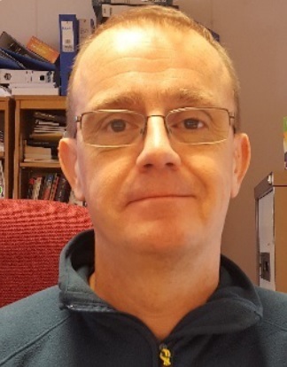
On behalf of GeoForAll and the Open Source Geospatial Foundation, it is my great pleasure to introduce Dr. Mark Ware of the University of South Wales, UK as our GeoAmbassador. Mark is a Reader in GIS at the University of South Wales, United Kingdom. His research interests include automated map generalization, GIS-based optimization algorithms, GIS for disaster management, spatial data structures and Open Source GIS. He has studied, researched and worked in GIS since 1989. During that time, he has been involved in many GIS teaching, research and consultancy projects with partners that include BECTA, Ordnance Survey, BGS, MULRI, Environment Agency, West Coast Energy and Admiral. Mark regularly present research results in the academic literature and enjoy attending and presenting at conferences.
mark


University of South Wales (previously the University of Glamorgan) has been active in the fields of GIS education and research for over 30 years. Most of this activity is carried out by the university’s GIS Research Unit (http://gis.research.southwales.ac.uk/), which is currently led by Prof Gary Higgs. The unit has always been based in a computing department – currently it is part of the School of Computing and Mathematics. This has meant that much of its teaching and research has looked at GIS from a computing perspective. Mark was key lead in helping establish the first Open Source Geospatial lab in Wales as in November 2013 the unit joined GeoForAll and it became the first Open Source Geospatial lab in Wales.

Mark Ware provided the following updates on FOSS GIS and Teaching at USW

“GIS is taught at both undergraduate and post-graduate level; USW is proud to have delivered one of the UK’s first Masters programme dedicated fully to GIS. Traditionally, our teaching has made extensive use of proprietary software. While still using this software on some of our modules, in recent years FOSS has played a significant role in our delivery. At undergraduate level, QGIS is used extensively as a means of introducing first-year mainstream computing students to the world of GIS. The fact that the software is readily and freely available for download and installation make it an attractive option. Students almost always like the subject – we try our best to make their studies as interesting and relevant as possible. This is achieved by emphasising the computing aspects (such as discussing underlying algorithms, talking about and demonstrating the ability to create plugins, and emphasising good data modelling and design) and by the use of data sets and example applications that are local (this is facilitated to a large extent by access to open data products such as OSM and https://data.police.uk/) Second and third year students have dedicated modules in which they can learn about spatial databases (PostgresSQL/PostGIS) and web mapping (GeoServer, OpenLayers and Leaflet); the emphasis here is on the design, implementation, deployment and administration of systems, rather than simply their use and application. Our post-graduate teaching places more importance on the applications of GIS, with modules often being taken by students from courses in other academic subject areas (including geography, environmental studies and BIM); QGIS is again the primary software used. The group also has experience of delivering short courses in GIS to local businesses and organisations. The most recent of these, which took place at USW in June 2016, was a free Introduction to GIS course. This was organised and sponsored by WISERD (http://www.wiserd.ac.uk/) and focused on the use of QGIS and freely available socio-economic data sets.

USW has a strong-track record in GIS research, with notable success in various areas, including: automated cartographic design (map generalization and label placement), terrain modelling, data compression, accessibility modelling and population estimation modelling. Here are some examples of some of our more recent projects, each of which involves the development or application of open-source solutions:

One of the first FOSS projects undertaken at USW involved the design and implementation an online geoportal, the main function of which is to enhance the ability of researchers to search for and find socio-economic research data relating to Wales. The aim is to encourage collaborative research and re-use of data. This work was carried out as part of our involvement with The Wales Institute of Socio-Economic Research, Data and Methods (http://www.wiserd.ac.uk/). The portal was built using various open-source technologies, including PostgresSQL, PostGIS, GeoServer, Apache, OpenLayers and GeoExt. It was developed by Dr Richard Fry (now at Swansea University, UK) and Dr Rob Berry (now at the Countryside and Community Research Institute, UK).

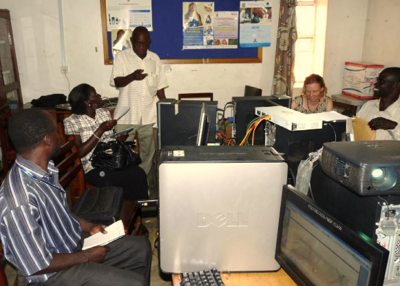
A recently completed project1 has considered ways of improving crowdsourced mapping in developing countries (particularly in East Africa) for the purposes of disaster preparedness. In many developing countries, maps of vulnerable region tend to be low resolution and/or not up to date. There are many examples of crowdsourced mapping initiatives that have taken place after a disaster has occured, but the geographic information becomes available perhaps days or weeks later. By populating digitals map before a potential disaster, various advantages may be gained, including the information being available at the outset of disaster response. The project focused specifically on the Mbale region of Uganda, with which USW has close links. At the beginning of the study, the region was poorly mapped. Early in the project, its main investigator, Dr Dave Farthing, ran several courses in Mbale to train locals in the use of GIS and GPS for data gathering and data analysis (see image below). The project identified competing factors that either inspire/discourage communities to/from adopting and using mapping technologies. The main output from the project is a new model (called the TASUT model) for encouraging technology acceptance and sustained use in the context of digital mapping in developing countries, together with an accompanying set of detailed guidelines for its application. These guidelines suggest (along with many other things) that appropriate training, the use of free open-source GIS, the adoption of standard data formats and making GI available under an open or Creative Commons license are all key to promoting the initial acceptance and then sustained use of mapping technologies. The hope is that we can make apply, and further develop, the TASUT model and its guidelines in future mapping/GIS projects – please get in touch if you are interested in collaborating!
mark1

A soon to be completed PhD project (being undertaken by Jon Britton and supervised by Dave Kidner) has considered the problem of spatial data processing on the web using open standards and open source software. To date the work has produced a detailed specification for a generic web-based GIS client application able to access data and processes provided by standard geospatial services. This specification has been used to develop a prototype browser-based GIS application based on existing open-source software. The prototype, named SmartWPS, can integrate data from standard sources, such as WFS, WCS and WMS, and process this data using remote WPS. ”

Geo for All is committed to work towards the vision of the United Nations 2030 Agenda for Sustainable Development for building a better world for everyone [1]. Open Education is the simple and powerful idea that the world’s knowledge is a public good and that technology in general and the internet in particular provide an extraordinary opportunity for everyone to share, use, and reuse knowledge. Openness is key for true empowerment and sustainability [2].

We are proud to honour Mark as our GeoAmbassador and we are extremely grateful for his contributions to Geo For All.

Best wishes,

Suchith

Dr. Suchith Anand
http://www.geoforall.org/
https://opensourcegeospatial.icaci.org/

GeoForAll – Building and expanding Open Geospatial Science

[1] http://icaci.org/maps-and-sustainable-development-goals/

[2] https://opensourcegeospatial.icaci.org/2016/07/sharing-is-caring-why-openness-is-key-for-true-empowerment-and-sustainability/

1 David W. Farthing, 2015, “Theory of Acceptance and Sustained Use of Technology: A technology acceptance model adapted in the context of digital mapping for disaster preparedness in East Africa”, PhD Thesis, available from the University of South Wales (soon to be available from the British Library)

“GeoForAll” Lab of the Month – Texas A&M University – Corpus Christi , USA

Dear Colleagues,

On behalf of GeoForAll and the Open Source Geospatial Foundation let me take this opportunity to wish you and your families a very Happy New Year 2017 [1] and a successful year ahead. It is also my great pleasure, to introduce our colleagues at Texas A&M University – Corpus Christi , USA as our “GeoForAll” lab of this month in the New Year.

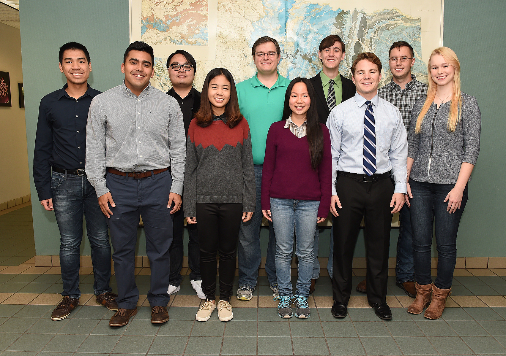
The Spatial {Query} Lab [2] at Texas A&M University – Corpus Christi [3] has a mission of making spatial technology, education, and information accessible to everyone. A large part of meeting this mission is the continued development and maintenance of the GeoAcademy curriculum (http://spatialquerylab.com/foss4g-academy-curriculum/).

texas1


Richard Smith (Assistant Professor and Program Coordinator of GISc/GSEN) said “Over the past several months, we have been working to update the labs to match the latest versions of QGIS, GRASS, and Inkscape, as well as releasing related lecture materials. Combined, the GeoAcademy curriculum offers five college-level courses of content, all Creative Commons licensed and freely available to all who wish to use it. As an example of recent use, the GeoAcademy curriculum is being used as the inaugural curriculum for the UN Open GIS Initiative where we are currently teaching our third cohort of students and will be teaching the fourth and final cohort starting in December. Students at the Spatial {Query} Lab worked hard to get the curriculum updated to QGIS 2.14 for the course and are thrilled that their work is having an immediate benefit and being used by the UN Open GIS Initiative. The beauty of maintaining this type of open curriculum is seeing its adoption, use, and collaborations that are taking place. Another project we are working on at the Spatial {Query} Lab is our map scanning project (http://spatialquerylab.com/projects/map-scanning/) where we are scanning, cataloging, transcribing, and rectifying tens of thousands of historic maps from South Texas (we occasionally blog about interesting things we find as we scan them at: http://spatialquerylab.com/tag/find-of-the-week/).

texas


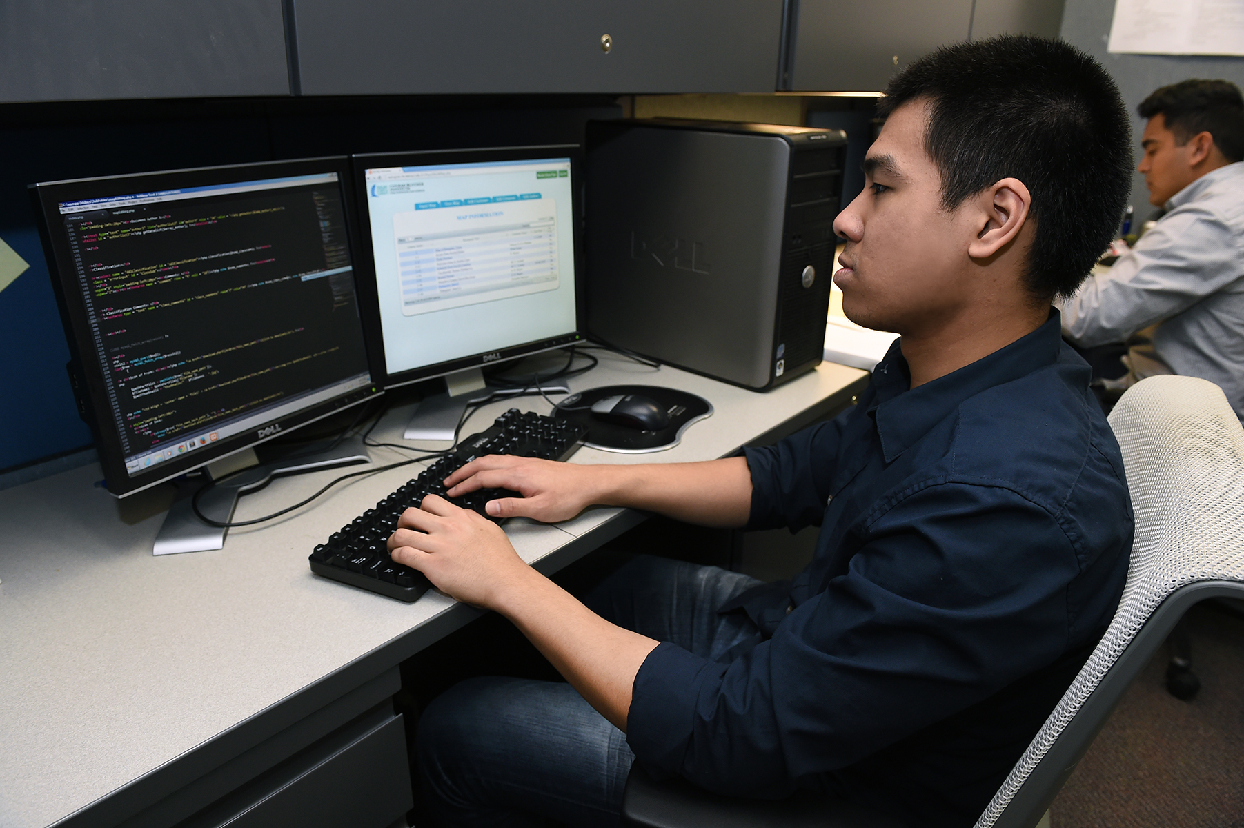
We will begin publishing this collection online to the public, for free, starting in Spring 2017. Something we are particularly proud of is the software we wrote to operationalize our scanning project, BandoCat, has been so useful to us, and, as we have demonstrated it to others, looks to be potentially useful for them, we are going to be open sourcing the BandoCat software beginning in Spring 2017 in the hopes that it can be useful to others who are looking at digitizing hard copy maps and documents.” Thank you Richard for these excellent updates from your lab. This is truly amazing work you and colleagues are doing…

texas2


On behalf of the GeoForAll community, we thank Richard Smith and all colleagues the Texas A&M University – Corpus Christi , USA for their help and for their contributions to the GeoForAll initiative and look forward to working and building more collaborations with all interested on this education mission. We believe in empowering people with spatial decision making tools to help build a better society for all of humanity. Open principles in geoeducation (open educational resources, free and open software, open data, open standards etc) are key for  true empowerment of staff and students globally and making geospatial education and opportunities accessible to all . Access to quality education and opportunities is key for getting rid of extreme poverty and enabling broadly shared prosperity for all.

Millions of globally connected minds working together on the common mission of enabling Open Education opportunities for everyone will be key for making these developments possible. An idea whose time has come is the most powerful force in the universe, and the time for “Access to quality education opportunities for everyone” has arrived. We look forward to working and building collaborations with all interested in this education mission.

Happy Year of Open 2017 …

open2017


Best wishes,

Suchith Anand

[1] https://opensourcegeospatial.icaci.org/2017/01/happy-year-of-open-2017/

[2] http://www.spatialquerylab.com

[3] http://gisc.tamucc.edu

Summary of the workshop on Advancing GIScience with Open Source Technologies

The ICA Commission on Open Source Geospatial Technologies held a very well-attended, successful one-day workshop on Advancing GIScience with Open Source Technologies the day before the start of Auto Carto. The agenda consisted of seven invited speakers and an open discussion session. The Chair of the commission, Silvana Camboim, opened the presentations and led the discussion. The Vice-Chair, Michael P. Finn, organized the workshop and served as the moderator. Summary of the workshop on Advancing GIScience with Open Source Technologies are at http://icaci.org/summary-of-the-workshop-on-advancing-giscience-with-open-source-technologies/

Happy Year of Open 2017

Happy New Year 2017.  On behalf of GeoForAll community , we are very excited to support the Year of Open  2017 and looking forward to work with you all on expanding Open Education worldwide.

open2017


15 years ago the term “Open Educational Resources” was created, the Budapest Open Access Initiative was launched, and the first Creative Commons licenses were released;

10 years ago the Cape Town Open Education Declaration was written;

5 years ago the first Open Education Week took place and the first OER World Congress was held, resulting in the Paris OER Declaration.

2017 is a great year to celebrate our achievements while making even more people aware of the benefits of openness. That’s why we’re calling 2017 the Year of Open, and we want the global open community to lead the way. Here’s how:

*   Use promotional materials https://drive.google.com/drive/u/1/folders/0B-2iwGe3GdicVWZpVG9jOExoVDQ . The more people see the Year of Open logo, the more they will want to find out what it’s about.

*   Get the word out about open. Write blog posts, op-eds, articles; make videos; hold discussions with new audiences. Let everyone know you support open by using the #yearofopen hashtag.

*   Participate in Open Education Week https://www.openeducationweek.org – let’s make this the biggest and best one yet. Open Education Week is one of the key activities for open education globally, with online and locally hosted events around the world.  Get ideas on the website, and let us know what you’re doing so it will appear on the Open Education Week events calendar.

The Year of Open is not just for open education; we encourage our colleagues working in other areas of open to join with us. Look for more information in the coming few weeks, and the official launch on 1.17.17.

Access to quality education opportunities is everyone’s birthright. Open principles  in education (open educational resources , open standards, free and open software, open access to research publications) are key to lower entry barriers and make sure there is no digital divide etc. Open principles  in education are key for breaking down the artificial barriers and rapidly bringing down the walls of digital divide.  Caring and sharing are important values in education  .

Education and empowerment are key for getting rid of extreme poverty and help create digital economy opportunities also for billions of our economically poor brothers and sisters across our planet .  Education and empowerment of students are also key for developing creative and open minds in students which is critical for building open innovation and contributes to building up Open Knowledge for the benefit of the whole society and for our future generations.So let us all  join efforts and  work together to enable open principles in education to help create a world that is more accessible, equitable and full of innovation and opportunities for everyone.

Details of why this is important at

https://opensourcegeospatial.icaci.org/2016/07/sharing-is-caring-why-openness-is-key-for-true-empowerment-and-sustainability/

Wishing everyone  Happy New Year 2017…

Best wishes,

Suchith

Dr. Suchith Anand
http://www.geoforall.org/
https://opensourcegeospatial.icaci.org/

GeoForAll – Building and expanding Open Geospatial Science

Seasons Greetings from GeoForAll

As 2016 is nearly over, i wish to take this opportunity to thank each and every one of you for your support and contributions which helped to build up the “GeoFor All”    initiative. Our thanks to an incredible 2016.  2016 has been an important year for us as it exactly 10 years ago we started putting initial ideas for Open Geospatial Science [1]. We went through lot of hardships and struggles (some laughed at us initially!) but it has been an incredibly amazing journey over the last decade.

We had to take this one step at a time to make this possible . We started by building the community (started workshops, conferences), then we started establishing dedicated open source research labs in universities so we have universities globally invested to the idea, then we started dedicated journals etc for expanding the discipline and now we are working on implementing our vision 2030 [2].

Geospatial Science = Open Geospatial Science

We were very clear from the start that we will be supporting Open Principles (open standards, open data, open educational resources, open software, open access to scientific publications) for our mission to ensure sustainability and bring together academics, universities, industry, SMEs, NGOs together on this shared vision.

Geo for All is a shared idea whose time has come.  An idea whose time has come is the most powerful force in the universe, and the time for “Access to quality education opportunities for everyone” has arrived.

The Open Source Geospatial Foundation is now the world’s largest Geospatial ecosystem .Open innovation is key in driving Digital Economy opportunities and we are determined to make sure that everyone benefits. We look forward your collaborations on our mission to  make geospatial education and opportunities accessible to all.

It has been amazing to see our humble initiative grow rapidly and this has been due to the dedication of all of you and we would like to thank you for your continued contribution. We have now put strong foundations for our “GeoForAll” initiative from Australia to Uruguay and we are  looking forward to working with you all in 2017 to rapidly build upon this.

seasons-greetings

On behalf of everyone at “GeoForAll” , we wish you and your families very happy holidays and Happy New Year 2017.

May the FOSS be with everyone…

Best wishes,

Suchith Anand

[1] https://opensourcegeospatial.icaci.org/2016/04/open-geospatial-science-2/

[2] https://opensourcegeospatial.icaci.org/2016/06/open-consultation-on-the-vision-2030-for-open-geospatial-science/


“GeoForAll” Lab of the Month – Asian Institute of Technology, Thailand

It is my great pleasure, to introduce our colleagues at Asian Institute of Technology, Thailand as our “GeoForAll” lab of the month. The Asian Institute of Technology promotes technological change and sustainable development in the Asian-Pacific region through higher education, research and outreach. Established in Bangkok in 1959, AIT has become a leading regional postgraduate institution and is actively working with public and private sector partners throughout the region and with some of the top universities in the world. Recognized for its multinational, multicultural ethos, the Institute operates as a self-contained international community at its campus located 40km (25 miles) north of downtown Bangkok, Thailand. More details at http://www.ait.ac.th

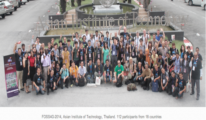
Thailand has a very vibrant OSGeo community. Thailand hosted the Free & Open Solutions for Geoinformatics-Asia conference in Bangkok( 2-5 December 2014)

Bringing together FOSS4G users and developers worldwide and foster closer interactions with and amongst Asian communities in order to share ideas for improving software and applications. The Bangkok conference covered all aspects of FOSS4G, Open Data and Open Standards, with a particular focus on exchanging experiences between FOSS4G users and developers and providing first-hand information on FOSS4G for developing national/local spatial data infrastructures in Asian countries. FOSS4G-Asia 2014 also commemorated ten years since the FOSS-GRASS User Conference was held at Faculty of Engineering, Chulalongkorn University, Thailand between 12-14 September 2004.

screen-shot-2016-12-09-at-15-06-47


The OSGeoLab@AIT was established for promote and enhance education, research and service activities in the area of Open Geospatial Science & Applications. The OSGeo software were taught in various classes including Geographic Information Systems, Web GIS Technology,  Spatial Analysis Methods in GIS, Geospatial Data Processing etc. Recently the class of Free and Open Source Software for Geospatial Analysis was initialized. This course aims at providing students with practical utilization of Free and Open Source Software (FOSS) for data manipulation, management and analysis of remote sensing images and GIS data. 50 computers in the laboratory was installed the OSGeo VM suite. More details are at http://rsgis.ait.ac.th/osgeoait/category/education/

screen-shot-2016-12-09-at-15-07-11

The lab is lead by Dr.Sarawut Ninsawat (Team Leader) with Prof. Nitin K. Tripathi Dr. Marc Souris, Mr. Sanit Arunpold , Dr. Rajesh V Chowdhary , Mr. Dalower Hossain . GeoForAll lab at AIT also provide training activities such as Geospatial Analysis using Free Open Sources Software (FOSS) and PyQGIS for QGIS plugins development.

screen-shot-2016-12-09-at-15-07-26


During August 2016, the workshop of GNSS & Crowdsourcing for Geospatial Data using OSM was organized for undergraduate students from 16 countries who have few background on geoinformatics. The participants learned the principle of GNSS and understand how it works. Also, they have opportunity to use GNSS receiver in AIT and analyzed the result. Furthermore, afternoon session, they will be assigned task to map the certain things in AIT and then locate and input the information via Open Street Map platform. More details of the lab are at http://rsgis.ait.ac.th/osgeoait/

screen-shot-2016-12-09-at-15-07-35


The group at AIT also submitted a proposal for hosting the FOSS4G2018 conference and was passed to second stage of selection. However due to the great sadness situation of the passing away of H.M. King Bhumibol Adulyadej of Thailand, they decided to withdrawn from the selection process since it is unlikely as they cannot approach any organisation in the current situation.

GeoForAll’s mission is to make geospatial education opportunities open to all and to make sure we all work together to create global citizens contributing to the betterment of humanity. Please be our GeoAmbassadors and share these ideas with all. Open principles in education (open educational resources, free and open software, open data, open standards etc) are key for true empowerment of staff and students globally and making education and opportunities accessible to all . We look forward to working and building collaborations with all interested in this education mission. Access to quality education and opportunities is key for getting rid of extreme poverty and enabling broadly shared prosperity for all.


The Open Source Geospatial Foundation is the world’s largest Geospatial ecosystem , so we welcome you to the huge network of our partners and collaborators globally from governments, industry , universities, NGOs worldwide that you can connect to expand your ideas rapidly. Open innovation is key in driving Digital Economy opportunities and we are determined to make sure that everyone benefits.

We thank Sarawut Ninsawat , Nitin Tripathi ,Marc Souris, , Sanit Arunpold , Rajesh Chowdhary , Dalower Hossain and all colleagues and students at GeoForAll lab at the AIT for their contributions to the GeoForAll initiative and look forward to working and building more collaborations with all interested on this education mission.

Best wishes,

Suchith Anand


GeoAmbassador of the month – Dr. Daria Svidzinska

It is my great pleasure to introduce Dr. Daria Svidzinska from Taras Shevchenko National University of Kyiv in Ukraine as our GeoAmbassador. Daria established GeoforAll lab at her university [1] and has been actively expanding geoeducation opportunities for all.

screen-shot-2016-12-09-at-14-54-33


Daria Svidzinska defended her PhD in physical geography at Taras Shevchenko National University of Kyiv, Ukraine in 2007.  Since then she has been working as a professor at the Department of Physical Geography and Geoecology. Her research and teaching in the areas of landscape ecology, habitat mapping, protected areas, and ecological networks stimulate constant pursuit for better analytical tools and complex sources of geodata. With the time she understood that Free and Open Source Software coupled with Open Geodata can help to sustain best practices in research and teaching through ensuring freedom and reproducibility.

In 2014 she published a textbook called ‘Methods of Geoecological Research: a geoinformational tutorial based on the Open Source GIS SAGA’ under Creative Commons License. It became the very first university textbook in Ukraine (and post-soviet countries) based on open source software and open geodata exclusively.

She also actively promotes open source GIS among students and young researchers through her courses such as ‘Methods of Geoecological Research’, ‘Geospatial Ananlysis for Landscape Research’, ‘Design of Ecological Networks’. These courses discuss concepts, methods, and tools for mapping, analysis and modelling of landscape spatial patterns and processes, landscape-ecological basis of ecological networks development, approaches and methods of their design and management. Approaches and algorithms of advanced geospatial analysis and modelling are covered with the focus on digital relief modelling, geomorphometry, hydrological analysis, and thematic classification of remote sensing data. Practical part of the courses requires the development of analytical process, that combines a few open source geospatial software tools (for example, QGIS, SAGA, GRASS, Orfeo Toolbox, Circuitscape etc.) to solve an applied problem.

Daria is also involved in local training for colleagues from the other areas of expertise who would like to become more powerful GIS users. She gives workshops and provides counseling to promote FOSS GIS use and adoption in Ukraine.

screen-shot-2016-12-09-at-14-54-46


In January 2016 jointly with her colleagues from the Institute of Geography of National Academy of Sciences, she organized the first meeting of the Ukrainian FOSS GIS users which attracted over 100 attendees.

screen-shot-2016-12-09-at-14-55-04


Vladimir Agafonkin about Leaflet at the Meeting of Ukrainian FOSS GIS Users
Photo © Roman Sizo

As a coordinator of GeoForAll Open Source Geospatial Research and Education Lab at her university she is involved in the project as follows:

 screen-shot-2016-12-09-at-14-55-14


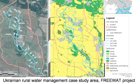
FREEWAT: FREE and Open Source Tools for WATer Resource Management

FREEWAT is a project of the EU framework program for research and innovation HORIZON 2020. FREEWAT main result will be an open source and public domain GIS integrated modelling environment for the simulation of water quantity and quality in surface water and groundwater with an integrated water management and planning module. Within the project we are focusing on the application and approbation of the FREEWAT tools for the research aimed at improvement and development of integrated rural water resource management scenarios that take into account the requirements of the EU Water Framework Directive.

screen-shot-2016-12-09-at-14-55-24


Ukrainian rural water management case study area, FREEWAT project

Ramsar Sites in Ukraine

Ukraine is a contracting party (member state) of the Ramsar Convention on Wetlands of International Importance especially as Waterfowl Habitat and there are over 30 sites in its territory placed onto the List of Wetlands of International Importance. In cooperation with the Ministry of Ecology and Natural Resources of Ukraine, we are working on actualization of geodata and update cartographic materials for existing and perspective wetlands of international importance in accordance with the requirements of the Ramsar Convention Secretariat.

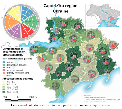
Protected Areas of Ukraine

Despite the goals and requirements of national and international environmental policy and legislation, Ukraine does not have a single, reliable and publicly available tidy geodata source of current importance on protected areas. This significantly complicates their protection, monitoring, management, and research. Understanding importance of the issue, we have joined a civil crowdsourcing project, initiated in 2014 by the specialists and activists in the areas of nature conservation, geoinformatics, and open data. The project is aimed at the mapping of the boundaries of protected areas of Ukraine in the OpenStreetMap and development of the derivative open geodata on this basis. The procedure of mapping pays a special attention to the protected areas of local importance which make up over 90% of total quantity and about 50% of total area of all protected areas in Ukraine.

 screen-shot-2016-12-09-at-14-55-34


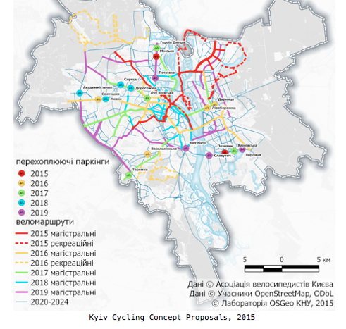
Kyiv Cycling Concept

In 2014 Kyiv Cyclists’ Association initiated the collective development of the scheme of cycling network and related measures for Kyiv. In this project we provided geospatial analysis and mapping, which were based on the joint use of the OpenStreetMap data and QGIS tools.

 Documentation Translation and Localization

In addition to applied use of open geotechnologies, Daria and colleagues at GeoForAll lab also work on the translation of documentation and interface to make QGIS more accessible for the Ukrainian users. As the part of these activities Semi-Automatic Classification Plugin User Manual version 2.5.1 was translated into Ukrainian, and translation update to the current version is in progress.

More details are at http://lab.osgeo.org.ua

I am sure Daria will expand these ideas for the future. We are looking forward to building  strong research and teaching collaborations  worldwide in Open Geospatial Science. We are proud to honour Daria as our GeoAmbassodor and we are extremely grateful for her contributions to Geo for All.

Best wishes,

Suchith Anand

[1] http://lab.osgeo.org.ua

GeoForAll Webinar Series – FOSS4G at The National Renewable Energy Laboratory

On behalf of GeoForAll, we would like to welcome you to our next webinar which might be  of interest to wider community.Details on the webinar on Friday December 2, 2016 at 7:00 PM GMT and how to connect remotely below. 
 
 
The National Renewable Energy Laboratory (NREL) is the United States’ primary laboratory for renewable energy and energy efficiency research and development. Details at http://www.nrel.gov
Talk details and how to connect are at http://www.geoforall.org/webinars/
 
Please join at https://ucdenver.zoom.us/j/173408130If you can’t attend, presentation recording will be posted in the Geo4All YouTube Channel https://www.youtube.com/channel/UCL1E2akvCNWP_nC0p5CpB8g
FOSS4G Tools for Geospatial Analysis at the National Renewable Energy Lab: A Pragmatic Approach
Presented by Nick Grue
The proliferation of geospatial analysis tools and methods means that no matter what your analysis goals, there are likely several options for running analysis, generating data, and visualizing your results. With a wide selection of tools to choose from, you are also presented with the question of which tool is most useful, has highest performance and efficiency, and easiest to use for your case.Here at the National Renewable Energy Lab (NREL), we had the unique opportunity to start fresh with building a new analysis model, and had to decide which technologies would be most useful. We eventually ended up primarily using Python for analysis, and PostGIS and Geoserver for visualization. Deciding on those tools took a fair amount of testing and comparison. This webinar will discuss the different tests we ran, our findings, and why some tools appeared to be better suited for our case than others.Analysis tools discussed in this webinar will include PostGIS vector analysis, PostGIS raster analysis, Python analysis of vector datasets, Python vectorized analysis of raster datasets, Python multiprocessing, and Geoserver visualization.

=====================================
Dan Getman of the NREL did an excellent presentation last year on “Creation, Analysis, Sharing, and Visualization of Complex Spatiotemporal Data Using Free and Open Source Software at the National Renewable Energy Laboratory”.The recording is at https://www.youtube.com/watch?v=Z0NTPFzGXn8&feature=youtu.be
We thank Rafael Moreno  and colleagues  at the University of Colarado Denver, USA for their help  in organising the GeoForAll free webinars for the benefit of the wider community.

OPEN FIELDS

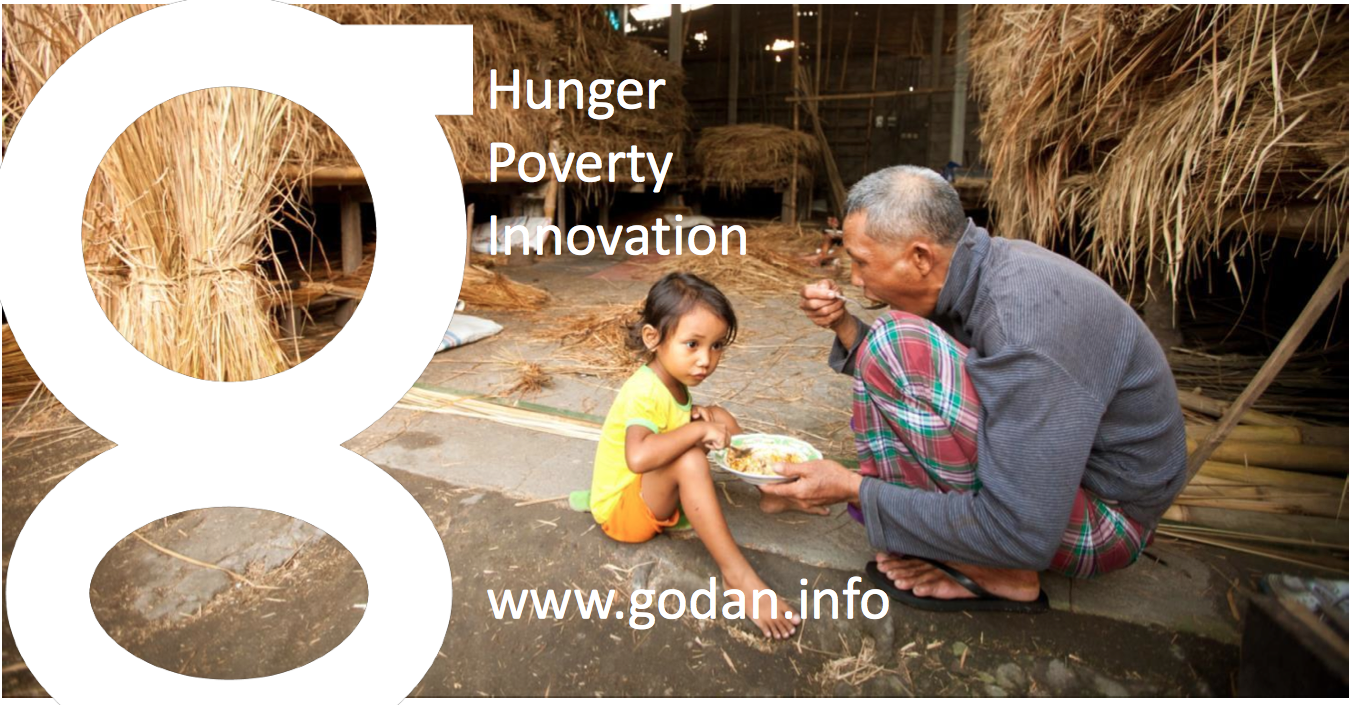
Today, nearly 800 million people suffer from hunger and malnutrition around the world. For the first time in human history, we have the knowledge and the tools to put an end to it. Open data makes that knowledge available to everyone [1].

At the 2012 G-8 Summit, G-8 leaders committed to the New Alliance for Food Security and Nutrition, the next phase of a shared commitment to achieving global food security. As part of this commitment, they agreed to “share relevant agricultural data available from G-8 countries with African partners and convene an international conference on Open Data for Agriculture, to develop options for the establishment of a global platform to make reliable agricultural and related information available to African farmers, researchers and policymakers, taking into account existing agricultural data systems.”

screen-shot-2016-11-28-at-11-44-48

The GODAN initiative was announced at the Open Government Partnership Conference in October 2013 following 2012 G8 discussions.  Participants made commitments to Open Data for Agriculture at the International Conference on Open Data for Agriculture in Washington D.C. Subsequently the Governments of the United States and United Kingdom partnered to form this global initiative.


I am really happy to get the opportunity to work for the  Global Open Data for Agriculture and Nutrition (GODAN) . I am seconded from the University of Nottingham to GODAN now.  I would like to invite you all to know more about the amazing work that GODAN  is doing  and join us. Some introduction slides that i presented on GODAN  at AgriGIS ThinkTank at Kenya last month are at  https://www.nottingham.ac.uk/genius/documents/godan-uon-intro.pdf


OPEN FIELDS is the second episode of GODAN’s new documentary web series that meets individuals around the world who are on the frontline of how technology and data are reshaping agriculture to combat food insecurity and improve global nutrition. In this episode, viewers meet Eunice, a successful smallholder farmer who lives outside of Mombasa, Kenya. In Kenya, around 80 per cent of people have access to some form of farmable land. Although the soil is rich and fertile for farming, many plots of land stand empty or with failed crops.In the Mombasa region, Haller Foundation (a GODAN partner) have been working with local farmers for 50 years to design organic methods to improve crop production and also provide a solid economic stream for rural families.

Eunice has found success in maximizing her crop yield by using the open-source mobile phone app from the Haller Foundation. With an estimated 83% of Kenya now online, largely through mobile phones, Haller Farmers App has been developed to digitise and release local knowledge on a global scale, to anyone, anywhere. The application is free to use for anyone with a smartphone and internet access. They have also worked with Free Basics and Airtel Kenya to improve rural access for low income families, providing free data to download and use the app.


Let us now all work together on our joint mission  to get every government, non­-governmental, international and private sector organization to make agriculture and nutrition data available, accessible and usable so that we acheive the United Nations Sustainable Development Goal on End hunger, achieve food security and improved nutrition, and promote sustainable agriculture. So please join the Open Data Revolution to end global hunger and together we can make this possible.

Best wishes,

Suchith

Dr. Suchith Anand

http://www.geoforall.org/

GeoForAll – Building and expanding Open Geospatial Science


[1] https://opensourcegeospatial.icaci.org/2016/10/reflections-from-godan-summit-2016-join-the-open-data-revolution-to-end-global-hunger/